Abandoned & Little-Known Airfields:
Northwestern Washington State
© 2002, © 2015 by Paul Freeman. Revised 7/11/15.
This site covers airfields in all 50 states: Click here for the site's main menu.
____________________________________________________
Please consider a financial contribution to support the continued growth & operation of this site.
Blaine Municipal Airport / Dierks Field (revised 7/11/15) - Oak Harbor Naval Seaplane Base (revised 7/11/15)
____________________________________________________
Blaine Municipal Airport / Dierks Field (4W6), Blaine, WA
48.99 North / 122.73 West (Northwest of Seattle, WA)
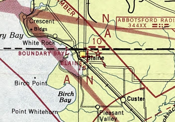
Blaine Municipal Airport, as depicted on the April 1946 Bellingham Sectional Chart.
According to its last entry in the Airport/Facility Directory,
Blaine Municipal Airport was opened in August 1945.
This little general aviation airport was located only a mile from the Canadian border.
The earliest depiction which has been located of the Blaine Municipal Airport was on the April 1946 Bellingham Sectional Chart.
It depicted Blaine as an auxiliary landing field.
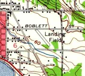
The 1952 USGS topo map depicted Blaine Airport as a single northwest/southeast runway, labeled simply as “Landing Field”.
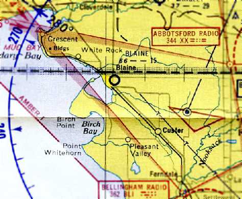
The October 1954 Bellingham Sectional Chart (courtesy of Chris Kennedy)
depicted Blaine as a tiny airport – having only a 1,500' unpaved runway.
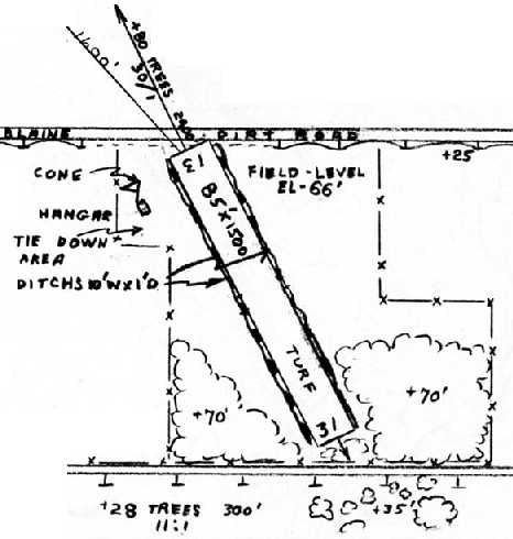
The 1966 WA Airport Directory (courtesy of Chris Kennedy)
depicted Blaine Airport as having a single 1,500' turf Runway 13/31,
with a single hangar on the northwest side.
The earliest photo which has been located of the Blaine Municipal Airport
was an undated aerial view looking north in the 1968 WA Airport Directory (courtesy of Chris Kennedy).
It depicted Blaine as as having a single northwest/southeast grass runway.
The runway at Blaine Municipal Airport was upgraded at some point between 1968-71 to a 2,000' gravel strip,
as that is how it was depicted in the 1971 WA Airport Directory (courtesy of Chris Kennedy).
The manager was listed as Traverse Skallman.
Blaine got a paved runway at some point between 1971-75,
as the January 1975 Seattle Sectional Chart (courtesy of Chris Kennedy)
depicted the field as having a single 2,100' strip.
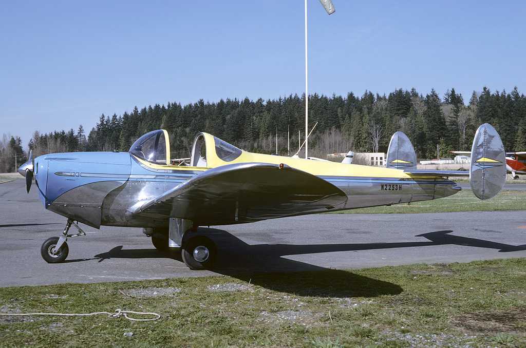
An April 1985 photo by Gary Vincent of a beautiful Ercoupe 415C (serial # 2878) at Blaine Municipal / Dierks Field.
The 1991 USGS topo map depicted the Blaine Municipal Airport as having a single northwest/southeast runway,
with a few small buildings on both the west & east sides.
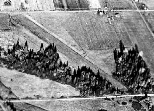
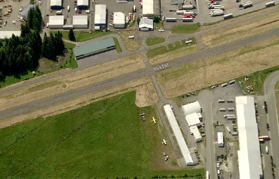
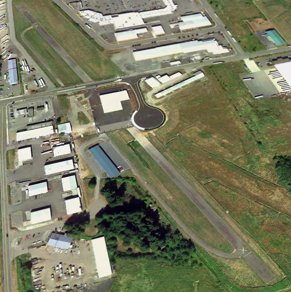
An August 2006 aerial view looking north at Blaine Municipal Airport showed a total of 7 light aircraft visible parked outside.
In addition to the paved Runway 14/32,
what appeared to be the trace of a former grass runway was visible at the bottom-right.
A circa 2006 aerial view looking west at Blaine Municipal Airport,
showing 4 aircraft visible parked outside.
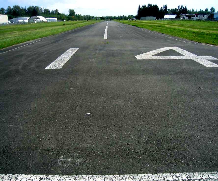
A 2006 view looking southeast along Blaine's Runway 14.
Unfortunately, on February 26, 2007, by a 4-3 vote, after years of on-&-off debate,
the Blaine City Council opted to shut down their airport by the end of 2008.
Oddly, this vote reversed an October 2006 council vote,
which approved creating a $16.8 million master-planned redevelopment of the 42-acre airport.
The council voted to close the airfield & proceed with earlier plans to open the land to private development.
What a great strategy: sell off a city-owned asset, into which has been invested public funds over the years,
in the name of a one-time financial gain.
Maybe the same thing should be done by local governments to all of their public-owned parkland -
imagine how much short-term financial gain could be realized by selling all of this off to real estate developers?
We certainly don't need long-term public assets to be still available to the public in the future,
when politicians can realize short-term financial gains, right?
In its last year of operation, 2008, Blaine Municipal was listed in the Airport/Facility Directory as being managed by Gary Tomsic.
The field was described as having a single 2,539' asphalt Runway 14/32 in “good” condition.
A total of 23 aircraft were based at the field, including 2 multi-engine aircraft,
and the field was said to conduct an average of 22 takeoffs or landings per day.

The December 2008 Seattle Sectional Chart depicted Blaine as having a single paved 2,500' runway,
with glider operations conducted just to the northeast.
Blaine Municipal Airport was closed on 12/31/08.
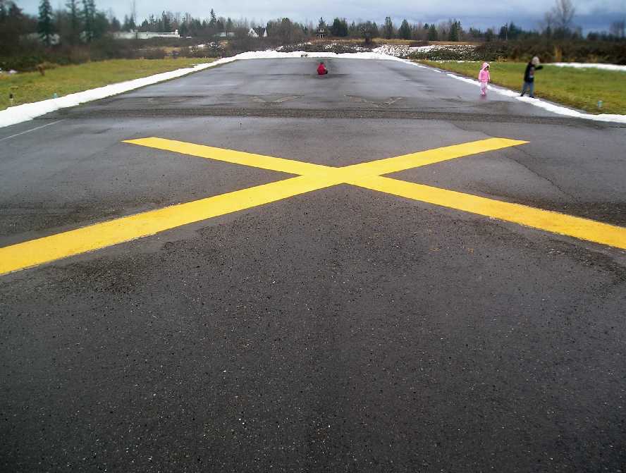
A January 2009 photo by Don White of the Blaine runway the day after its closure.
Don remarked, “We were just a little too late to land & get pictures of the last few minutes of the airport's 64-year life.
We drove back the next day & walked the field with a camera.”
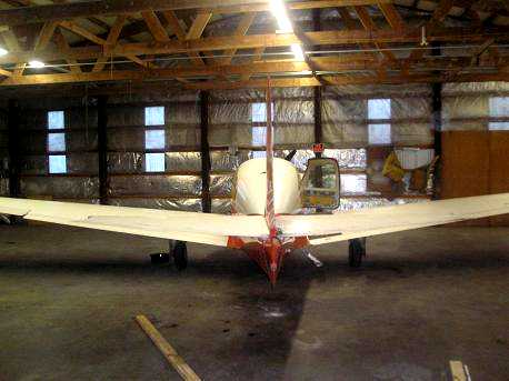
A January 2009 photo by Don White of a plane (a Mooney?) which remained at Blaine after its closure.
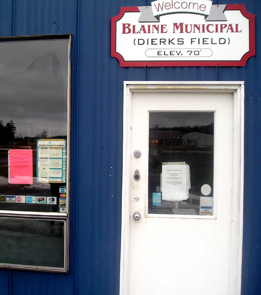
A January 2009 photo by Don White of the sign over the entrance to the Blaine Municipal Airport office.
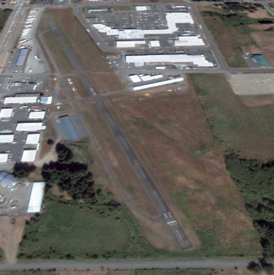
A sad 8/25/11 aerial view looking northeast at the site of Blaine Municipal Airport shows that redevelopment occurred very soon after the airport's closure,
with Boblett Street & and new building & parking lot having been built across the middle of the runway.
The former hangars remained, at least for now.
Thanks to Dcwriter77 for pointing out this airfield.
____________________________________________________
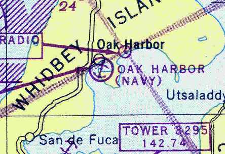
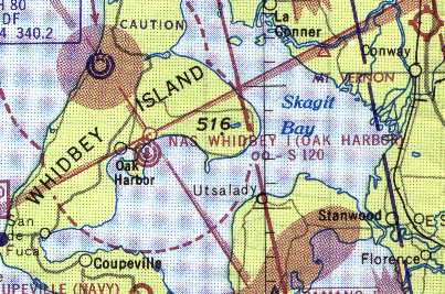
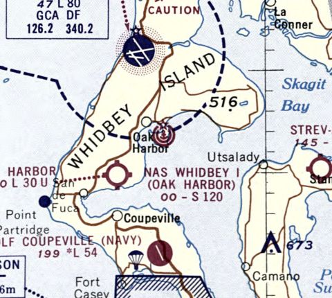
Oak Harbor Naval Seaplane Base, Oak Harbor, WA
48.29 North / 122.63 West (Northwest of Seattle, WA)
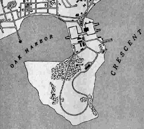
The peninsula of Maylor's Point extends south out into Crescent Harbor.
It was settled by the Maylor family in the mid-1800's.
In early 1941, the Office of the Chief of Naval Operations asked the Commandant of the 13th Naval District
to find a location for the re-arming & refueling of Navy patrol planes operating in defense of Puget Sound.
The commanding officer of Naval Air Station Seattle recommended the site
of Saratoga Passage on the shores of Crescent Harbor & Forbes Point
as a base suitable for seaplane takeoffs & landings under instrument conditions
The land of Maylor's Point was sold by the Maylor family to the Federal Government
for the purpose of constructing a seaplane base.
The seaplane base was commissioned in 1942.
A landplane airfield, Ault Field, was commissioned a year later, a few miles northwest.
Together, the two installations comprised Naval Air Station Whidbey Island.
The first seaplane to land at the base was a PBY Catalina, which arrived in late 1942.
Several PBM seaplanes were aboard by the summer of 1944.
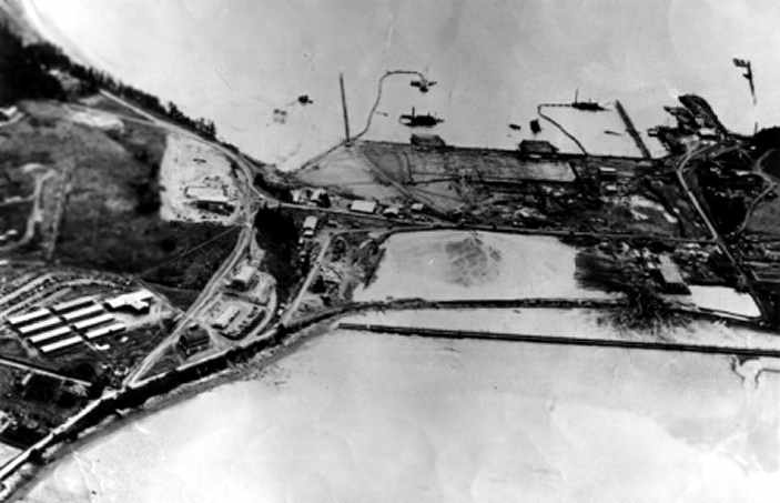
A 1944 aerial view looking northwest at the Oak Harbor seaplane base (National Archives photo).
A 1944 photo of a PBY-5A of VP-62 on the ramp at Oak Harbor (National Archives photo).
PBY patrol bombers took off with a churning of water & a roar of engines for their practice runs in Saratoga Passage,
then returned, skimming the hill above the hangar & settling into the bay to repeat the maneuver.
Residents of Oak Harbor soon became accustomed to the circling bombers training for the real thing in the Aleutian Islands.
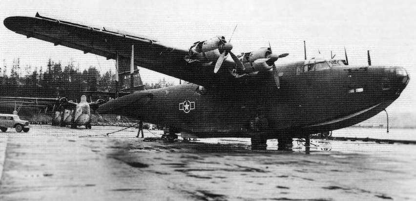
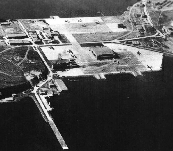
A 1945 photo of a captured Japanese Kawanishi H8K2 Emily at Oak Harbor, with Navy PBMs behind it.
The Emily was one of the highest performance flying boats of WW2.
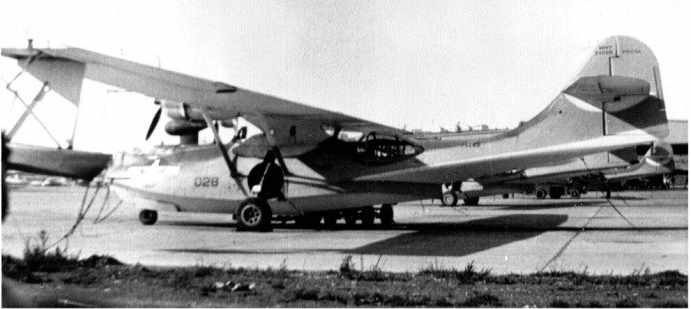
A 1945 photo of a PBY Catalina in front of the Oak Harbor hangar.
The Oak Harbor seaplane base, as depicted on the April 1945 Bellingham Sectional Chart (courtesy of Chris Kennedy).
The 1945 AAF Airfield Directory (courtesy of Scott Murdock) described the Oak Harbor Seaplane Base
as having a single 240' x 160' hangar, being owned by the U.S. Government, and operated by the Navy.
Originally commissioned as a temporary station, operations slowed at war's end.
It was depicted as “Oak Harbor Seaplane Base Naval Reservation” on the 1951 USGS topo map.
With the onset of the Korean conflict, the base was taken out of reduced operating status.
VP-50 moved up from Alameda in 1956, returning seaplanes to NAS Whidbey.
The Oak Harbor seaplane base, as depicted on the 1962 Bellingham Sectional Chart (courtesy of John Voss).
Kelly Siebecke recalled, “My dad was a Navy bombardier/navigator stationed at NAS Whidbey from 1958-77.
While we lived in Navy housing all around the base until 1970,
my earliest memory of base-living was in the old (WWII) officer's quarters
at the NAS Whidbey Seaplane Base on Coral Sea Avenue.
Red foxes used to roam the woods & subsequent fields surrounding the older-smaller officer's housing
and deer & rabbits were in abundance & seen quite frequently.
We had a wonderful view of Crescent Harbor & Camano Island
and the frequently anchored USS Salisbury Sound (stationed at NAS Whidbey from 1964-67).
Although my dad flew in A-3's at the time in VAH-6 I LOVED the P5M seaplanes!
To this day, some of my clearest memories of NAS WI
are of seeing the 'Sally Sound' anchored & watching the P5M's take off & land in the water.”
Flying the P5M-2 Marlin, patrol squadrons dominated the base until the 1960s.
VP-1, the last patrol squadron of that era, left Whidbey in 1970 for Barbers Point, Hawaii.
The seaplane base was closed at an unknown date after that.
The last aeronautical chart depiction which has been located of the Navy's Oak Harbor seaplane base was on the December 1970 Bellingham Sectional Chart.
Fulton Recepcion recalled, "I lived in Oak Harbor from 1974-77.
I lived in base housing that was up the hill from the seaplane base.
Of course there were no seaplanes operating there anymore
(except, I remember seeing a civilian Cessna with floats on the old tarmac).
I was on hand for the opening of the new Navy Exchange in 1977 when the old hangar took that role.
The white administration building was where I went to kindergarten in 1976.
I don't think it's being used in that role anymore.
In 1986, I visited Whidbey, and we passed by the old building & it didn't look like it was being used,
well at least not as a school.
I remember vividly the parking lot being paved when I went to school there.
Looking at the recent photo, I'm glad my old school building is still there,
for I was afraid they would've torn it down by now."
According to former NAS Whidbey Island resident Rick Morgan,
"The Seaplane base is still owned by the Navy & the old hangar,
believe it or not, was rebuilt into the base exchange.
The new commissary is the larger building just south of the hangar on the ramp in the picture.
The old seaplane tower now sports a large radome with electronic simulators for the EA-6B force at Ault Field.
It's the white dome on the cliff below the old seaplane tender pier.
The marina on the west side of the neck is owned by the city of Oak Harbor.
The former base headquarters & admin building is the white structure at the top of the picture."
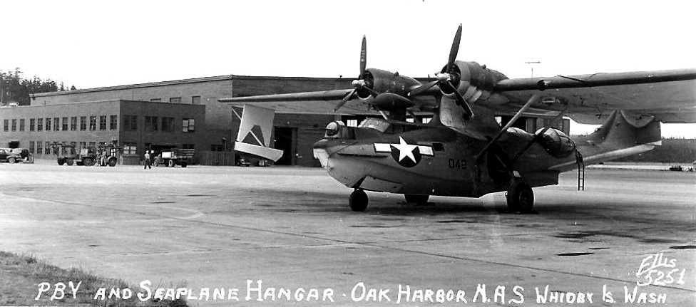
A 2003 photo by James Bond of the former Oak Harbor seaplane hangar.
As of 2005, a group called the The PBY Memorial Foundation
is trying to raise funds to construct a hangar in Oak Harbor to display a restored PBY Catalina seaplane.
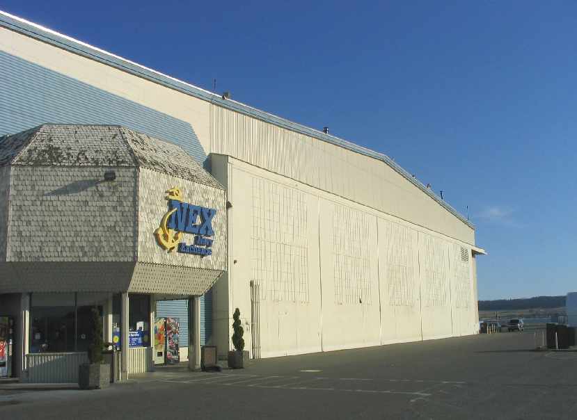
A 2005 photo by Paul Freeman looking northeast at the entrance to the Navy Exchange,
with the big former hangar door just to the right.
From the inside of the Navy Exchange, you would never guess you were inside a former seaplane hangar.
Yet the outside of the building remains completely recognizable,
with the big sliding steel hangar doors on both sides of the building.
The large paved expanse of the former seaplane ramp also remains intact.
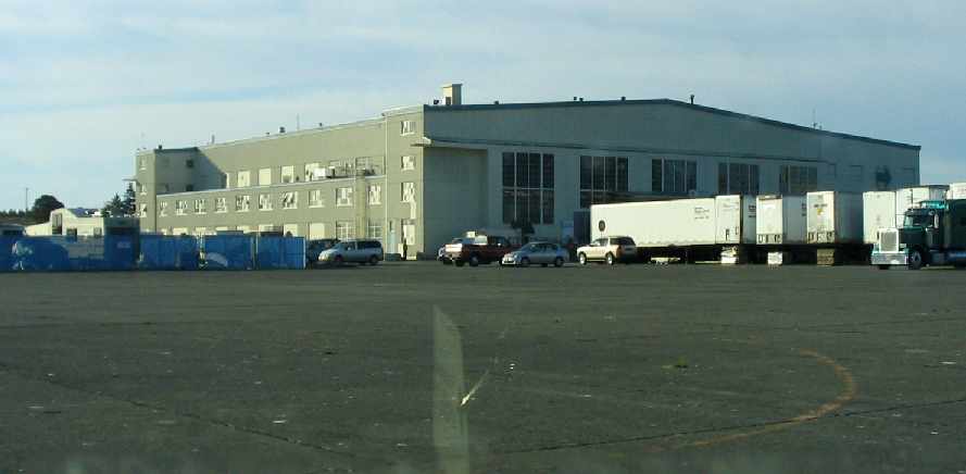
A 2005 photo by Paul Freeman looking southwest at the former seaplane hangar.
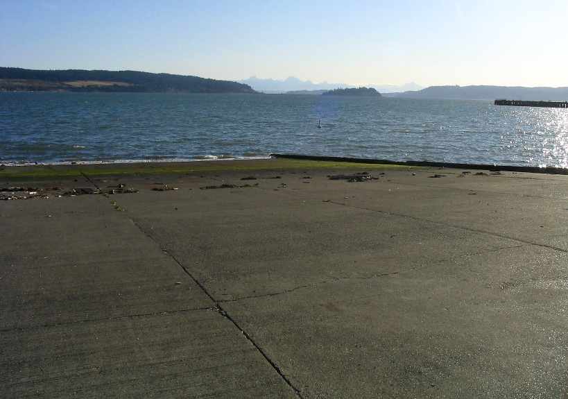
A 2005 photo by Paul Freeman looking southeast down the former seaplane ramp.
Kelly Siebecke reported on 9/19/09, “Today, for the 67th anniversary of the base,
a PBY Catalina landed in Crescent Harbor & came up one of the old seaplane ramps,
anchoring on deck near the old seaplane hangar (now the Navy Exchange).”
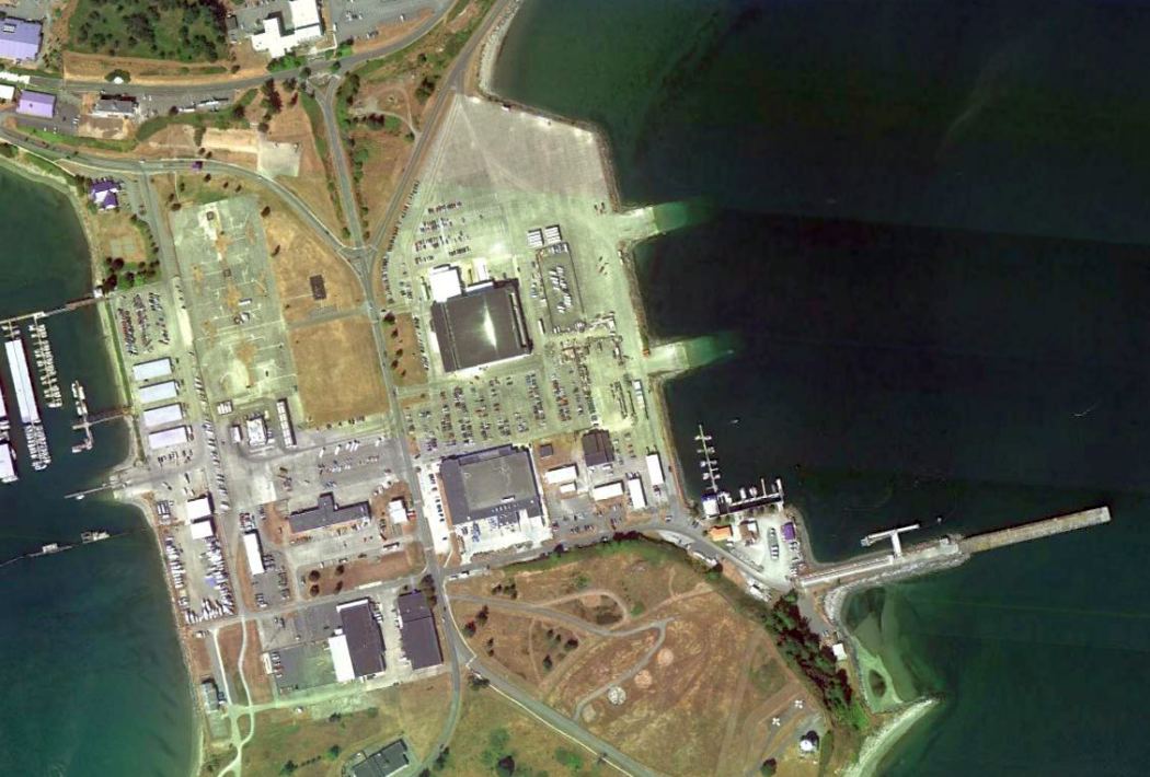
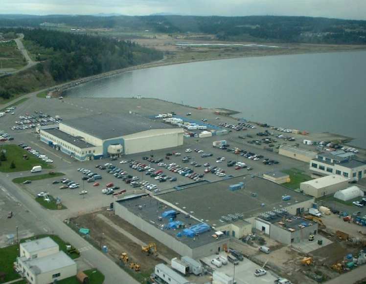
An 8/25/11 aerial view showed the remaining facilities at the seaplane base consist of a 2,000' square paved area,
a hangar, and 3 seaplane ramps which descend into the waters of the Puget Sound.
A marina for small boats has been built extending from the west side of the seaplane base.
See also: http://www.naswi.navy.mil/history-rel3.html
____________________________________________________
Since this site was first put on the web in 1999, its popularity has grown tremendously.
That has caused it to often exceed bandwidth limitations
set by the company which I pay to host it on the web.
If the total quantity of material on this site is to continue to grow,
it will require ever-increasing funding to pay its expenses.
Therefore, I request financial contributions from site visitors,
to help defray the increasing costs of the site
and ensure that it continues to be available & to grow.
What would you pay for a good aviation magazine, or a good aviation book?
Please consider a donation of an equivalent amount, at the least.
This site is not supported by commercial advertising –
it is purely supported by donations.
If you enjoy the site, and would like to make a financial contribution,
you
may use a credit card via
![]() ,
using one of 2 methods:
,
using one of 2 methods:
To make a one-time donation of an amount of your choice:
Or you can sign up for a $10 monthly subscription to help support the site on an ongoing basis:
Or if you prefer to contact me directly concerning a contribution (for a mailing address to send a check),
please contact me at: paulandterryfreeman@gmail.com
If you enjoy this web site, please support it with a financial contribution.
please contact me at: paulandterryfreeman@gmail.com
If you enjoy this web site, please support it with a financial contribution.
____________________________________________________
This site covers airfields in all 50 states.