Abandoned & Little-Known Airfields:
Southeastern Utah
© 2002, © 2015 by Paul Freeman. Revised 1/6/15.
This site covers airfields in all 50 states: Click here for the site's main menu.
____________________________________________________
Please consider a financial contribution to support the continued growth & operation of this site.
Grand County Airport / Spanish Valley Airport (added 1/6/15) - (Original) Green River Airport (added 7/1/12) - Halls Crossing Airport (revised 12/27/08)
(Original) Monticello Airport / San Juan County Airport (added 7/1/12)
____________________________________________________
Grand County Airport / Spanish Valley Airport, Moab, UT
37.94 North / 109.35 West (Southeast of Salt Lake City, UT)
A 7/10/53 USGS aerial photo depicted Grand County Airport as having a single northwest/southeast paved runway.
Jonathan Westerling reported, “Moab is a small mining town in Southeast UT at the head of a picturesque valley surrounded by high red sandstone mesas.
When the post-WW2 aviation boom hit, the community established its first airfield 8 miles south where the valley was a little wider.
This southern location was actually outside of city & county limits.
But since Moab is the County Seat of Grand County, it led to the odd situation of the Grand County airfield being located in San Juan County.”
According to “A History of Grand County, UT” by Richard Firmage (courtesy of Jonathan Westerling),
"The Spanish Valley airport opened in 1947 & was in San Juan County.
Because of the poor roads in southeast UT & its mining wealth, in the 1950s Moab had the 2nd highest rate of plane ownership per capita in the nation."
According to a 2007 article by by Craig Bigler in the Moab Times-Independent (courtesy of Jonathan Westerling),
“Nearly $90,000 in federal funds, untold thousands of local dollars, and hours of volunteer work
were put into the original Spanish Valley airport between 1948-55."
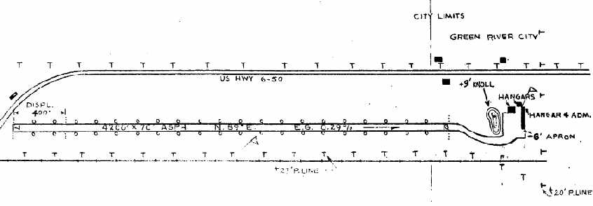
According to the 1951 Directory of Airfields (courtesy of Jonathan Westerling), the "Moab" airport had a paved 4,700' runway.
The earliest depiction which has been located of the Grand County Airport was a 7/10/53 USGS aerial photo.
It depicted Grand County Airport as having a single northwest/southeast paved runway,
with a paved ramp, one small building & 2 single-engine planes on the west side.
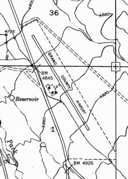
The 1954 USGS topo map Grand County Airport as having a single northwest/southeast paved runway,
with a paved ramp & buildings on the west side.
The 1961 Airman's Guide (courtesy of Jonathan Westerling) described Grand County Airport
as having a 5,000' runway & full services including airframe & engine repair.
According to the 1963 Airman's Guide (courtesy of Jonathan Westerling), the runway length had been slightly increased to 5,200'.
The only aeronautical chart depiction which has been located of the Grand County Airport
was on the 1964 Sectional Chart (courtesy of Jonathan Westerling).
It depicted Grand County Airport as having a 5,200' paved northwest/southeast runway.
According to Jonathan Westerling, “There were two key situations which led to the closure of the original airfield.
The first was the high cliffs which surrounded the airport & led to night flying hazards, as well as turbulent conditions whenever the winds were blowing.”
Jonathan continued, “The second situation which led to its closure is less obvious.”
According to a 2007 article by by Craig Bigler in the Moab Times-Independent (courtesy of Jonathan Westerling),
influential residents who had also been military veterans during WW II began a push in 1959
"for a U.S. Air Force base to be called Eisenhower Field strategically located near Moab to serve as a protectorate base for 12 of the nation's 20 uranium mills,
and where vast open spaces could be used for bombing practice & missile launching sites.
The airport's new location 16 miles north of Moab, adjacent to U. S. 160 [now U.S. 191] was nearly flat with no cliffs nearby.
There was even room for 12,000' runways."
Jonathan continued, “To enhance Moab's position with the Air Force,
the community secured federal lands & built a modest new airfield there with a 6,000' paved runway.
The new airport named 'Canyonlands' was dedicated on 4/25/65.
Operations at the old airfield were transferred to the new one, and the original Grand County airfield was closed.
Despite the new airfield, Moab did not get awarded an Air Force Base.
Furthermore, though the new airfield was clear of the surrounding cliffs,
its location (more than twice as far out of town than the original Grand County Airport) left some residents less than satisfied with the new airfield.”
Jonathan continued, “The only subsequent mention of the original airfield
was a proposal in January 1972 (according to Minutes of the Board of County Commissioners) by Dick Smith,
who proposed that the airfield be reopened as a privately-owned public airfield called the 'Spanish Valley Airport'.
Though the proposal was unanimously accepted, no further mention of this initiative can be found, and it does not appear the airport ever reopened.”
Jonathan reported that the runway was reused as a drag strip after the airport's closure.
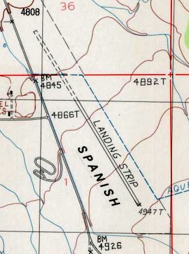
The 1996 USGS topo map continued to depict the former Grand County Airport runway, but labeled simply as “Landing Strip”,
and the northwestern half was depicted as being unpaved.
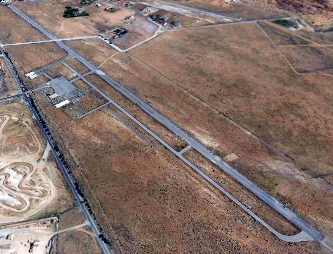
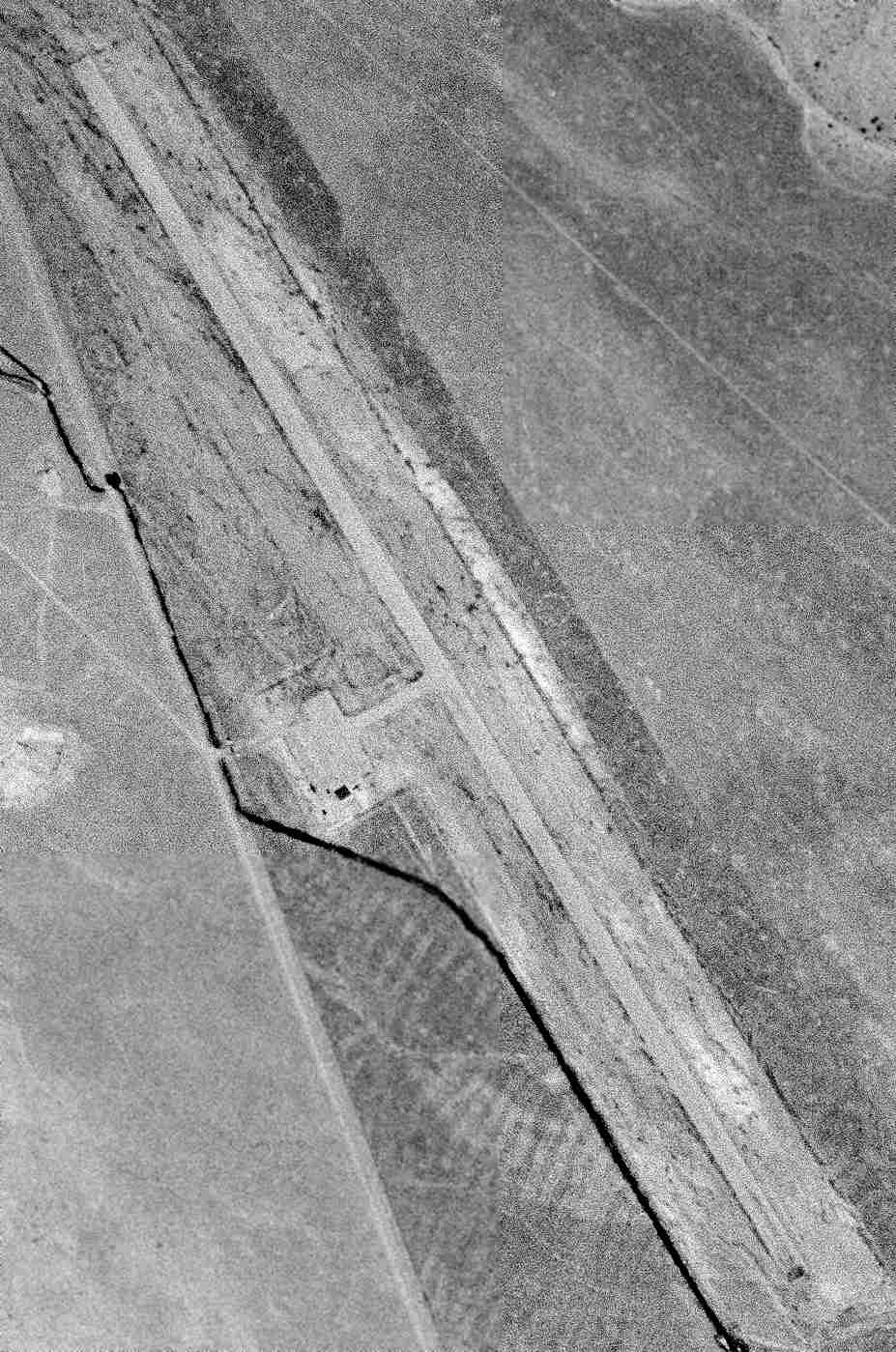
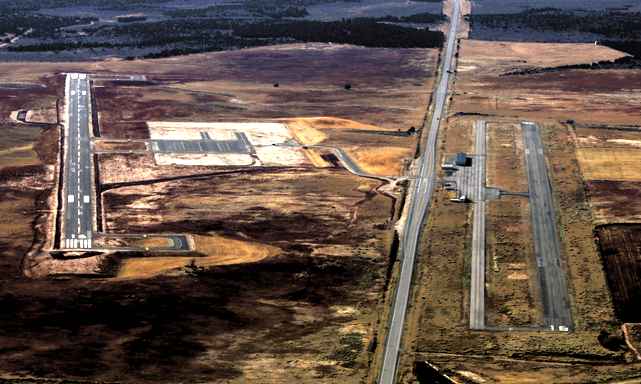
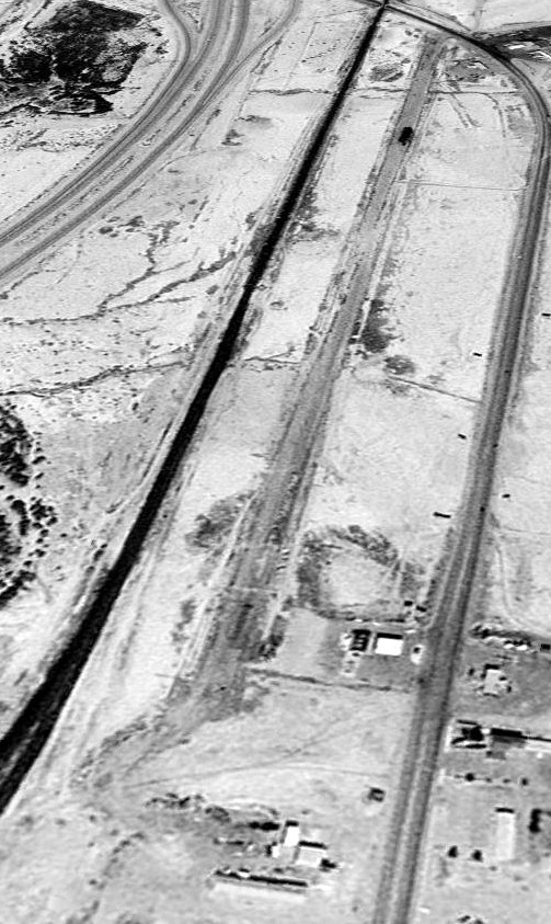
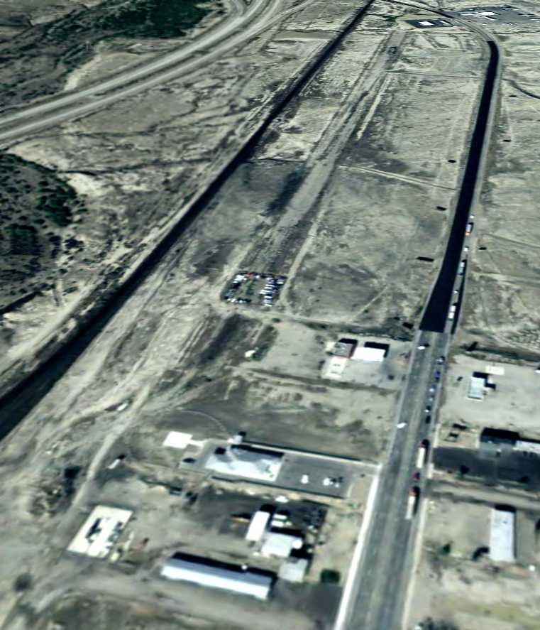
A 2013 aerial view looking northeast depicted the former Grand County Airport runway, taxiway, and ramp as remaining intact,
though a road cut across the northern portion of the runway.
All of the buildings had been removed.
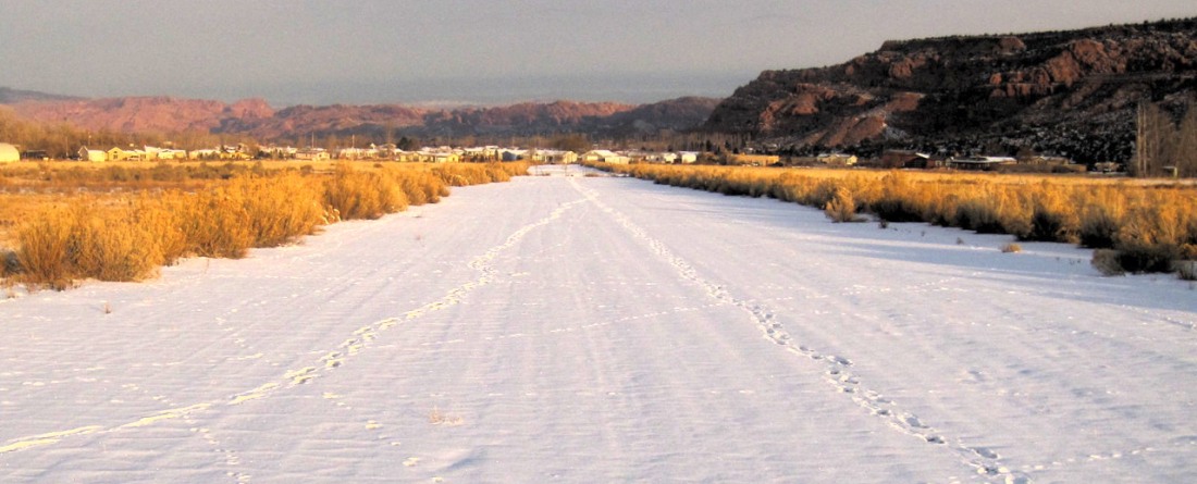
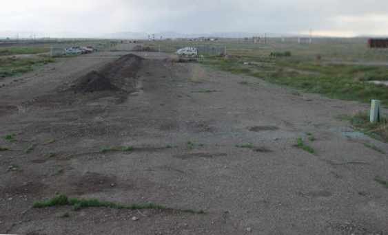
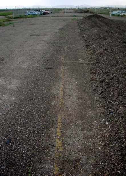
A 12/31/14 photo by Jonathan Westerling looking north along the remains of the Grand County Airport runway.
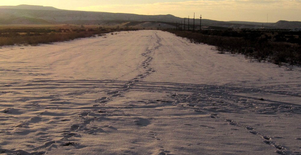
A 12/31/14 photo by Jonathan Westerling looking south along the remains of the Grand County Airport runway.
Jonathan observed, “The light poles are remnants of the airfield's use as a drag strip after its closure.”
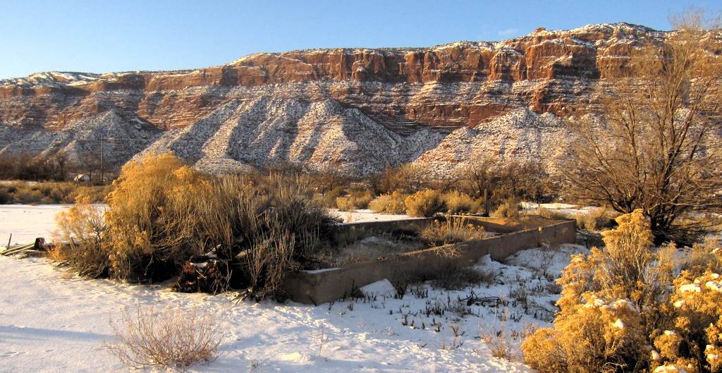
A 12/31/14 photo by Jonathan Westerling of the “foundation of one of the former buildings at the Moab Airport.”
The site of Grand County Airport is located at the intersection of Spanish Valley Drive & Old Airport Road, appropriately enough.
____________________________________________________
(Original) Monticello Airport / San Juan County Airport, Monticello, UT
37.94 North / 109.35 West (Southeast of Salt Lake City, UT)
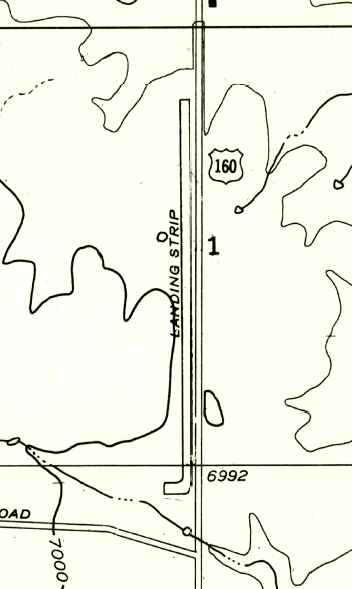
The 1958 USGS topo map depicted Monticello Airport as having a single north/south runway, labeled simply as “Landing Strip”.
The original airport for the town of Monticello was located on the west side of Route 160 / Route 191.
Monticello Airport was evidently established at some point between 1945-58,
as it was not yet listed among active airports in the 1945 AAF Airfield Directory (courtesy of Scott Murdock).
The earliest depiction which has been located of Monticello Airport was on the 1958 USGS topo map,
which depicted a single north/south runway on the west side of Route 160, labeled simply as “Landing Strip”.
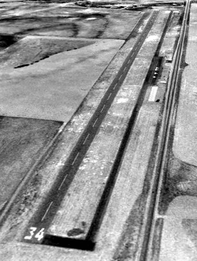
The earliest photo which has been located of Monticello Airport was a 7/3/97 USGS aerial view looking northwest.
It depicted Monticello as having a single paved Runway 16/34 with a parallel taxiway, and a ramp, several small hangars, and 4 single-engine planes on the east side.
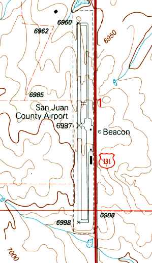
The 2001 USGS topo map depicted San Juan County Airport as having a single north/south runway & parallel taxiway, and a ramp & 3 small buildings on the east side.
A beacon was depicted on the opposite side of Route 191.
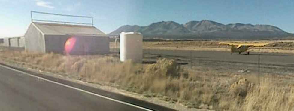
The last photo which has been located showing aircraft at the original Monticello Airport
was a circa 2010 view looking southwest at a single traildragger & a few hangars.
In March 2011 a larger replacement Monticello Airport was opened on the opposite side of Route 191,
and the original airport presumably closed at the same time.
A circa 2011 aerial view looking south at the new Monticello Airport (on the left) & the original field (on the right).
Both runways appeared to be marked as active runways.
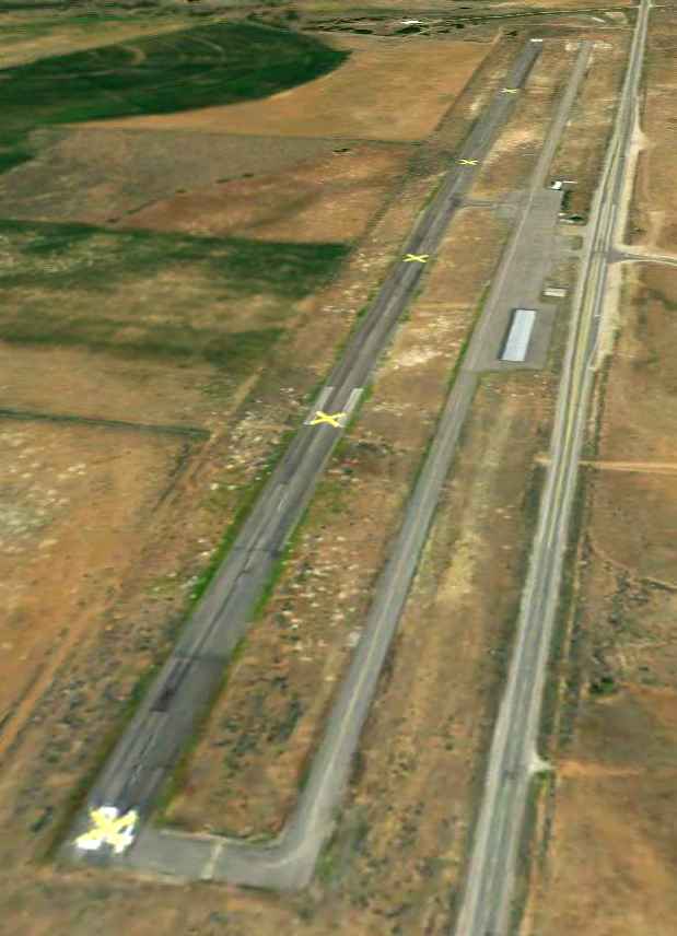
A 9/15/11 aerial view looking northwest at the original Monticello Airport.
The runway was marked with several closed “X” markings, but the field appeared to remain intact.
The original Monticello Airport is located northwest of the intersection of Route 191 & Spring Creek Road.
____________________________________________________
Halls Crossing Airport, Halls Crossing, UT
37.47 North / 110.7 West (Southeast of Salt Lake City, UT)
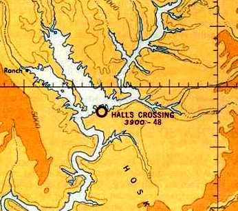
Halls Crossing Airport, as depicted on the December 1965 Denver Sectional Chart (courtesy of Chris Kennedy).
The date of construction of this small general aviation airport has not been determined.
The earliest depiction of the Halls Crossing Airport which has been located was on the December 1965 Denver Sectional Chart (courtesy of Chris Kennedy).
It depicted the field as having a 4,800' unpaved runway.
According to Jonathan Westerling, “The airport was apparently installed by the Park Service
as a way to access the then newly-formed North Lake Powell.”
The published length of the Halls Crossing Airport runway had been shortened to 3,800'
on the December 1968 Denver Sectional Chart (courtesy of Chris Kennedy).
Chris remarked, “I don't think anybody knew how long this strip was. Every reference has a different length.”
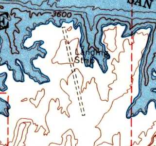
The Halls Crossing Airfield was depicted simply as “Landing Strip” on the 1970 USGS topo map.
The 1977 AOPA Airports USA Directory (according to Jonathan Westerling)
described Halls Crossing as having a 3,400' runway.
According to minutes of the San Juan County Commission,
“A letter dated 2/26/87 from Senator Jake Garn [concerned] the construction of the new airport at Halls Crossing.
The letter states that he strongly supports the proposal by San Juan County to construct a safe new landing strip at Halls Crossing.
The existing dirt strip is not a good facility & should be upgraded at the earliest opportunity.”
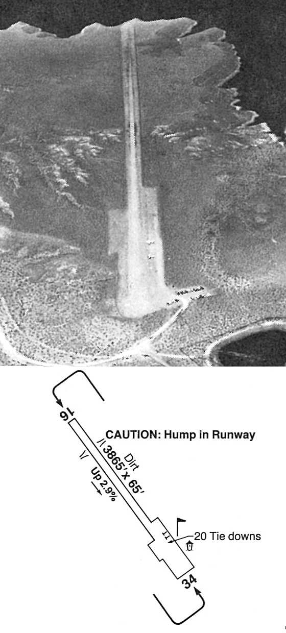
An undated aerial view looking northwest & the airport layout of Halls Crossing Airport
from the 1989 Guide to Southwest Airports (courtesy of Jonathan Westerling).
The photo depicted the field as having a single dirt runway,
with 2 light aircraft parked on the northeast side.
The diagram depicted the field as having a single 3,865' dirt Runway 16/34,
with Runway 16 having a 2.9% upslope.
The last aeronautical chart depiction which has been located of the Halls Crossing Airport
was on the 1993 Denver Sectional Chart (courtesy of Jonathan Westerling).
It depicted the field as having a 3,800' unpaved runway.
It also depicted a new paved-runway airfield (Cal Black) which had been constructed to the east.
The Halls Crossing Airport was closed at some point between 1993-95,
as it was no longer listed among active airfields in the 1995 AOPA Airport Directory (according to Jonathan Westerling).
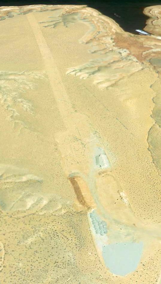
A 6/25/13 aerial view looking northeast shows the Halls Crossing runway remains mostly intact.
Jonathan Westerling noted, “The runway must have had a very dramatic (albeit unsafe) approach & departure
with the runway running right off the end of a red rock cliff overlooking the lake.”
____________________________________________________
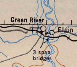
(Original) Green River Airport (U20), Green River, UT
38.99, -110.18 (Southeast of Salt Lake City, UT)
The original Green River Airport, as depicted on an 8/12/52 USGS aerial photo.
The first airport for the town of Green River was evidently built at some point between 1949-52,
as it was not depicted on the September 1949 Great Salt Lake World Aeronautical Chart (courtesy of Donald Felton).
The earliest depiction of the field which has been located was an 8/12/52 USGS aerial photo.
It depicted 2 unpaved east/west runways, with a few small buildings on the east side.
The earliest aeronautical chart depiction which has been located of the original Green River Airport
was its depiction as an auxiliary airfield on the March 1954 Grand Junction Sectional Chart (courtesy of Chris Kennedy).
The earliest depiction of the field which has been located
was on the March 1954 Grand Junction Sectional Chart (courtesy of Chris Kennedy),
which depicted it as an auxiliary airfield.
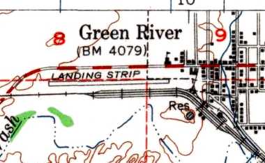
The 1954 USGS topo map depicted Green River as having a single east/west runway, labeled simply as “Landing Strip”.
The runway at Green River was apparently paved at some point between 1954-63,
as the 1963 AOPA Airport Directory (courtesy of Chris Kennedy)
described Green River as having a single 4,100' bituminous Runway 9/27.
The operator was listed as Green River Aviation Company, a Cessna dealer.
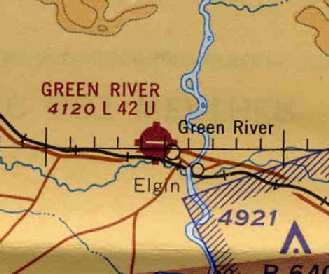
The original Green River Airport,
as depicted on the November 1965 Grand Junction Sectional Chart (courtesy of Chris Kennedy).
The 1967 Flight Guide (courtesy of Chris Kennedy) depicted Green River
as having a curving taxiway which led from the eastern end of the runway to a small ramp,
with several buildings (hangars?) along the northern side of the ramp.
The runway had also been redesignated as Runway 7/25.
The airfield configuration was depicted in the same manner
in the 1972 Flight Guide (courtesy of Chris Kennedy).
The runway configuration remained unchanged
as described in the 1976 AOPA Airport Directory (courtesy of Chris Kennedy),
and the operator remained listed as Green River Aviation.
By the time of the 1982 AOPA Airport Directory (courtesy of Ed Drury),
the operator had become Redtail Aviation Inc.
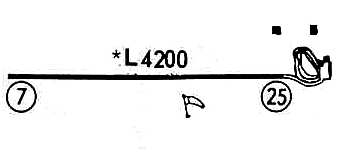
The February 4, 1982 FAA Inspection Report (courtesy of David Field)
depicted Green River as having a single 4,200' asphalt Runway 7/25,
with an apron & several hangars on the east side of the field.
The field was said to be owned by the City of Green River,
with the manager listed as Glen Baxter.
Green River was said to have a total of 7 single-engine aircraft based on the field,
which was listed as conducting an average of 558 takeoffs or landings per month.
According to David Field (referencing material in the FAA's Inspection Report), “The airport was abandoned April 11, 1984.”
It has been replaced by a new Green River Municipal Airport,
4 miles southwest of the town of Green River.
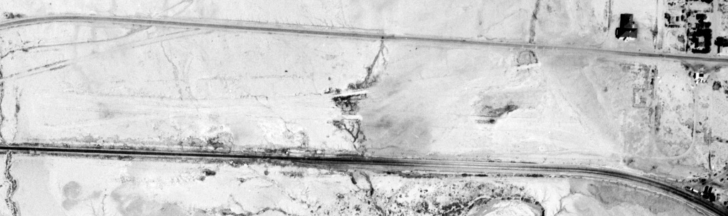
As seen in a 7/13/97 USGS aerial view looking southwest, the runway remained but in a somewhat deteriorated condition.
Several of the former airport buildings also appeared to remain at the eastern end of the runway.
A 2005 photo by Keith Wood, looking west along the remains of the abandoned Green River Runway,
“which has been trenched the long way down the middle, with sewer & fiber-optic cable laid.
The sewer has been there for quite a while, the fiber-optic cable is new & perhaps still being laid.
There is also a fenced area apparently used for impound.”
A 2005 photo by Keith Wood. “The yellow stripe... is the only remaining runway marking. No Xs or any other markings could be seen.”
Keith reported that an antenna tower used by the Sheriff's Department sits just off the east end of the abandoned runway.
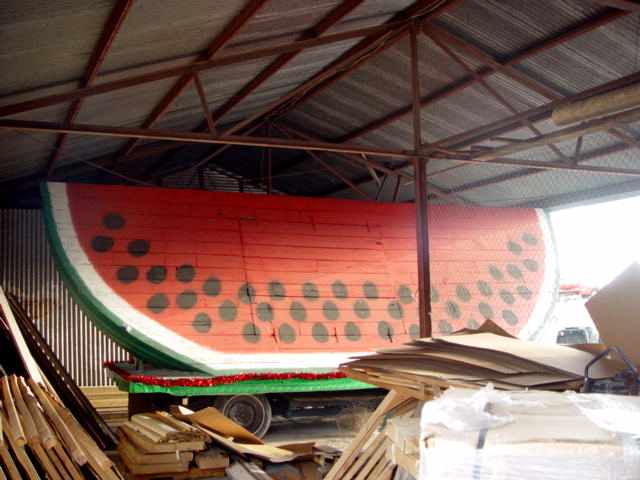
A 2005 photo by Keith Wood of perhaps the world's largest watermelon ever to inhabit a hangar at an abandoned airfield.
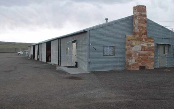
A 2005 photo by Keith Wood of “the largest building, with the FBO and/or pilot lounge at the north end (with chimney).
“The airfield buildings were at the east end of the airport, arranged in a U with the open end to the south.
There were several hangars.
All seem to have been taken over for city storage.”
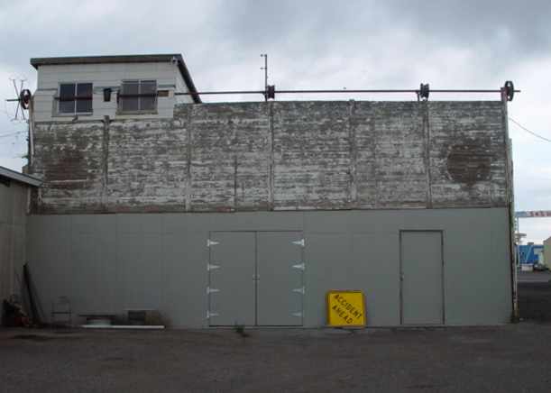
A 2005 photo by Keith Wood of “the oldest of the airport buildings,
on the north end of the originally with a door which slid upward on cables.
The outer 'pulleys' were spoked car wheels, the inner pulleys were steel wheels.”
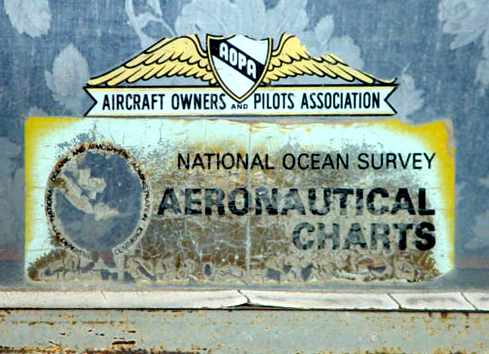
A 2005 photo by Keith Wood of “the only remaining 'signage' whatsoever to indicate an airport.
It is on the long hangar, in a window of the FBO.”
Keith reported, “Only one runway light is still in place, several others have been crushed & dumped.
The wind circle was made of tires, which are still in place, with the lights (also crushed) between them.
I found no sign of any fueling facilities or transient parking.”
A 2006 aerial view looking southwest along the remains of the runway at Green River.
The site of the original Green River Airport is located in between the D & RG Western Railroad tracks & the Old Highway,
adjacent to the west side of the town of Green River.
Thanks to Chris Kennedy for pointing out this airfield.
____________________________________________________
Since this site was first put on the web in 1999, its popularity has grown tremendously.
That has caused it to often exceed bandwidth limitations
set by the company which I pay to host it on the web.
If the total quantity of material on this site is to continue to grow,
it will require ever-increasing funding to pay its expenses.
Therefore, I request financial contributions from site visitors,
to help defray the increasing costs of the site
and ensure that it continues to be available & to grow.
What would you pay for a good aviation magazine, or a good aviation book?
Please consider a donation of an equivalent amount, at the least.
This site is not supported by commercial advertising –
it is purely supported by donations.
If you enjoy the site, and would like to make a financial contribution,
you
may use a credit card via
![]() ,
using one of 2 methods:
,
using one of 2 methods:
To make a one-time donation of an amount of your choice:
Or you can sign up for a $10 monthly subscription to help support the site on an ongoing basis:
Or if you prefer to contact me directly concerning a contribution (for a mailing address to send a check),
please contact me at: paulandterryfreeman@gmail.com
If you enjoy this web site, please support it with a financial contribution.
please contact me at: paulandterryfreeman@gmail.com
If you enjoy this web site, please support it with a financial contribution.
____________________________________________________
This site covers airfields in all 50 states.