Abandoned & Little-Known Airfields:
Southern Nevada
© 2002, © 2015 by Paul Freeman. Revised 9/5/15.
This site covers airfields in all 50 states: Click here for the site's main menu.
____________________________________________________
Please consider a financial contribution to support the continued growth & operation of this site.
Chicken Ranch Airfield (revised 3/14/15) – Scotty's Intermediate Field / Bonnie Claire Airport (revised 12/31/11)
Scotty Airport / Bonnie Claire Lake Landing Strip (revised 12/31/11) - Lathrop Well Airport / Jackass Aeropark (revised 12/25/08)
Mercury Airfield (added 9/5/15)
____________________________________________________
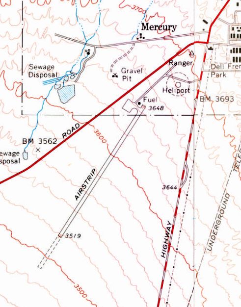
36.64 North / 116.01 West (Northwest of Las Vegas, NV)
Mercury Airfield, as depicted on the 1961 USGS topo map.
Photo of the airfield while open has not been located.
According to Wikipedia, the town of Mercury was established in 1950 at the beginning of operations of the Nevada Test Site as Base Camp Mercury,
a military-style encampment built to provide basic facilities for personnel involved.
As the scope of the testing program expanded, so did the number of personnel required to fulfill the site's mission,
and beginning in 1951 a $6.7 million construction project was undertaken to provide adequate individual housing, office, and service structures with a civilian town-like design.
A 1952 USGS aerial photo did not yet depict any airfield in Mercury.
The Naval Radiological Defense Laboratory conducted its first test flight in 1956 of tmospheric sounding rockets
to measure nuclear radiation and other atmospheric data, using Mercury as a staging area.
This test rocket lifted 30 lbs to an altitude of 25 miles.
In 1957, the US Navy launched 9 sounding rockets.
The earliest depiction which has been located of an airfield at Mercury was on the 1961 USGS topo map.
It depicted a single northeast/southwest runway, labeled simply as airstrip, with an additional overrun length on the southwest end.
A ramp with fuel was depicted on the north end, along with a heliport.
In 1962, a larger Desert Rock Airstrip was added less than a mile to the southwest for President John Kennedy's 12/8/62 visit.
Presumably at this point the original Mercury Airfield was abandoned.
The 1971 Las Vegas Sectional Chart (courtesy of Vince Granato) no longer depicted the original Mercury Airfield,
only the newer Desert Rock Airfield.
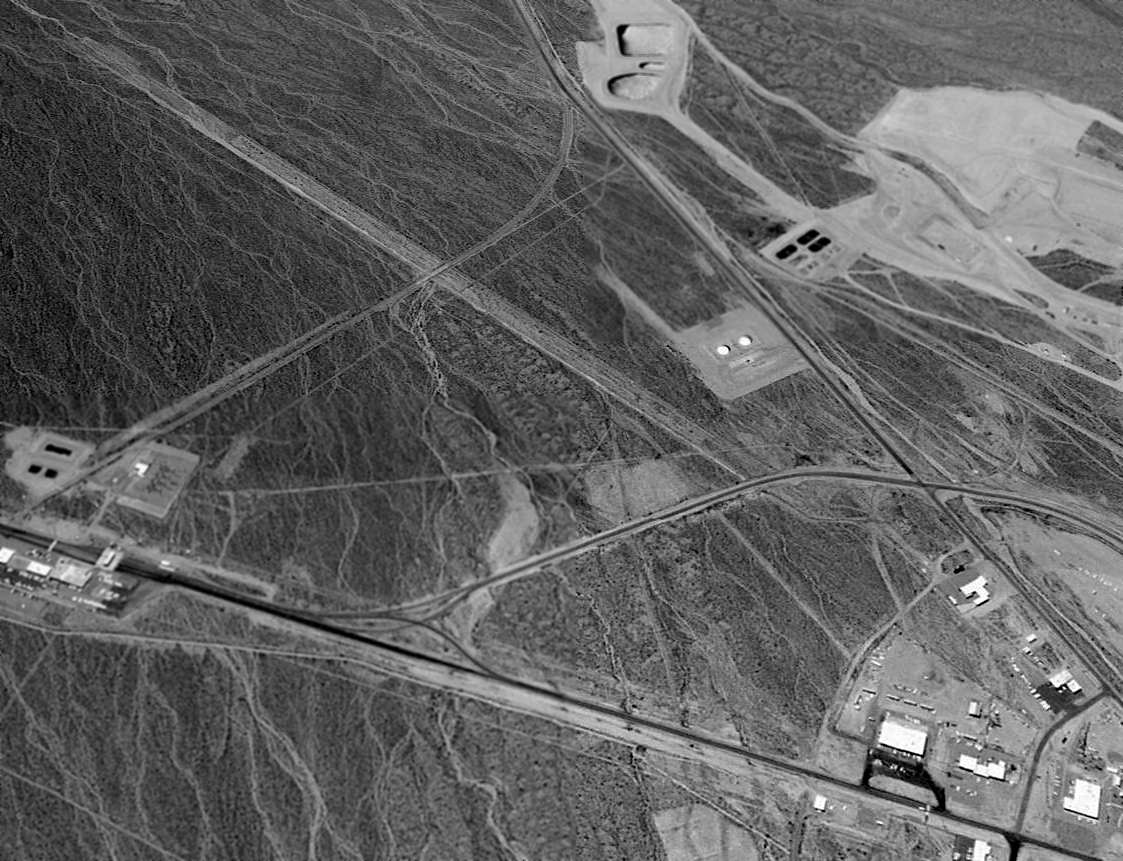
A 3/3/80 USGS aerial view depicted the Mercury Airfield as deteriorated but recognizable.
Several roads cut across the former runway, and the former heliport to the northeast was not recognizable.
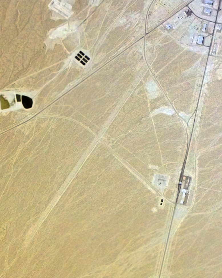
A 1998 aerial view looking west showed the runway of the former Mercury Airfield remained recognizable.
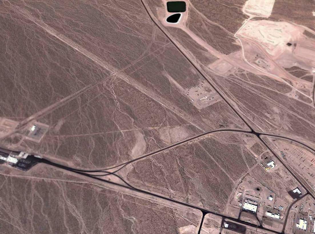
A 2011 aerial view looking west showed the runway of the former Mercury Airfield remained recognizable.
The site of Mercury Airfield is located southwest of the intersection of Jackass Flats Road & Mercury Highway.
Thanks to Colleen Beck for pointing out this airfield.
____________________________________________________
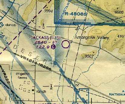
Lathrop Wells Airport / Jackass Aeropark (U75), Amargosa Valley, NV
36.64 North / 116.41 West (Northwest of Las Vegas, NV)
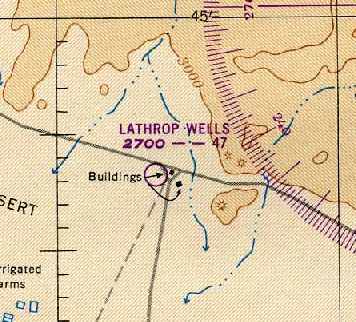
Lathrop Wells Airport, as depicted on the February 1949 Mt. Whitney Sectional Chart (courtesy of Chris Kennedy).
Photo of the airfield while open has not been located.
The Lathrop Wells Airport was evidently established at some point between 1946-49,
as it was not yet depicted at all on the February 1946 Mt. Whitney Sectional Chart (according to Chris Kennedy).
The earliest depiction of the field which has been located
was on the February 1949 Mt. Whitney Sectional Chart (courtesy of Chris Kennedy).
It depicted Lathrop Wells as having a 4,700' unpaved runway.
Lathrop Wells Airport was still depicted on the May 1957 Mt. Whitney Sectional Chart (according to Chris Kennedy),
with the listed runway length having grown slightly to 5,000'.
The Lathrop Wells Airport was evidently closed (for reasons unknown) at some point between 1957-59,
as it was no longer depicted at all on the March 1959 Mt. Whitney Sectional Chart (according to Chris Kennedy).
The Lathrop Wells Airport was depicted on the 1961 USGS topo map as having 2 runways.
It was merely labeled “Airstrip”, so it may not have been in operation at that time.
No airfield was depicted at this location on the June, 1963 Mt. Whitney Sectional Chart (according to Chris Kennedy).
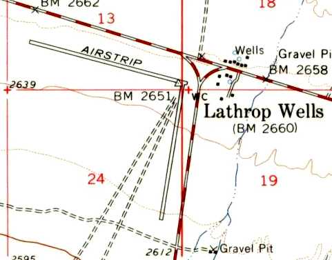
At some point between 1963-64, a new longer runway was constructed adjacent to the west side of the original airfield,
reopening under the name of Jackass Aeropark.
The June 1964 Mt. Whitney Sectional Chart (courtesy of Chris Kennedy)
depicted Jackass as having a 6,200' unpaved runway.
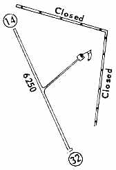
The 1968 Flight Guide (courtesy of Chris Kennedy)
depicted Jackass as having a single 6,250' unpaved Runway 14/32,
with a taxiway leading to a single hangar to the northeast.
The 2 closed runways of the original Lathrop Wells Airport were also depicted to the northeast.
The 1971 Las Vegas Sectional Chart (courtesy of Vince Granato)
depicted Jackass as having a 6,200' unpaved runway.
The 1994 USGS topo map depicted the Jackass Aeropark
as having a single paved runway, oriented northwest/southeast.
A taxiway led northeast toward a single hangar.
The 1998 USGS aerial photo depicted the single northwest/southeast paved runway,
along with the 2 earlier unpaved runways of the original Lathrop Wells Airport,
oriented roughly east/west & north/south, paralleling the adjacent roads.
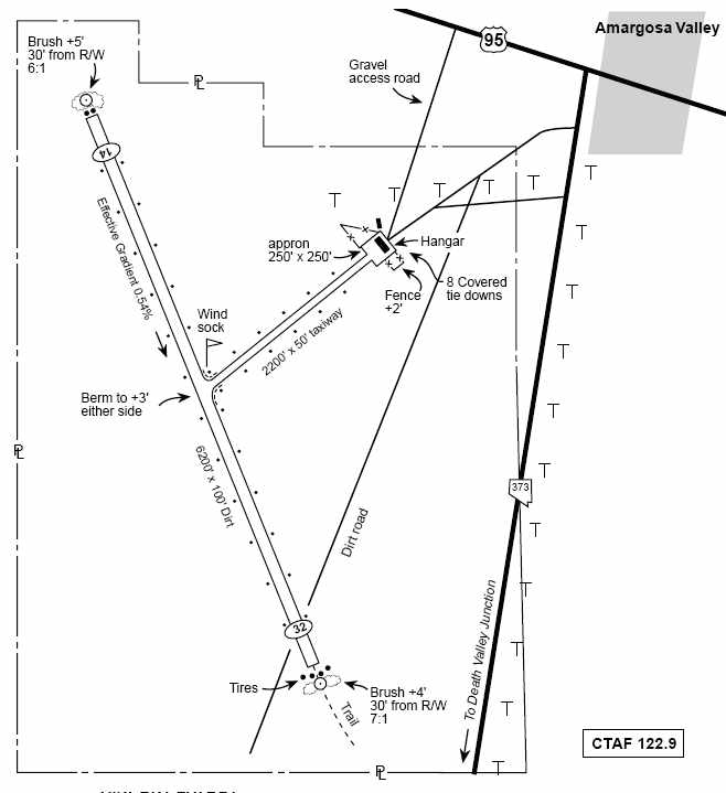
The December 2003 NV Department of Transportation airport diagram
depicted Jackass Aeropark as having a single 6,200' dirt Runway 14/32.
A taxiway led to a single hangar, containing 8 covered tie-downs.
Jan Cameron (chairwoman of the Amargosa Valley Advisory Board) reported in 2004
that the Jackass Aeropark was the only airport in Nye County capable of taking jets.
A Boeing 737 has on at least on occasion landed there, she said.
Upgrade plans for the airport were discussed in 2004, but were not implemented.
The last aeronautical chart depiction which has been located of the Jackass Aeropark
was on the March 2004 Las Vegas Sectional Chart (courtesy of Chris Kennedy).
It depicted Jackass as having a 6,200' unpaved runway.
The Jackass Aeropark was evidently abandoned at some point between 2004-2006,
as it was no longer depicted at all on the 2006 Las Vegas Sectional Chart.
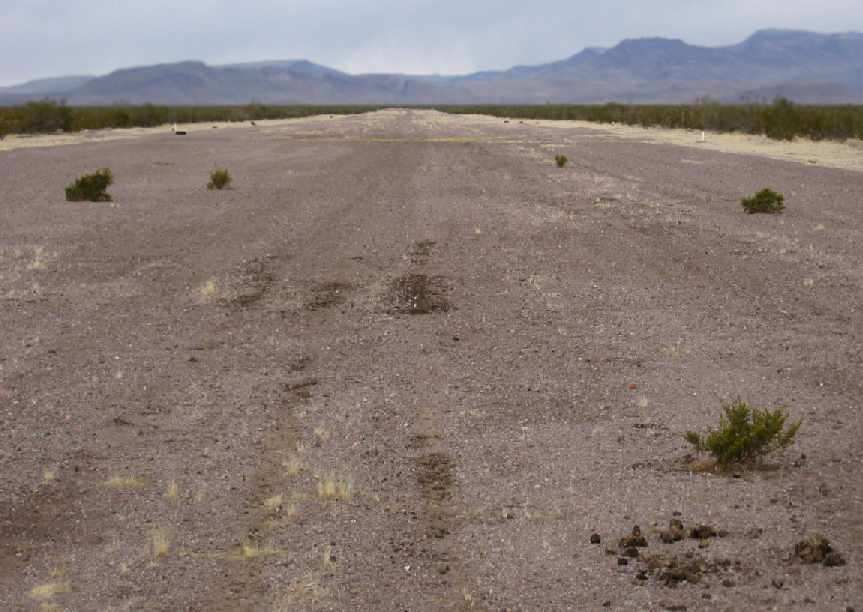
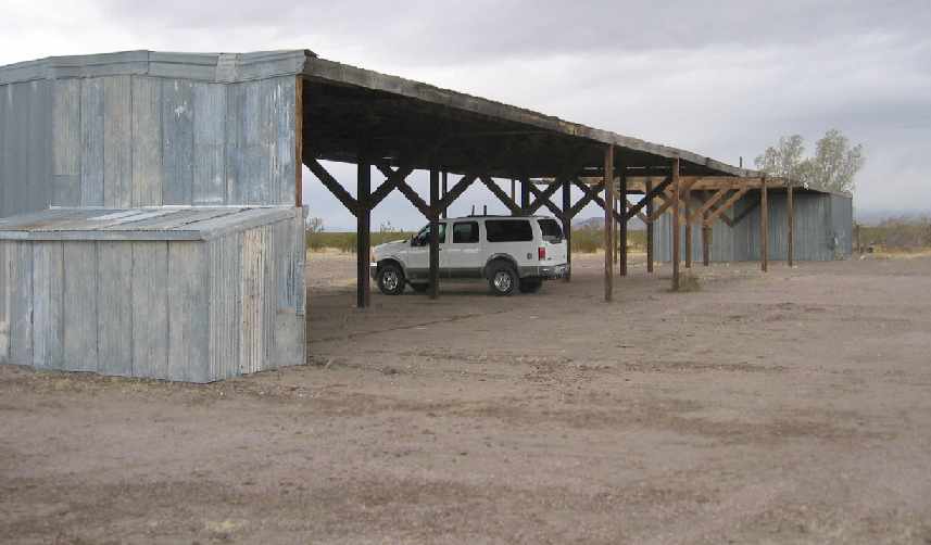
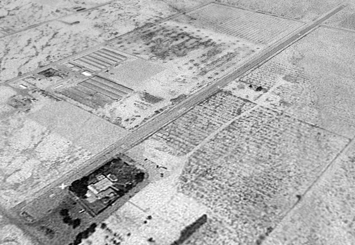
A 2006 photo by Pen Parks, looking along the former paved runway at Jackass Aeropark.
Pen reported, “It was paved at one time, 1.2 miles long & 130 feet wide,
with a taxiway to a hangar & tiedowns from the center.”
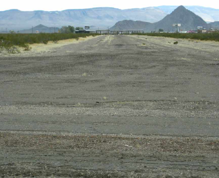
A 2006 photo by Pen Parks, looking northeast along the former taxiway toward the abandoned hangar at Jackass Aeropark.
A 2006 photo by Pen Parks of the abandoned former hangar at Jackass Aeropark.
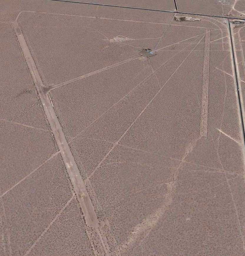
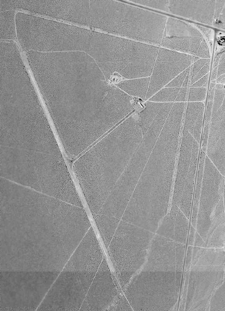
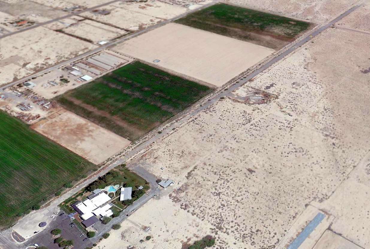
A circa 2006 aerial view looking north at Jackass Aeropark.
Jackass Aeropark is located west of the intersection of Route 95 & Route 373.
____________________________________________________
Chicken Ranch Airfield, Pahrump, NV
36.07 North / 115.95 West (West of Las Vegas, NV)
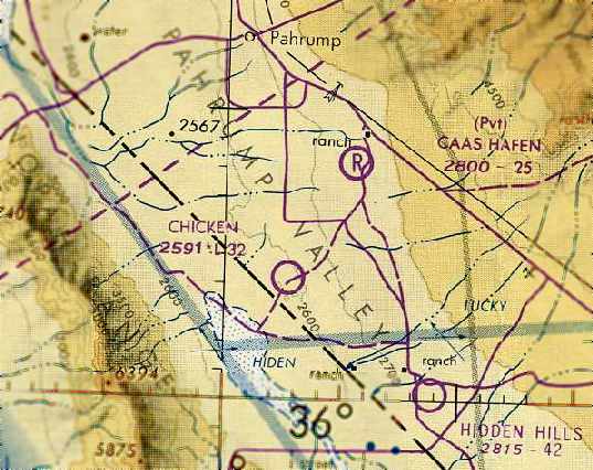
The Chicken Ranch Airfield, as depicted on the October 1980 Las Vegas Sectional Chart (courtesy of Chris Kennedy).
This private airfield was established by the Chicken Ranch brothel - one of the more unusual operators of a private airfield.
No runway was yet depicted at this location on the 1958 USGS topo map.
It may have been established as far back as the 1960s,
as Dan Eikleberry reported in 2006, “They have had a runway for 'commuters' from Las Vegas on & off for about 40 years.
Sometimes it shows up on sectional charts, sometimes it doesn't.”
No airfield at this location was depicted on the 1971 Las Vegas Sectional Chart (courtesy of Vince Granato).
According to Dan Eikleberry, “There was an air-taxi from [Las Vegas] McCarran Airport in the 1970's & 1980's
who advertised & flew Cessna 182's to & from the Chicken Ranch.”
No airfield at this location was depicted on the April 1980 Las Vegas Sectional Chart (according to Chris Kennedy).
The earliest depiction of the Chicken Ranch Airfield which has been located
was on the October 1980 Las Vegas Sectional Chart (courtesy of Chris Kennedy).
It depicted “Chicken” as a public-use airfield having a 3,200' unpaved runway.
However, it was not listed among active airfields in the 1980 or 1982 AOPA Airport Directories (according to Chris Kennedy).
The 1983 USGS topo map labeled the field simply as “Landing Field”.
The Chicken Ranch Airfield was depicted simply as “Landing Field” on the 1984 USGS topo map.
The single paved runway at the Chicken Ranch had closed runway “X” symbols visible along it in a 1994 USGS aerial view looking northeast,
so it was evidently already closed by that point.
There was no sign of any hangars or other buildings directly related to the airfield.
The Chicken Ranch Airfield was no longer depicted at all
on the March 1999 Las Vegas Sectional Chart (according to Chris Kennedy).
According to Dan Eikleberry, “One of the county real estate moguls who makes a business out of selling lots & hangars
at the Calvada Meadows Airport at the North end of Pahrump
didn't appreciate the competition for airports in his town
and somehow got them to shut down the Chicken Ranch airport about 2004.”
A 2013 aerial view looking northeast showed the closed-runway “X” symbols visible along the length of the Chicken Ranch Airfield runway.
The Chicken Ranch Airfield is located southeast of the intersection of Homestead Road & Silver Street.
____________________________________________________
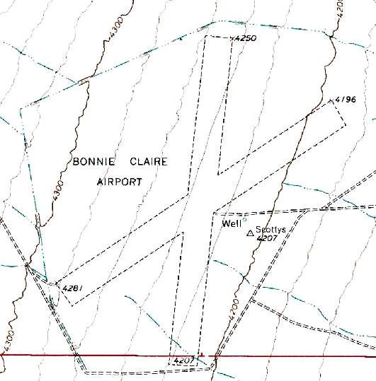
Scotty Airport / Bonnie Claire Lake Landing Strip, Bonnie Claire, NV
37.16 North / 117.16 West (Northwest of Las Vegas, NV)
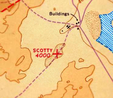
Scotty Airport, as depicted on the 1941 Mt. Whitney Sectional Chart (courtesy of David Brooks).
The date of construction of this lakebed airfield has not been determined.
The earliest depiction of this airfield which has been located
was on the 1941 Mt. Whitney Sectional Chart (courtesy of David Brooks).
It depicted “Scotty” as an auxiliary airfield.
Scotty Airport was evidently abandoned at some point between 1941-49,
as it was no longer depicted on the 1949 Mt Whitney Sectional Chart (according to Chris Kennedy)
or subsequent aeronautical charts.
During the 1950s & 1960s, Bonnie Claire Lake may have been intended for use
as one of several emergency landing sites for the X-15 rocket plane.
Another lakebed landing strip which is of very similar configuration is the Delamar Lake Landing Strip,
which was one of the designated emergency landing sites for the X-15.
Therefore, although not listed among references of X-15 landing sites,
Bonnie Claire Lake could have presumably been among possible X-15 landing sites.
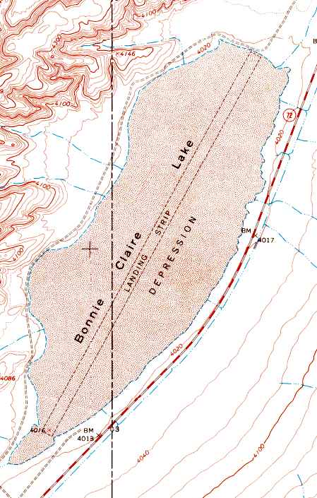
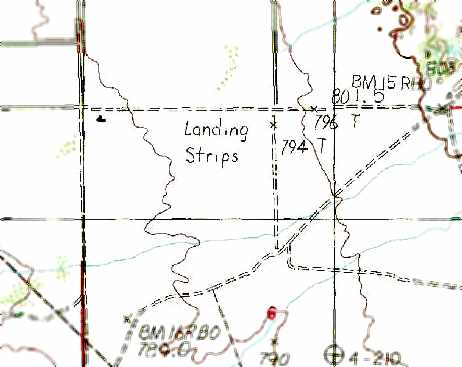
The 1968 USGS topo map depicted a single northeast/southwest runway outline running the entire length of Bonnie Claire Lake,
labeled simply as "Landing Strip".
No airfield at this location was depicted on the 1970 USGS topo map
or the 1971 Las Vegas Sectional Chart (courtesy of Vince Granato).
The field was depicted as a "Landing Strip" on the 1985 USGS topo map.
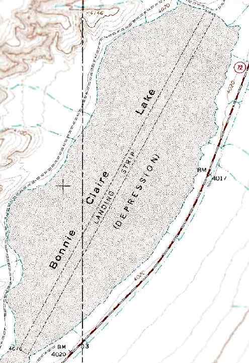
The 1991 USGS topo map depicted a single northeast/southwest runway outline running the entire length of Bonnie Claire Lake,
labeled simply as "Landing Strip".
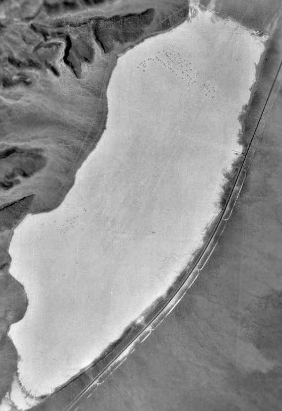
The outline of the landing strip was barely discernible in the 1994 USGS aerial photo.
There was no sign of any buildings or other improvements.
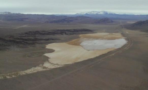
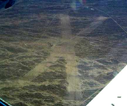
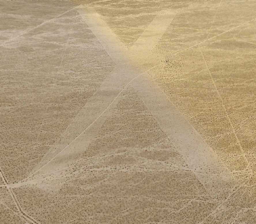
A 2001 aerial view by JD Lawson looking north at Bonnie Claire Lake,
with Bonnie Claire Airport visible as an "X" in the upper left corner.
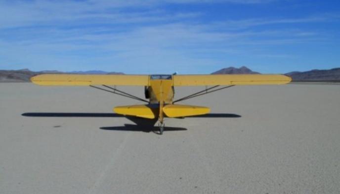
A 2001 photo by JD Lawson of a Taylorcraft on the dry lakebed at Bonnie Claire.
The airfield was not depicted at all on the 2002 Sectional Chart.
A 2006 aerial view depicted the site in an unchanged fashion.
Bonnie Claire Dry Lake is located 4 miles southwest of the town of Bonnie Claire,
adjacent to the west side of Route 267 (which is labeled Route 72 on USGS topo maps).
Yet another airfield, Bonnie Claire Airport, is located only 2 miles northwest.
Thanks to JD Lawson for pointing out this airfield.
____________________________________________________
Scotty's Intermediate Field / Bonnie Claire Airport, Bonnie Claire, NV
37.2 North / 117.18 West (Northwest of Las Vegas, NV)
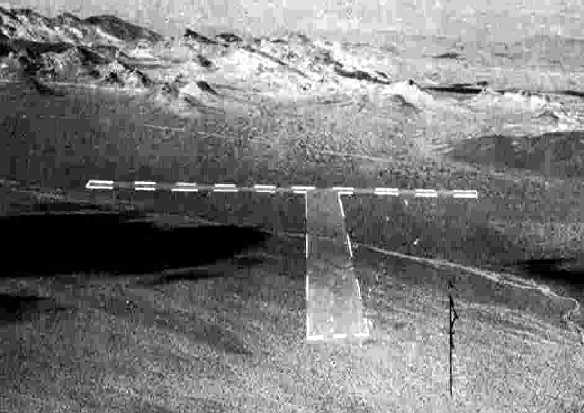
A 10/21/43 aerial view looking north at “Scotty's Intermediate Field”
from the 1945 AAF Airfield Directory (courtesy of Scott Murdock).
Only 2 miles northwest of Bonnie Claire Lake Landing Strip
sits another airfield in the middle of nowhere: Scotty's Intermediate Field / Bonnie Claire Airport.
Scotty's Intermediate Field was apparently built as one of the Civil Aeronautics Administration's network of intermediate fields.
It may have been built at some point in 1943,
as it was not depicted at all on the 1940 Airports & Airways Map from the NV Division of Aeronautics (courtesy of Jim Mallery)
nor on the August 1943 Mt. Whitney Sectional Chart (according to Chris Kennedy).
The earliest photo which has been located of Scotty's Intermediate Field
was a 10/21/43 aerial view looking north from the 1945 AAF Airfield Directory (courtesy of Scott Murdock).
It depicted the “Scotty's Intermediate Field” as having 2 unpaved runways.
Keith Wood noted that Scottys was most likely established as an intermediate field
along the Las Vegas - Reno & Salt Lake City – Bakersfield airways,
as the field is located almost directly along these 2 routes.
The earliest aeronautical chart depiction of the field which has been located
was on the August 1945 Mt. Whitney World Aeronautical Chart (courtesy of Chris Kennedy).
It labeled the field as "Scottys”, and also indicated that the field was the Civil Aeronautics Administration's Site 22.
The 1945 AAF Airfield Directory (courtesy of Scott Murdock) described “Scotty's Intermediate Field”
as a 640 acre irregularly-shaped property having 2 graded 6,000' runways, oriented north/south & northeast/southwest.
The field was said to not have any hangars,
to be owned by the U.S. Government, and operated by the Civil Aeronautics Administration.
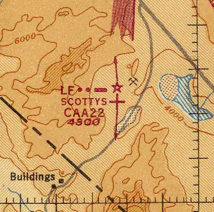
"Scottys CAA Site 22" Airport, as depicted on the August 1945 Mt. Whitney World Aeronautical Chart (courtesy of Chris Kennedy).
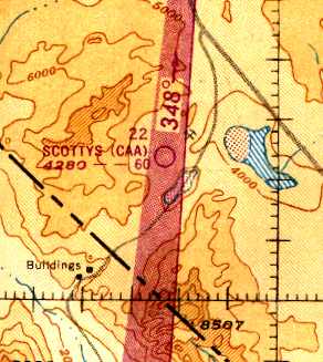
The September 1949 Mt. Whitney World Aeronautical Chart (courtesy of Donald Felton)
labeled the field as "Scottys (CAA)", and also indicated that the field was the Civil Aeronautics Administration's Site 22.
The field was described as having a 6,000' unpaved runway.
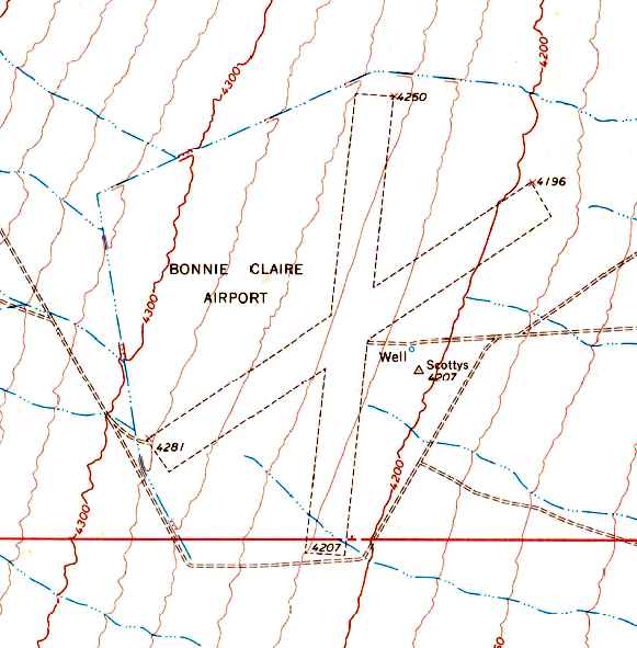
The 1968 USGS topo map depicted the 2 unpaved runways of Bonnie Claire Airport.
A reminder of the airport's previous name was also still depicted - a survey marker named "Scottys" just east of the runway intersection.
Scottys Airport was evidently abandoned by 1970,
as it was no longer depicted at all on the 1970 USGS topo map
or the 1971 Las Vegas Sectional Chart (courtesy of Vince Granato).
At some point between 1971-85, the airfield was evidently reopened as "Bonnie Claire Airport",
as that is how it was labeled on the 1985 USGS topo map.
Bonnie Claire Airport was depicted as a private airfield on the 1990 NV Airports & Landing Strips Map (courtesy of Jim Mallery).
The 1991 USGS topo map depicted the 2 unpaved runways of Bonnie Claire Airport.
A reminder of the airport's previous name was also still depicted - a survey marker named "Scottys" just east of the runway intersection.
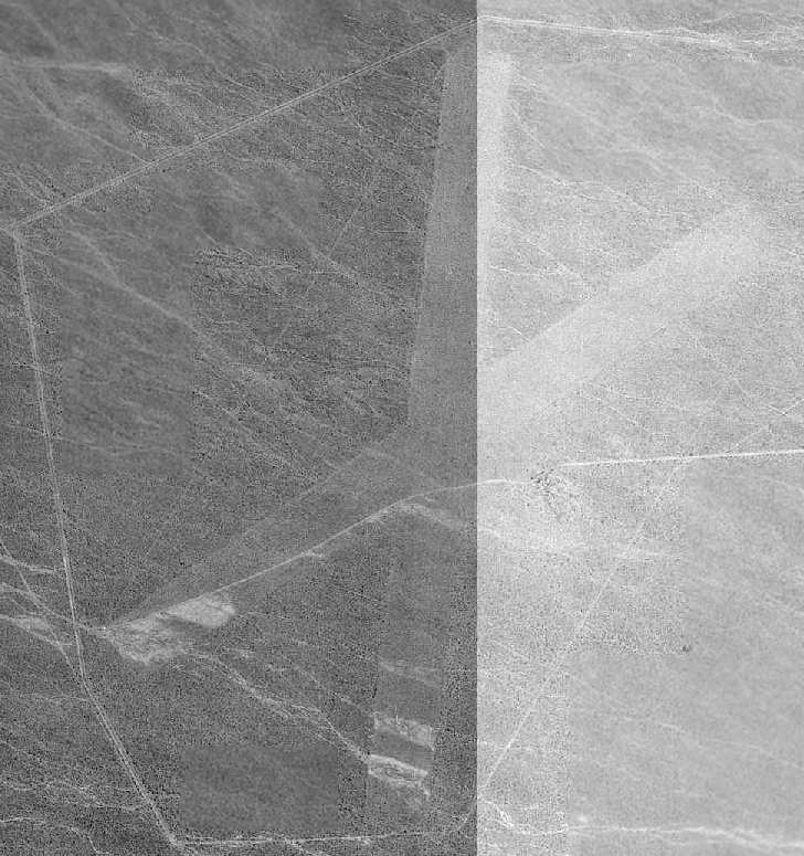
The 1994 USGS aerial photo of Bonnie Claire Airport was very low-contrast,
but it depicted the airfield as consisting of two 5,800' unpaved runways,
with an unpaved road ringing the airfield.
Keith Wood noted that this airfield's “perimeter road suggests military use, either during or after WW2,
possibly in conjunction with the nuclear testing program at Yucca Flat.
In fact, it appears that there were 2 perimeters, the obvious one near the edge of the overhead,
and an inner perimeter from the corners of the runways (probably a fenceline).
The outer line would have been patrolled by jeep, the inner possibly by dog teams.
Whatever they were doing there, they didn't want to have visitors, though the field is clearly visible from surrounding hills.”
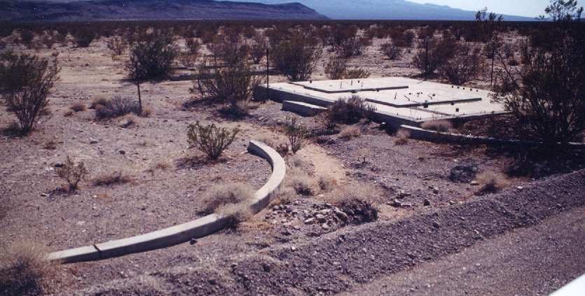
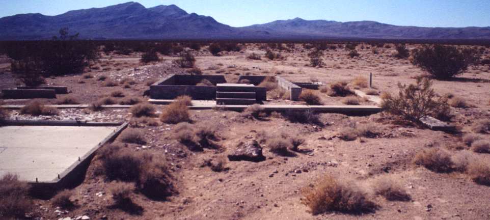
A 2002 photo by Gerry of Talk Radio of Pahrump of unidentified remains at Bonnie Claire Airport.
Note the fence which has been placed (at a later date) over the concrete foundation.
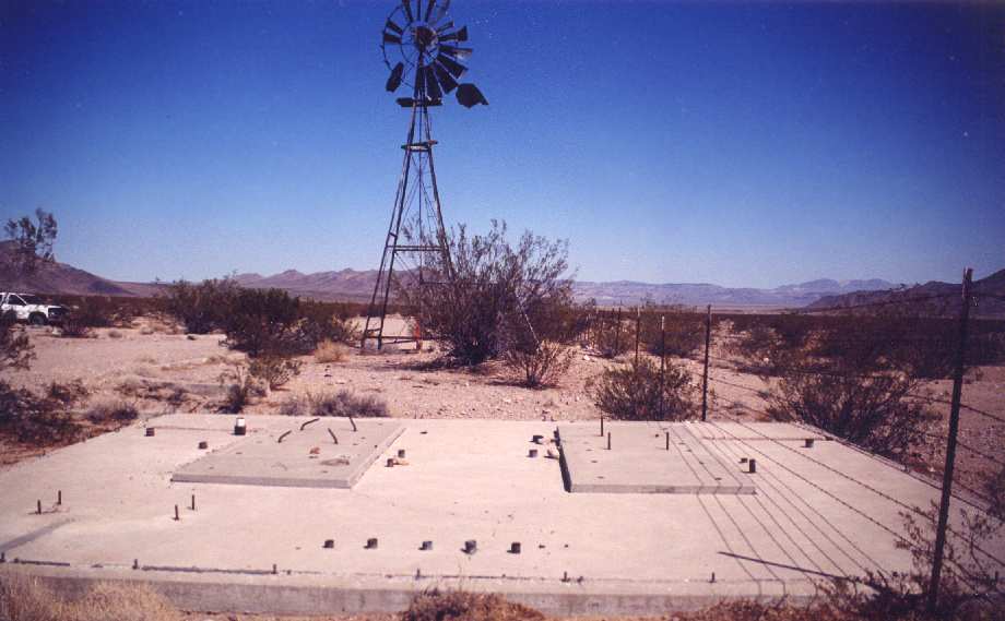
A 2002 photo by Gerry of Talk Radio of Pahrump of unidentified remains at Bonnie Claire Airport.
The water holding tank (behind the bush in front of the windmill) had "4300" spray-painted on it, presumably the elevation.
A 2002 photo by Gerry of Talk Radio of Pahrump of unidentified remains at Bonnie Claire Airport.
Gerry visited Bonnie Claire Airport in 2002, and observed that the airstrip is
"drivable but it's washed out to the point that it would take extensive repairs to make it usable."
She found a variety of concrete foundations (see photos above), a windmill,
and several drainage channels along the airfield perimeter.
But still no clues as to who constructed this airfield, or what purpose it served.
A 2003 aerial photo by Keri Daminelli (via Bill Sloan), looking southwest at Bonnie Claire Airport.
A circa 2006 aerial view looking northeast at the Bonnie Claire Airport runways.
A 4/11/11 photo looking at the Bonnie Claire Airport runways from a distance.
Noe Flightrisk reported in December 2011, “I landed at Scotty's earlier this week.
Of the three 2002 photos, the first shows the foundation for an antenna mast (or masts).
The second shows the same foundation with windmill & water tank.
The third shows the remains of a garage in the left foreground & a building in the center with what appears to have been the base of a flagpole on the right.
The building apparently contained communication equipment, since there are cables running in conduit through the building's foundation,
presumably connecting to the conduit emerging from the antenna foundation.
The airfield hasn't yet been fully overgrown by creosote bushes,
but is currently usable only by high ground clearance aircraft with large tires, due to erosion, hummocks, and brush.
I have a Maule M7-235C with 31" Alaskan Bushwheels.
I camped out at Scotty's, in part because I'm an amateur astronomer and it is VERY dark there, and in part because I just like camping.
The low was 20 F, but there was no snow as it has been a very dry winter so far.”
The Bonnie Claire Airport is located on an unnamed dirt road, 3 miles west of Route 267,
3 miles southwest of the town of Bonnie Claire.
Thanks to JD Lawson for pointing out this airfield.
____________________________________________________
Since this site was first put on the web in 1999, its popularity has grown tremendously.
That has caused it to often exceed bandwidth limitations
set by the company which I pay to host it on the web.
If the total quantity of material on this site is to continue to grow,
it will require ever-increasing funding to pay its expenses.
Therefore, I request financial contributions from site visitors,
to help defray the increasing costs of the site
and ensure that it continues to be available & to grow.
What would you pay for a good aviation magazine, or a good aviation book?
Please consider a donation of an equivalent amount, at the least.
This site is not supported by commercial advertising –
it is purely supported by donations.
If you enjoy the site, and would like to make a financial contribution,
you
may use a credit card via
![]() ,
using one of 2 methods:
,
using one of 2 methods:
To make a one-time donation of an amount of your choice:
Or you can sign up for a $10 monthly subscription to help support the site on an ongoing basis:
Or if you prefer to contact me directly concerning a contribution (for a mailing address to send a check),
please contact me at: paulandterryfreeman@gmail.com
If you enjoy this web site, please support it with a financial contribution.
please contact me at: paulandterryfreeman@gmail.com
If you enjoy this web site, please support it with a financial contribution.
____________________________________________________
This site covers airfields in all 50 states.