Abandoned & Little-Known Airfields:
Northeastern Mississippi
© 2002, © 2016 by Paul Freeman. Revised 9/7/16.
This site covers airfields in all 50 states: Click here for the site's main menu.
____________________________________________________
Please consider a financial contribution to support the continued growth & operation of this site.
Fulton-Itawamba County Airport (added 10/25/14) - River Aux AAF #2 / River AF Aux / River Airport (revised 9/7/16) - Tupelo Industrial Airpark (revised 5/8/16)
Columbus AAF Auxiliary #7 / Stinson Field Municipal Airport (revised 6/8/13) - Vaughn Aux AAF #6 / Vaughn AF Aux / Vaughn Airport (revised 6/8/13)
____________________________________________________
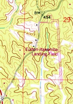
Fulton-Itawamba County Airport (11M), Fulton, MS
34.35, -88.38 (Northeast of Tupelo, MS)
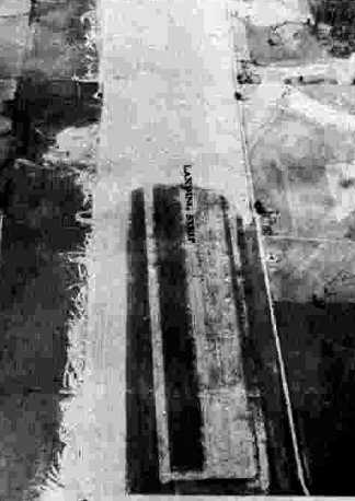
“Fulton-Itawamba Landing Field”, as depicted on the 1979 USGS topo map.
Photo of the airport while open has not been located.
This small general aviation airport was evidently established at some point between 1965-79,
as it was not yet depicted on the 1965 USGS topo map.
The earliest depiction which has been located of Fulton-Itawamba County Airport was on the 1979 USGS topo map.
It depicted “Fulton-Itawamba Landing Field” as having a single paved runway with a paved ramp on the northwest side.
According to its FAA Airport/Facility Directory data,
Fulton-Itawamba County Airport was owned by Fulton-Itawamba County Airport Board.
It comprised an area of 76, and had a single 3,000' asphalt Runway 17/35.
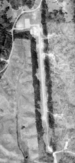
The earliest photo which has been located of Fulton-Itawamba County Airport was a 4/4/90 USGS aerial view.
It depicted Fulton-Itawamba County Airport as having a single paved runway with a paved ramp on the northwest side.
But there were no aircraft visible or any other sign of recent aviation use.
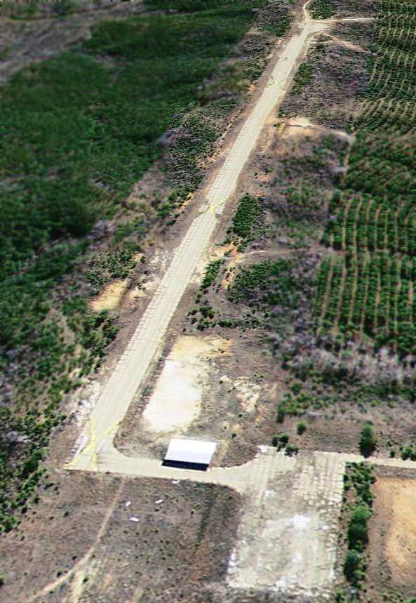
A 1/3/07 aerial view looking southeast at Fulton-Itawamba County Airport showed a small building had been added at some point between 1990-2007 along the northwest taxiway.
But the runway was marked with multiple closed-runway “X” symbols, and the pavement appeared quite deteriorated.
The reason for the airport's closure has not been determined.
Fulton-Itawamba County Airport is located on the east side of Airport Road, appropriately enough.
Thanks to Aubrey Patterson for pointing out this airfield.
____________________________________________________
Columbus AAF Auxiliary #7 / Stinson Field Municipal Airport, Aberdeen, MS
33.85 North / 88.59 West (Southeast of Memphis, TN)
A 6/3/43 aerial view looking north at “Columbus AAF Auxiliary #7 (Stinson Field)”
from the 1945 AAF Airfield Directory (courtesy of Scott Murdock).
The date of construction of this airfield has not been determined.
The earliest depiction of Stinson Field which has been located
was a 6/3/43 aerial view looking north from the 1945 AAF Airfield Directory (courtesy of Scott Murdock).
It depicted “Columbus AAF Auxiliary #7 (Stinson Field)” as an irregularly-shaped grass field, with several buildings along the road on the northeast side.
The 1945 AAF Airfield Directory (courtesy of Scott Murdock) described “Columbus AAF Auxiliary #7 (Stinson Field)”
as a 109 acre irregularly-shaped property having a single 3,500' northwest/southeast sod runway.
The field was not said to have any hangars,
to be owned by private interests, but operated by the Army Air Forces.
At some point after 1945, Stinson Field was relinquished by the military & reverted to its role as a general aviation airport.
The only photo which has been located showing aircraft at Stinson Field was a 3/26/60 USGS aerial view.
It depicted Stinson Field as having a single unpaved northwest/southeast runway,
with 2 small buildings & one single-engine aircraft on the east side.
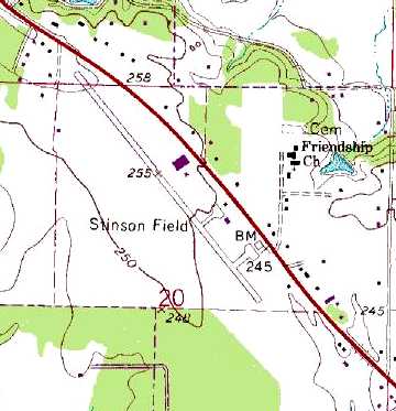
The 1966 USGS topo map depicted Stinson Field as having a single 2,000' paved northwest/southeast runway (evidently an improvement at some point between 1960-66),
with 2 paved ramps & small hangars on the east side.
The 1982 USGS topo map showed that the length of Stinson's runway had been nearly doubled to 3,400', having been lengthened toward the northwest.
A 1995 USGS aerial photo looking northwest showed Stinson Municipal Airport to remain completely intact,
but there were no aircraft visible on the field, so it is indeterminate whether the field was still operational at that point.
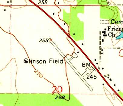
The 1995 USGS topo map depicted Stinson Field as having a single paved northwest/southeast runway,
with two ramps & several small buildings on the east side.
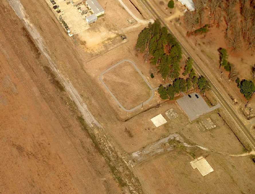
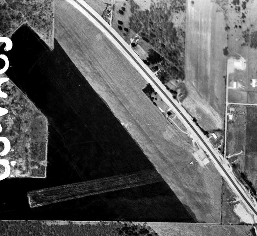
A circa 2007 aerial view looking north at the remains of Stinson Municipal Airport
showed the remains of the runway pavement, along with the ramp, and foundations of several buildings.
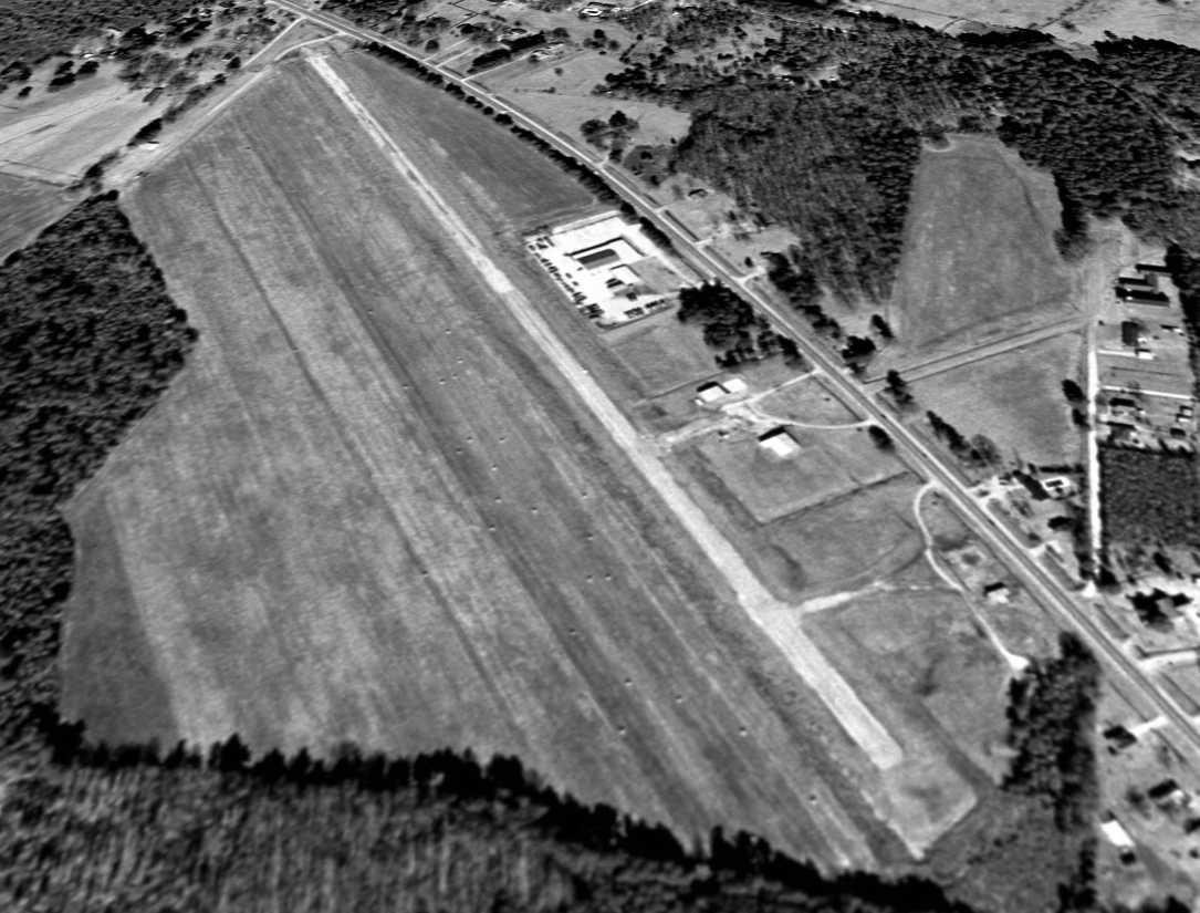
An 8/8/07 aerial view depicted the majority of Stinson's runway remained intact, although 2 buildings had been built at some point between 1995-2007,
one a school adjacent to the northwest side of the runway, and the Northern Mississippi Bankruptcy Court covering the southeast end of the runway.
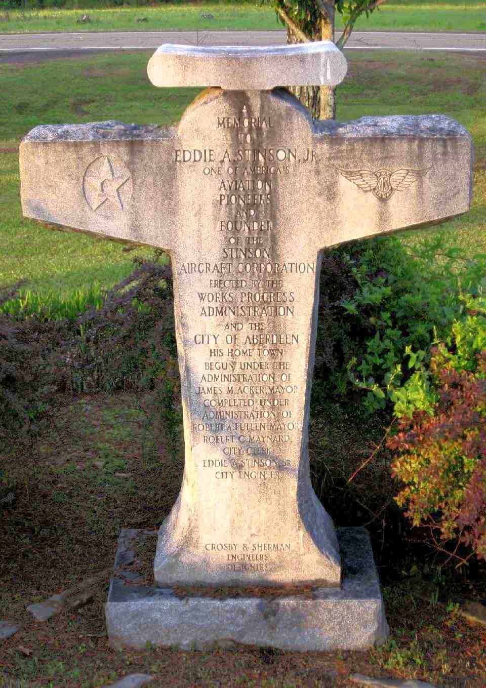
A 4/15/11 photo by Matthew Nichols of a memorial to Eddie Stinson located in a small park next to the hangar foundations at the site of Stinson Field Municipal Airport.
The monument reads: “A memorial to Eddie A Stinson Jr. One of America's aviation pioneers & founder of the Stinson Aircraft Corporation.
Erected by the Works Progress Administration & the City of Aberdeen, his home town.”
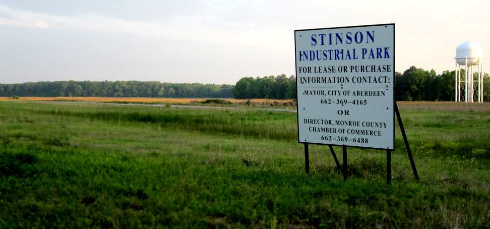
A 4/15/11 photo by Matthew Nichols looking south at a “sign on the north end of the former Stinson Field Municipal Airport indicating its current use as an industrial park.
The remaining strip of runway can be seen behind the sign.
Looks like they should have left it as an airport.”
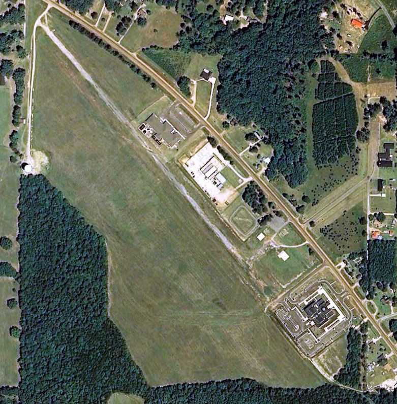
A 4/15/11 photo by Matthew Nichols looking southeast “down the remaining strip of runway at the site of the former Stinson Field Municipal Airport.
A school facility, National Guard Armory and Tax Court encroach on the field.”
The site of Stinson Municipal Airport is located south of the intersection of Route 45 & Stinson Road.
Thanks to Bud Green for pointing out this airfield.
____________________________________________________
Tupelo Industrial Airpark, Verona, MS
34.18, -88.69 (Southeast of Memphis, TN)
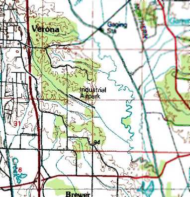
Tupelo Industrial Airpark, as depicted on the 1983 USGS topo map.
Photo of the airport while open has not been located.
This airfield was evidently established at some point between 1979-83,
as it was not yet depicted on a 1977 USGS aerial photo nor on the 1979 USGS topo map.
The earliest depiction of the Tupelo Industrial Airpark which has been located was on the 1983 USGS topo map.
It depicted the “Industrial Airpark” as having a single northwest/southeast runway.

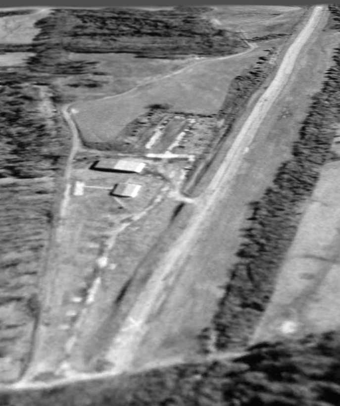
The earliest photo which has been located of the Tupelo Industrial Airpark was a 4/4/90 USGS aerial view.
It depicted the field as having a single paved southeast/northwest runway, and a hangar & multiple parking spots on the northwest side.
The airport may already have been abandoned by this point though, as there were no aircraft visible on the field.
The Tupelo Industrial Airpark was still depicted as an active airfield on 1991 aeronautical charts.
The Tupelo Industrial Airpark was evidently abandoned (for reasons unknown) by 1995,
as it was depicted as an abandoned airfield on the 1995 Sectional Chart.
A 1/19/97 USGS aerial view looking east depicted Tupelo Industrial Airpark as having a single paved southeast/northwest runway, marked with closed “X” symbols.
Two hangars & possible foundations of other buildings were located on the northwest corner.
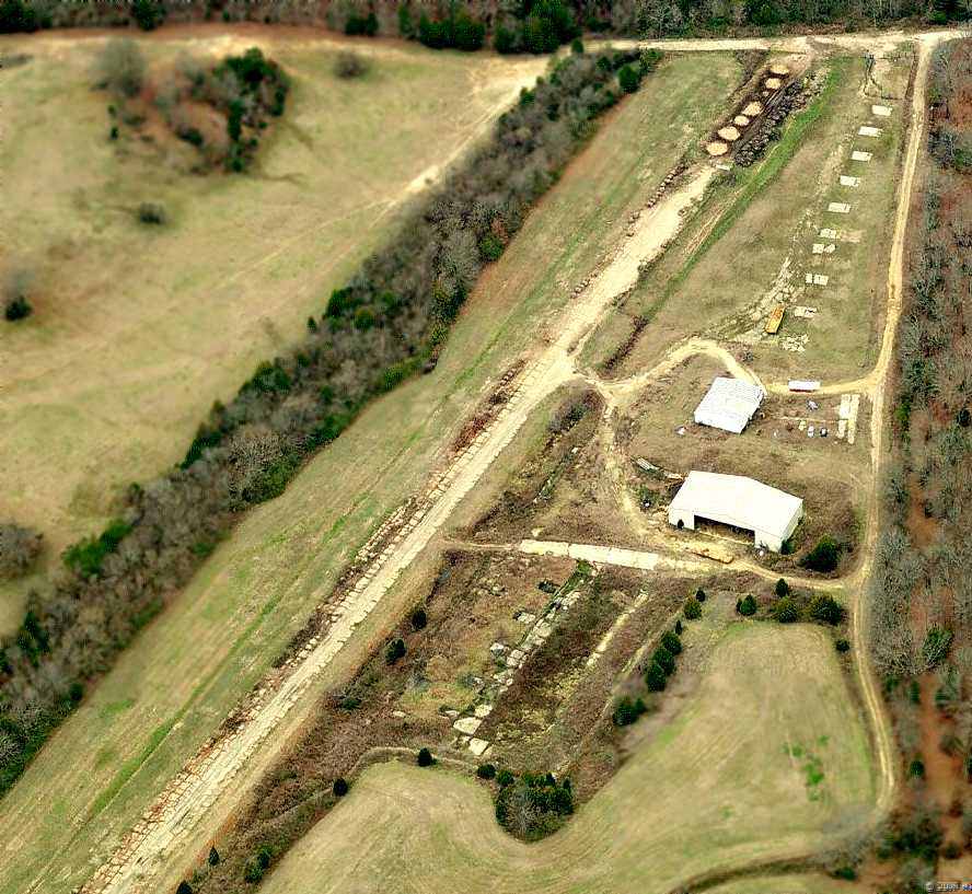
A circa 2006 aerial view looking west at the remains of the Tupelo Industrial Airpark
showed the runway pavement in a significantly deteriorated state.
A large & small hangar still remained standing,
along with what appeared to be the foundations of several smaller hangars,
and a deteriorated paved ramp.

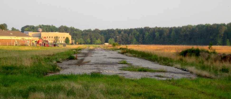
A January 2009 photo by Matt Nichols looking north at a former Tupelo hangar.
Matt remarked, “I couldn't tell if this was used for aviation purposes or not. It's full of old cars & farm equipment now.”
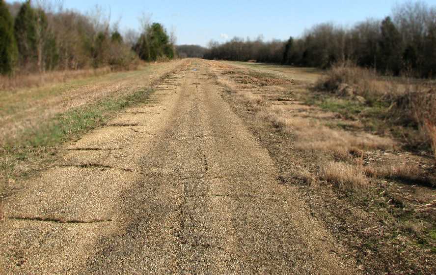
A January 2009 photo by Matt Nichols looking southeast along the remains of the Tupelo Industrial Airpark runway.
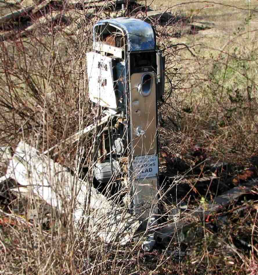
A January 2009 photo by Matt Nichols of a former fuel pump at Tupelo Industrial Airpark.
Matt remarked the the pump had “a LEAD warning sticker.
It was located next to the concrete tie-down pads, but I couldn't tell if this pump was used for aviation purposes or not.
Since it carried leaded fuel, we will assume it was.”
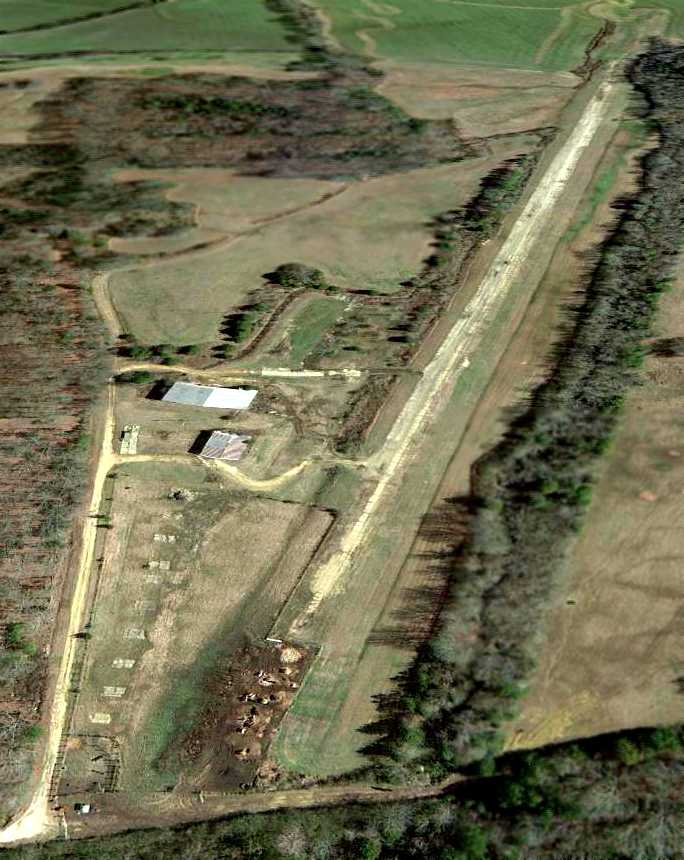
A 1/18/13 aerial view looking east depicted Tupelo Industrial Airpark as deteriorated but without any redevelopment.
The site of Tupelo Industrial Airpark is located southeast of the intersection of Road 753 & Road 711.
Thanks to Matt Nichols for pointing out this airfield.
____________________________________________________
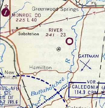
River Auxiliary Army Airfield #2 / River Air Force Auxiliary / River Airport, Aberdeen, MS
33.8, -88.32 (West of Birmingham, AL)
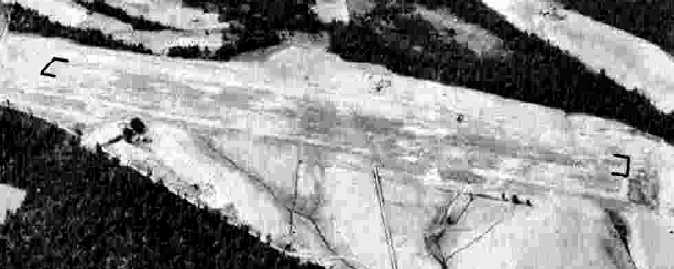
A 6/3/43 aerial view looking north at “Columbus AAF Auxiliary #2 (River Field)”
from the 1945 AAF Airfield Directory (courtesy of Scott Murdock).
The date of construction of this airfield has not been determined.
River Field was reportedly established during WW2 as one of 8 satellite airfields for Columbus AAF (12 miles southwest),
which conducted training in twin-engine bombers.
The earliest depiction which has been located of the River airfield
was a 6/3/43 aerial view looking north from the 1945 AAF Airfield Directory (courtesy of Scott Murdock).
It depicted “Columbus AAF Auxiliary #2 (River Field)” as a single north/south runway, with a parallel taxiway.
The airfield appeared to still be under construction, with only the southern half of the runway & taxiway having been built.
The 1945 AAF Airfield Directory (courtesy of Scott Murdock) described “Columbus AAF Auxiliary #2 (River Field)”
as a 143 acre rectangular property having a single 4,000' north/south sod runway.
The field was not said to have any hangars,
to be owned by private interests, but operated by the Army Air Forces.
River Field was presumably abandoned by the military shortly after WW2,
as it was not depicted at all on the April 1945 Birmingham Sectional Chart
or the April 1946 Birmingham Sectional Chart.

River Field was evidently reactivated by the Air Force under the jurisdiction of Craig AFB at some point between 1946-50,
as it was depicted as “River AF” on the February 1950 Birmingham Sectional Chart.
It was depicted as having a 4,300' unpaved runway.
The use of the River airfield by the Air Force in the 1950s reportedly lasted only a few months.
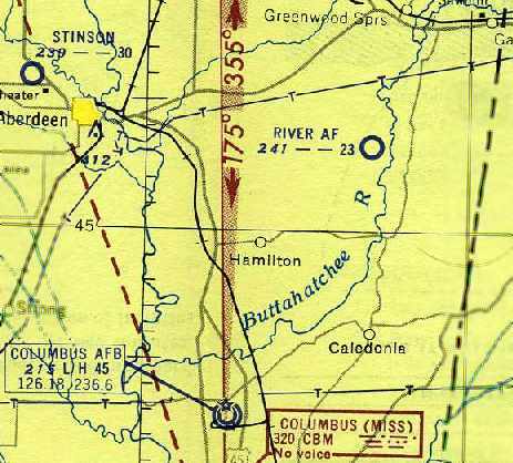
It was still labeled as “River AF” on the August 1954 Birmingham Sectional Chart (courtesy of Chris Kennedy),
and depicted as having a 2,300' unpaved runway.
By the time of the February 1960 Birmingham Sectional Chart (courtesy of Chris Kennedy),
“River” was depicted as a civilian airfield, with a 2,300' unpaved runway.
The River Airport was still depicted in an identical fashion
on the June 1961 Boston Mountains World Aeronautical Chart (courtesy of Chris Kennedy).
The last aeronautical chart depiction which has been located of the River Airport
was on the August 1963 Birmingham Sectional Chart (courtesy of Chris Kennedy).
It depicted River as having a 2,300' unpaved runway.
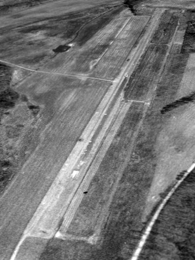
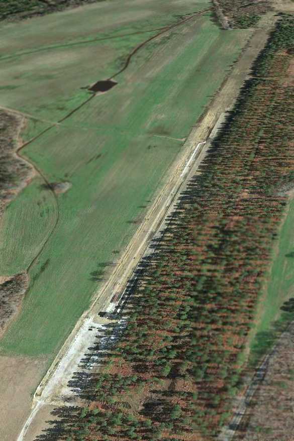
River Airport was evidently abandoned (for reasons unknown) at some point between 1963-70,
as it was no longer depicted at all on the 1970 or 1980 USGS topo maps.
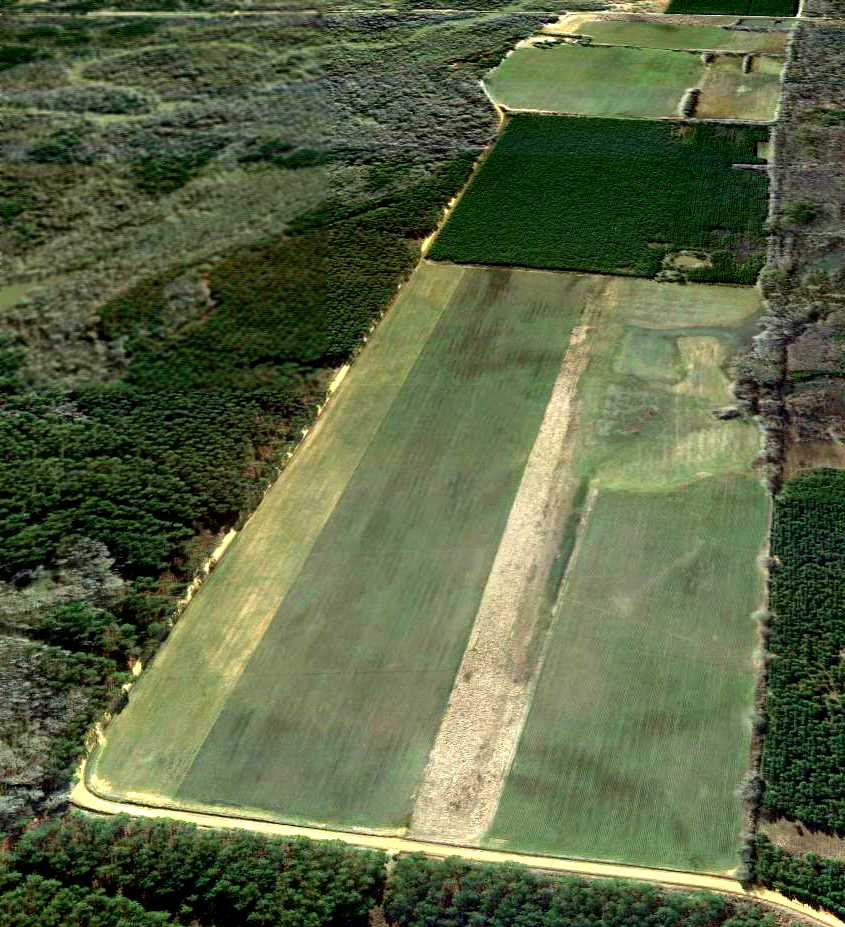
The outline of River Airport's runway was very distinct in a 1/18/13 aerial view looking southeast.
Thanks to Steven McNicoll for information about River Airport.
____________________________________________________
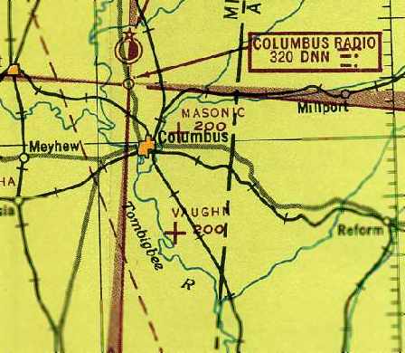
Vaughn Auxiliary Army Airfield #6 / Vaughn AF Aux / Vaughn Airport, Columbus, MS
33.38 North / 88.37 West (West of Birmingham, AL)
A 6/3/43 aerial view looking north at “Columbus AAF Auxiliary #6 (Vaughn Field)”
from the 1945 AAF Airfield Directory (courtesy of Scott Murdock).
The date of construction of this airfield has not been determined.
It evidently was established during WW2 as one of 8 satellite airfields for Columbus AAF (13 miles north),
which conducted training in twin-engine bombers.
The earliest depiction which has been located of the River airfield
was a 6/3/43 aerial view looking north from the 1945 AAF Airfield Directory (courtesy of Scott Murdock).
It depicted “Columbus AAF Auxiliary #6 (Vaughn Field)” as a single northwest/southeast paved runway.
The 1945 AAF Airfield Directory (courtesy of Scott Murdock) described “Columbus AAF Auxiliary #6 (Vaughn Field)”
as a 68 acre irregularly-shaped property having a single 4,000' northwest/southeast bituminous runway.
The field was not said to have any hangars,
to be owned by private interests, but operated by the Army Air Forces.
The earliest aeronautical chart depiction of the Vaughn airfield which has been located
was on the October 1945 Boston Mountains World Aeronautical Chart (courtesy of Chris Kennedy).
It depicted “Vaughn” as an auxiliary airfield.
The former Vaughn airfield was evidently reactivated by the Air Force
under the jurisdiction of Craig AFB at some point between 1945-54,
as it was depicted as “Vaughn AF” on the August 1954 Birmingham Sectional Chart (courtesy of Chris Kennedy).
It was depicted as having a 4,000' paved runway.
The use of the Vaughn airfield by the Air Force in the 1950s reportedly lasted only a few months.
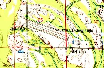
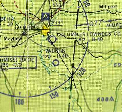
The 1960 USGS topo map depicted "Vaughn Landing Field"
as having a single northwest/southeast runway, with a parallel taxiway.
By the time of the February 1960 Birmingham Sectional Chart (courtesy of Chris Kennedy),
“Vaughn” was depicted as a civilian airfield, with a single 4,000' paved northwest/southeast runway.
The last aeronautical chart depiction which has been located of Vaughn as an active airport
was on the June 1961 Boston Mountains World Aeronautical Chart (courtesy of Chris Kennedy).
It depicted the field as having a 4,000' paved runway.
The Vaughn Airport was evidently abandoned (for reasons unknown) at some point between 1961-63,
as it was depicted as “Aband airport” on the the August 1963 Birmingham Sectional Chart (courtesy of Chris Kennedy).
The airfield was apparently reused for some period of time as a drag strip.
Michael Anthony recalled that he visited a drag strip at the site "in the 1960s to the late 1970s",
and he believes that it was privately owned during that period.
The 1980 USGS topo map depicted the "Vaughn Landing Field"
as having a single northwest/southeast runway.
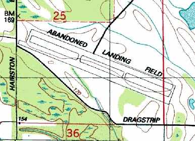
The 1987 USGS topo map depicted the "Abandoned Landing Field"
as having a single northwest/southeast runway, with a parallel taxiway.
It also labeled the road to the south as "Dragstrip Road".
The airfield was labeled "Drag Strip" on late 1990s aeronautical charts.
A 2/19/92 USGS aerial view looking east depicted Vaughn Field as having a single paved 4,300' runway & a parallel taxiway.
There was no indication of any buildings at the site.
A 1/17/13 aerial view looking east showed the remains the runway & its parallel taxiway.
Signs of the dragstrip operation were recognizable on the northwest end of the former runway.
Thanks to Steven McNicoll for information about this field.
____________________________________________________
Since this site was first put on the web in 1999, its popularity has grown tremendously.
That has caused it to often exceed bandwidth limitations
set by the company which I pay to host it on the web.
If the total quantity of material on this site is to continue to grow,
it will require ever-increasing funding to pay its expenses.
Therefore, I request financial contributions from site visitors,
to help defray the increasing costs of the site
and ensure that it continues to be available & to grow.
What would you pay for a good aviation magazine, or a good aviation book?
Please consider a donation of an equivalent amount, at the least.
This site is not supported by commercial advertising –
it is purely supported by donations.
If you enjoy the site, and would like to make a financial contribution,
you
may use a credit card via
![]() ,
using one of 2 methods:
,
using one of 2 methods:
To make a one-time donation of an amount of your choice:
Or you can sign up for a $10 monthly subscription to help support the site on an ongoing basis:
Or if you prefer to contact me directly concerning a contribution (for a mailing address to send a check),
please contact me at: paulandterryfreeman@gmail.com
If you enjoy this web site, please support it with a financial contribution.
please contact me at: paulandterryfreeman@gmail.com
If you enjoy this web site, please support it with a financial contribution.
____________________________________________________
This site covers airfields in all 50 states.