Abandoned & Little-Known Airfields:
Hawaii, Maui island
© 2001, © 2016 by Paul Freeman. Revised 2/23/16.
This site covers airfields in all 50 states: Click here for the site's main menu.
____________________________________________________
Please consider a financial contribution to support the continued growth & operation of this site.
Kaanapali Airport (revised 2/23/16) - Puunene Naval Air Station / Maui Airport (revised 11/8/14)
____________________________________________________
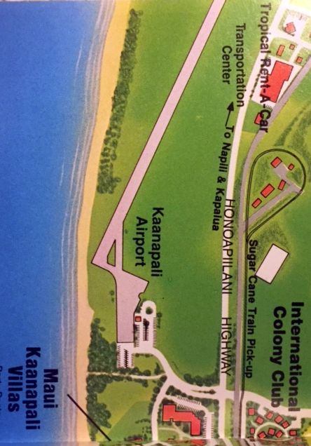
Kaanapali Airport (HKP), Kaanapali, HI
20.945, -156.69 (Island of Maui, HI)
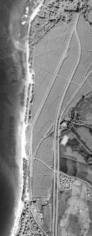
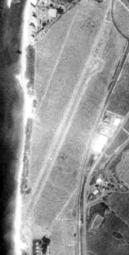
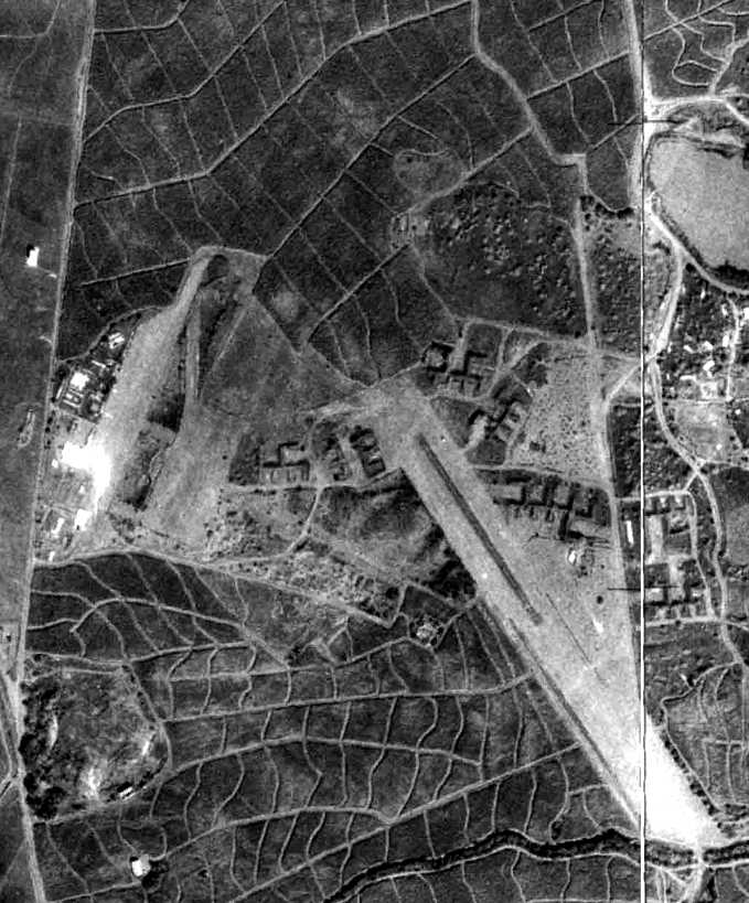
A 1/20/65 aerial view of Kaanapali Airport (from the University of HI).
This small airport was located along the west coast of the Island of Maui.
Kaanapali Airport was not yet depicted on the 1956 USGS topo map.
According to an article in the 7/1/10 Lahaina News, “Kaanapali Airport was built on an old coastal road in 1961
to transport workers & materials into West Maui’s new resort developed by Amfac Inc.
Surrounded by sugar cane, Runway 01/19 started just 30 feet from the shoreline & extended north 2,615'.
Fresh tradewinds often challenged flight operations. It was exciting to arrive & depart at this short airstrip.”
The earliest depiction which has been located of the Kaanapali Airport was a 1/20/65 aerial view (from the University of HI).
It depicted the field as having a single, narrow, northeast/southwest runway.
Several light planes were parked on a ramp on the south side, near some small buildings.
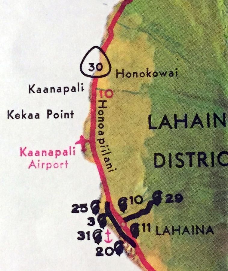
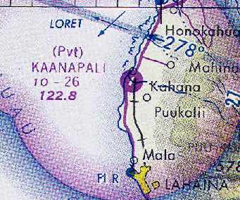
Kaanapali Airport, as depicted on the 1967 HI State Transportation Map (courtesy of Kevin Walsh).
Eddie Lopez recalled, “In the late 1960s I was a flight attendant with JetAire Hawaii flying DeHavilland Twin Otters.
Kaanapali was a regular stop on our way to Kona.
Here are the serial numbers of the Otters along with delivery dates to Hawaii Jet Aire:
#61 – 10-06-1967, #54 – 09-12-1967, #65 – 01-11-1968, #91 – 01-31-1968, #101 – 05-08-1968.
The hairiest landings were at Kaanapali. Many times we glided in with nose pointing North on a SW/NE runway.
The Otters were Short Takeoff & Landing aircraft & when we had no passengers the pilots would perform STOL landings & take offs.
With full throttle & a good headwind & full flaps I think we landed using about 50' of runway. Almost same with takeoffs.”
Johnny Miller recalled, “My wife & I landed a rented Piper Cherokee on this airstrip in August 1970 while on our honeymoon.
It was not shown on the chart I had with me at the time.
While the airport had no markings to indicate restricted or private use only,
we were not well received & were politely but firmly asked to leave.
The airstrip was in good condition & was surrounded by sugar cane fields.
The wind socks left an impression on me as they were at each end of the single runway
and both were pointing toward the center of the field.”
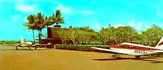
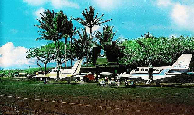
An undated (circa 1970s?) postcard of a Twin Cessna & a Piper in front of Kaanapali's terminal building.
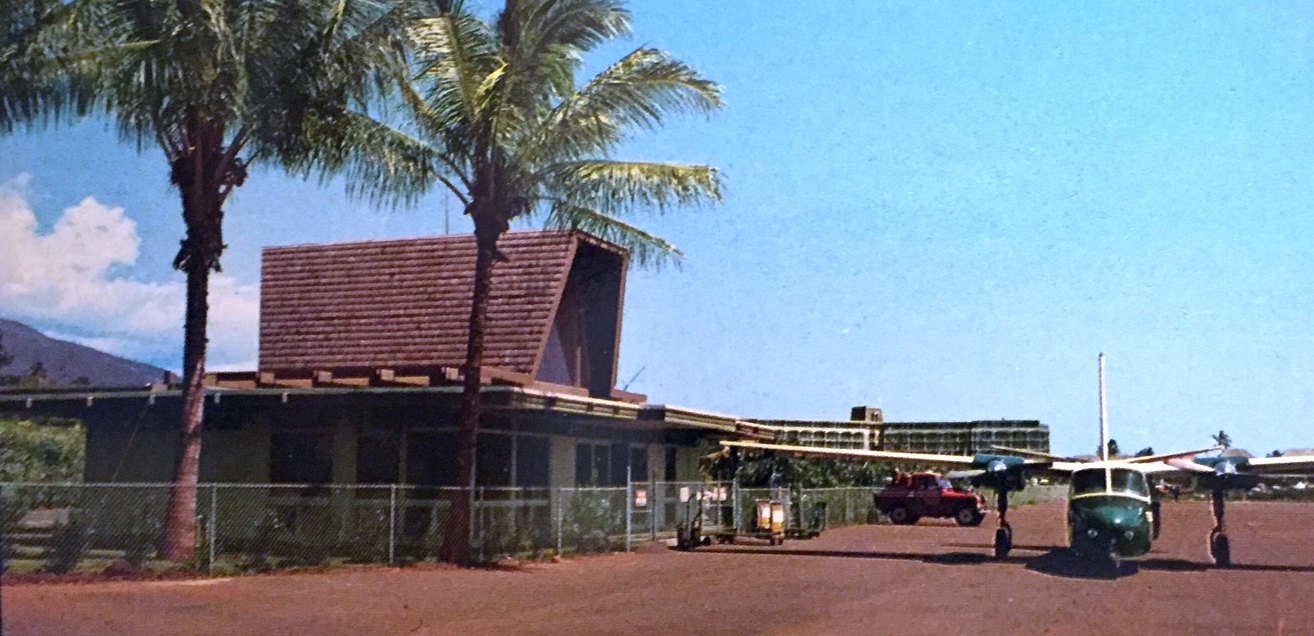
An undated (circa 1970s?) postcard of a Twin Commander in front of Kaanapali Airport's terminal building (courtesy of Kevin Walsh).
A 1977 aerial view depicted Kaanapali Airport as having a single paved northeast/southwest runway.
The earliest aeronautical chart depiction of the Kaanapali Airport which has been located
was on the December 1977 Hawaiian Islands Sectional Chart (courtesy of Chris Kennedy).
It depicted Kaanapali as a private field with a single 2,600' paved runway.
The remarks said "Restricted to previously approved commercial operations only."
Mike Jolicoeur recalled of Kaanapali, “I worked for Royal Hawaiian Air Service in the late 1970s
as a 'ramp rat' & this was a great place to work.”
David Lien recalled that the Kaanapali Airport "was there in the late 1970s or early 1980s, used by Federal Express.
I met the plane several times in mid-afternoon
and dropped off packages of documents for overnight delivery to the mainland via Honolulu.
The airstrip itself seemed short & not in great shape, but Fedex used it.
The 'terminal' building I recall had a very rustic look,
and it seems like it was a combination bar & 2 story control tower all made of old plywood.
As I recall it looked like something out of an old WW2 tropics movie.
It is my further recollection that this airport was about to be overrun by the heavy development at the time."
Kaanapali Airport was used exclusively by the commuter aircraft of Royal Hawaiian,
initially using Cessna 402 aircraft.
The runway at Kaanapali was known among the commuter pilots as a real 'favorite',
due to the challenge offered by its short length.
The positioning of the runway also offered an additional challenge,
as its asphalt runway began just beyond Kaanapali Beach
and cut a narrow swath through high green cane fields.
The terminal building was described as "a small affair with friendly employees",
which also had a tiny lounge on the second floor known as the Windsock.
According to former Royal Hawiian pilot Peter Forman,
"The wind line stood out as the most remarkable obstacle to a Kaanapali landing.
Beyond the cane fields rose the West Maui Mountains,
which shielded much of the southwestern side of the island from trade winds.
Kaanapali Airport lay near the edge of this wind shadow,
and, depending on wind direction that hour, windsocks could hang limp or dance along in 25 knot winds.
Sometimes the ocean sock showed no wind & the mountain sock stuck straight out.
You could even see the wind line drawn across the sea of sugar cane & blue ocean surface.
When the line crossed the far end of the field, it presented no serious problems to landings.
A wind line in the touchdown zone was a different animal entirely."
Richard Curran recalled, "I was on Maui in February 1980
and the Kaanapali airfield was in operation then & a car rental operation was there."
The 1982 AOPA Airports USA directory (courtesy of Ed Drury)
described Kaanapali Airport as having a single 2,615' asphalt Runway 1/19.
The remarks said, "Private. Closed to public. Airport is permanently closed to private aircraft."
Bill Jacobs recalled, “In 1983 on my honeymoon we took a C402 over to Kaannapali Airport to see Maui.
The whole way over this lady in front of us opened her newspaper to read, obstructing our view.
We couldn’t believe she wouldn’t be in awe of the beautiful view out the windows.
When we landed, we realized it was Carol Burnett. We had a nice chat with her where she apologized for the newspaper.”
The 1983 USGS topo map depicted Kaanapali Airport as having a single paved runway,
along with a paved ramp at the southern end, with a single building in the middle of the ramp.
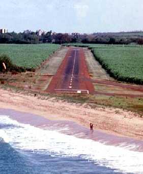
An undated aerial view looking northeast on final approach to Kaanapali's Runway 1.
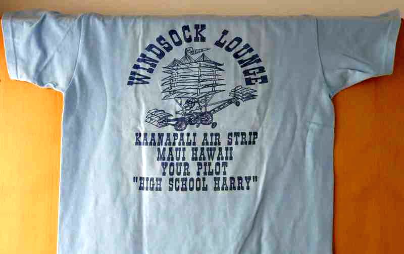
An undated T-shirt commemorating the “Windsock Lounge, Kaanapali Air Strip” (courtesy of Mike Kmetz).
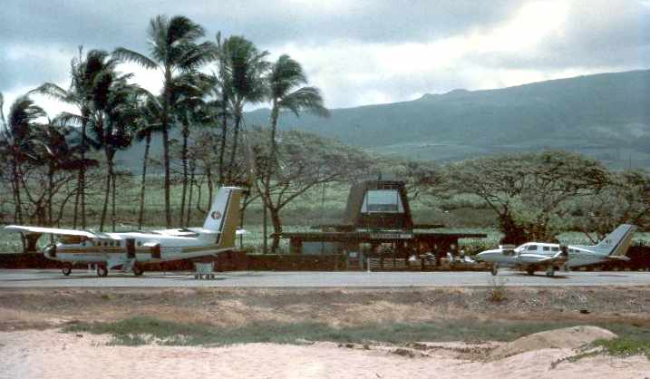
An October 1980 photo of 2 twin Cessnas at Kaanapali Airport.
An undated aerial view looking north showing the Kaanapali Airport in the background
from a 1982 HI Visitors' Bureau brochure (courtesy of Kevin Walsh).
Around 1983 Royal Hawaiian acquired 2 Twin Otters, which flew nearly exclusively on the Honolulu to Kaanapali route.
They carried more passengers than 402s but were vulnerable to gusty winds,
and on particularly nasty days only the twin Cessnas landed at this beach strip.
The last depiction which has been located of Kaanapali Airport was on a 1986 road map (courtesy of Kevin Walsh).
In 1986 Royal announced that Kaanapali Airport would close to make room for a hotel project.
Many loyal passengers wished this were not so,
but if Kaanapali service were coming to an end, then they should be on the last plane out of town.
For this reason Royal needed 4 extra 402s for the final Kaanapali to Honolulu flight that late afternoon.
Without Kaanapali, Royal Hawaiian Air Service's route system could not produce a profit,
and in short time the airline ceased operations.
A 2000 aerial photo showed that the outline of the majority of the runway remained recognizable,
although the ramp at the south end appeared to have been removed.
The 2001 USGS topo map still depicted a single runway,
but it was labeled merely as "Landing Strip",
which typically means that it was no longer an operating airport by that time.
Ironically, the planned hotel which was intended to take the place of the Kaanapali Airport not built for over another decade.
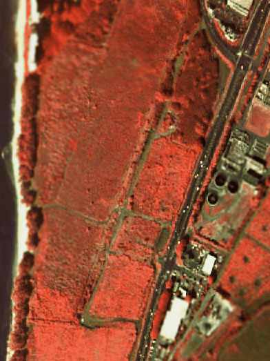
A pre-2005 USGS false-color aerial photo showed that the runway remained intact,
but no airport buildings appeared to remain standing.
A 2007 aerial photo showed that hotel construction had removed any trace of the former Kaanapali Airport at some point between 2000-2007.

A 2010 photo of pilot Robert Morrison in front of a plaque commemorating Kaanapali Airport.
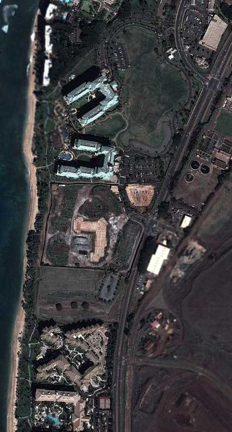
A 2/8/11 aerial view showed hotels covering the site of Kaanapali Airport.
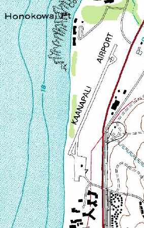
The site of Kaanapali Airport is located southwest of the intersection of Route 30 & Honoapillani Road.
Thanks to David Lien for pointing out this airfield.
____________________________________________________
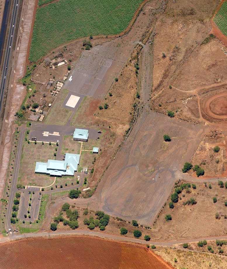
Puunene Airport / Naval Air Station Maui / Naval Air Station Puunene / Maui Airport, Puunene, HI
20.817, -156.46 (Island of Maui, HI)
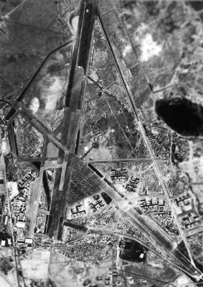
A 1/30/42 aerial view depicted over a dozen aircraft on NAS Maui's ramp.
A civil airfield was first established by the Territory of Hawaii on this site in 1937
to replace a smaller airfield at Maalaea.
Inter-Island Airways began service from the Puunene Airport in 1939.
Navy use of the airfield began in 1940,
When elements of Utility Squadron VJ-3 arrived to tow targets & operate target drones for the fleet.
The Army Air Corps also established a small support base at the airfield in the same year.
The base was commissioned as Naval Air Station Maui in 1942.
The Navy's facilities at the field were expanded, to support CASU 4 & VF-72.
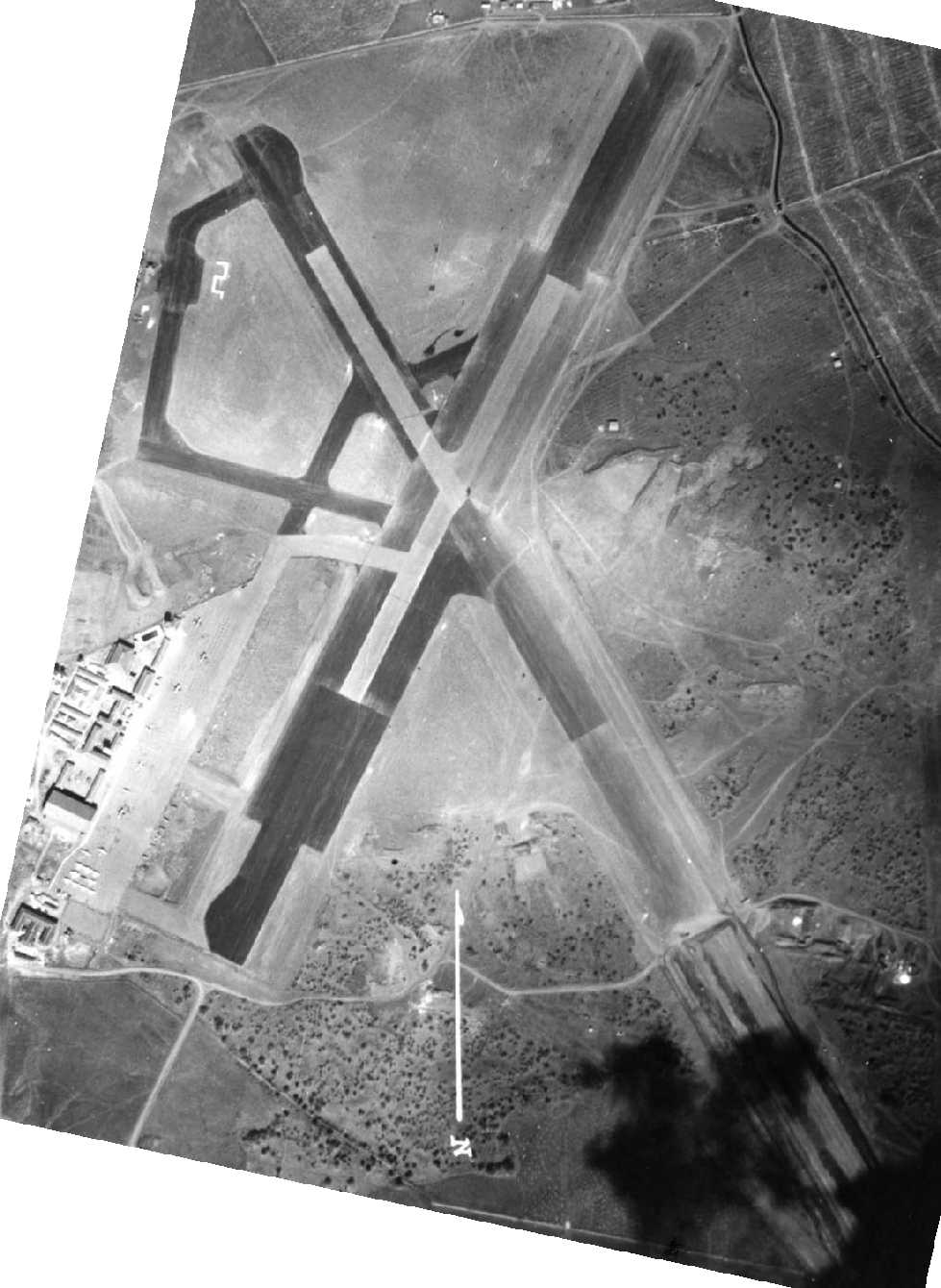
The earliest depiction which has been located of NAS Maui was a 1/30/42 aerial view.
It d depicted the field as having 2 paved runways, with the southeastern end of Runway 14/32 possibly still under construction.
Over a dozen aircraft were visible on the southwestern ramp.
Army forces eventually concentrated on Oahu,
leaving the Navy as the primary user of the field.
An expansion lengthened & widened the runways, and added Link trainers.
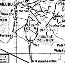
The station was renamed NAS Puunene when the larger NAS Kahului
was opened five miles to the northeast in 1943.
By the end of the war, Puunene had a total complement of over 3,300 personnel & 271 aircraft.
A total of 106 squadrons & carrier air groups passed through during WW2.
The base consisted of a total of 2,202 acres.
A 1943 aerial view (National Archives photo) depicted Puunene in its eventual full configuration,
with 2 paved runways (14/32: 6,800' long & 1/19: 6,500' long), taxiways, ramps, hangars & other buildings.
The April 1945 V-450 Hawaiian Islands U.S. Navy Aviation Chart (courtesy of Chris Kennedy)
depicted Puunene NAS as having a control tower.
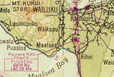
During WW2, the Navy leased the former airport at Maalaea (precise location unknown)
as an Outlying Landing Field for the use of Puunene.
The island of Kahoolawe was also used as a bombing range.
NAS Puunene was placed in caretaker status in 1945.
The Puunene airfield was released by the Navy to the Territory of Hawaii in 1947,
and was reused as Maui's civil airport.
Puunene Airport was depicted on the 1947 Hawaiian Islands Sectional Chart (courtesy of John Voss)
as having a 6,900' hard-surface runway.
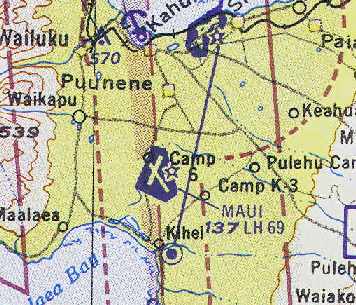
The airfield atPuunene was labeled as Maui Airport on the 1951 USGS topo map.
In 1952 the larger former NAS Kahului to the north was closed by the military & became available for civil use.
Although some sources have indicated that the Puunene Airport closed in 1952,
that was apparently not the case.
The October 1954 Hawaiian Islands Sectional Chart (courtesy of Chris Kennedy)
showed that the former Puunene Airport was depicted as "Maui" Airport.
The October 1954 Hawaiian Islands Sectional Chart (courtesy of Chris Kennedy)
depicted "Maui" Airport as having 2 paved runways,
with the longest being the 6,900' Runway 14/32.
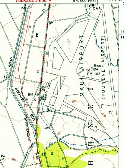
The 1956 USGS topo map depicted the extensive airfield layout of “Maui Airport (Puunene Airport)”.
The 1961 USGS topo map depicted "Maui Airport” as having 2 paved runways.
The last photo which has been located showing Maui Airport intact was a 1/4/65 aerial view (from the University of HI).
It showed the field to have 2 paved runways & 2 paved ramps on the west side.
There were no aircraft visible on the field.
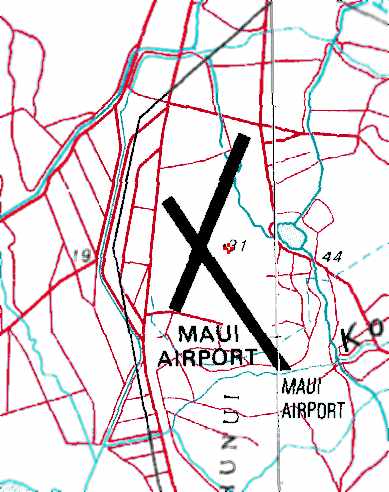
The Maui Airport was evidently closed at some point between 1961-77,
as it was depicted as an abandoned airfield
on the December 1977 Hawaiian Islands Sectional Chart (courtesy of Chris Kennedy).
After the Puunene / Maui Airport was closed,
Maui racers began using the old runways for impromptu races.
Paul Wessel recalled, "I spent many a weekend at the remnants of the old Puunene airstrip,
cleaning cropdusters to pay for my flying lessons.
My dad was a mechanic on the Emair MA-1B duster plane & I assisted him, in addition to cleaning the beast.
Our airstrip was actually the old tie-down area, with the drag strip located east of our location.
I landed there a couple of times in Cessnas.
What we used as an airport was less than 2,000', but more than adequate for the aircraft flown there."
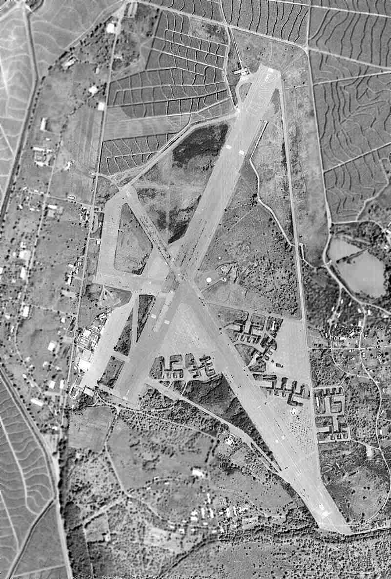
A 1977 aerial view showed that most of Puunene's Runway 1/19 & the northwestern ramp had been removed with the land returned to cultivation.
Most of Runway 14/32 & the southwestern ramp remained.
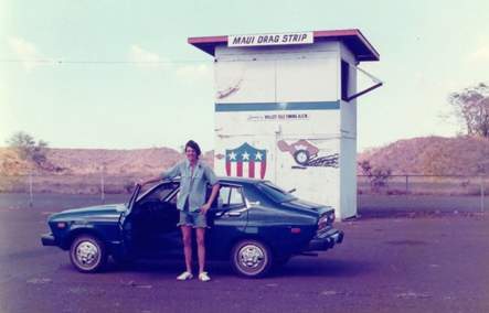
A circa 1977-78 photo of what was then known as the "Maui Drag Strip" (courtesy of Scott).
In 2003, Scott recalled "I learned to drive there, as much of the area was still pretty usable 20 years ago.
My dad knew about that place, so when we'd go on vacation, we'd head over there for some driving lessons.
Ahhhh... nothing like teaching kids how to drive using a rental car & an abandoned airfield.
The drag strip part of the runway was still in great shape, as it was still being used at the time for racing.
The Christmas Tree was still there. I think there was also a short tower structure built for the drag strip.
It was some 2-level box about 10' square, and perhaps 15' tall.
I believe that the drag strip was a full 1/4 mile, plus some.
The rental car did not turn in impressive times.
There was also a go-cart track near the runway.
It was just a large area with the track painted down, also in pretty decent shape.
My brothers & I spent a bunch of time exploring the old bunkers;
the dirt-covered storage rooms shaped as a U, and just driving around & around.
Looking at your old aerial photo, it looks like just the south end of the airbase was what was left when we went there."
On the 1996 USGS topo map, the majority of the airfield is no longer depicted.
Only a 1,600' portion of the southern end of Runway 32 is still depicted, labeled "Maui Drag Strip".
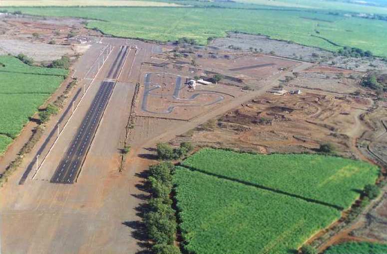
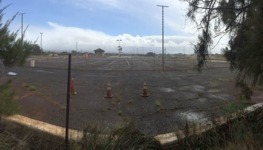
A 2002 aerial view of the Maui Raceway Park Drag Strip (courtesy of Sarah Gee).
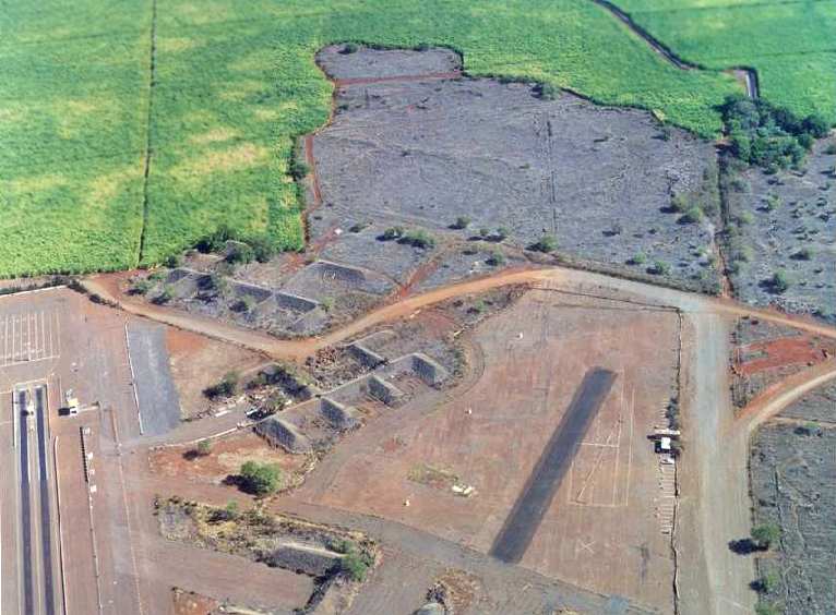
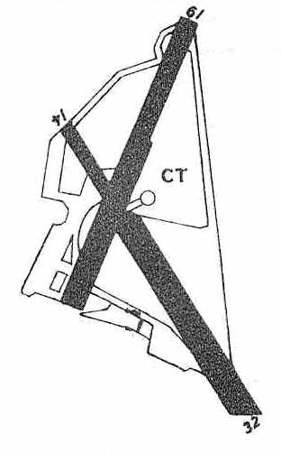
A 2002 aerial view of numerous revetments which remain from the Naval Air Station (courtesy of Sarah Gee).
The Radio Controlled landing strip is to the right of the revetments, and the drag strip starting area is to the left.
The gray areas at the top are overgrown cement areas remaining from the airfield.
In 2002, Maui County assumed control of the 215-acre facility
and management is provided by the County Parks & Recreation Department.
Portions of the former airport are now used by the Maui Raceway Park Drag Strip,
the Paradise Speedway Dirt Track (Stock Cars), and the Maui Remote Control Airplane Club.
In the near future, the County plans to re-locate the County Fair to this site
in addition to groups such as Maui Economic Opportunity & the National Guard.
In 2003, the Valley Isle Timing Association used $85,000 from Maui County
to re-pave the shutdown portion of the track.
Paul Wessel reported in 2004, "The area we used as an airstrip [the former tiedown area west of the former runways]
has been taken over by the National Guard.
They've built buildings on the strip so all that's left of the place is the drag strip."
John Sullivan reported, "On February 3, 2004 my wife Vickie & I drove to the site.
It is not well marked; however, there is a new National Guard Armory under construction
at the road entrance on Mokulele Highway (Route 311, currently being widened)
and we encountered a large helicopter landing nearby.
I was later told that there is a helipad there used by a company that supplies & ferries workers to the island of Kahoolawe.
They are undertaking a $400 million cleanup of the island that was used as a bombing range,
removing old ordnance, plane parts, and even human remains."
Jim continued, "The red dirt road into the site is not impressive or well maintained.
We drove to the drag strip & saw the other facilities, as well as a motocross track.
The old earth bunkers are grown over with vegetation, not too inviting for exploration.
Trash & old tires litter the site, which is now bordered by sugar cane fields.
There is no sign or memorial to indicate the former nature of the site
or the service performed by the 3,300 men & women & 271 aircraft stationed there,
or the 106 squadrons & carrier air groups that passed through there during WW2.
It was disappointing."
Jim continued, "On February 5, 2004 I visited the Maui County offices in Wailuku
and spoke with Mr. Brian Miskae, Administrator, Long Range Division, Department of Planning.
He said that the base was eventually turned over to the state
and then sold to H C & S (Hawaiian Commercial & Sugar Company), with the exception of 222 acres.
He said that just about 2 months ago the 222 acres were finally deeded to the County.
He provided me with a copy of a Sept. 19, 2002 draft master plan
prepared by R T Tanaka Engineers, Inc. & Chris Hart & Partners, Inc.
It is a current color photo of the site with proposed future uses superimposed,
including a raceway, county fair grounds, HI National Guard, Maui correctional center,
and 3.5 acres for a naval memorial park to be located at the northeast end of the drag strip,
at about the one-third point of old Runway 32.
According to Mr. Miskae, the memorial would include restoration of 2 of the old revetments for exhibits.
He didn’t indicate any timetable or whether any funding was available for these improvements or the memorial."
According to the County of Maui Department of Planning's David Yamashita,
as of 2011 they are “working on an update of the master plan for the area that includes the old NAS.
We will likely have recommendations to preserve & maintain some of the bunkers
but I am not sure who the county could partner with to do this work, not that the county has any resources.”

A 3/10/11 aerial view looking north showed the remains of Puunene's 14/32 & the southwestern ramp.
Interestingly the site may once again have any aviation purpose,
as the former Navy ramp on the southwest side has painted heliport markings.
A circa 2011 aerial view looking north showed the remains of Puunene's southwestern ramp, including several heliport markings.
A November 2014 photo by Timothy Williamson looking along the dragstrip located on the site of NAS Puunene.
Edward Einhart reported, “In November 2014 I visited NAS 30 in Puunene that my Dad, Joseph Einhart, served at during WWII.
It was an AWE INSPIRING feeling to stand on & explore what is remaining of the airfield.
I even went into the concrete bunkers built into the earthen bunkers used to protect the planes from bombing shrapnel.
I saw original plane tie-down anchors embedded in concrete squares surrounded by original 'tarvia' near the runway.”
The Puunene airfield site sits on the east side of Route 311, three miles south of Puunene.
____________________________________________________
Since this site was first put on the web in 1999, its popularity has grown tremendously.
That has caused it to often exceed bandwidth limitations
set by the company which I pay to host it on the web.
If the total quantity of material on this site is to continue to grow,
it will require ever-increasing funding to pay its expenses.
Therefore, I request financial contributions from site visitors,
to help defray the increasing costs of the site
and ensure that it continues to be available & to grow.
What would you pay for a good aviation magazine, or a good aviation book?
Please consider a donation of an equivalent amount, at the least.
This site is not supported by commercial advertising –
it is purely supported by donations.
If you enjoy the site, and would like to make a financial contribution,
you
may use a credit card via
![]() ,
using one of 2 methods:
,
using one of 2 methods:
To make a one-time donation of an amount of your choice:
Or you can sign up for a $10 monthly subscription to help support the site on an ongoing basis:
Or if you prefer to contact me directly concerning a contribution (for a mailing address to send a check),
please contact me at: paulandterryfreeman@gmail.com
If you enjoy this web site, please support it with a financial contribution.
please contact me at: paulandterryfreeman@gmail.com
If you enjoy this web site, please support it with a financial contribution.
____________________________________________________
This site covers airfields in all 50 states.