Abandoned & Little-Known Airfields:
Hawaii, Hawaii island
© 2001, © 2016 by Paul Freeman. Revised 11/22/16.
This site covers airfields in all 50 states: Click here for the site's main menu.
____________________________________________________
Please consider a financial contribution to support the continued growth & operation of this site.
Original Kona Airport (revised 11/22/16) - MCAS Bordelon (added 10/8/15) - Morse Field (revised 11/15/14)
___________________________________________________
Marine Corps Air Station Bordelon / Bordelon Field / (Original) Kamuela Airport / Waimea Airport, Kamuela, HI
20.01, -155.68 (North portion of Island of Hawaii)
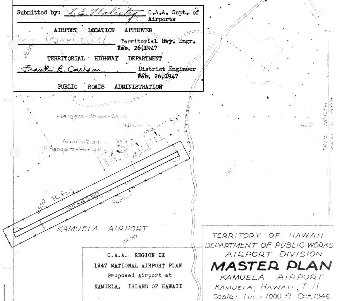
A 2/26/47 Hawaii Airport Division Master Plan for the “Proposed Airport at Kamuela”.
According to the Hawaii Aviation Department, “During World War II, the 3rd Marine Corps built a small airstrip near Kamuela,
consisting of a graded & oiled 3,000' airstrip on land belonging to Parker Ranch.
It was designed for use by liaison aircraft in connection with their training operations in Hawaii. This facility was known as Bordelon Field.
The field was named for William Bordelon, a U.S. Marine who served in combat during World War II.
During the Battle of Tarawa, he was killed in action while he led the assault on the enemy & rescued fellow Marines.
For his acts of gallantry, he was posthumously awarded the United States' highest military honor - the Medal of Honor.”
The earliest depiction which has been located of Bordelon Field
was a 2/26/47 Hawaii Airport Division Master Plan for the “Proposed Airport at Kamuela”.
The Hawaii Aviation Department continued, “In order to provide air service to the Waimea district after the war,
the area on which this airstrip was situated was leased from Parker Ranch by the Hawaii Aeronautics Commission
and renamed Kamuela Airport by Act 32 of the 1947 Legislature, effective 7/1/47.
The 1947 Territorial Legislature appropriated $60,000 for the development of this field,
but the construction necessary to develop a field in this area with sufficient length to meet scheduled airline operation
using DC-3 type of aircraft required an expenditure of several hundred thousand dollars.
Engineering studies were made to determine the most economical method whereby a field could be constructed
in this general area which would conform to scheduled airline operating requirements.”
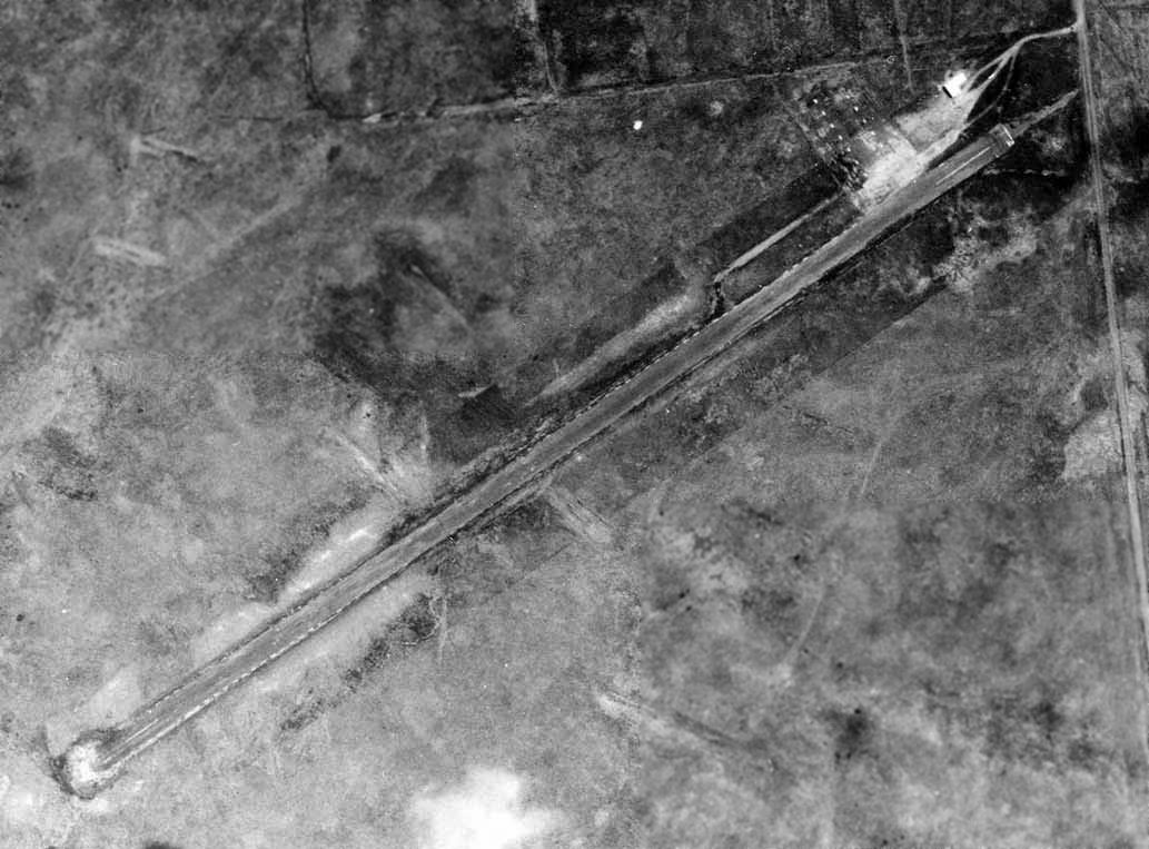
The earliest photo which has been located of Bordelon Field was a circa 1948 aerial view,
which depicted a single paved northeast/southwest runway with a ramp & a small building on the northeast side.
The Hawaii Aviation Department continued, “In 1949 the Legislature appropriated $200,000 for paving, grading and improvements.
The community was desirous of a satisfactory airport in this area,
not only for the convenience of the travelling public but for the transportation of produce from this area to the Honolulu market.
Extensive studies were conducted with regard to the further development of lands for increased production of farm commodities
and if the community were assured of prompt delivery of its goods to the local markets, the air freight carriers alone would be the major users of this field.
The HAC approved $58,000 for repairs to Kamuela Airport in July 1950.
The HAC agreed to an extension of the lease for Kamuela Airport beginning 11/4/50.
Approval was also given to make repairs to the runway.
In 1950 Kamuela Airport was deemed unsuitable for development as a modern airport.
Studies of terrain and weather were conducted to find a suitable site for a new Kamuela Airport.
Repairs to the old Kamuela Airport were completed & the airport reopened on 12/22/50.”
The Hawaii Aviation Department continued, “In January 1951, the field runway was widened by 16' & completely resurfaced at a cost of $17,198.
Office space was rented to Cockett Airlines at a rate of $1/ square foot / annum, which conformed to the rate charged at Port Allen for like facilities.
Act 63, SLH 1951, approved 5/10/51 ratified an agreement between Hawaii County & the HAC
to provide the labor & materials necessary to repair the surface of the airplane landing field. The HAC would reimburse costs.”
The Hawaii Aviation Department continued, “On 10/22/51 the HAC approved a sum of $728,000
for the development of a new runway at Kamuela to accommodate freight planes & Convairs.
The airport was served by daily (except Sunday) scheduled freight flights & non-scheduled passenger planes in 1951.
It did not meet the requirements for scheduled passenger service.
The airport ranked very high in the Territory as pertains to amount of freight shipped by air.
Routine maintenance & custodial duties are performed by one full-time HAC employee.
Kamuela Airport was inactivated in August 1953 due to the opening of the new Waimea-Kohala Airport near Kamuela town.”

A 9/4/53 aerial view depicted both “Old MCAS Bordelon (Abandoned)” on the west side of Route 19,
and the replacement “Kamuela Airport” on the east side.
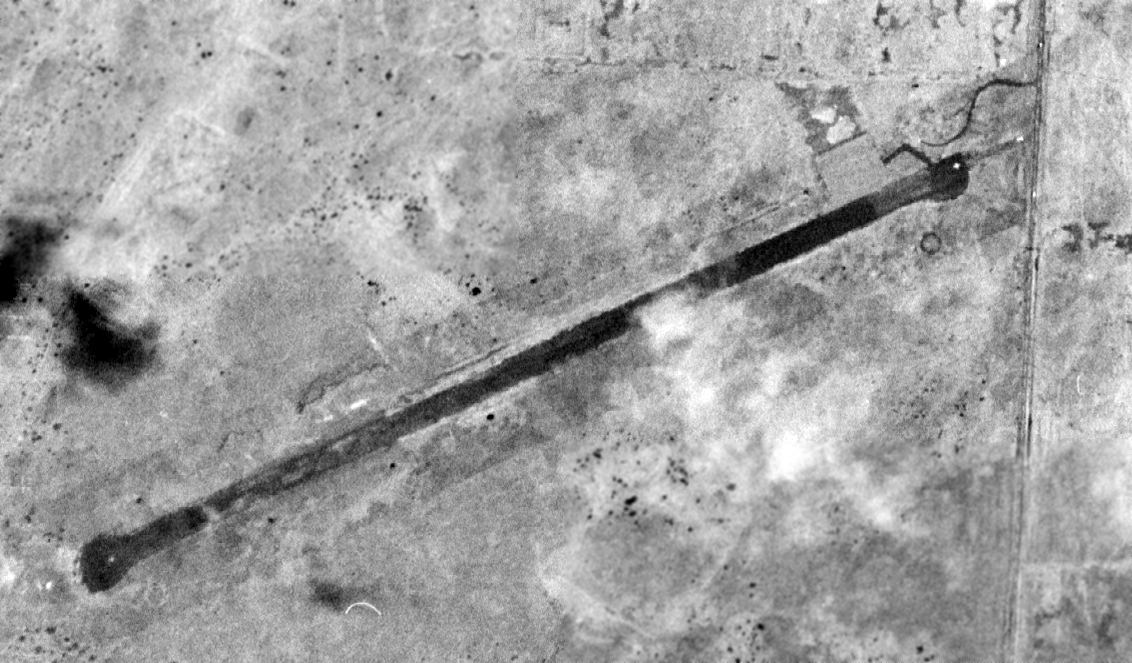
A 9/28/54 USGS aerial view depicted the original Kamuela Airport in a deteriorated state.
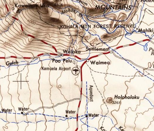
The last depiction which has been located showing the original Kamuela Airport still in operation was on the 1954 USGS topo map.
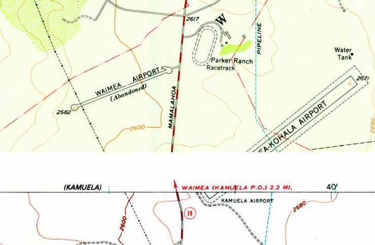
The 1956 USGS topo map depicted both the “Waimea Airport (Abandoned) on the west side of Route 19,
and the replacement “Kamuela Airport” / “Waimea-Kohala Airport” on the east side.
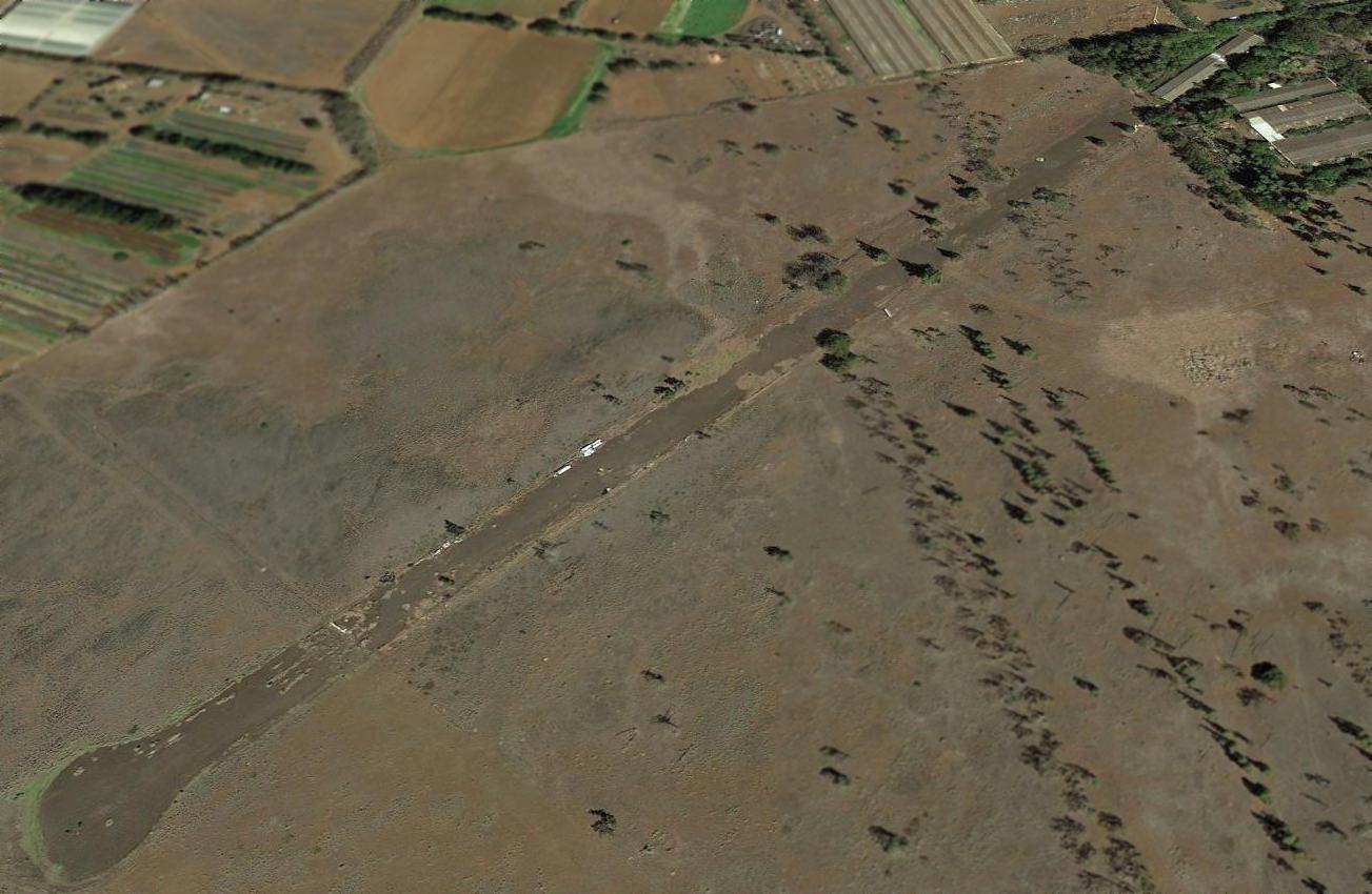
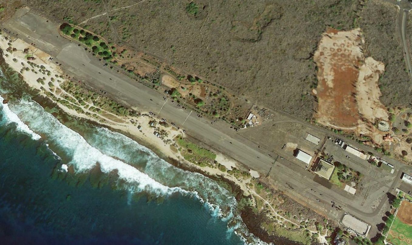
A 2013 aerial view looking north showed the Bordelon Field runway remained remarkably intact 60 years after being abandoned.
A building had been erected over the eastern end of the runway.
The site of Bordelon Field is located southwest of the intersection of Route 190 & Lalmilo Farm Road.
Thanks to Jason Ballesteros for pointing out this airfield.
____________________________________________________
18.92, -155.68 (Island of Hawaii, Southeast of Honolulu, HI)
A circa 1940 photo of Boeing P-26 Peashooter fighters at Morse Field.
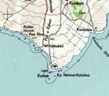
This airfield was located at the southernmost point on the island of Hawaii.
The Morse Field property was also called Ka Lae Military Reservation.
The date of establishment of Morse Field has not been determined.
War Department Orders #8, dated 8/19/33, designated the airfield as Morse Field in honor of 2nd Lt. G.E. Morse.
It had a runway & one small barracks.
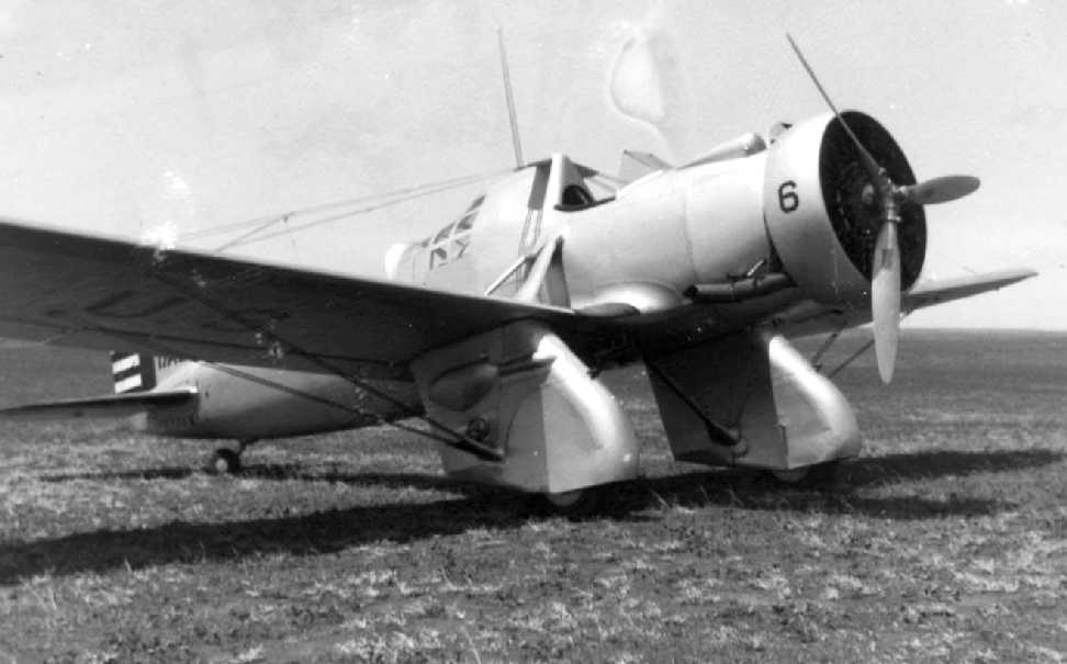
A 1940 photo of a beautiful Curtiss A-12 Shrike at Morse Field.
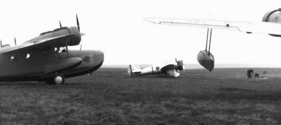
A circa 1940 photo of a Grumman OA-9s & a Boeing P-26 Peashooter fighter at Morse Field.
In 1941, the Civil Aeronautics Adminstration began work to improve Morse Field
due to its location 200 miles closer to Christmas Island than Honolulu,
which allowed range-limited aircraft to refuel at South Point before continuing on to the next island destination.
Construction increased the number of buildings to 5, built nine 50,000 gallon fuel tanks, a water line, access roads,
and extended the runway to 6,000'.
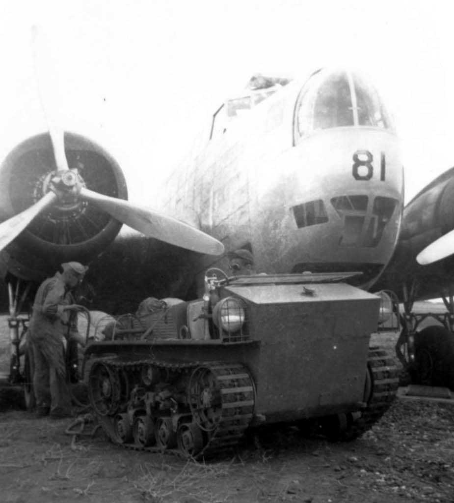
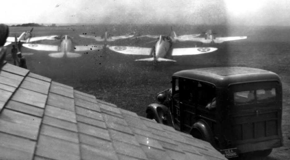
A 1941 photo of a B-18 bomber from Hickam Field being rigged for towing at Morse Field.
A 1941 photo of P-36 fighters from Wheeler Field taxiing to the gas pit to refuel at Morse Field
The small roof covered the gas system segregation.
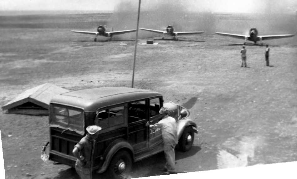
An 8/26/41 aerial view of Morse Field, showing an open grass landing area.
David Walks-As-Bear reported, “From interviews I did with locals in the area,
there were at least 2 USAAC fighters stationed at the strip when Pearl Harbor was attacked 12/7/41.
From the descriptions, I assume them to have been P-39s or P-40s.”
The work on runways at Morse Field was suspended shortly after the Pearl Harbor attack on 12/7/41
and all adjacent landing areas demolished & the strip destroyed as a precautionary measure against enemy use.
Blocking of landing areas on the island occupied large amounts of time & manpower
due to the extensive areas involved & the comparatively smooth surfaces surrounding the field, which could be used as landing fields.
Gun emplacements were also added around the field.
By 12/28/41, gasoline storage facilities were complete, a water line installed, and mobilization buildings were more than half finished.
These projects were all that were deemed appropriate for continuance at the time.
After World War II the Morse Field property was declared surplus
and on 1/16/48, a right of entry from the U.S. Army to the Territory of Hawaii was approved.
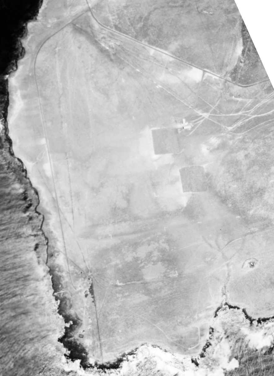
A 9/13/51 aerial view looking east at Morse Field, showing the single east/west runway.
Morse Field, as depicted on the 1951 USGS topo map.
It was not until 8/30/52 that the property was finally restored to the Territory of Hawaii by Executive Order.
Cost of maintenance was such that conditions became increasingly worse
until, in July 1953, the field was condemned as unsafe & was closed.
In the meantime, a new Federal Aid Highway project had been completed into Hilo,
which caused the entire community to look to the Hilo Airport for their transportation needs.
As a result, traffic into the field came to a standstill.
The nearest settlement to the airport, Naalehu, was 16 miles by road
and it was estimated that the population in the vicinity of Morse Field was only about 174 persons.
Estimates for proper rehabilitation ran as high as $54,837.
On 10/22/54, the Director of Aeronautics addressed a letter to the Civil Aeronautics Administration Regional Administrator,
requesting abandonment of the airport.
Reasons given were: "Surplus to the Needs of the Community Because:
1. The continued increase in frequency of schedules into Hilo Airport made it gradually more desirable to travel & ship from Hilo.
2. On 3/10/53, Federal Aid Highway Project # F18(5) unit 1, was completed,
offering an excellent highway direct to Hilo, which caused the entire community to look to the Hilo Airport for their transportation needs.
Uneconomical to Rehabilitate & Operate Because: 1. It serves such a small number of people.
2. Not strategically located to best serve these people.
3. Extreme weather conditions make it expensive to maintain.
4. Impractical even as an emergency field because of its isolated location, lack of communications and transportation.
Unsafe for further Operation Because:
An airstrip subjected to these extreme conditions over a long period of time must be maintained continuously
and this proved impossible because its limited use, even in the peak year of 1951, precluded an elaborate maintenance program."
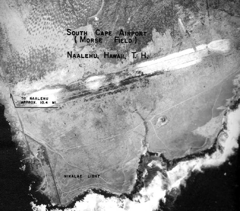
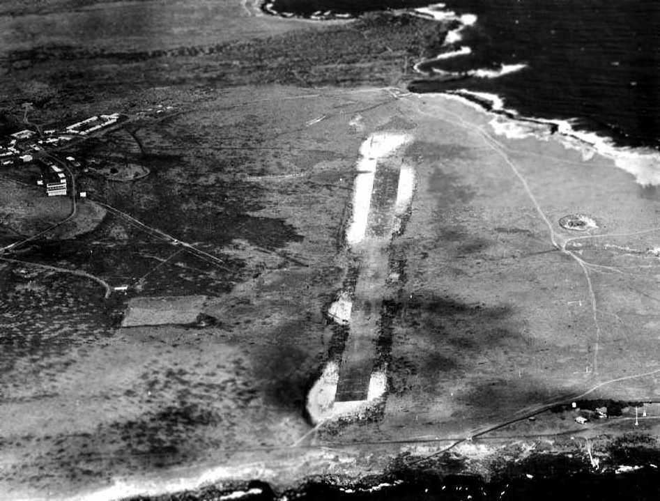
A 4/21/55 aerial view of the “South Cape Airport (Morse Field)”.
A 4/22/55 aerial view looking southwest along the Morse Field runway.
The 1962 USGS topo map did not depict an airfield, but rather labeled the site as “Astronomic Station”.
In December 1964, General Bernard A. Schriever of the AFSC
announced that the Air Force would assume control of space tracking & communications from the Navy at South Point on 2/1/65.
Then on 9/30/65, the station was closed.
South Point AFS was later reopened in support of Project Have Lent,
a sounding rocket probe program to evaluate advanced ballistic reentry system experiments.
The close proximity & aspect angle of South Point to the optical site sensors located on the island of Maui
were the primary reasons for launching the probes from this location.
In 1979, the station was divided in 2 parcels located about 1.5 miles apart, containing approximately 6 acres each.
One of the sites was the main operations area, while the other areas was used for a boresight tower.
The station was under the operational control of the Space and Missile Test Center (SAMTEC).
South Point AFS was one of the few Air Force installations in the State of Hawaii that did not fall under the control of the 15th Air Base Wing.
It belonged to the Air Force Systems Command (AFSC), with headquarters at Andrews AFB.
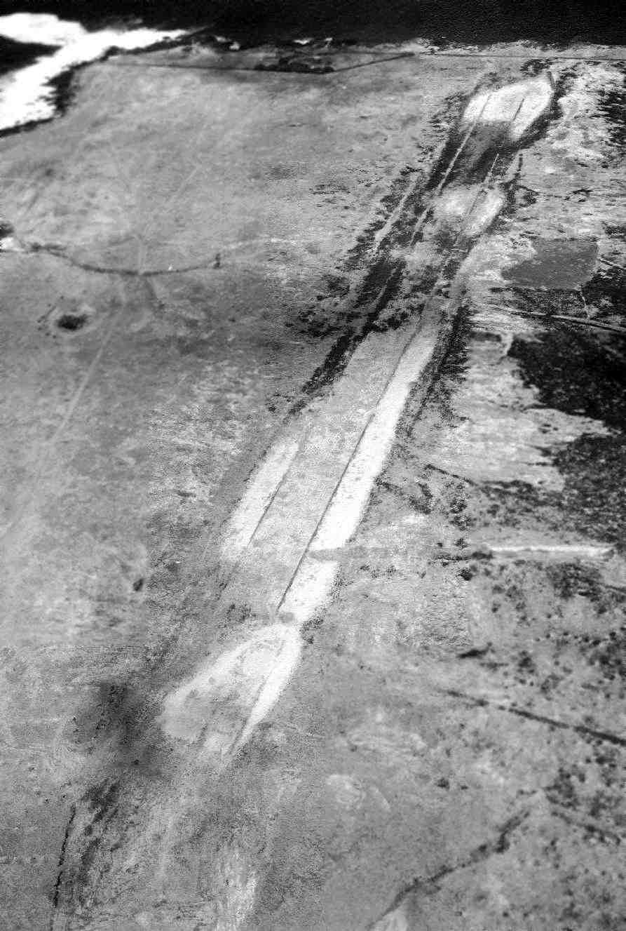
A 4/27/03 aerial view showed the outline of the Morse Field runway remains very much recognizable.
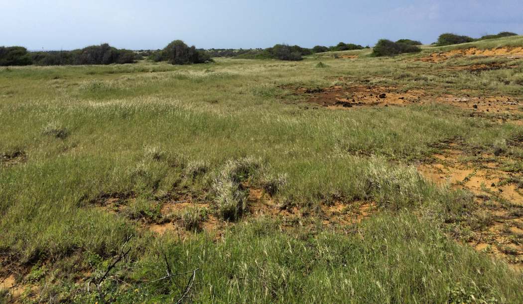
An 11/9/14 photo by Timothy Williamson looking west along the site Morse Field shows no obvious signs of a runway.
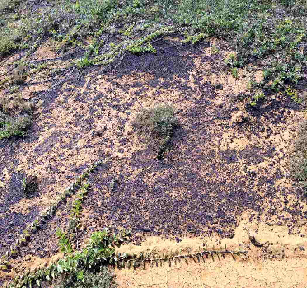
However an 11/9/14 closeup by Timothy Williamson of the site of the Morse Field shows signs of a possible oiled runway surface.
____________________________________________________
Original Kona Airport, Kailua, HI
19.644, -156.009 (Island of Hawaii, Southeast of Honolulu, HI)
A February 1950 photo (courtesy of Troy Downey) of Athur Belcher & Glenn Belcher (“apparently a bit of a pioneer in Hawaiian aviation”),
standing in front of one of the original Kona Airport buildings.
This was originally the municipal airport for the town ofKona.
According to Kona resident Laura Dierenfield,
the property was purchased by the State of Hawaii & developed into the Kona Airport in 1948.
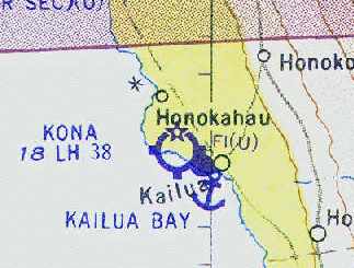
The earliest depiction which has been located of the Kailua Kona Airport
was a February 1950 photo (courtesy of Shemethree) of their grandfather & one of his sons, Glenn Belcher
standing in front of a building marked “Kona Airport”.
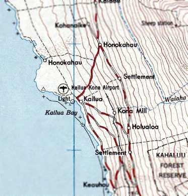
Kailua Kona Airport, as depicted on the 1951 USGS topo map.
The October 1954 Hawaiian Islands Sectional Chart (courtesy of Chris Kennedy)
depicted the original Kona Airport as having a 3,800' paved runway.
The October 1954 Hawaiian Islands Sectional Chart (courtesy of Chris Kennedy)
depicted Kona Airport as having a single 3,800' asphalt Runway 11/29.
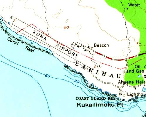
The 1954 USGS topo map depicted Kona Airport as having a single paved northwest/southeast runway, with a ramp, several small buildings, and a beacon on the northeast side.
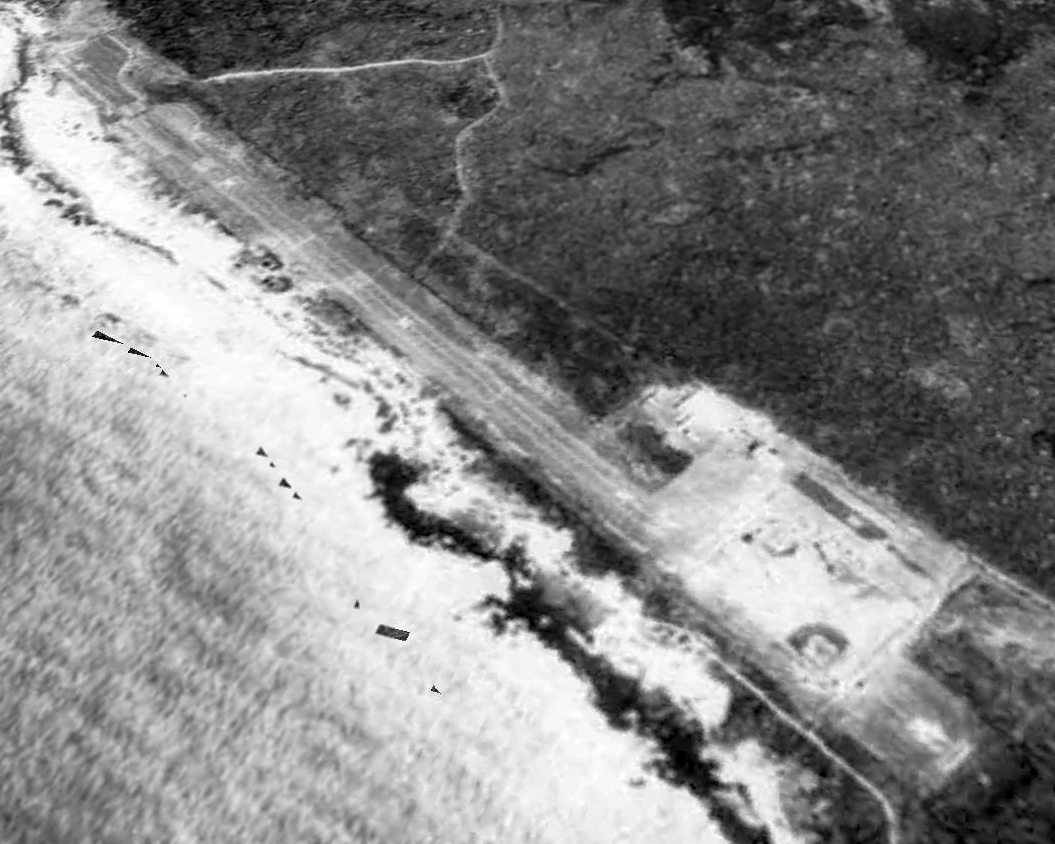
The last photo which has been located showing the original Kona Airport still in operation was a 10/1/54 USGS aerial view.
It depicted Kona Airport as having a single paved northwest/southeast runway,
with a ramp, a few small buildings, and 1 single-engine aircraft on the east side.
Kona was listed among active airports in the 1962 AOPA Airport Directory,
with a 3,800' paved runway, and the operator listed as "Hawaii Aeronautics Commission".
No airfield at this location was depicted on the 1967 USGS topo map.
Was it overlooked by the mapmakers,
or had the airport already closed by that point?
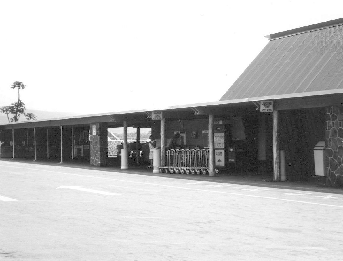
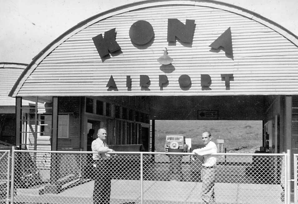
An undated (circa 1960s?) photo of the Kona Airport terminal (from the HI Aviation Department, courtesy of Jason Ballesteros).
According to Laura Dierenfield, the original Kona Airport closed in 1970,
when the larger Kona International Airport was built in Keahole to the north.
Greg Myers recalled, “It was then used for legitimate drag racing for a few years (and bootleg nighttime racing).
I remember attending a race there.
That lasted until the county built the new million-dollar dragstrip near the Hilo Dump in the mid-1970's.
It then became a county park.”
The abandoned Kona Airport became a State/County park in 1976.
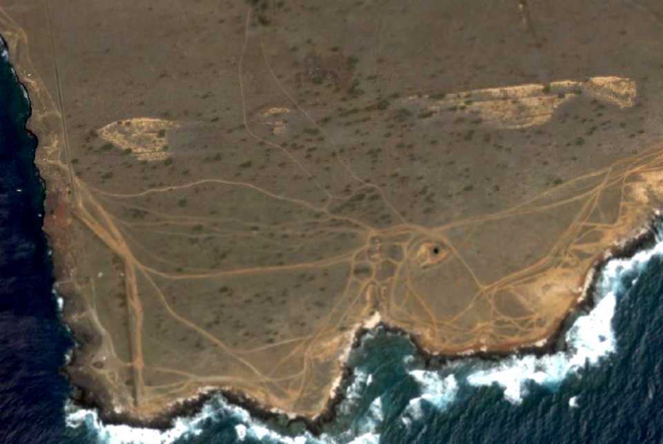
A 1977 aerial view looking northwest showed the original Kona Airport remaining intact.
Jason Ballesteros recalled, “I grew up on the island of Hawaii in the late 1980s & spent many a summer wandering around 'Old A's' or just the 'Old Airport' as it is referred to locally.
Having grown up around aviation the airport held special interest to me & I spent as much time exploring what was left of it as I could.
This airport was my original 'Abandoned & Little-Known Airfield' some 30 years ago now!
It appears, at some point the runway had extended to where the tennis courts are now [2015].
Up until at least 1993 there was what appeared to be an old rusted wind tee where the blue square is now.
It disappeared shortly thereafter when the area was redone as a jogging path.”
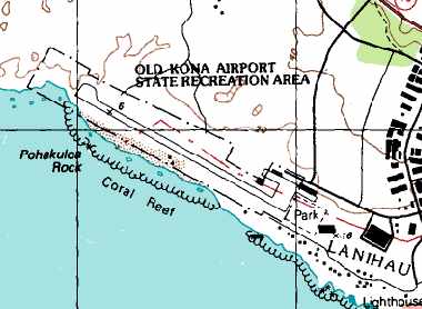
The runway of the original Kona Airport was still depicted on the 1996 USGS topo map,
with the property being labeled the "Old Kona Airport State Recreation Area".
The old terminal building is now a large public pavilion for gatherings
and what were possibly the former hangars now serve as facilities for the local DMV.
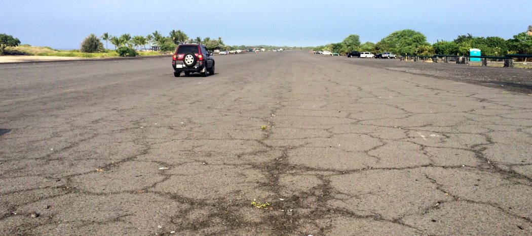
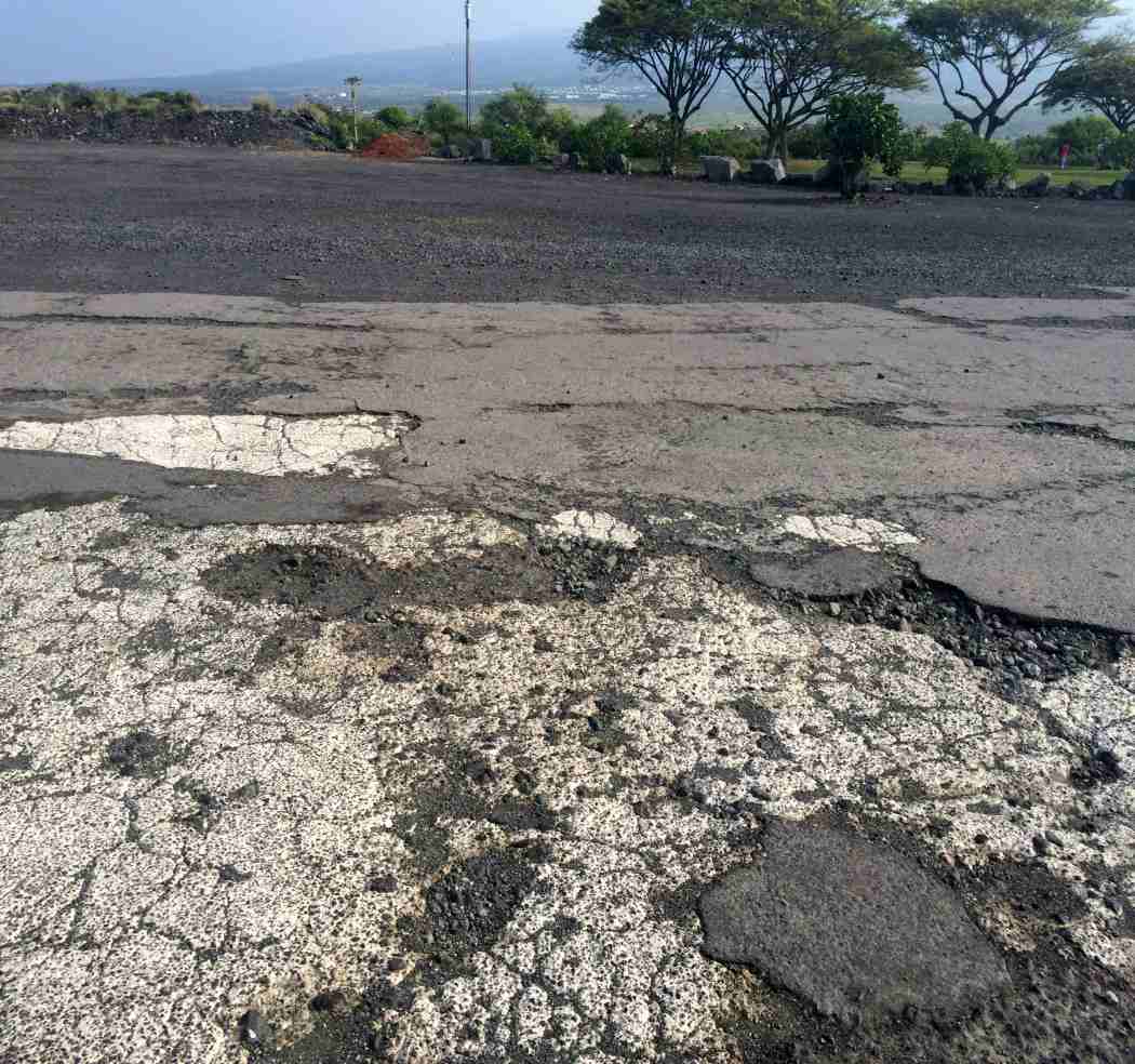
The runway pavement also still exists.
A local group is trying to further improve the park facilities at the site.
The original Kona Airport is still depicted as an abandoned airfield on recent aeronautical charts.
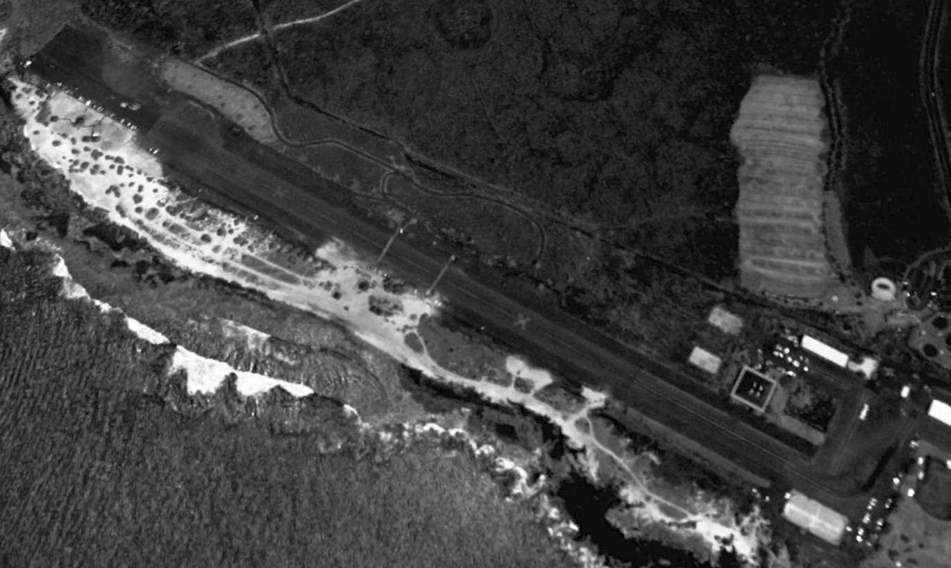
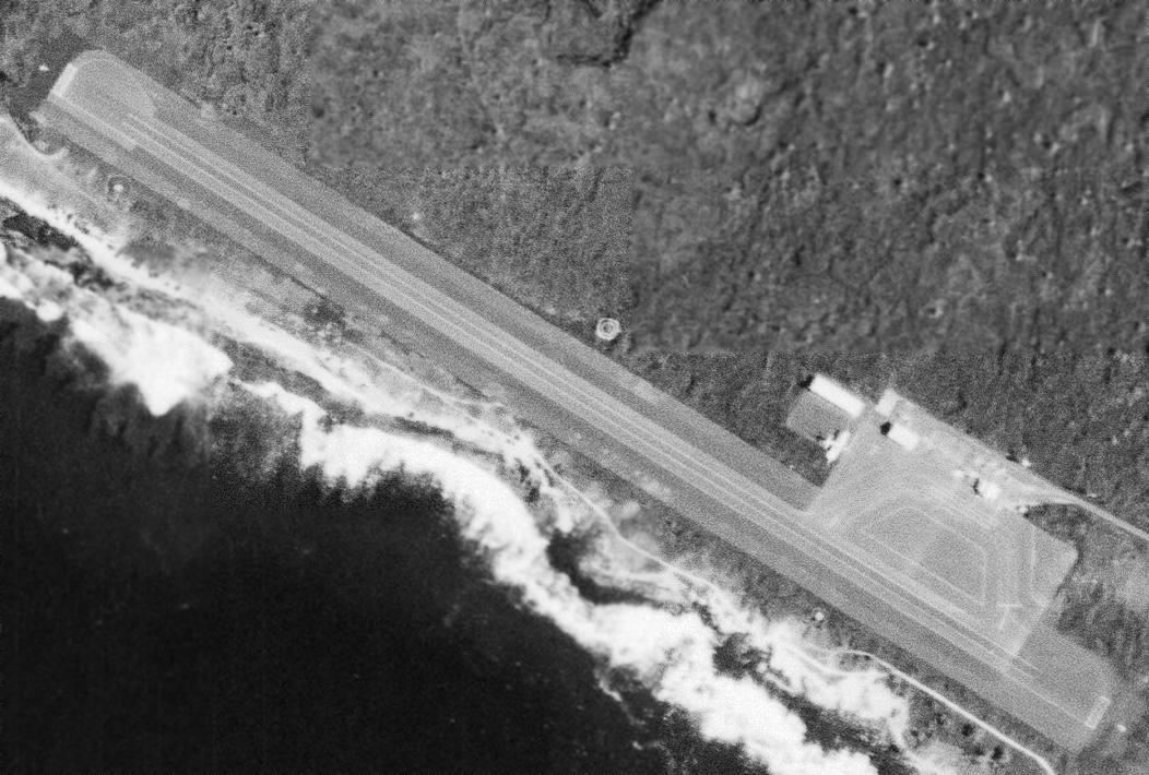
A 2000 USGS aerial view looking north showed the original Kona Airport runway remained completely intact but marked with closed-runway “X” symbols.
Jason Ballesteros recalled, “The edges of a large yellow 'X' used to be visible peeking out of beyond the edges of the courts until the lot was resurfaced sometime in the early 2000s.”
Bob Murphy reported in 2004, "It is still used as an airport of sorts...
A local radio-controlled model airplane club uses the field as a runway on Thursday & Sunday mornings."
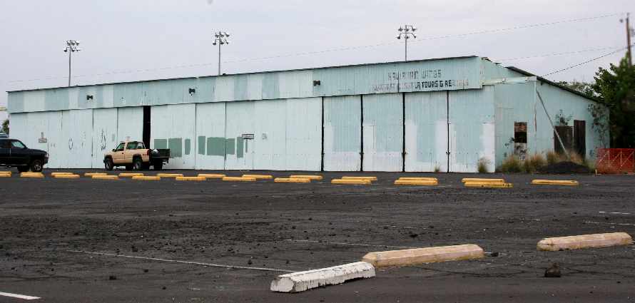
A 2006 photo by Eric Helms. Eric reported, “The hangar is about 75 yards east of the old terminal building.
'Hawaiian Wings' is still written on the hangar front.”
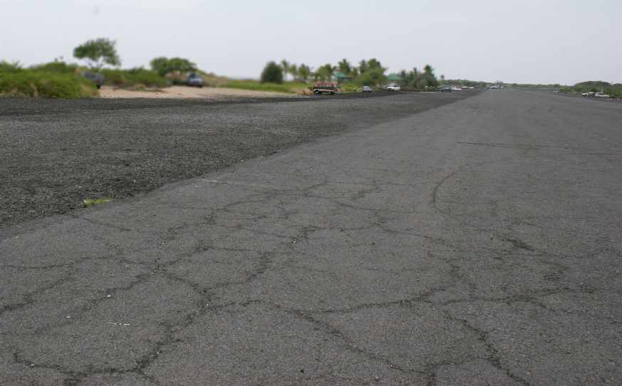
A 2006 photo by Eric Helms, looking northwest down the former Kona runway.
Eric reported, “This area is now a state park (nice park by the way) open sunrise to sunset.
Yellow X's are painted on either end of the old runway.”
A local government meeting facility (previously reported to have been the former airport terminal building)
was constructed on the former Kona Airport property.
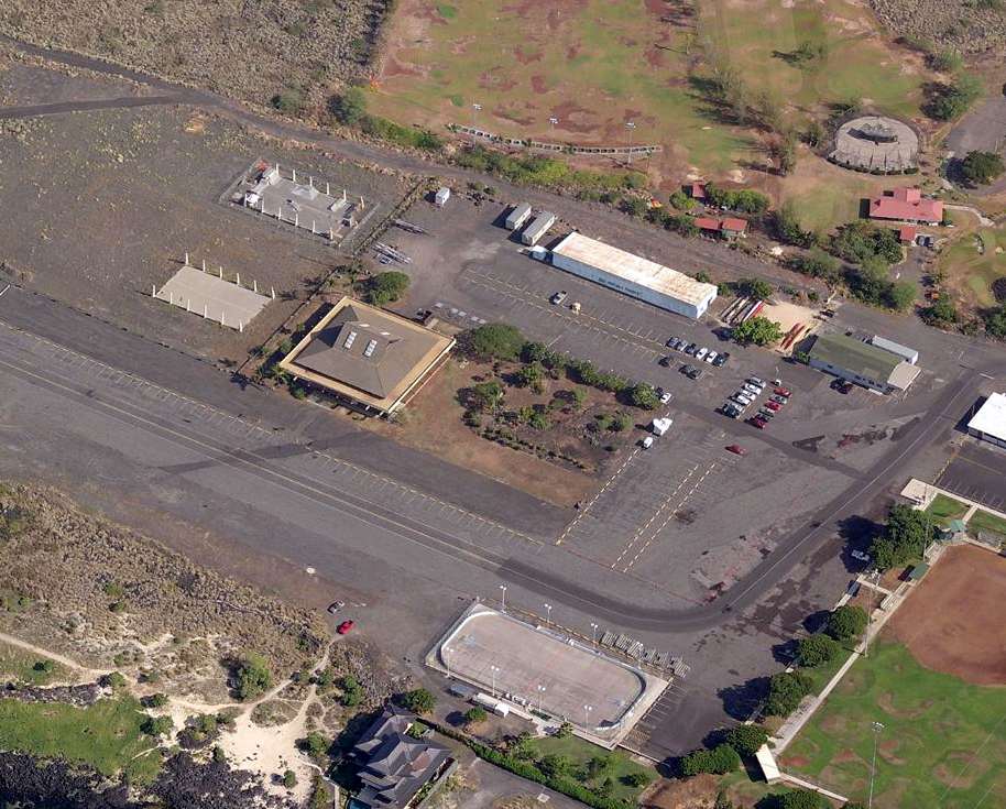
A circa 2011 aerial view looking north at the site of the original Kona Airport, showing the remains of the runway, ramp, and the former hangar.
A 2013 aerial view looking north showed the original Kona Airport runway remained completely intact but marked with closed-runway “X” symbols.
An 11/9/14 photo by Timothy Williamson looking along the former Kona runway.
An 11/9/14 photo by Timothy Williamson of what appears to be the remnants of white runway numbers on the former Kona runway.
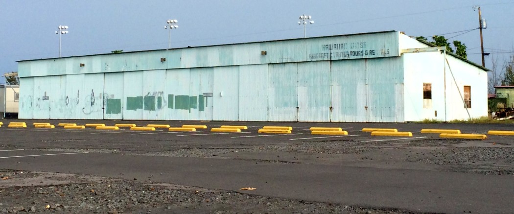
An 11/9/14 photo by Timothy Williamson of the former Kona hangar, on which “Hawaiian Wings” is still visible.
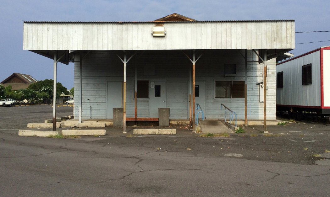
An 11/9/14 photo by Timothy Williamson of what appears to be a possible former Kona airport building,
possibly the same building shown in the 1950 picture at the top of this article.
Jason Ballesteros reported in 2015, “The old airport terminal remains on site, but it isn't the airport pavilion that is commonly referred to in many descriptions.
The terminal (at least the most recent one) is now a public restroom & county storage facility located across from the baseball/football fields at the park - we used to play on its roof as kids.
There was a nearby pole on the mauka (opposite the ocean) side of the terminal that had a pair of old disconnected VHF antennas on it that is long since gone.
Towards its end, the airport was larger than what is popularly depicted with the ramp extending to where the baseball/football fields are today.
When the carnival comes to town, they set up at the far north end of the runway turning everything south of it into a parking lot.”
____________________________________________________
Since this site was first put on the web in 1999, its popularity has grown tremendously.
That has caused it to often exceed bandwidth limitations
set by the company which I pay to host it on the web.
If the total quantity of material on this site is to continue to grow,
it will require ever-increasing funding to pay its expenses.
Therefore, I request financial contributions from site visitors,
to help defray the increasing costs of the site
and ensure that it continues to be available & to grow.
What would you pay for a good aviation magazine, or a good aviation book?
Please consider a donation of an equivalent amount, at the least.
This site is not supported by commercial advertising –
it is purely supported by donations.
If you enjoy the site, and would like to make a financial contribution,
you
may use a credit card via
![]() ,
using one of 2 methods:
,
using one of 2 methods:
To make a one-time donation of an amount of your choice:
Or you can sign up for a $10 monthly subscription to help support the site on an ongoing basis:
Or if you prefer to contact me directly concerning a contribution (for a mailing address to send a check),
please contact me at: paulandterryfreeman@gmail.com
If you enjoy this web site, please support it with a financial contribution.
please contact me at: paulandterryfreeman@gmail.com
If you enjoy this web site, please support it with a financial contribution.
____________________________________________________
This site covers airfields in all 50 states.