Abandoned & Little-Known Airfields:
Northwestern Arizona
© 2002, © 2016 by Paul Freeman. Revised 4/24/16.
____________________________________________________
Please consider a financial contribution to support the continued growth & operation of this site.
Kingman Aux AAF #1 / Cyclopic Field (revised 5/14/12) – Kingman Aux AAF #3 / Hackberry Field (revised 5/14/12)
Lake Mohave Ranchos Airport (revised 4/19/14) - Searchlight Ferry Airport (1st location) (revised 4/24/16)
Searchlight Ferry (2nd location) / Cottonwood Landing Airport (revised 3/28/15)
____________________________________________________
Lake Mohave Ranchos Airport, Dolan Springs, AZ
35.57 North / 114.3 West (Northwest of Phoenix, AZ)
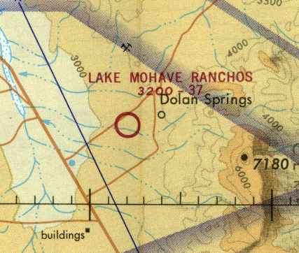
Lake Mohave Ranchos Airport, as depicted on the December 1970 Phoenix Sectional Chart (courtesy of David Brooks).
The Lake Mohave Ranchos Airport was evidently established at some point during 1970,
as it was not yet depicted on the June 1970 Phoenix Sectional Chart (according to David Brooks).
The earliest depiction of the field which has been located
was on the December 1970 Phoenix Sectional Chart (courtesy of David Brooks).
It depicted Lake Mohave Ranchos as a public-use airport, with a 3,700' unpaved runway.
The 1970 AOPA Airport Directory (according to David Brooks) described Lake Mohave Ranchos as offering tie-downs & fuel.
Its purpose was stated to serve the Lake Mead Recreational Area.
The earliest photo which has been located of the Lake Mojave Rancho Airport was a 11/13/78 USGS aerial photo.
It showed the field as having a single northeast/southwest runway, with a ramp on the northeast side.
There did not appear to be any sign of any buildings related to the airfield.
The last depiction which has been located of Lake Mohave Ranchos as an active airfield
was on the June 1980 Phoenix Sectional Chart (according to David Brooks).
Lake Mohave Ranchos was evidently closed (for reasons unknown) at some point in 1980,
as it was no longer depicted on the December 1980 Phoenix Sectional Chart (according to David Brooks) or the 1980 USGS topo map.
Thus, this small general aviation airport apparently only lasted about 9-10 years.
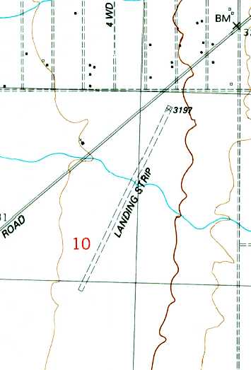
The 1989 USGS topo map still depicted a single unpaved northwest/southeast runway, labeled simply as “Landing Strip”.
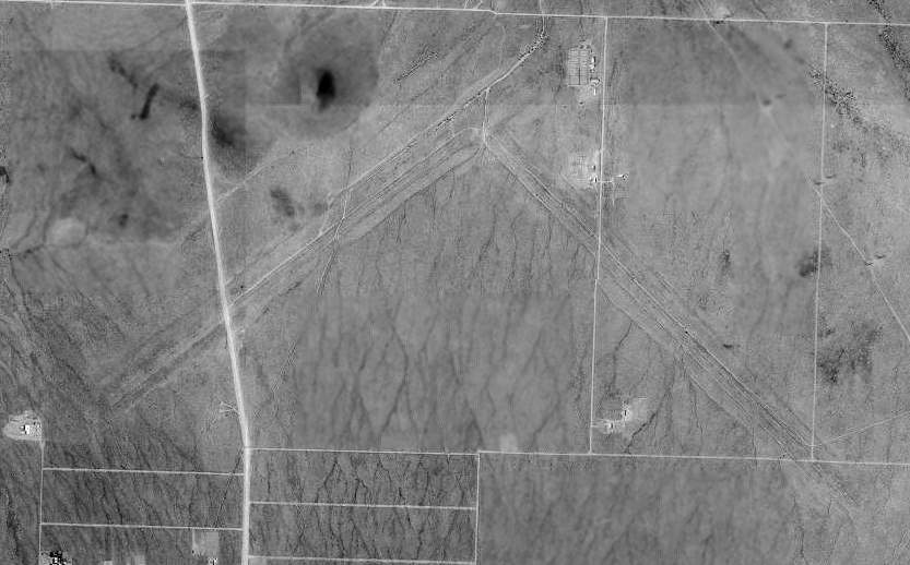
A 1997 USGS aerial view depicted Lake Mojave Rancho Airport as having several closed-runway “X” symbols still recognizable on the former runway.
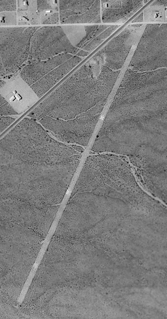
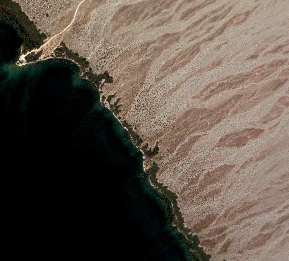
An 11/8/11 aerial view looking south showed the Lake Mojave Rancho runway still remained intact although overgrown.
Lake Mohave Ranchos Airport is located south of the intersection of Pierce Ferry Road & Gila Drive.
____________________________________________________
Searchlight Ferry Airport (1st location), Dolan Springs, AZ
35.46, -114.63 (Northwest of Phoenix, AZ)
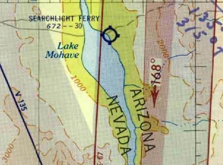
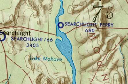
The original Searchlight Ferry Airfield, as March 1955 LA Sectional Chart (courtesy of David Brooks).
Photo of the airport while in operation has not been located.
This small general aviation airport was located along the eastern shore of Lake Mojave, along the western border of Arizona.
The original Searchlight Ferry Airfield was evidently established at some point between 1949-53,
as it was not yet depicted at all on the February 1949 LA Sectional Chart (according to Chris Kennedy).
The earliest depiction which has been located of the Searchlight Ferry Airfield
was on the 1953 LA Sectional Chart (according to David Brooks).
It depicted the field as having a 3,000' unpaved runway.
The March 1955 LA Sectional Chart (courtesy of David Brooks) depicted Searchlight Ferry in the same fashion.
The last chart depiction which has been located of the original Searchlight Ferry Airfield
was on the March 1958 LA Sectional Chart (courtesy of Chris Kennedy).
The field was labeled as “Emergency only”,
and the Aerodromes table on the chart described the field as having a single 1,200' bare runway.
The comment said "Caution: Short field. Fuel avail."
Note that the field had evidently lost more than half its length between 1955-58.
In the words of Chris Kennedy, “I guess the lake must have swallowed most of the runway by then.”
The original Searchlight Ferry Airfield was evidently abandoned at some point between 1958-60,
as no airfield was depicted in this area on the 1959 USGS topo map
nor on the September 1960 LA Sectional Chart (according to Chris Kennedy).
By 1963, a new Searchlight Ferry Airfield had been established, a mile further north along the shore of the Lake.
According to David Brooks, it appears as if the original Searchlight Ferry Airfield
was flooded out by rising waters of Lake Mojave.
A 1992 USGS aerial photo did not appear to show any trace of the original Searchlight Ferry Airfield.
A 2006 aerial photo did not appear to show any trace of the original Searchlight Ferry Airfield.
The Searchlight Ferry Airfield is located south of where Cottonwood Road ends at the shore of Lake Mojave,
inside the Lake Mead National Recreational Area.
____________________________________________________
Searchlight Ferry Airport (2nd location) / Cottonwood Landing Airport (P53), Dolan Springs, AZ
35.48 North / 114.67 West (Northwest of Phoenix, AZ)

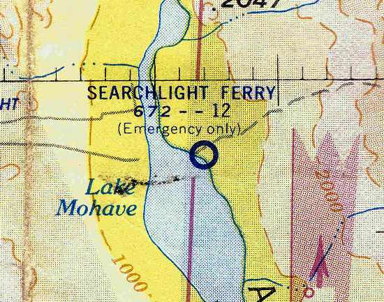
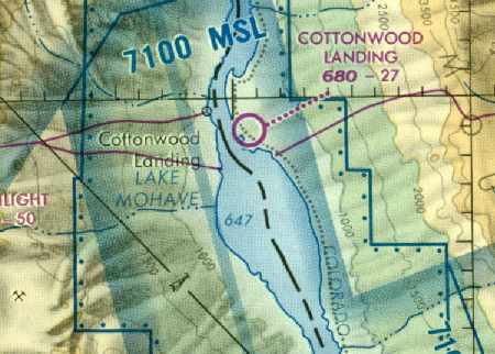
The second location of the Searchlight Ferry Airfield, as depicted on the 1959 USGS topo map.
Photo of the airport while in operation has not been located.
To replace the original Searchlight Ferry Airfield which was flooded by rising lake waters,
a new airfield was established along the shore of Lake Mojave,
one mile to the north of where the original Searchlight Ferry Airfield had been located.
The earliest chart depiction of the second airfield which has been located was on the 1959 USGS topo map.
It depicted a single northwest/southeast runway, labeled simply as “Landing Strip”.
No airfield was depicted in this area on the March 1961 LA Sectional Chart (according to Chris Kennedy).
The earliest aeronautical chart depiction of the second airfield which has been located
was on the July 1963 Gila River USAF World Aeronautical Chart (courtesy of David Brooks).
It depicted Searchlight Ferry as a public-use airport.
The second location of the Searchlight Ferry Airfield was listed in the 1963 AOPA Airport Directory (according to Chris Kennedy).
It was described as having a single 3,000' dirt Runway 18/36,
and the note "Last report 1961."
The August 1965 & August 1966 LA Sectional Charts (courtesy of Chris Kennedy)
depicted Searchlight Ferry as having a 3,000' unpaved runway.
At some point between 1966-67 the field was evidently renamed “Cottonwood”,
as that is how it was labeled on the March 1967 LA Sectional Chart (courtesy of Chris Kennedy).
“Cottonwood Cove” was described in the 1967 AOPA Airport Directory (according to Chris Kennedy)
as having a single 3,000' dirt Runway 18/36.
However, the runway configuration was apparently changed at some point in 1967,
as a November 1967 Flight Guide (according to Chris Kennedy) described the field as having a single 3,000' Runway 13/31.
“Cottonwood” was described on the August 1968 LA Sectional Chart (courtesy of David Brooks)
as having a 3,000' unpaved runway.
“Cottonwood Landing” was described in the 1982 AOPA Airports USA Directory (according to Chris Kennedy)
as having a single 2,600' dirt/gravel Runway 13/31.
The last chart depiction of the Cottonwood Landing Airport which has been located
was on the 1987 Phoenix Sectional Chart (courtesy of David Brooks).
It depicted Cottonwood Landing as having a 2,700' unpaved runway.
Cottonwood Landing Airfield was evidently closed at some point between 1987-89,
as it was no longer depicted at all on the July 1989 LA Sectional Chart (according to Chris Kennedy).
According to Mike Lerner, “The runway was never paved nor are their any buildings there.
I had wonderful camping & fishing there before Park Service closed it.
I used the strip in the 1980s before the Park Service told me it had been closed.
Even in the 1980s the main strip was overgrown; we landed on the roadway along it's Northern edge which led to a tie-down area by the lake.
The airstrip was closed by the Park Service when Lake Mead Recreational Area was established.
This airstrip was one of the most beautiful lakeside landing strips & camping areas in the West.”
An 8/25/92 USGS aerial view looking northwest clearly showed the runway as being marked with closed "X" symbols.
The runway otherwise appeared to be in fine condition.
There did not appear to have been any hangars or other buildings directly associated with the airfield.
The 2003 Phoenix Sectional Chart (according to David Brooks) depicted an airfield at this location, but simply labeled “U”.
As of 2005, the FAA Airport/Facility Directory did not list any active airfield at this location.
The 2007 Phoenix Sectional Chart (courtesy of Mike Lerner) continued to depict Cottonwood Landing simply with a “U” (unidentified).
Mike Lerner reported, “The 'U' symbol, meaning unverified, adds to the current confusion.”
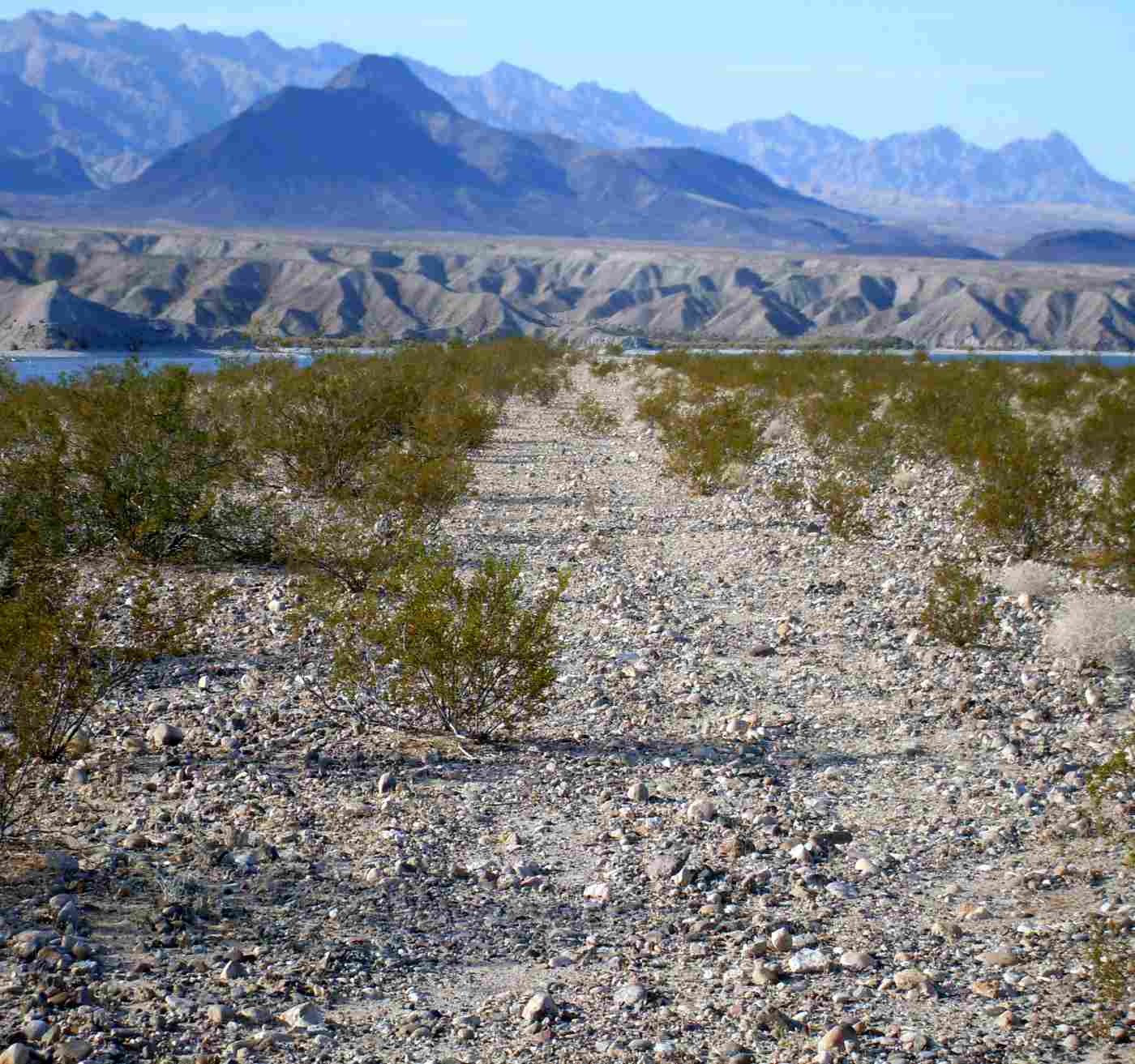
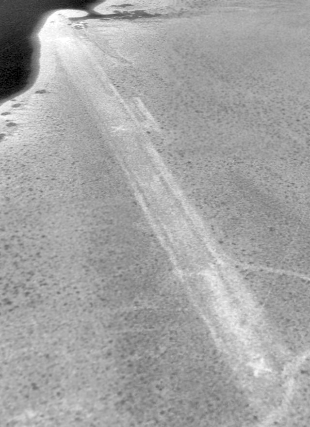
A 2008 photo by John Bacon looking north along the site of Cottonwood Landing's former Runway 31.
John reported, “Driving to the location was actually pretty easy and could be done in a regular 2-wheel-drive sedan.
It was a dirt road but wide & graded most of the way.
The runway was barely discernible. It was only 8-10' wide with several boulders averaging between 4-8 inches.
You can also see where several creosote bushes have grown in.
The Lake Mead park authorities have fenced off the access roads around the perimeter of the field.
A sign reads 'Restoration Project.' I soon learned that they were restoring the field to raw land & not restoring the airstrip.
They are allowing it to be filled in with natural vegetation.”
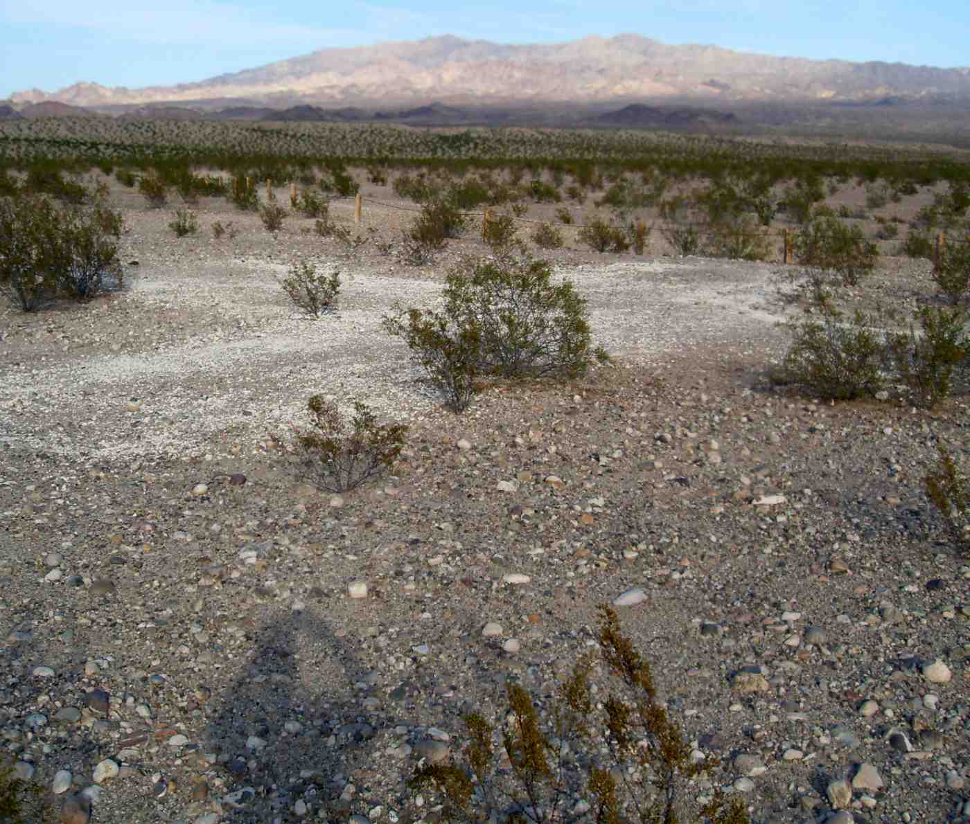
A 2008 photo by John Bacon at “the faint white X designating a closed runway” at the site of Cottonwood Landing Airfield.
John reported, “The area surrounding the airstrip was truly quiet, serene, and beautiful.
The water [is] just 30-40' from the edge of the runway.
It's a shame that this airstrip was not preserved. It would be a great place to fly into & camp.”
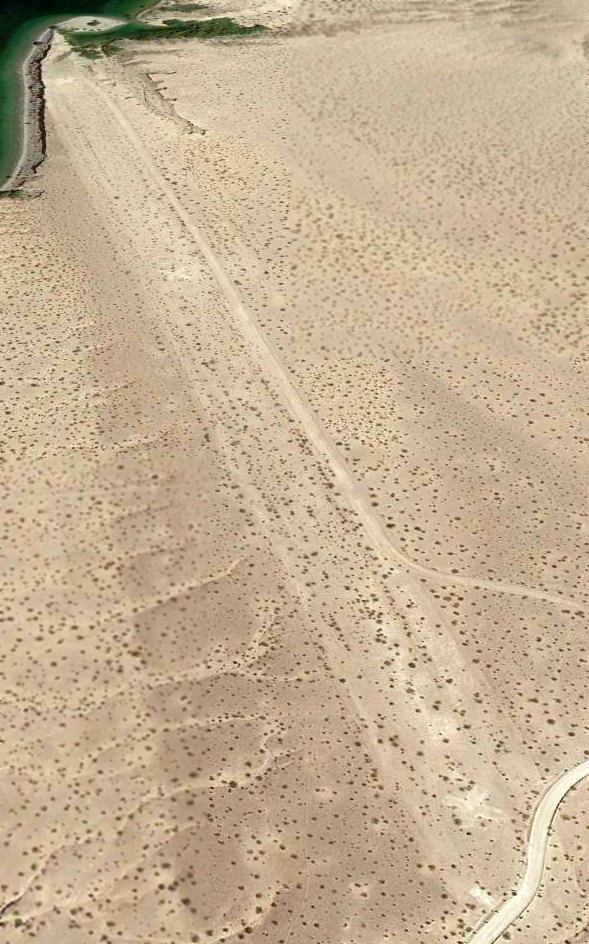
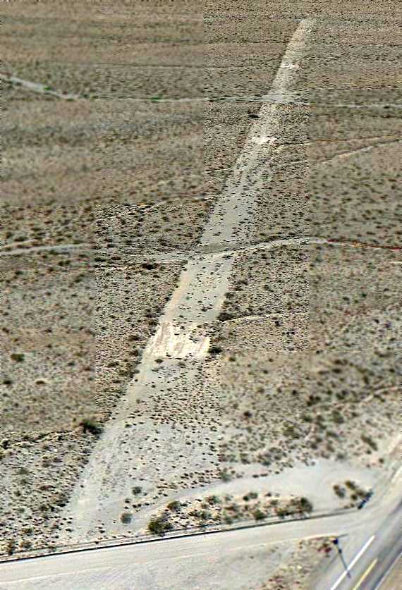
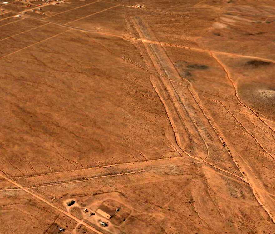
A 6/24/13 aerial view looking northwest showed the runway to remain intact, still marked with closed "X" symbols.
Mike Lerner reported in 2014, “Looking at a current Code of Federal Regulations, it is still today listed as a designated landing strip number (4).
Myself along with the Recreational Aviation Foundation are waiting for an answer from the National Park Service, Lake Mojave National Recreational Area,
about this seemingly contradictory situation.
I had a reply from one local Arizona aviator who stated the strip had been sewn with rocks besides the 'X's.”
The Cottonwood Landing Airfield is located north of where Cottonwood Road ends at the shore of Lake Mojave,
inside the Lake Mead National Recreational Area.
In the word of David Brooks, “Getting there would be a challenge by road!”
____________________________________________________
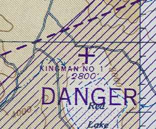
Kingman Auxiliary Airfield #1 / Cyclopic Field, Cyclopic, AZ
35.74 North / 114.09 West (Northwest of Phoenix, AZ)
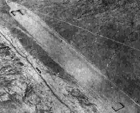
A 6/22/43 aerial view looking north at "Kingman Army Airfield Auxiliary (Cyclopic Field)”
from the 1945 AAF Airfield Directory (courtesy of Scott Murdock).
Cyclopic Field was evidently built during WW2 as one of several satellite airfields for Kingman AAF (33 miles to the southeast),
which conducted training for the 70,000 Pilot Training Program.
The date of construction of Cyclopic Field has not been determined,
but most of the other Kingman Auxiliary Airfields were established in 1942-43.
Cyclopic Field was located in an extremely remote & barren area.
The only photo which has been located showing Cyclopic Field while it was in operation
was a 6/22/43 aerial view looking north at "Kingman Army Airfield Auxiliary (Cyclopic Field)” from the 1945 AAF Airfield Directory (courtesy of Scott Murdock).
The directory described Cyclopic Field as a 40 acre rectangular property having a single graded 6,000' NNW/SSE runway.
Cyclopic Field was described as being owned by the U.S. Government, and operated by the Army Air Forces.
The only aeronautical chart depiction which has been located of Cyclopic Field
was on the March 1945 Prescott Sectional Chart (courtesy of Chris Kennedy).
It depicted "Kingman #1" as an auxiliary airfield.
The date of closure of the Cyclopic Field has not been determined,
but many of the other Kingman Auxiliary Airfields were classified surplus in 1945.
It is unlikely that the Cyclopic Airfield was ever reused for civilian aviation,
due to its extremely remote location.
No airfield at this location was listed in the 1962 AOPA Airport Directory,
and nothing at all was depicted at this location on USGS topo maps from 1968, 1969, 1980, or 1991.
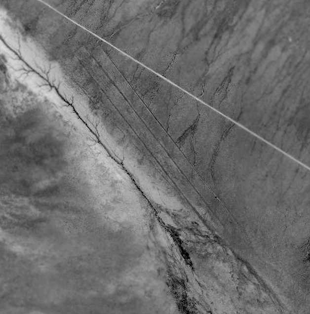
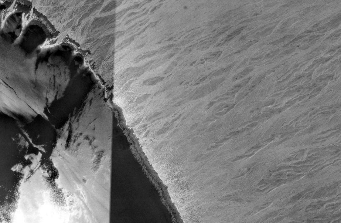
The 1997USGS aerial photo showed the outline of Cyclopic Field's 6,000' runway to remain very intact.
A 6/8/07 aerial view looking northwest along the remains of the Cyclopic Aux AAF #1 runway, remaining remarkably intact after 64 years.
The site of Cyclopic Aux AAF #1 is located 2 miles southeast of the intersection of Routes 25 & 149.
Thanks to Chris Kennedy for locating this airfield.
____________________________________________________
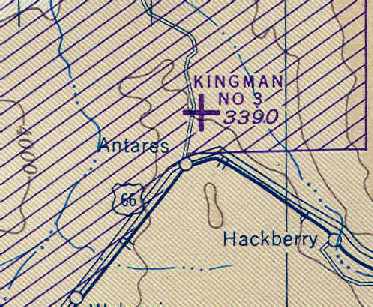
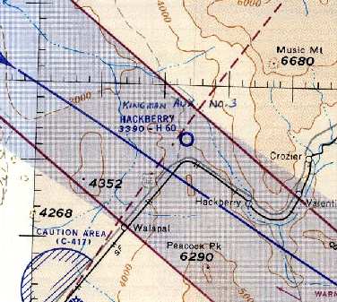
Kingman Army Auxiliary Airfield #3 / Hackberry Field, Antares, AZ
35.42 North / 113.8 West (West of Phoenix, AZ)
A 6/22/43 aerial view looking north at "Kingman Army Airfield Auxiliary (Hackberry Field)”
from the 1945 AAF Airfield Directory (courtesy of Scott Murdock).
Hackberry Field was built as a WW2-era satellite field for Kingman AAF (a few miles west),
which conducted training for the 70,000 Pilot Training Program.
The War Department acquired the property by transfer & lease in 1943.
Two 6,000' earthen airstrips were constructed on the property, in addition to 3 sheds, a tower, and a latrine.
The landing field was used in conjunction with the Kingman Air to Air Gunnery range
as an emergency landing field & as a target dropping ground.
The only photo which has been located showing Hackberry Field while it was in operation
was a 6/22/43 aerial view looking north at "Kingman Army Airfield Auxiliary (Hackberry Field)” from the 1945 AAF Airfield Directory (courtesy of Scott Murdock).
The directory described Hackberry Field as an irregularly-shaped property having 2 bituminous 6,000' runways, oriented northeast/southeast & northwest/southeast.
Hackberry Field was described as being owned by the U.S. Government, and operated by the Army Air Forces.
The earliest aeronautical chart depiction which has been located of Hackberry Field
was on the March 1945 Prescott Sectional Chart (courtesy of Chris Kennedy).
It depicted "Kingman #3" as an auxiliary airfield.
Hackberry Field was classified surplus in 1945.
A directory of AZ Airports in the 5/47 issue of Arizona Highways (courtesy of George Miller)
described Kingman Aux AAF #3's longest runway as 6,500'.
At some point between 1947-49, Hackberry was apparently reused as a civil airport.
"Hackberry" airfield was depicted on the 1949 Prescott Sectional Chart (according to Chris Kennedy),
and was described as having a 6,000' hard-surface runway.
It was depicted as "Hackberry" Airport on the 1956 Prescott Sectional Chart (courtesy of John Voss).
The field was described as having 2 runways, with the longest being a 6,000' paved runway.
The 1967 AOPA Airport Directory (courtesy of Chris Kennedy)
described Hackberry Airport as having two 6,000' hard-surface runways: Runway 4/22 & Runway 13/31.
The remarks said, "Caution: Abandoned military strip reported usable but not maintained.
Cattle sometimes on field. Caution required."
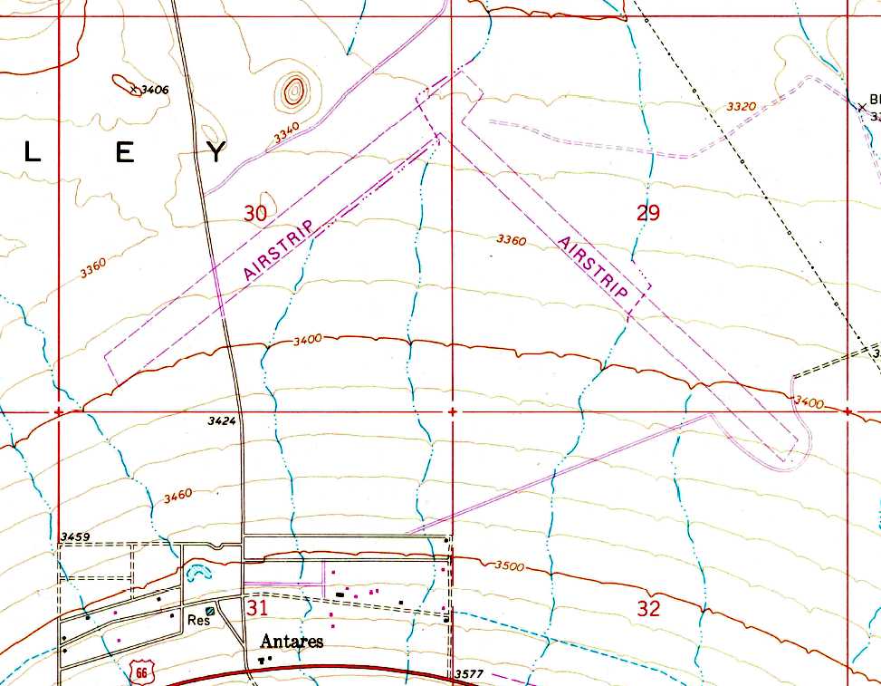
Hackberry was apparently abandoned again at some point between 1967-68,
as the 2 runways were still depicted on the 1968 USGS topo map, but it was labeled simply as "Airstrip".
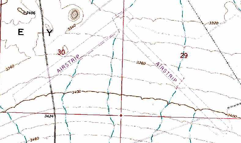
The 2 Hackberry runways were still depicted on the 1980 USGS topo map, labeled simply as "Airstrip".
Hackberry Field was labeled simply as "Landing Field" on the 1991 USGS topo map.
USGS aerial photo 1999.
According to a late-1990s Army Corps of Engineers report,
as of that date the Hackberry airfield property was partly private land, and part-owned by the Department of Interior.
The property remained as undeveloped desert land, except for what was left of the airstrips,
which were barely discernible through the vegetative overgrowth.
Several unpaved roads crossed over the runway remains.
The airfield was not depicted at all (even as an abandoned airfield) on 2000 aeronautical charts.
Chris Kennedy visited the site of Kingman #3 in September 2004.
He reported: "Although I knew exactly where the runway should have intersected
the county road that goes through the site on the west end,
I could not find any evidence of a runway except possibly an area
that appeared to be at a slightly higher grade than the surrounding dirt.
The runways must have been dirt & are completely overgrown with desert bushes of some kind,
just like the surrounding area."
Tim Tyler visited the site of Hackberry #3 in October 2004, and found "a few mobile homes scattered about the area,
and some high tension power lines crossing the site.
We didn’t get any closer than about half a mile to the area, but didn’t see the signature of anything airfield-related."
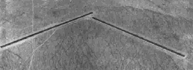
An October 2005 photo by Keith Wood, looking southeast from the road that crosses the former northwest/southeast runway at Hackberry AAF.
Keith reported, “The overhead [photo] is still pretty accurate.
There is a new barn/garage being built in the home site just south of where I shot the pictures, but otherwise there was no change.
I found no evidence that the runways had ever been paved,
but what I could see was in good condition & could be used again after a weekend of clearing up growth.”
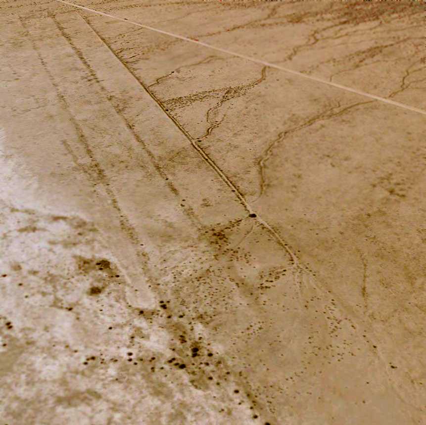
A circa 2006 aerial view looking southeast at the remains of Hackberry's 2 runways.
The Hackberry airfield is located just northeast of the tiny town of Antares.
____________________________________________________
Since this site was first put on the web in 1999, its popularity has grown tremendously.
That has caused it to often exceed bandwidth limitations
set by the company which I pay to host it on the web.
If the total quantity of material on this site is to continue to grow,
it will require ever-increasing funding to pay its expenses.
Therefore, I request financial contributions from site visitors,
to help defray the increasing costs of the site
and ensure that it continues to be available & to grow.
What would you pay for a good aviation magazine, or a good aviation book?
Please consider a donation of an equivalent amount, at the least.
This site is not supported by commercial advertising –
it is purely supported by donations.
If you enjoy the site, and would like to make a financial contribution,
you
may use a credit card via
![]() ,
using one of 2 methods:
,
using one of 2 methods:
To make a one-time donation of an amount of your choice:
Or you can sign up for a $10 monthly subscription to help support the site on an ongoing basis:
Or if you prefer to contact me directly concerning a contribution (for a mailing address to send a check),
please contact me at: paulandterryfreeman@gmail.com
If you enjoy this web site, please support it with a financial contribution.
This site covers airfields in all 50 states.