|
THE FARM
Previous Owners
Plat Maps
Area Maps
Pictures
LOCAL HISTORY
Caldwell County 1876 Atlas History
1876 Atlas People
1897 Atlas People
WPA Interviews
IMPROVEMENTS
Chronological Events
HUNTING INFORMATION
SEARCH
HOME

| |
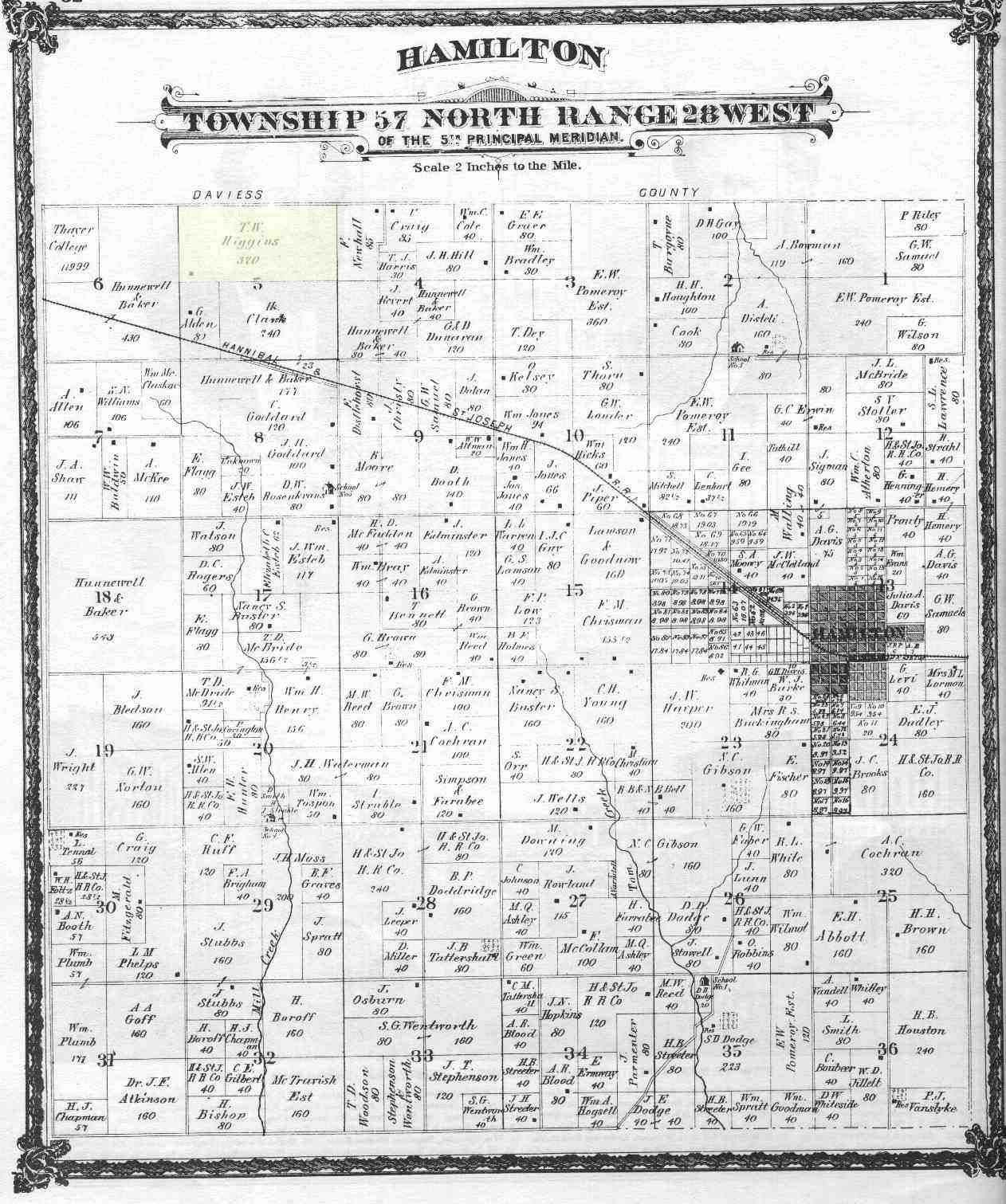
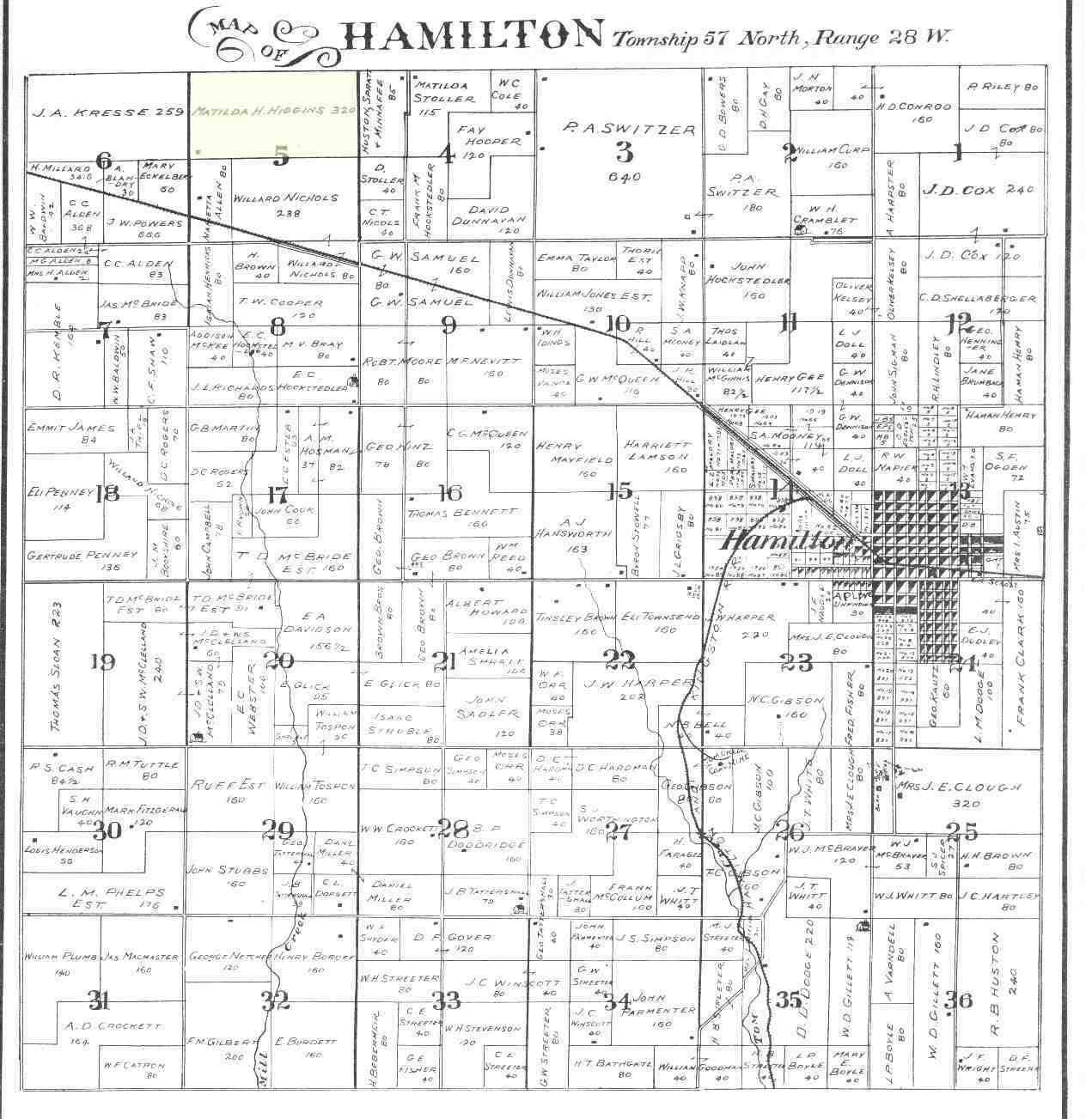
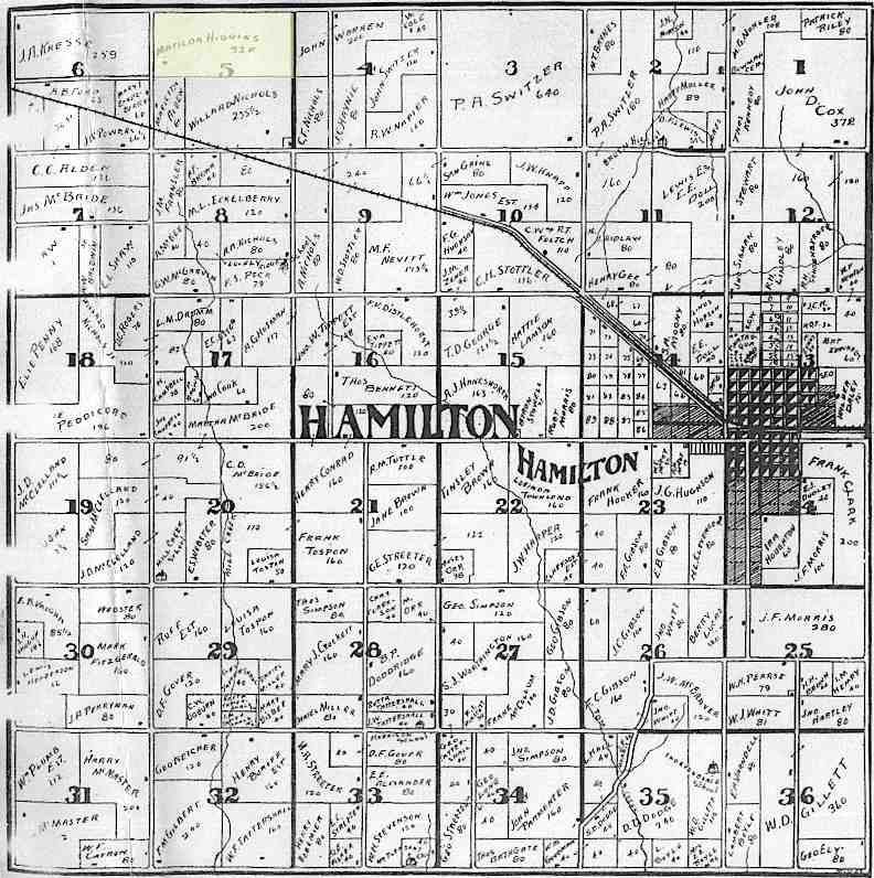
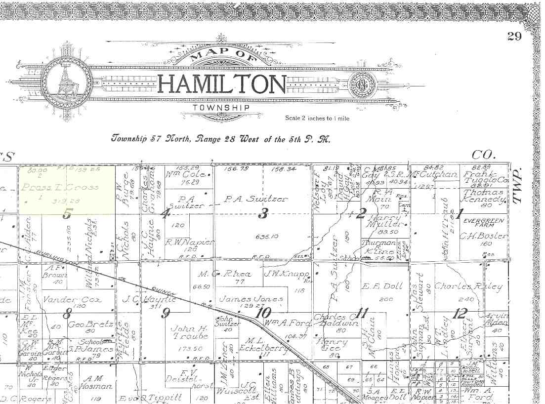
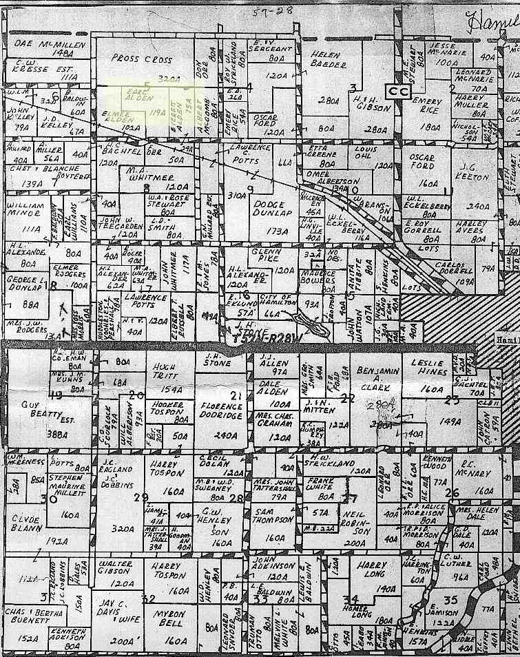
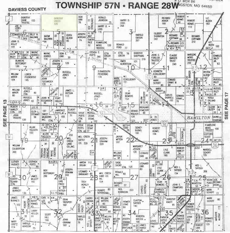
| Plat Maps Through the Ages |
The following links are of plat maps contianing the immdiate area around
the farm. I have the complete 1876 and 1897 Caldwell County, Missouri Atlas if anyone
needs other areas of Caldwell County scanned.
These maps are somewhat large. Please allow time to fully load. |
|