Abandoned & Little-Known Airfields:
West Virginia, Northwestern
© 2002, © 2016 by Paul Freeman. Revised 10/2/16.
This site covers airfields in all 50 states: Click here for the site's main menu.
____________________________________________________
Please consider a financial contribution to support the continued growth & operation of this site.
Glendale Fokker Field (revised 10/2/16) - Steelton Civil Air Patrol Airport / P.W. Johnson Memorial Airport (revised 5/3/16) - Weirton Airport (revised 5/11/13)
____________________________________________________
Steelton Civil Air Patrol Airport / P.W. Johnson Memorial Airport (75D), Steelton, WV
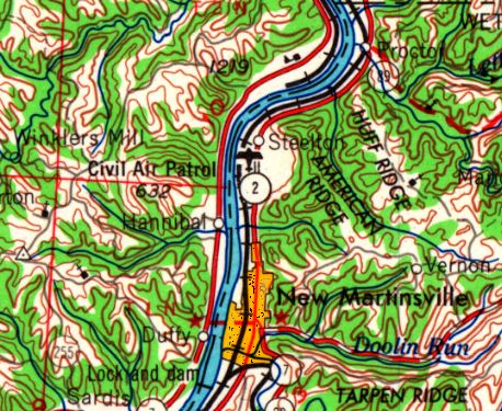
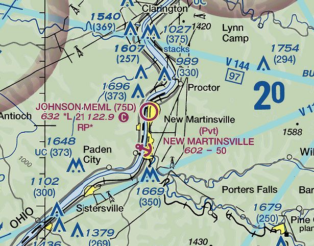
39.684, -80.862 (Southwest of Pittsburgh, PA)
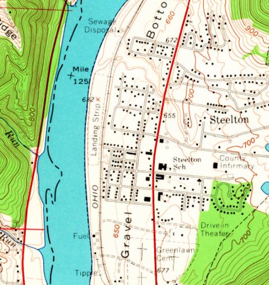
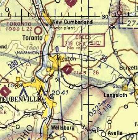
Steelton Civil Air Patrol Airport, as depicted on the 1960 USGS topo map.
This small general aviation airport on the east bank of the Ohio River was evidently established at some point between 1949-60,
as it was not yet depicted on the 1949 USGS topo map.
The earliest depiction which has been located of the Steelton Civil Air Patrol Airport was on the 1960 USGS topo map.
It depicted a single unpaved north/south runway along a narrow strip on the east bank of the Ohio River, labeled simply as “Landing Strip”.
There were no buildings depicted on the field.

The earliest aeronautical chart depiction which has been located of the Steelton Civil Air Patrol Airport
was on the July 1962 Huntington Sectional Chart (courtesy of David Stevenson).
It depicted the “Civil Air Patrol” Airport as having a 2,700' unpaved runway.
The earliest topo map depiction which has been located of the Steelton Civil Air Patrol Airport was on the 1965 USGS topo map.
At some point between 1965-84 it was evidently renamed P.W. Johnson Memorial Airport,
as that is how it was labeled on the 1984 USGS topo map.
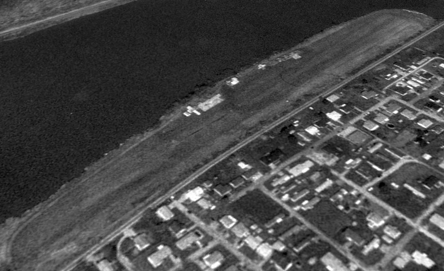
The earliest photo which has been located of P.W. Johnson Memorial Airport was a 1994 USGS aerial view looking northwest.
It depicted a single north/south grass runway, with a few small T-hangars in between the runway & the river.
There were no aircraft visible on the field.

The 1994 USGS topo map depicted a single unpaved north/south runway along a narrow strip on the east bank of the Ohio River, labeled simply as “Landing Strip”.
Three small buildings were depicted along the west edge of the field.
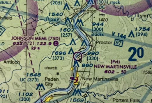
The July 2009 Huntington Sectional Chart depicted Johnson Memorial Airport as having a 2,100' unpaved runway.
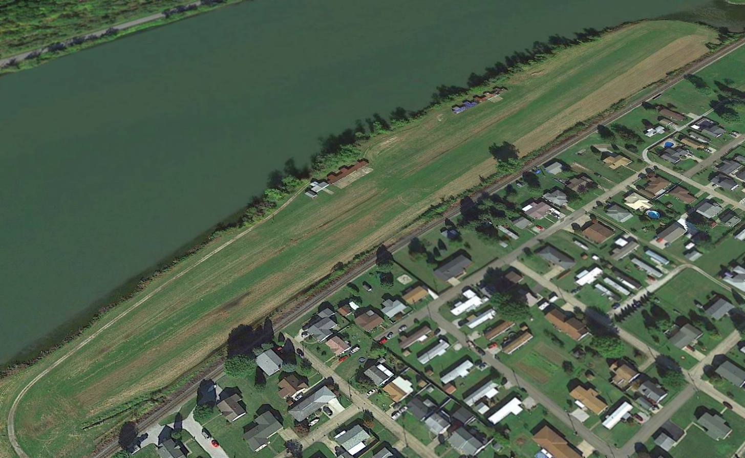
A 2015 aerial view looking northwest depicted P.W. Johnson Memorial Airport as remaining well-maintained,
but there were no aircraft visible on the field.
The 2016 Huntington Sectional Chart depicted Johnson Memorial Airport as having a 2,100' unpaved runway.
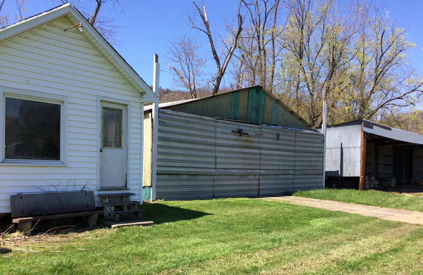
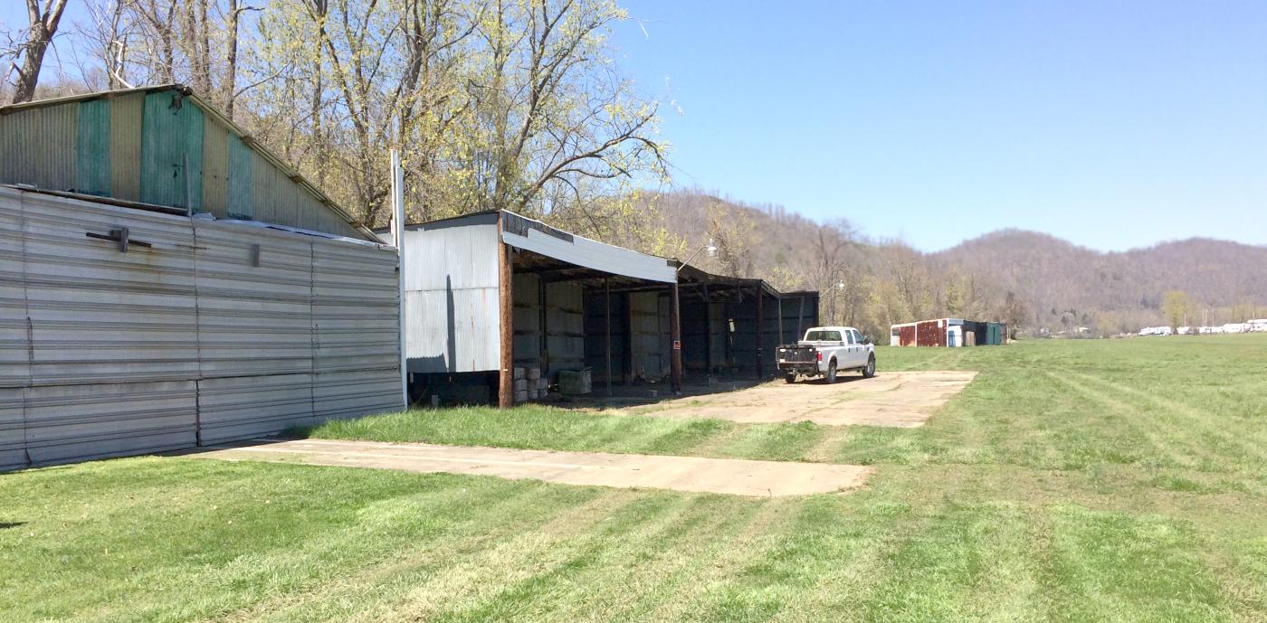
A 4/15/16 photo by Pat Schafer looking northwest at the Johnson Memorial Airport hangars & runway.
A 4/15/16 photo by Pat Schafer looking northwest at the Johnson Memorial Airport office & hangars.
Pat Schafer reported in 2016 of Johnson Memorial Airport, “I have flown into it for years.
The hangars [are] being dismantled in April 2016, and Parks Department employees [are] removing all markers.
Apparently the parks want ball fields."
As of May 2016, P.W. Johnson Memorial Airport was no longer listed with the FAA as an active airfield.
P.W. Johnson Memorial Airport is located at the western terminus of West Benjamin Drive.
Thanks to Pat Schafer for pointing out this airfield.
____________________________________________________
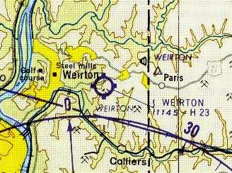
40.4, -80.55 (West of Pittsburgh, PA)
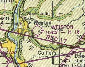
Weirton Airport, as depicted on the January 1949 Cleveland Sectional Chart (courtesy of Chris Kennedy).
Terry Marsh recalled, “The Weirton Airport was built in 1947
and replaced the former Half Moon Airport in the valley by the turn in the Ohio River.
[Airport founder] Lawrence Gullette was my grandfather
and I was just about raised at that airport in Weirton.
There was an old military building which could house 18 planes,
but all planes had to be moved to get any but the end ones out,
a main building maintenance shop for 3 planes with room to work, 5 planes tight.
This building had a large side shop with a parts room, and a boiler room in the rear.
No control tower. Next to that building was a building used to train pilots it had 3 rooms.
Later 10 private T-hangars were built on the north end.”
Terry recalled, “In 1947 my grandfather purchased all the production of Piper aircraft, up to that point,
which was 18 J-3 Cubs & 1 PA-12.
All were brought to Weirton & a flight school was started.
Over the years the training building was used for everything from a restaurant, living quarters,
Civil Air Patrol building, pilots lounge, to another flight school, for a while new tires were stored in it.
The old military building was later converted to an auto auction
and in the last years old trucks were stored there.
The main building was always a maintenance hangar.
The PA-12 Piper Super Cruiser that my grandfather purchased in 1947...
William Porter purchased it & kept it at the airport until the field was closed.”
According to James Brostman, “Weirton Airport... the airport construction was overseen by Harold Weekley who became the airport's first manager.
He ran that airport into the early 1950s.”
The earliest depiction of the Weirton Airport which has been located
was on the January 1949 Cleveland Sectional Chart (courtesy of Chris Kennedy).
It depicted Weirton as having a 1,600' hard-surface runway.

A 6/18/52 USGS aerial photo depicted Weirton Airport as having a single paved northeast/southwest runway, with 3 small buildings along the northwest side,
near which were visible 3 single-engine aircraft.
Terry Marsh recalled, “The main building was destroyed by an explosion in 1952 & rebuilt.”
The 1958 USGS topo map depicted Weirton Airport as having a single unpaved northeast/southwest runway, with a few small buildings along the north side.
The 1962 AOPA Airport Directory (based on a latest report from 1960)
described Weirton as having a single 2,300' slag Runway 4/22,
and the operator was listed as Lawrence Gullette.
By the time of the 1961 Pittsburgh Local Aeronautical Chart (courtesy of Mike Keefe),
Weirton's runway had evidently been lengthened somewhat to a 2,300' hard-surface strip.
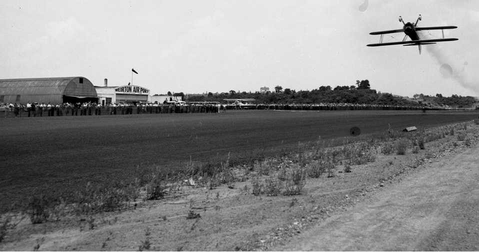
Jim McCoy described the "Weirton General Airport".
"I remember flying with my dad as passengers on summer evenings in Mr. Porter's Piper,
Mr. Porter being a work friend of my dad.
I also remember seeing several airs shows in the early 1960s
including one where an authentic X-15 was displayed on a trailer that kids were even allowed to climb up for a closer view!"
Terry Marsh recalled, “The runway was tar & gravel
and at one point a layer of the residue from coal washing operation
was applied to the gravel which gave a solid good stopping surface.
The runway was lengthened to 2,700' but I do not think the records were changed.”
The last aeronautical chart depiction which has been located of the Weirtin Airport
was its depiction on the May 1968 Cleveland Sectional Chart (courtesy of Richard Finley).
It depicted Weirton Airport as having a single 2,600' paved runway.
Terry continued, “During the 1960's & 1970's there was an old See-Bee that sat behind the main building;
it had crashed in the Saint Lawrence Seaway & was hauled in by truck to use for parts to rebuild a replacement plane.”
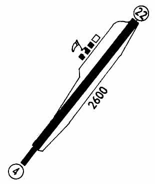
The last depiction which has been located of Weirton Airport as an active airport was in the 1971 Flight Guide (courtesy of Chris Kennedy).
It depicted Weirton as having a single 2,600' paved Runway 4/22,
with 3 buildings (hangars?) along the northwest side of the field.
It was described as being attended during daytime.
Wierton Airport was evidently closed at some point between 1971-72,
as it was depicted as an abandoned airfield on the November 1972 Detroit Sectional Chart (courtesy of Richard Finley).
John Maze recalled, "I grew up in Weirton & lived there until 1976.
My Mom still lives there, so I am quite familiar with the site [of the airport].
The 'original' 1960s-era buildings were a shed/hangar (to the south),
a Civil Air Patrol meeting room/control tower building in the middle
and a 'row' hangar to the north (I don't remember how many 'spots' it had).”
Terry Marsh recalled, “The old Cessna T-50 left behind the old hangars when the airport was closed
was a plane my grandfather grounded because of rotten wood in the spar.”
Terry Marsh recalled, “A W.T. Grant was to be built on the site of the main buildings but opened as a K-Mart.”
Terry Marsh recalled, “In 1977 my Grandfather [Lawrence Gullette] was awarded by the FAA
for 50 years of aircraft maintenance with a perfect safety record.
His mechanic FAA number was M-2890 & was still active at his death in 1979.”
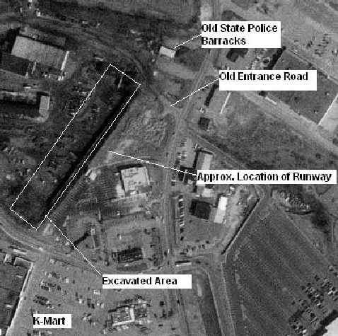
The 1994 USGS aerial photo of the site of the former Weirton Airport,
annotated by John Maze to show the locations of some of the features of the former airport.
John Maze reported in 2004, "I really haven't looked over that way in recent years,
but I believe some of the surface is still there,
beyond the State Police driving test course (parallel parking and a figure eight with curbs that you aren't suppose to hit if you want to pass!)."
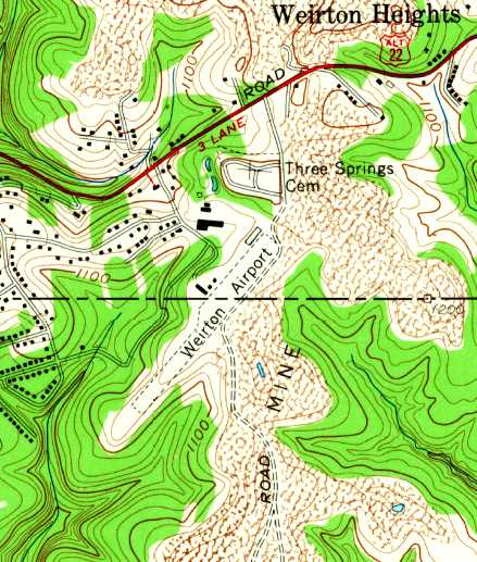
The site of Weirton Airport is located northwest of the intersection of Route 22 & Three Springs Drive.
Thanks to Jim McCoy for pointing out this airfield.
____________________________________________________
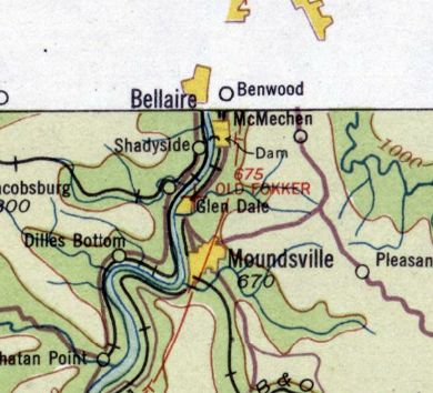
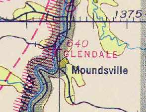
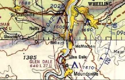
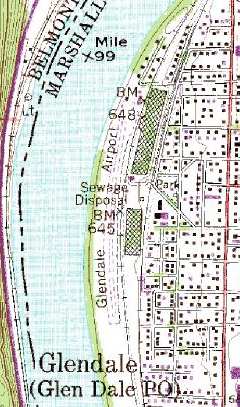
Glendale Fokker Field (GWV, WV66), Glendale, WV
39.95, -80.76 (Southwest of Pittsburgh, PA)
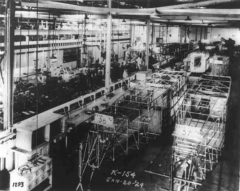
A 1/20/29 photo of the fuselage assembly line at the Fokker Aircraft Corporation of America, Glendale.
According to Tom Beamer, Glendale Fokker Field probably opened in the early to mid-1920s.
It was one of 2 Fokker factories in the US, the other being in Teterboro, NJ.
The history of the Fokker company in America is fairly convoluted.
In 1923, the Atlantic Aircraft Corporation (of Teterboro NJ & Wheeling WV)
obtained a government contract to modify De Havilland DH-4s as mail planes.
In 1924, as the Netherlands Aircraft Manufacturing Company of America,
it became an importing agency for Fokker's Dutch aircraft designs.
By 1927, it had become the Fokker Aircraft Corporation of America (of Passaic NJ & Glendale WV).
The earliest depiction which has been located of the Glendale Fokker facility
was a 1/20/29 photo of the fuselage assembly line at the Fokker Aircraft Corporation of America, Glendale.
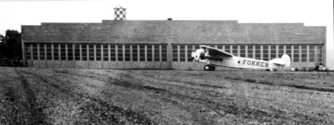
An April 1929 photo by J.E. Anderson of a Fokker Trimotor at Glendale Fokker Field,
in front of the north end of the Fokker factory where it was built.
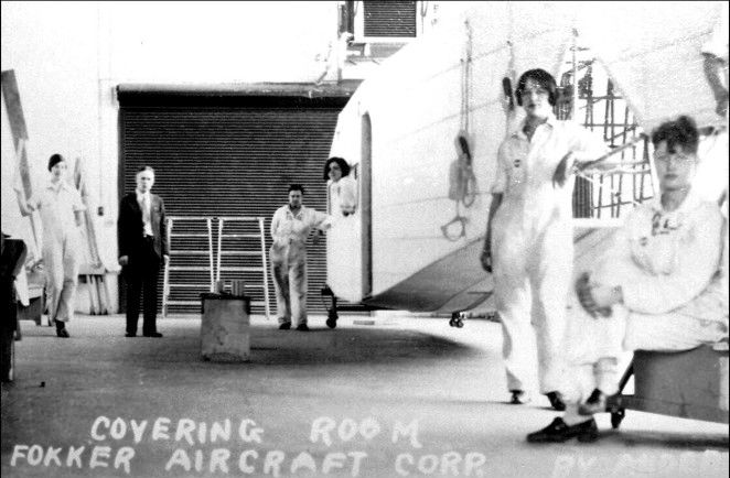
An April 1929 photo by J.E. Anderson of the Covering Room in the Glendale Fokker factory.
In 1929 the Fokker Aircraft Corporation became a subsidiary of General Motors as General Aviation Corporation.
The company ended operations in 1931 because of the Depression
and a much-publicized crash of a Fokker F-10 on March 31 in which famed Notre Dame coach Knute Rockne & 7 others were killed.
The company assets were turned over to GAMC,
then in a stock exchange became a subsidiary of North American Aviation,
which moved operations to a factory in Baltimore.
In their short heyday of WV aircraft manufacturing, Fokker produced a total of 58 passenger planes in Glendale.
The Glendale Fokker airfield apparently continued in operation after its namesake company faded away.
"Old Fokker Field" was listed in the 1934 Commerce Department Airports Directory (courtesy of Chris Kennedy).
It was described as consisted of a rectangular sod field, measuring 4,000' x 350'.
The earliest aeronautical chart depiction which has been located of the Fokker Field was on the 1934 Huntington Sectional Chart,
which depicted “Old Fokker” as an auxiliary airfield.
One of the Fokker factory buildings was depicted on the 1935 USGS topo map, but not the airfield itself.
Glendale Fokker Field was not listed in the Airport Directory Company's 1937 Airports Directory (courtesy of Bob Rambo),
but it was open at the time (according to Tom Beamer).
The September 1941 9M Regional Aeronautical Chart (courtesy of Chris Kennedy) depicted it as Glendale Airport.
The 1944 US Army/Navy Directory of Airfields (courtesy of Ken Mercer)
described Glendale Fokker Field as having a 2,900' runway.
The 1945 AAF Airfield Directory (courtesy of Scott Murdock) described Glendale Airport
as a 39 acre rectangular property within which was a single 2,900 sod north/south runway.
The field was said to have 2 hangars, the largest being a 80' x 60' metal structure,
and to be privately owned & operated.
“Glen Dale” Airport was depicted on a 1953 Flight Chart (courtesy of Scott O'Donnell) as having a 2,100' unpaved runway.
A 4/9/54 USGS aerial photo depicted the Glendale Airport as having a curved north/south grass runway,
with an airport circle marking still visible in the center of the field.
What appeared to be 2 small hangars were located on the north end of the runway.
The last aeronautical chart depiction which has been located of the Glendale Airport
was its depiction on the May 1968 Cleveland Sectional Chart (courtesy of Richard Finley).
It depicted “Glen Dale” Airport as having a 2,700' unpaved runway.
The Marx Toy Company apparently reused the former Fokker factory at some point,
according to Tom Beamer.
Tom Beamer visited Glendale Fokker Field in 1984,
and reported that it was operated at the time by the local EAA Chapter.
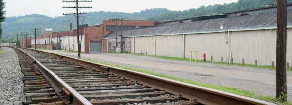
"The Fokker factory was still standing along the east side of the field
and you could read 'FOKKER' under a black overpaint on the road side.
I was told that Marx made toy trains there at one time.
Near a concrete pad where the line shack had been there was a underground fuel pit
with a VERY long hose still on the reel…
imagine dragging that long hose up to the wing tanks of a Fokker Tri-motor or Super Universal."
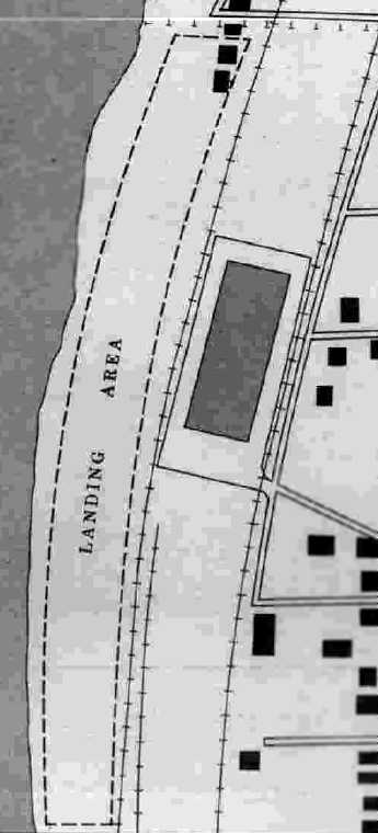
As seen in the 1995 USGS topo map,
the runway at Glendale Fokker Field actually curves along the riverbank,
which must make for interesting takeoff & landing runs!
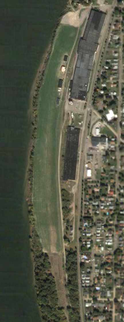
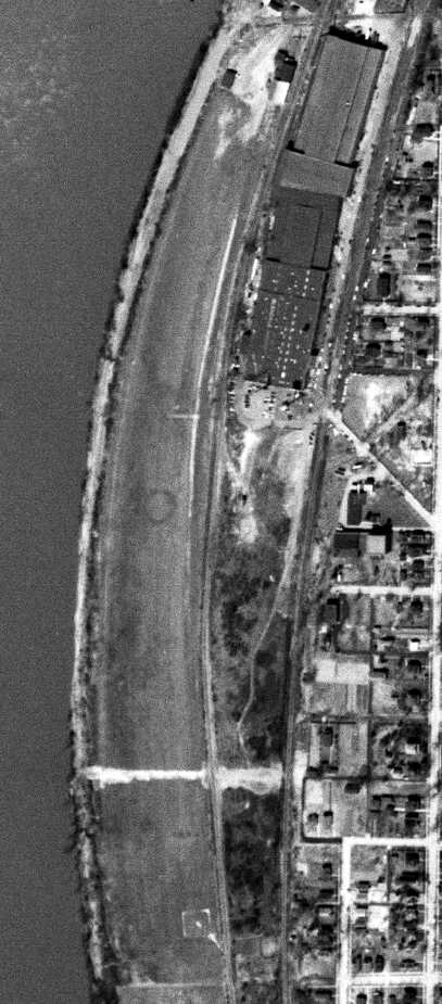
As seen in a circa 2001-2005 USGS aerial photo,
a total of four hangars were located along the northeast side of the runway.
The large former Fokker factory buildings were still visible,
adjacent to the east side of the runway, across the railroad tracks.
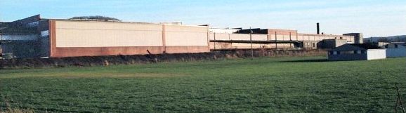
A circa 2003 photo of Glendale Fokker Field, with the former Fokker factory buildings in the background.
As of 2003, Glendale Fokker Field is still listed as an active private airfield.
It has a single maintained runway, a 2,600' turf Runway 1/19,
and a total of 11 aircraft are listed as being based at the field, including 6 ultralights.
The owner is listed as Thomas Aandrich,
and the manager is listed as Chuck Yager (which must be a pretty popular name for a WV pilot!).
A pre-2005 picture of the former Fokker factory in Glendale (courtesy of Tom Beamer).
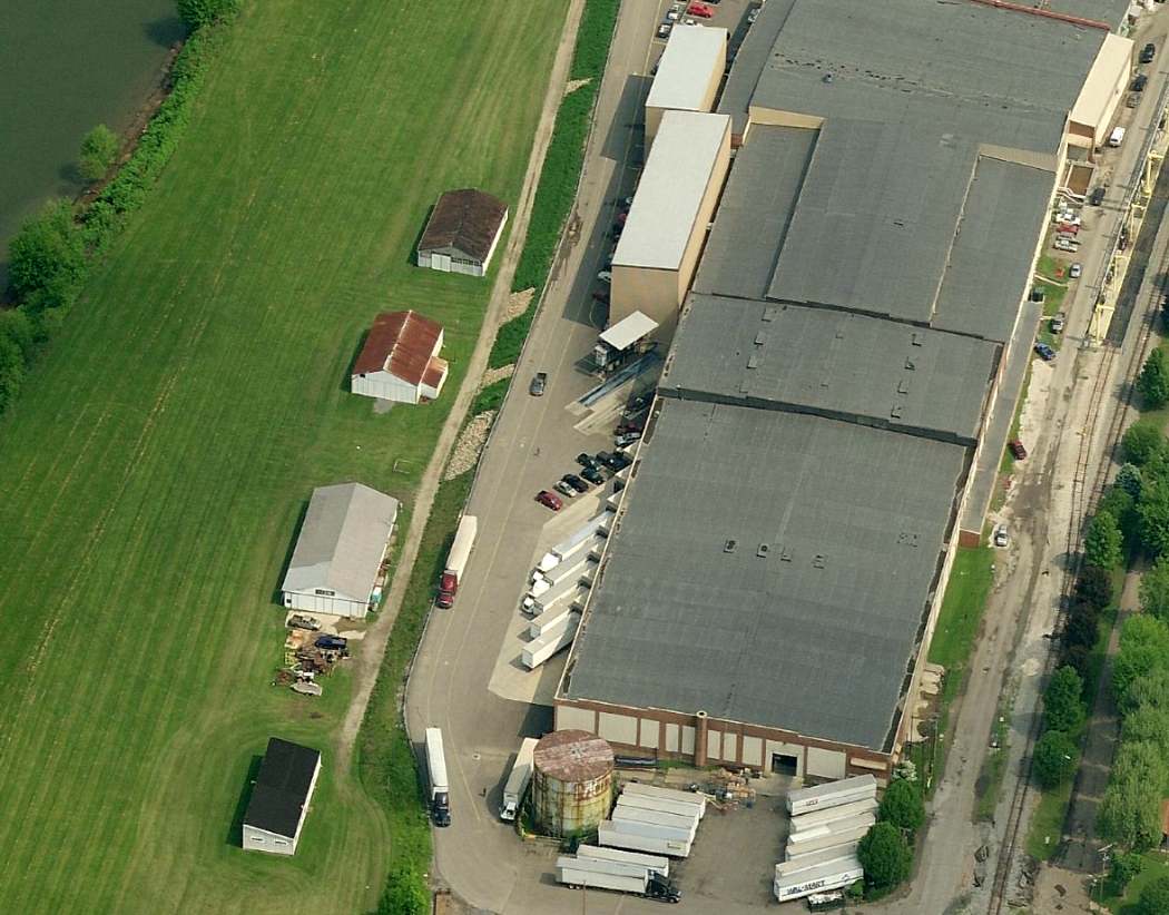
A circa 2010 aerial view looking north at the Glendale runway & former Fokker factory.
As of 2014, Glendale Fokker Field is still listed as an active private airfield.
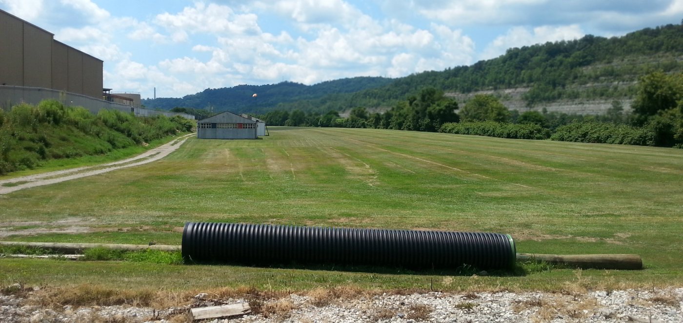
A 7/24/16 photo by Rick Harshbarger looking south along the Glendale runway, with the former Fokker airplane factory visible at left.
Glendale Fokker Field is located in between the Ohio River & the Baltimore & Ohio Railroad.
____________________________________________________
Since this site was first put on the web in 1999, its popularity has grown tremendously.
That has caused it to often exceed bandwidth limitations
set by the company which I pay to host it on the web.
If the total quantity of material on this site is to continue to grow,
it will require ever-increasing funding to pay its expenses.
Therefore, I request financial contributions from site visitors,
to help defray the increasing costs of the site
and ensure that it continues to be available & to grow.
What would you pay for a good aviation magazine, or a good aviation book?
Please consider a donation of an equivalent amount, at the least.
This site is not supported by commercial advertising –
it is purely supported by donations.
If you enjoy the site, and would like to make a financial contribution,
you
may use a credit card via
![]() ,
using one of 2 methods:
,
using one of 2 methods:
To make a one-time donation of an amount of your choice:
Or you can sign up for a $10 monthly subscription to help support the site on an ongoing basis:
Or if you prefer to contact me directly concerning a contribution (for a mailing address to send a check),
please contact me at: paulandterryfreeman@gmail.com
If you enjoy this web site, please support it with a financial contribution.
please contact me at: paulandterryfreeman@gmail.com
If you enjoy this web site, please support it with a financial contribution.
____________________________________________________
This site covers airfields in all 50 states.