Abandoned & Little-Known Airfields:
Northern Wisconsin
© 2002, © 2016 by Paul Freeman. Revised 11/19/16.
This site covers airfields in all 50 states: Click here for the site's main menu.
____________________________________________________
Please consider a financial contribution to support the continued growth & operation of this site.
Colby-Abbotsford Airport (added 10/25/15) - Rice Lake Municipal Airport / Arrowhead Airport (revised 11/19/16) - Old Tomahawk Airport / Forrest Protection Airfield (revised 11/2/13)
____________________________________________________
Colby-Abbotsford Airport, Abbotsford, WI
44.925, -90.32 (Northeast of Minneapolis, MN)
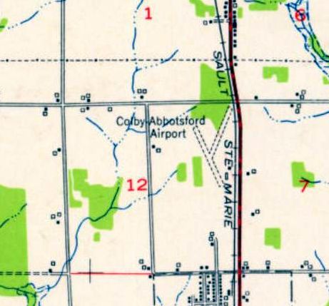
Colby-Abbotsford Airport, as depicted on the 1953 USGS topo map.
This small general aviation airport was evidently established at some point between 1945-53,
as it was not yet listed among active airfields in the 1945 AAF Airfield Directory (courtesy of Scott Murdock).
The earliest depiction which has been located of Colby-Abbotsford Airport was on the 1953 USGS topo map.
It depicted Colby-Abbotsford Airport as having 2 unpaved runways, with 2 small buildings on the east side.
The earliest photo which has been located of Colby-Abbotsford Airport was a 1962 USGS aerial view.
It depicted Colby-Abbotsford Airport as having an unpaved northeast/southwest runway, with remnants of a northwest/southeast runway.
A taxiway lead to a hangar & 1 light single-engine aircraft on the east side.
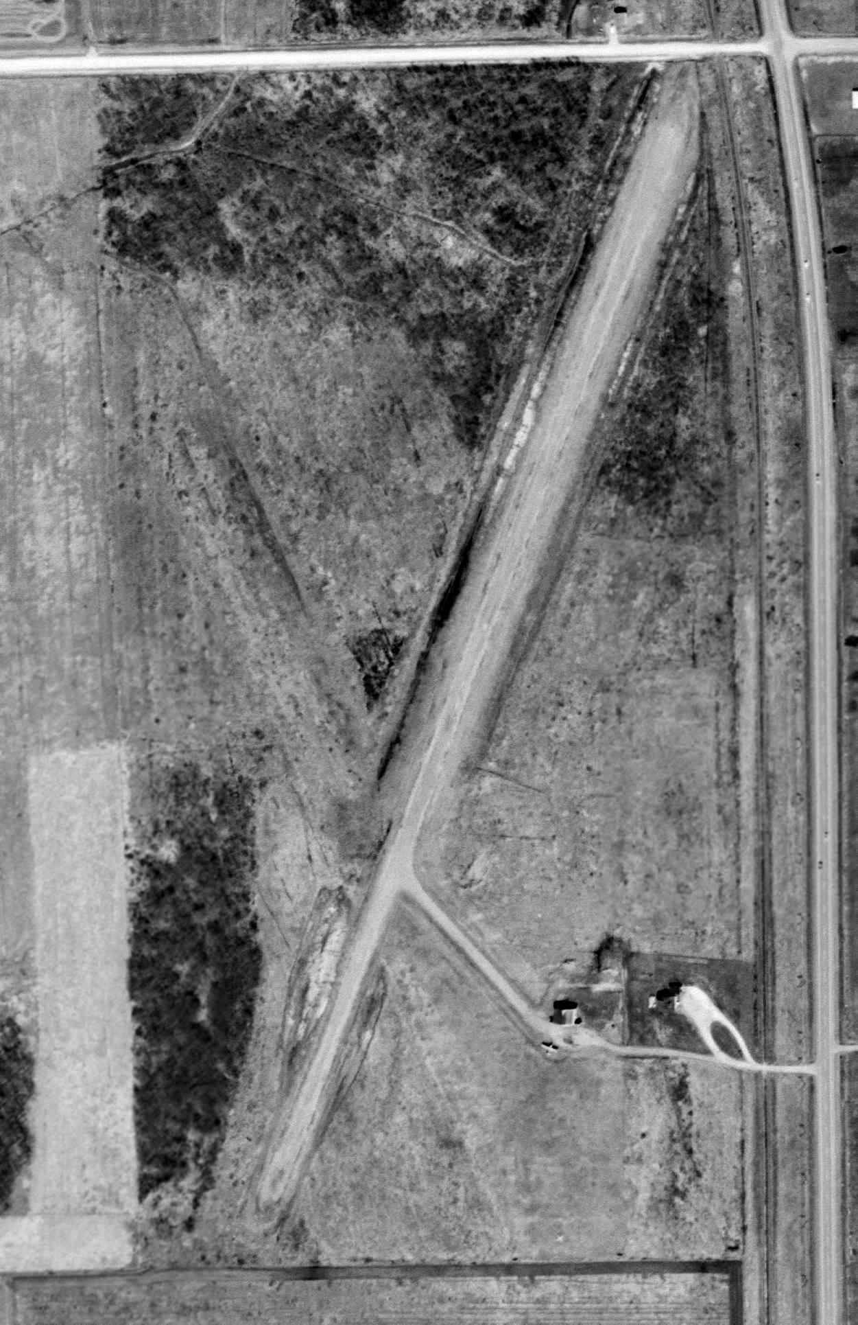
The last photo which has been located showing the Colby-Abbotsford Airport presumably still in operation was a 1980 USGS aerial view.
Both the northeast/southwest & northwest/southeast runways were very distinct.
A hangar remained on the east side, but there were no aircraft parked outside.
The last map depiction which has been located showing the Colby-Abbotsford Airport was the 1988 USGS topo map.
It depicted Colby-Abbotsford Airport as having a northeast/southwest runway.
Colby-Abbotsford Airport was evidently closed at some point between 1988-99,
as a 1999 aerial view looking northwest showed that a new portion of Route 29 had been built over the northeast end of the northeast/southwest runway.
The hangar remained on the east side.
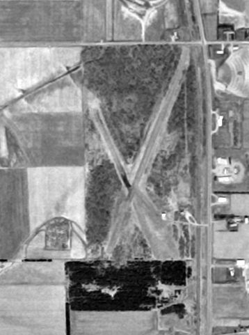
A circa 2010 aerial view looking north at the side of Colby-Abbotsford Airport showed that the hangar had been removed at some point between 1999-2010, as only the foundation remained.
The path of the northeast/southwest runway remained clear.
A 2012 aerial view looking northwest at the site of Colby-Abbotsford Airport
showed the path of the northeast/southwest runway remained clear, and the foundation of the hangar remained recognizable.
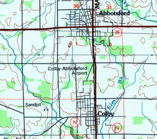
The site of Colby-Abbotsford Airport is located southwest of the intersection of Route 13 & Oak Road.
Thanks to Brandon Vlasak for pointing out this airfield.
____________________________________________________
Rice Lake Municipal Airport / Arrowhead Airport (RIE), Rice Lake, WI
45.478, -91.722 (Northeast of Minneapolis, MN)
Rice Lake Airport, as depicted in its original location (SSW of the town) on the 1934 Twin Cities Airway Map.
The Rice Lake Municipal Airport was originally located south-southwest of the town of Rice Lake.
The date of construction of the field is unknown.
The earliest reference to the field which has been located
was in the 1934 Department of Commerce Airfield Directory (according to Chris Kennedy).
It described Rice Lake Airport as consisting of a 1,320' x 1,275' sod field.
The Airport Directory Company's 1937 Airports Directory (courtesy of Bob Rambo)
described Rice Lake Municipal Airport as being 1 mile south of the center of the town.
The airfield was described as consisting of a 1,320' x 1,275' sod landing area.
The earliest photo which has been located of the Rice Lake Airport
was a circa 1943-45 aerial view from the 1945 AAF Airfield Directory (courtesy of Scott Murdock).
It depicted Rice Lake as a square grass landing area.
The 1944 US Army/Navy Directory of Airfields (courtesy of Ken Mercer)
also described Rice Lake Airport as being located 1 mile south of the town,
and described it as having a 1,500' unpaved runway.
The 1945 AAF Airfield Directory (courtesy of Scott Murdock)
described Rice Lake Municipal Airport as a 39 acre rectangular field within which were 3 sod runways,
the longest being the 1,500' northeast/southwest & northwest/southeast strips.
The field was said to have a total of 7 hangars, the largest being a 60' x 40' wood structure.
Rice Lake was said to be privately owned, but operated by the City of Rice Lake.
The last photo which has been located of the Rice Lake Airport was a 4/21/48 USGS aerial view.
It depicted Rice Lake as having a north/south grass runway.
Two light planes were visible near some small buildings on the northwest side,
and a single floatplane was visible on the lakeshore at the south end of the runway.
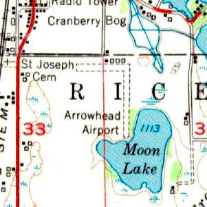
The 1951 USGS topo map depicted the airport as being labeled “Arrowhead Airport”,
and having 2 unpaved runways & several small buildings along the north side of the field.
The 1962 AOPA Airport Directory described Rice Lake Municipal Airport as having 3 turf runways,
with the longest being the 3,500' Runway 4/22.
However, the remarks said: "Caution: Emergency use only."
At some point between 1962-66, the old location of the airport was apparently abandoned,
and a new Rice Lake Municipal Airport was built to the southeast of the town,
as that is where the field was depicted on the 1966 USGS topo map.
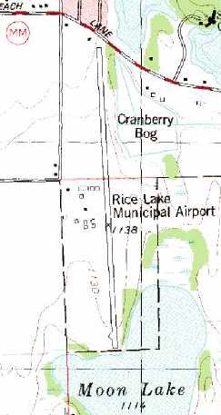
Rice Lake Municipal Airport, as depicted on the 1978 USGS topo map.
The 1982 AOPA Airport Directory (courtesy of Ed Drury) described Rice Lake Municipal Airport at the new location,
and described the field as having a single 3,700' asphalt Runway 18/36.
The operator was listed as Lakeland Aviation.
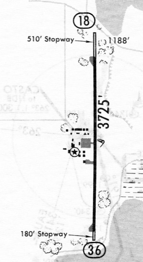
The last depiction which has been located showing Rice Lake Municipal Airport still operational
was on an 11/30/84 airport directory (courtesy of John Kielhofer).
It depicted Rice Lake as having a 3,725' paved Runway 18/36 with 2 ramps & several small buildings on its west side.
In 1995, a new & larger Rice Lake Regional Airport was built 5 miles southwest of the town of Rice Lake,
and the old Rice Lake Municipal Airport was presumably closed at the same time.
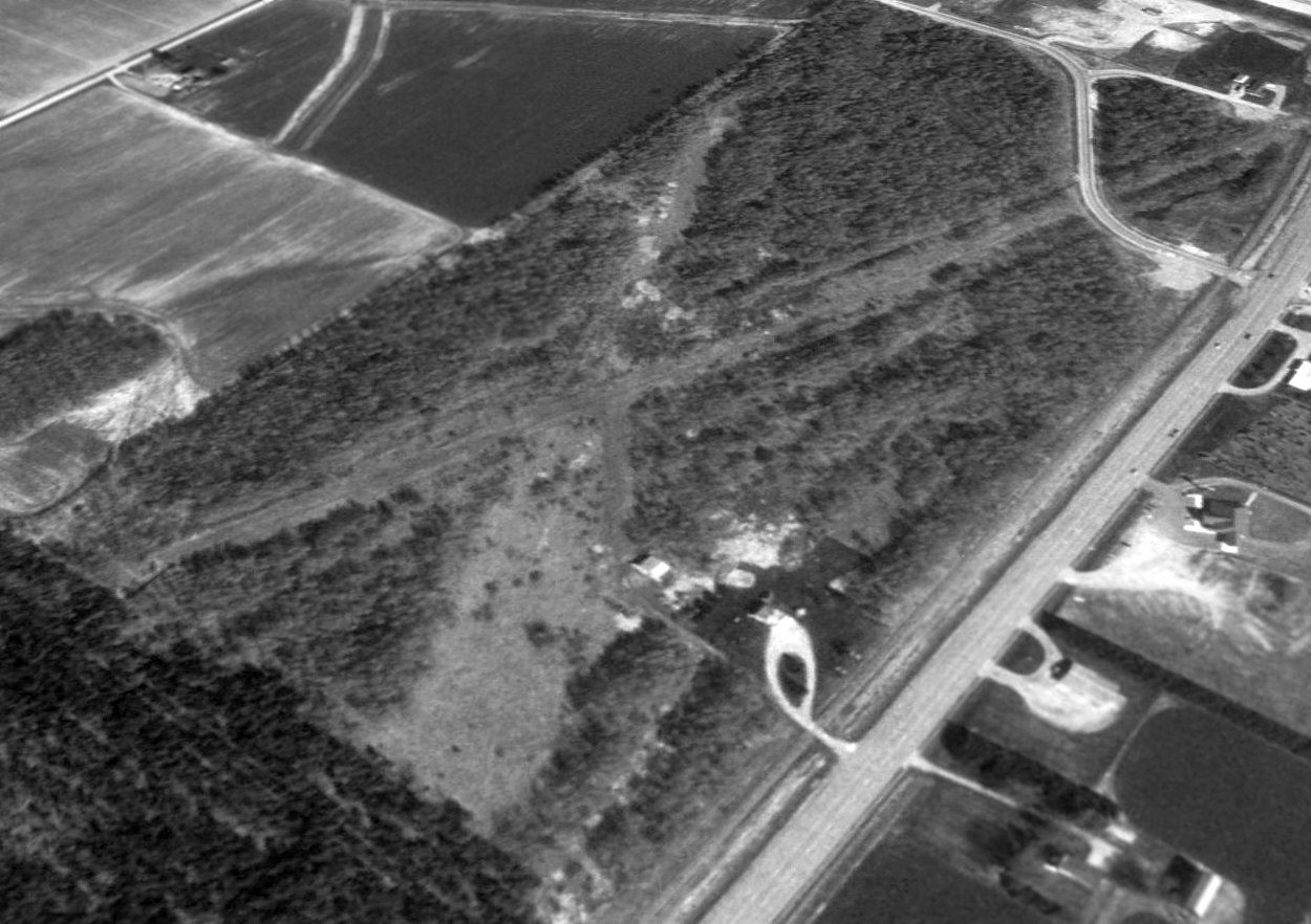
The old airport was depicted as an abandoned airfield on the 1998 Wisconsin Aeronautical Chart.
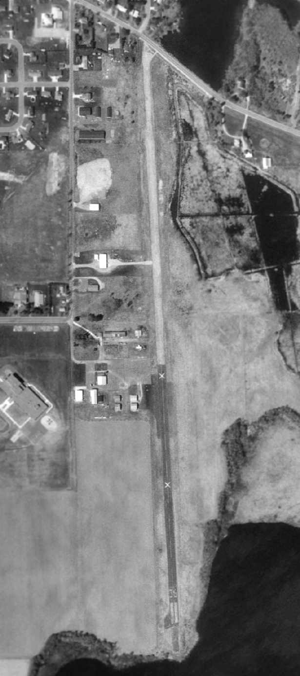
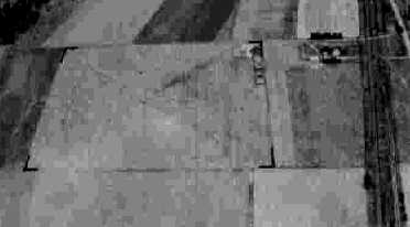
In the 1998 USGS aerial photo, the runway at Rice Lake was marked with several closed "X" symbols.
The airport was otherwise still intact, with the entire runway remaining,
and several taxiways leading to a number of small hangars on the west side of the runway.
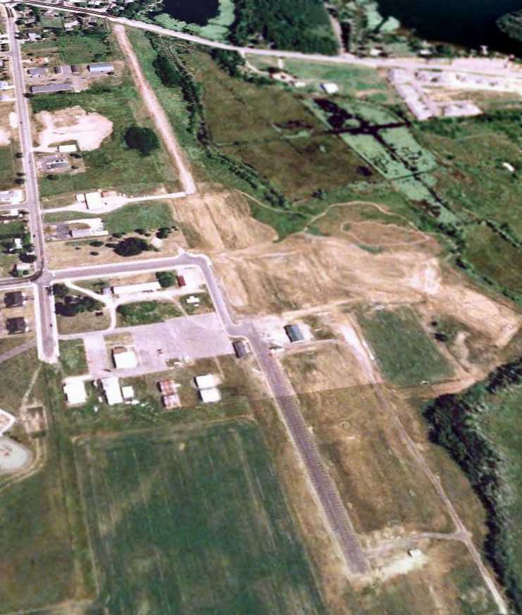
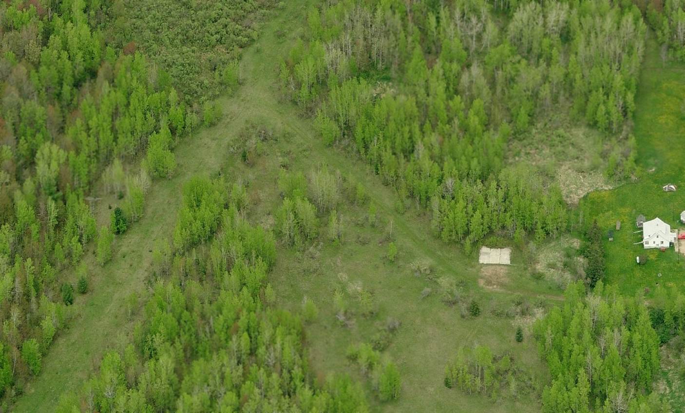
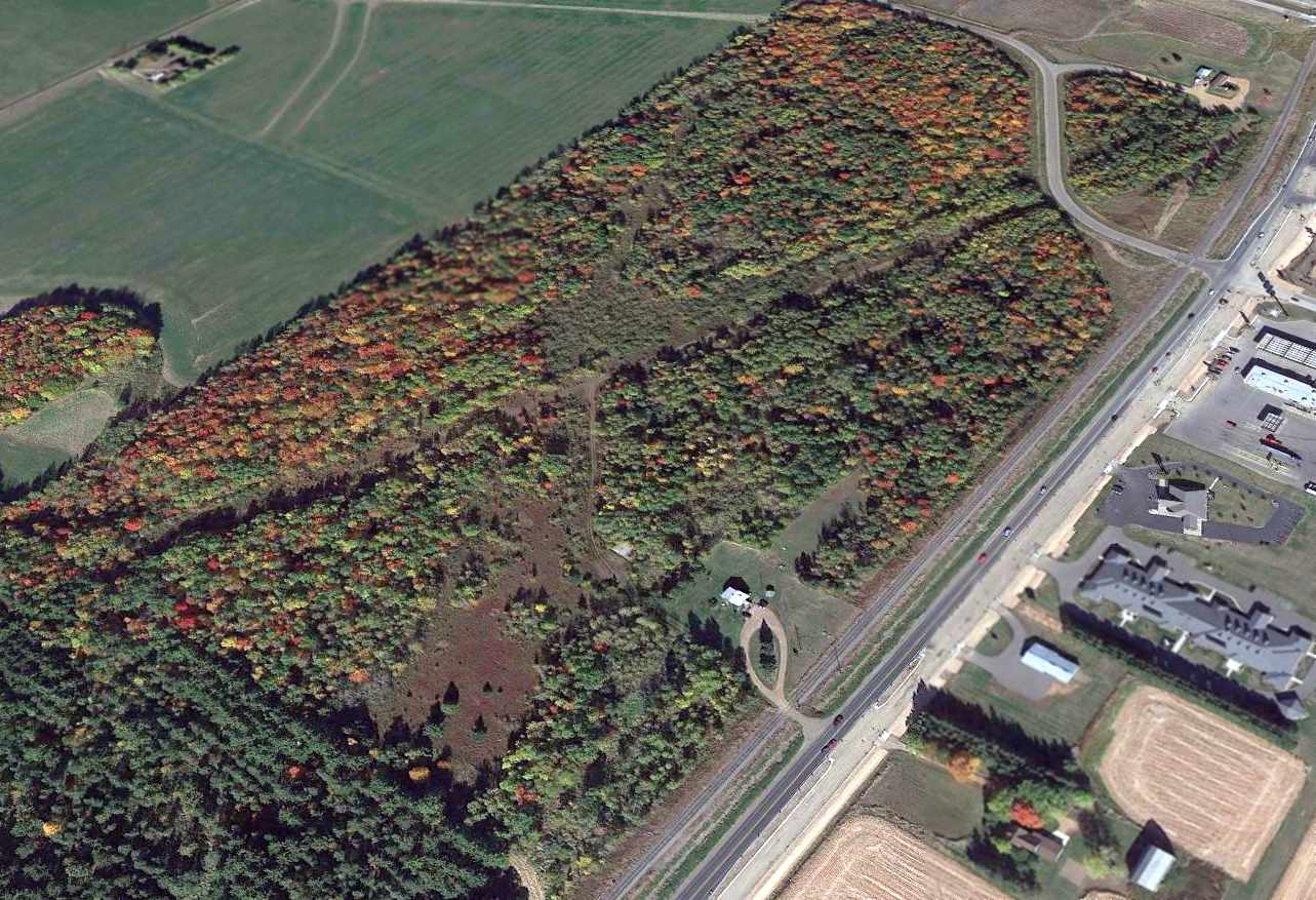
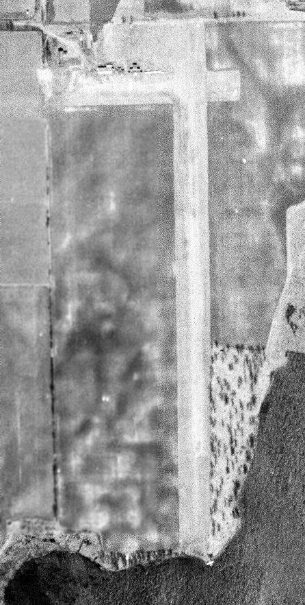
A 6/1/05 USGS aerial view looking northeast showed that the midsection of Rice Lake Municipal Airport was cut at some point between 1994-2005, and land has been cleared.
Several hangars remain intact on the west side of the runway.
The Rice Lake Municipal Airport is located southeast of the intersection of East Orchard Beach Lane & Kern Avenue.
____________________________________________________
Old Tomahawk Airport / Forrest Protection Airfield, Tomahawk, WI
45.474, -89.744 (Northwest of Green Bay, WI)

The original Tomahawk Airport, as depicted on the 1942 Regional Aeronautical Chart (courtesy of Chris Kennedy).
The date of construction of the original Tomahawk Airport has not been determined.
The earliest depiction of the field which has been located
was on the 1942 Regional Aeronautical Chart (courtesy of Chris Kennedy).
The earliest photo which has been located of Tomahawk Airport
was a 9/25/40 aerial view looking west from the 1945 AAF Airfield Directory (courtesy of Scott Murdock).
It depicted Tomahawk as having a grass east/west landing area.
The 1945 AAF Airfield Directory (courtesy of Scott Murdock)
described Tomahawk Airport as a 37 acre irregularly-shaped field
within which was an asphalt, sand, and gravel all-way field, measuring 1,500' northeast/southwest.
The field was said to have a single 120' x 100' concrete, brick, and steel hangar.
Tomahawk was described as being owned by the State of Wisconsin, but not currently in operation.
The 1948 Green Bay Sectional Chart (according to Chris Kennedy)
described "Tomahawk" as having a 1,500' unpaved runway.
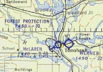
Chris Kennedy also noted that the 1948 chart depicted "another airport just across town to the east called Werner,
another one about two miles southeast of town called Allard,
and a seaplane base across the lake called McLaren - lots of airports for a small town."

A 5/28/50 USGS aerial view of Tomahawk Airport showed it to have an open grass landing area.
The dark building on the southeast side had the letters “Tomahawk” & an airport circle marking.
At some point between 1948-54 the airfield was apparently renamed "Forrest Protection",
as that is how it was labeled on the November 1954 Green Bay Sectional Chart (courtesy of Chris Kennedy).
The field was described as having a 3,000' unpaved runway.
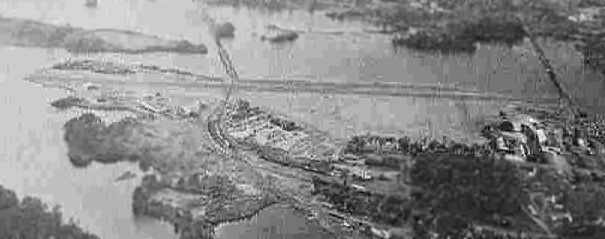
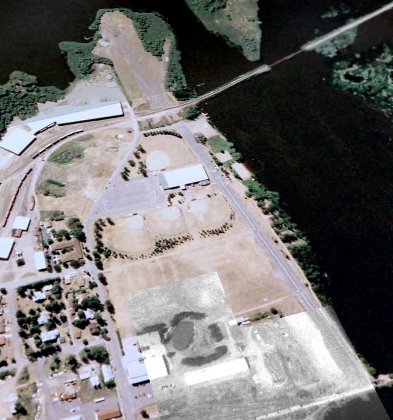
An aerial view looking north at the Tomahawk "Forrest Protection Airport",
from the 1960 Sky Eye Wisconsin Airport Directory (courtesy of Chris Kennedy).
The runway had apparently been paved at some point between 1954-60,
as the field was described as having a single 3,200' paved runway.
Note the Marin Tomahawk & Western Railroad which crossed right over the paved runway.
The remarks said "Field owned by Wisconsin Conservation Dept. & the Owens-Illinois Glass Co.
It is not a municipal field but transient aircraft may use the field."
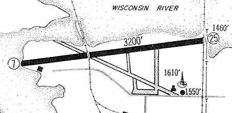
The 1960 Jeppesen Airway Manual (courtesy of Chris Kennedy)
depicted the Forrest Protection Airport as having a single paved 3,200' Runway 7/25,
along with a former unpaved crosswind runway.
Two buildings (hangars?) were depicted on the southwest & southeast sides of the field.
The remark said "Railroad crosses runway."
The original Tomahawk Airport was apparently closed at some point prior to between 1960-64,
after being replaced by Tomahawk Regional Airport (3 miles to the west).
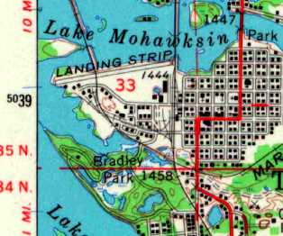
The 1966 USGS topo map depicted a single east/west runway at the site of the original Tomahawk Airport,
labeled simply as “Landing Strip”.
On the 1982 USGS topo map, the original Tomahawk Airport was no longer depicted,
but was rather depicted simply as an open unmarked area.
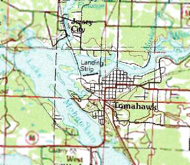
On the 1990 USGS topo map, the original Tomahawk Airport was simply labeled as “Landing Strip”.
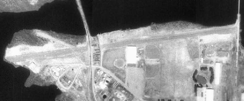
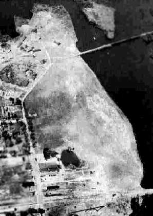
As of the 1992 USGS aerial photo, the airfield consisted of a single 3,600' paved runway,
which occupied almost the entire width of a peninsula jutting into Lake Mohawksin.
The original Tomahawk Airport was depicted as an abandoned airfield on the 1992 Sectional Aeronautical Chart (courtesy of Ed Drury).
The original Tomahawk Airport was no longer depicted at all on 2002 aeronautical charts.
A December 30, 2005 USGS aerial view looking northwest at the site of the original Tomahawk Airport showed the remains of the paved east/west runway
as well as traces of the former crosswind runway.
The site of the original Tomahawk Airport is located at the western end of West Somo Ave.
____________________________________________________
Since this site was first put on the web in 1999, its popularity has grown tremendously.
That has caused it to often exceed bandwidth limitations
set by the company which I pay to host it on the web.
If the total quantity of material on this site is to continue to grow,
it will require ever-increasing funding to pay its expenses.
Therefore, I request financial contributions from site visitors,
to help defray the increasing costs of the site
and ensure that it continues to be available & to grow.
What would you pay for a good aviation magazine, or a good aviation book?
Please consider a donation of an equivalent amount, at the least.
This site is not supported by commercial advertising –
it is purely supported by donations.
If you enjoy the site, and would like to make a financial contribution,
you
may use a credit card via
![]() ,
using one of 2 methods:
,
using one of 2 methods:
To make a one-time donation of an amount of your choice:
Or you can sign up for a $10 monthly subscription to help support the site on an ongoing basis:
Or if you prefer to contact me directly concerning a contribution (for a mailing address to send a check),
please contact me at: paulandterryfreeman@gmail.com
If you enjoy this web site, please support it with a financial contribution.
please contact me at: paulandterryfreeman@gmail.com
If you enjoy this web site, please support it with a financial contribution.
____________________________________________________
This site covers airfields in all 50 states.