Abandoned & Little-Known Airfields:
Virginia: Delmarva area
© 2002, © 2016 by Paul Freeman. Revised 9/18/16.
This site covers airfields in all 50 states: Click here for the site's main menu.
____________________________________________________
Please consider a financial contribution to support the continued growth & operation of this site.
Cape Charles Air Force Station Airfield (revised 9/18/16) - Wallops Island Airfield (revised 3/10/14)
____________________________________________________
Wallops Island Airfield, Wallops Island, VA
37.827, -75.495 (Northeast of Hampton, VA)
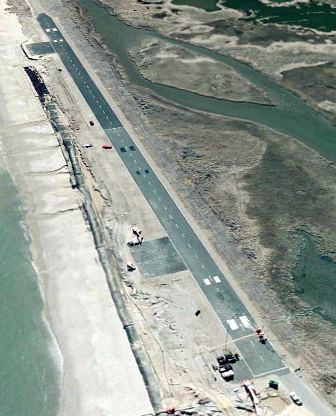
A 6/7/05 aerial view looking southwest at the Wallops Island runway.
Not to be confused with the much larger Wallops Flight Facility (former NAS Chincoteague) 6 miles to the north,
this airfield is a single runway which was constructed on the narrow barrier island of the Wallops Island space launch facility, just south of the launch pads.
Not much is known about this airfield, including its name or specific purpose.
No airfield was yet depicted at this location on a 1994 USGS aerial view.
A 6/7/05 aerial view showed that an 800' long painted runway had been constructed over a portion of the road
which runs the length of the barrier island at the very southern end of the Wallops Island launch facility.
The runway was located a mere 190' from the Atlantic Ocean, which would end up being a problem in only a few more years.
The extreme short length of the runway is puzzling, too short even for small general aviation aircraft.
Presumably the runway was built to operate drone aircraft?
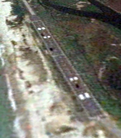
A 5/22/06 aerial view looking southwest showed that the Wallops runway had been extended toward the south,
now reaching a total of 1,600' – still very short even for light (manned) aircraft.
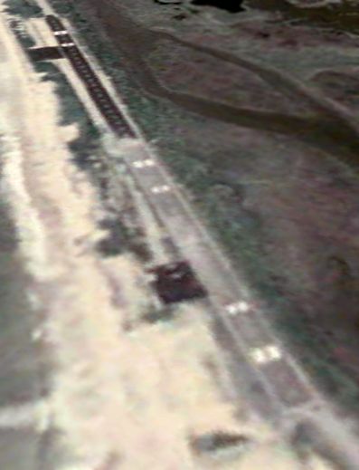
A 1/31/07 aerial view looking southwest showed construction activity in progress on the Wallops runway.
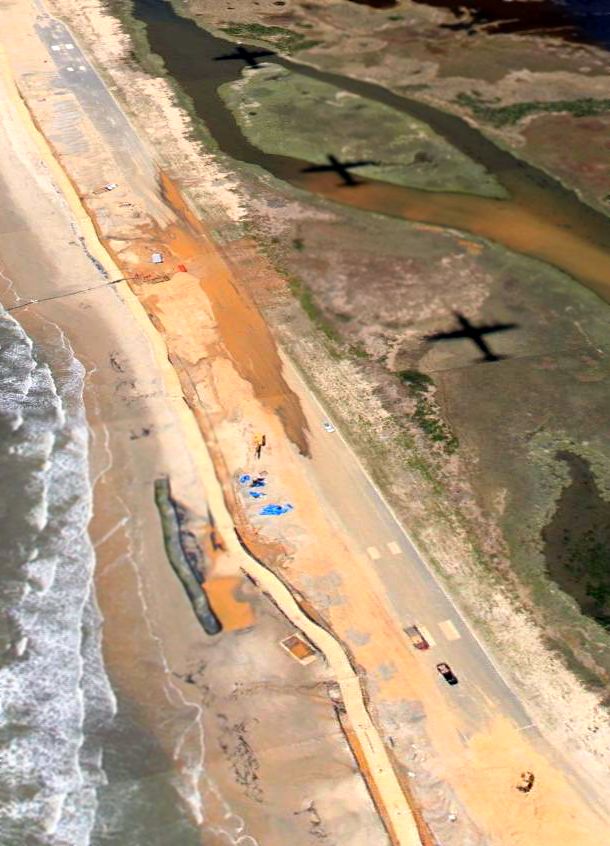
A 4/29/10 aerial view looking southwest showed that it might not have been very prudent to build a runway 190' from the Atlantic Ocean,
as sand & water had covered a considerable portion of the Wallops Island runway.
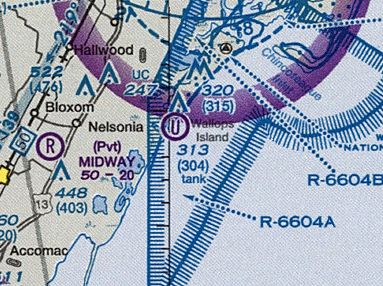
The 2014 Sectional Chart depicted a “U” symbol (for “Unverified” airfield) on Wallops Island.
As of 2014, even though the Wallops Island airfield is depicted on aeronautical charts,
there is no airfield at that location registered with the FAA.
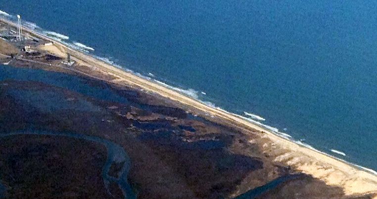
A 3/29/14 aerial view by Paul Freeman looking east at the Wallops Island runway.
____________________________________________________
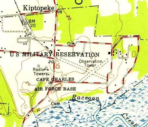
Cape Charles Air Force Station Airfield, Kiptopeke, VA
37.132, -75.957 (Northeast of Hampton, VA)
Cape Charles Air Force Station Airfield, as depicted on a 11/15/52 USGS aerial view.
Located on the very southern tip of the Delmarva Peninsula,
this site was originally the location of Fort Winslow,
built in 1941 as a coastal defense artillery installation to compliment Fort Story in Virginia Beach
in order to protect the vast entrance of the Chesapeake Bay against enemy vessels.
It was renamed Fort John Custis in 1942.
Over the WW2 period, the fort eventually was armed with two massive 16" guns, four 8" guns, and four 155mm guns.
Fort John Custis was depicted on the 1943 USGS topo map, but no airfield was yet depicted at the site.
Fort John Custis was closed by the Army in 1948.
In 1949 the property was reused by the Air Force to establish Cape Charles Air Force Station, an air defense radar installation.
A small airfield was built at the site, presumably for logistical support flights.
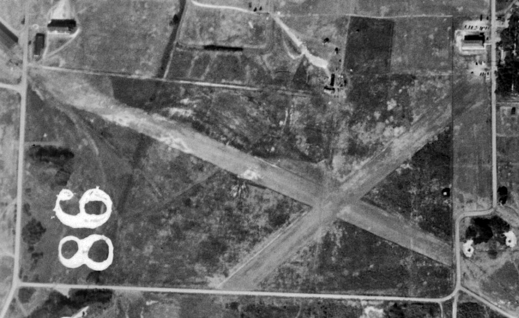
The earliest depiction which has been located of the Cape Charles Airfield was a 11/15/52 USGS aerial photo,
which depicted 2 grass runways in an X-shape.
The 1955 USGS topo map depicted “Cape Charles Air Force Base” as having 2 unpaved runways in an X-shape.
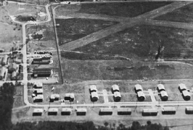
A circa 1958-59 aerial photo of Cape Charles AFS, showing the two grass runways at the top-right,
from the 1960 Washington Air Defense Sector yearbook (courtesy of Thomas Page).
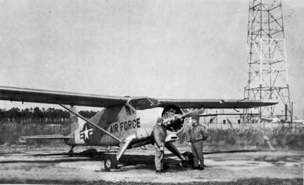
A circa 1958-59 photo of an Air Force DeHavilland U-1 Beaver at Cape Charles AFS,
from the 1960 Washington Air Defense Sector yearbook (courtesy of Thomas Page).
The Cape Charles Airfield was evidently abandoned at some point between 1958-65,
as it was no longer depicted on the 1965 Norfolk Sectional Chart (courtesy of John Voss).
A 1967 aerial view showed the 2 grass runways remained intact, but were noticeably less distinct than in previous photos.
Cape Charles AFS was deactivated in 1981,
and became the property of the US Fish & Wildlife Service in 1984.
The area is now the Eastern Shore of Virginia National Wildlife Refuge.
Two intersecting grass runways were still depicted at Cape Charles on recent USGS topo maps.
Only a single 2,600' grass runway was still depicted on the 1994 USGS aerial view of Cape Charles AFS.
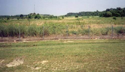
A 1998 photo by Phil Payette of the former Cape Charles AFS airfield.
Prior to this it was the site of 8-inch railway guns (1942-44).
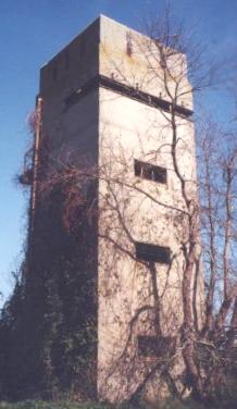
A 2000 photo of the Group Station Observation Tower, also known as the Kiptopeake Tower.
The tower was built of reinforced concrete in 1942, and is located by the airfield.
It served different gun group commanders.
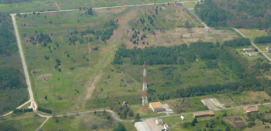
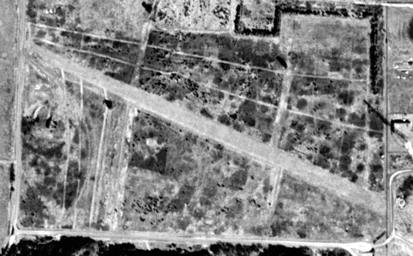
A 2003 aerial photo of the Cape Charles AFS airfield, looking west by Russ Roslewski.
One of the former runways was still recognizable, while the other was overgrown.
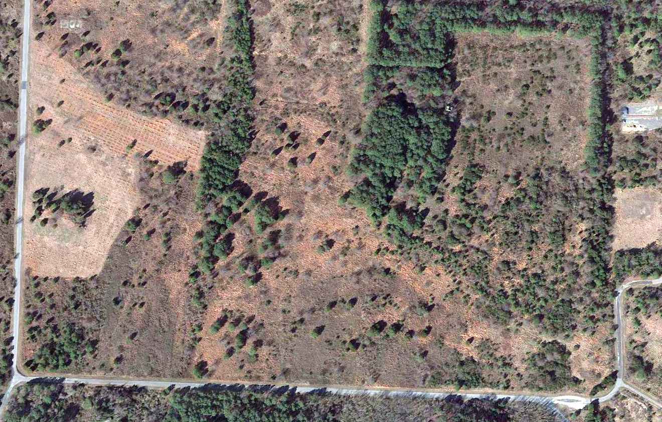
Only the faintest trace was still perceptible of the northwest/southeast grass runway in a 2013 aerial view of Cape Charles AFS.
Thanks to Bill Facenda for information about Cape Charles.
____________________________________________________
Since this site was first put on the web in 1999, its popularity has grown tremendously.
That has caused it to often exceed bandwidth limitations
set by the company which I pay to host it on the web.
If the total quantity of material on this site is to continue to grow,
it will require ever-increasing funding to pay its expenses.
Therefore, I request financial contributions from site visitors,
to help defray the increasing costs of the site
and ensure that it continues to be available & to grow.
What would you pay for a good aviation magazine, or a good aviation book?
Please consider a donation of an equivalent amount, at the least.
This site is not supported by commercial advertising –
it is purely supported by donations.
If you enjoy the site, and would like to make a financial contribution,
you
may use a credit card via
![]() ,
using one of 2 methods:
,
using one of 2 methods:
To make a one-time donation of an amount of your choice:
Or you can sign up for a $10 monthly subscription to help support the site on an ongoing basis:
Or if you prefer to contact me directly concerning a contribution (for a mailing address to send a check),
please contact me at: paulandterryfreeman@gmail.com
If you enjoy this web site, please support it with a financial contribution.
please contact me at: paulandterryfreeman@gmail.com
If you enjoy this web site, please support it with a financial contribution.
Or if you prefer to contact me directly concerning a contribution (for a mailing address to send a check),
please contact me at: paulandterryfreeman@gmail.com
If you enjoy this web site, please support it with a financial contribution.
____________________________________________________
This site covers airfields in all 50 states.