Abandoned & Little-Known Airfields:
Northeastern South Carolina
© 2002, © 2016 by Paul Freeman. Revised 11/27/16.
This site covers airfields in all 50 states: Click here for the site's main menu.
____________________________________________________
Please consider a financial contribution to support the continued growth & operation of this site.
Coulbourne Airport (revised 11/27/16) - Cypress Bay Airport (revised 4/5/16) - Kershaw Airport (revised 11/27/16) - Lane Airport (revised 9/12/15)
____________________________________________________
Cypress Bay Airport, Little River, SC
33.876, -78.627 (Northeast of Myrtle Beach, SC)
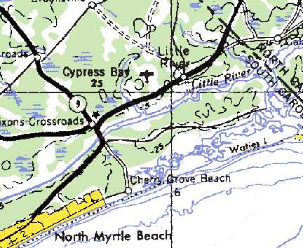
Cypress Bay Airport, as depicted on the 1978 USGS topo map.
This small general aviation airport was evidently established at some point between 1964-78,
as it was not yet depicted at all on the 1964 Savannah Sectional Chart.
The earliest depiction of Cypress Bay Airport which has been located was on the 1978 USGS topo map.
Storm Bear recalled, “I have photos of Cypress Bay Airport from 1984. Back then, it was mostly a glider operation taking tourists for rides.”
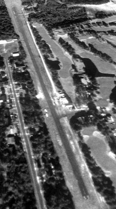
The earliest photo which has been located of the Cypress Bay Airport was a 3/3/87 USGS aerial view.
It depicted Cypress Bay as having a paved Runway 15/33 with a few small buildings on the east side, near which were parked 9 light aircraft.
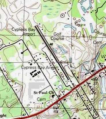
The 1990 USGS topo map depicted Cypress Bay Airport as having a paved northwest/southeast runway with a paved parallel taxiway,
and several small buildings along the southwest side.
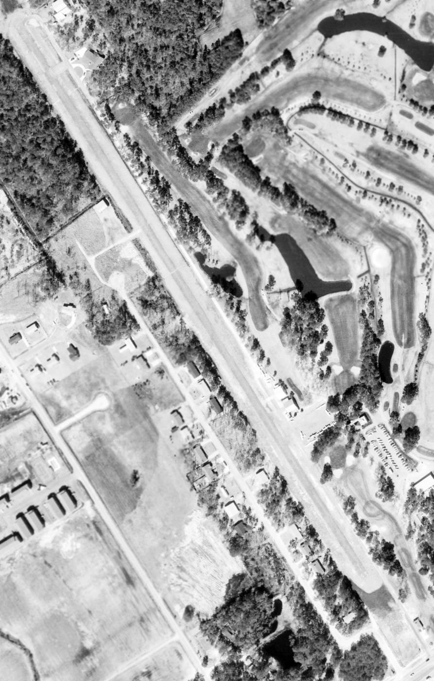
The last photo which has been located of the Cypress Bay Airport was a 1/22/94 USGS aerial view looking northwest.
It depicted Cypress Bay as having a paved Runway 15/33 with a few small buildings on the east side.
Five light aircraft were visible on the field.
Cypress Bay Airport was evidently closed at some point between 1994-99,
as a 2/16/99 aerial view showed that the property had been covered with housing.
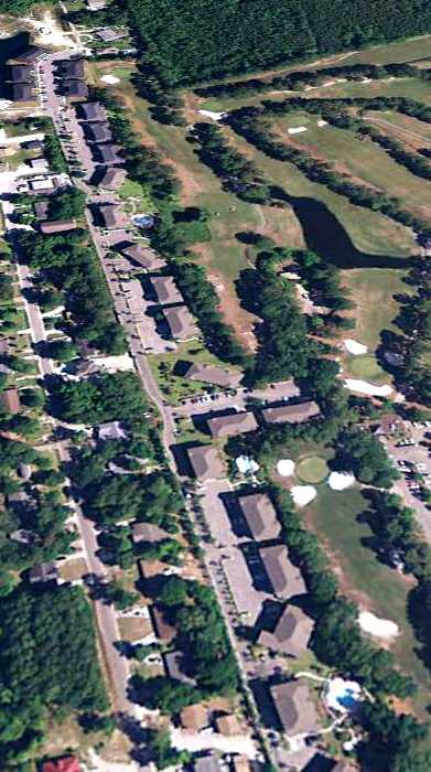
A 6/9/11 aerial view looking northwest showed housing covering the site, with no trace remaining of Cypress Bay Airport.
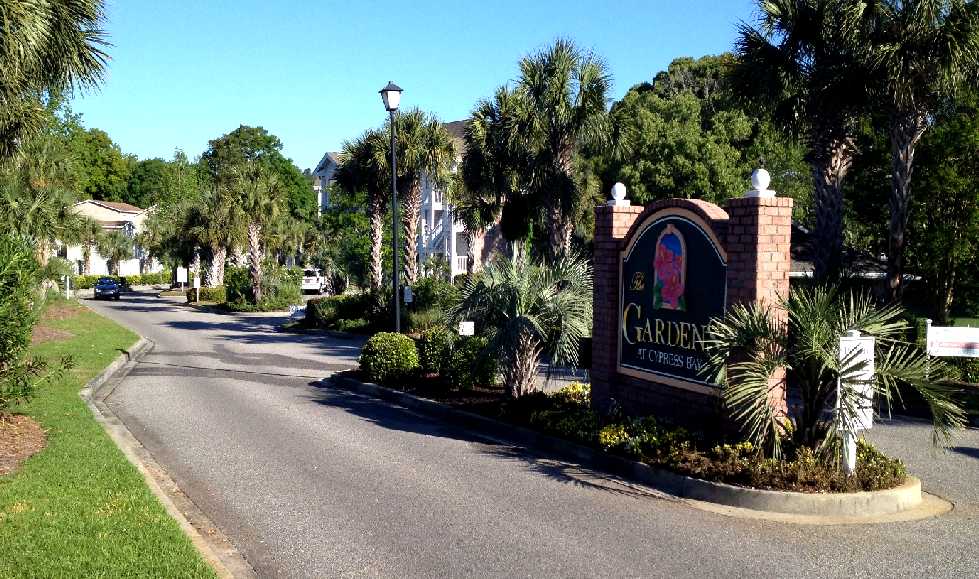
A 4/7/12 photo by Paul Freeman looking north at The Gardens at Cypress Bay, which covers the site of the Cypress Bay Airport.
The site of Cypress Bay Airport is located north of the intersection of Hibiscus Drive & Route 17.
____________________________________________________
Coulbourne Airport, Lancaster, SC
34.69, -80.78 (South of Charlotte, NC)
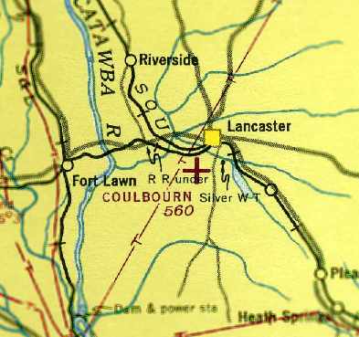
Coulbourn Airport, as depicted on the April 1944 Charlotte Sectional Chart (courtesy of Chris Kennedy).
Coulbourn Airport was evidently established at some point between 1941-44,
as it was not yet depicted at all on the 1941 Sectional Chart (according to Chris Kennedy).
The earliest depiction of Coulbourn Airport which has been located was on the 1944 Sectional Chart (courtesy of Chris Kennedy).
It depicted Coulbourn as an auxiliary airfield.
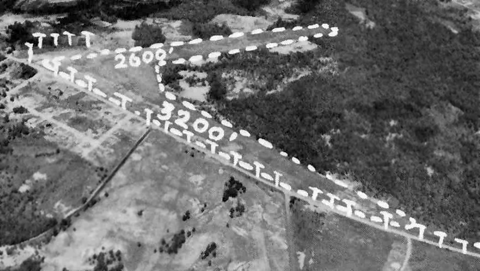
An aerial view looking north at Coulbourn Airport from the March 1945 SC Airport Directory (courtesy of Bo Bowman).
The directory described Coulbourn as having 2 sod runways: 2,000' northwest/southeast & 1,800' northeast/southwest.
The field was said to be privately owned, to consist of a total of 50 acres, and to offer fuel.
An undated aerial view looking north at Coulbourn Airport from a circa 1957 SC Airport Directory (courtesy of Don Fraser).
The directory described Coulbourn as county-owned, and lacking an operator.
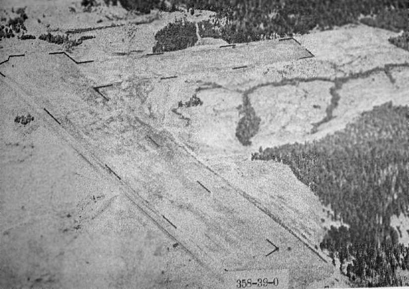
The only photo which has been located showing aircraft at Coulbourn Airport was a 2/23/64 USGS aerial photo.
It depicted Coulbourn as having 2 grass runways, with 2 small hangars & 3 single-engine aircraft on the west side.
NTSB records indicate that a Cessna 150 had its landing gear collapse following a hard landing at Coulbourn Airport on 4/7/68.
The last aeronautical chart depiction which has been located of Coulbourn Airport
was on the October 1968 Charlotte Sectional Chart.
It depicted Coulbourn as a public-use airport having a 2,500' unpaved runway.
The 1969 USGS topo map depicted Coulbourn Airport
as having 2 unpaved runways, with a single building (a hangar?) west of the runway intersection.
Coulbourn Airport was evidently closed (for reasons unknown) at some point between 1968-71,
as it was no longer depicted at all on the 1971 Sectional Chart (according to Chris Kennedy).
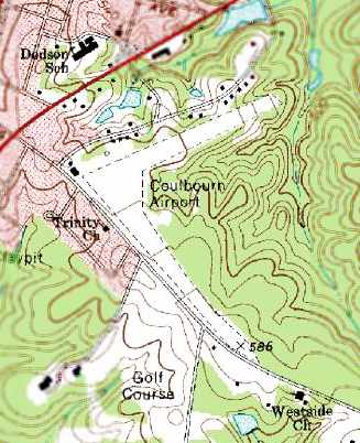
The area of wooded property & surrounding residences was still named “Airport Crossroads” on the 2003 Lancaster County Map,
according to Bo Bowman.
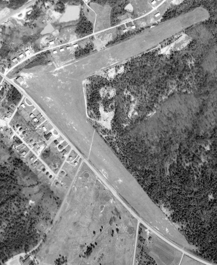
A 7/17/06 aerial view by Bo Bowman looking north at the site of Coulbourn Airport.
Bo observed, “The runways were located in the center of the approximate triangle of thickly wooded property formed by three roads.”
No recognizable trace of the airport appeared to remain.
The site of Coulbourn Airport is located east of the intersection of Edgeport Drive & Airport Road,
appropriately enough.
Thanks to Bo Bowman for pointing out this airfield.
____________________________________________________
Lane Intermediate Field / Lane Airport (43J), Lane, SC
33.48, -79.88 (North of Charleston, SC)
Lane Airport, as depicted on the September 1935 V-237 U. S. Navy Aviation Chart (courtesy of Chris Kennedy).
The date of construction of the Lane Airport has not been determined.
It was evidently built as one of the Department of Commerce's network of intermediate fields,
which were established in the 1920s & 1930s for the emergency use of commercial aircraft
flying along airways between major cities.
The earliest reference to the field which has been located
was in The Airport Directory Company's 1933 Airports Directory (courtesy of Chris Kennedy).
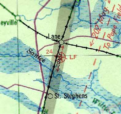
It listed the Lane Airport as the Department of Commerce's Site 24, along the Jacksonville-Richmond Airway.
The airfield was said to consist of a rectangular sod field, measuring 2,800' x 2,350',
and the field was said to have a rotating beacon.
The earliest depiction of Lane Airport which has been located
was on the September 1935 V-237 U. S. Navy Aviation Chart (courtesy of Chris Kennedy).
It depicted Lane as Site 24.
The Airport Directory Company's 1937 Airports Directory (courtesy of Bob Rambo)
listed the Lane Airport as the Department of Commerce's Site 24, along the Jacksonville-Richmond Airway.
The airfield was said to consist of a rectangular sod field, measuring 2,800' x 2,500',
and there was said to be a shed & a rotating beacon.
The earliest depiction of the Lane Airport which has been located
was on the November 1940 Savannah Sectional Chart (courtesy of Chris Kennedy).
It depicted Lane as the Department of Commerce's Site 24.
Larry Gamble recalled, "The airport in Lane built up during WW2 as a training base with a squadron of P-39 Aircobras.
It was an auxiliary field to handle overflow from other Air Corps bases that were getting too crowded.
The Army contracted with local homeowners to provide 'Bed & Breakfast' type accommodations.
The Squadron Commander plus several pilots stayed in my Great Uncle's home
and another group of pilots lived at Grandfather's home & in an 'over-the-garage' apartment.
I think this all started in late 1942 or early 1943 & lasted until early 1945."
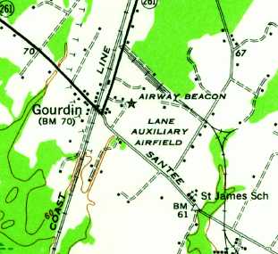
The 1943 USGS topo map depicted Lane Auxiliary Airfield as an open area with an Airway Beacon on the west side.
Lane Airport was depicted on the 1943 Savannah Sectional Chart (courtesy of Chris Kennedy)
as the Department of Commerce's Site 24.
According to Bill Saavedra of the Air Force History Office, “There is an accident report of a BT-15 which crashed near Lane, SC
on July 21, 1943 that refers to 'Lane Auxiliary Field' & discussions with the Lane Control Tower.”
The April 1944 US Army/Navy Directory of Airfields (courtesy of Ken Mercer)
listed Lane as "Site 24, JX-RW", and described the field as having a 3,400' unpaved runway.
The field was listed as conducting Army flight operations.
A circa 1943-45 aerial view looking north at “Lane Intermediate Field”
from the 1945 AAF Airfield Directory (courtesy of Scott Murdock).
The directory described Lane as a 120-acre irregularly-shaped field having 3 sod runways,
the longest being the 3,400' north/south strip.
The field was said to have a single 30' x 9' wood hangar,
to be owned by private interests, and operated by the Civil Aeronautics Administration.
According to Larry Gamble, "After the war, the Air Corps left the field but there was a single hangar,
lighted runway, rotating beacon, radio beacon, and lighted taxiways.
The radio beacon was removed in the 1960s by the FAA."
"FAA Site 24" at Lane was described in the 1962 AOPA Airport Directory as having 2 turf runways:
3,464' Runway 13/31 & 3,347' Runway 4/22.
The field was said to be unattended, and the operator was the FAA.
According to Bill Carter, "Many people in Kingstree remember planes practicing take off & landing at the site.
I know the family that owns the property where the airport was.
I remember him telling me they tore down the tower in the 1970's & sold the metal for scrap."
Alton McCullough recalled, "My grandfather Wayne Gamble, my father Alton McCullough,
and my uncle JP Gamble used this airport through the 1970s and maybe into the early 1980s."
Larry Gamble recalled, "I grew up in the area of that airport.
My family leased the airport from the Brown family, who were farmers.
We were also farmers & operated crop dusters from there.
The old hangar built by the Air Corps sheltered our Cessna 182.
In the early 1970's all but the longer, east-west runway & a single taxiway to the hangar were plowed under to grow crops.
I soloed there on my 16th birthday in 1979.
At one time C-130 aircraft from Pope AFB would use it for it's 'unimproved runway' to practice landings.
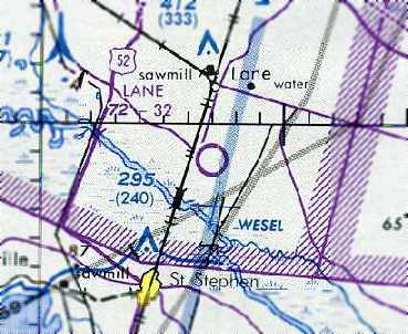
It sat on a flyway at WESEL intersection on the Jacksonville sectional & very easy to find."
The 1982 AOPA Airport Directory (courtesy of Ed Drury)
listed the Lane Airport as having 2 turf runways: 3,464' Runway 16/34 & 3,347' Runway 9/27.
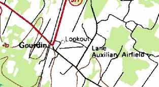
"Lane Auxiliary Airfield", as depicted on the 1983 USGS topo map.
Lane's former second runway had apparently been abandoned,
as this & subsequent topo maps only depicted a single east/west runway.
Larry Gamble recalled, "The airport saw continuous operation until 1983.
Finally, in 1983, my father sold our Cessna
and the airport was tilled once more returning the entire area to crop land."
However the Lane Airport continued to be depicted on aeronautical charts
as late as on the August 1988 Savannah Sectional Chart (courtesy of Chris Kennedy).
It depicted Lane as a public-use airport having a 3,200' unpaved runway.
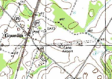
"Lane Airport", as depicted on the 1990 USGS topo map.
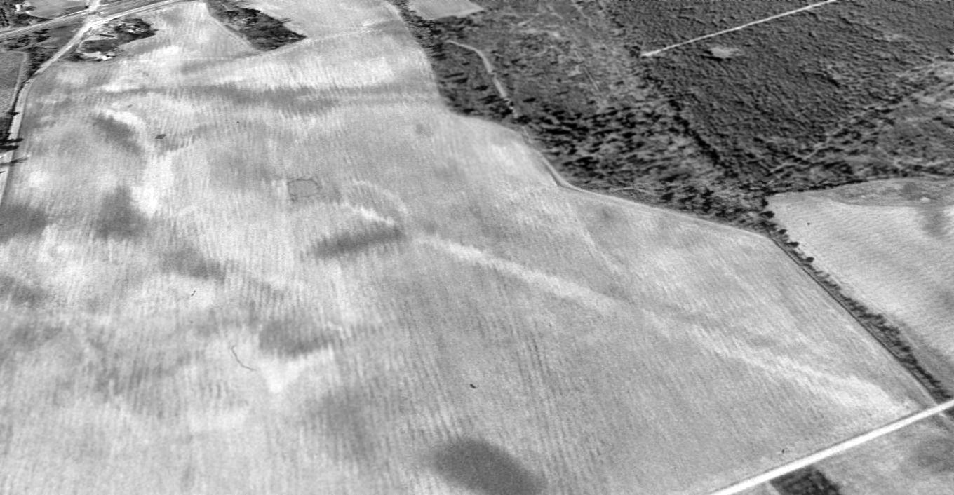
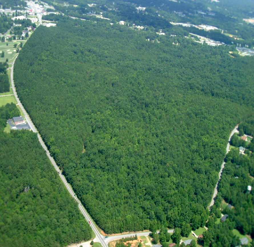
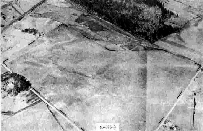
In a 1994 USGS aerial view looking northwest at the site of Lane Airport. the outline of a single east/west runway was still apparent in a large open field.
The outline of the former compass rose was also still apparent, in the middle of the runway.
According to Larry Gamble, the former hangar, beacon tower, and control shed for the beacons
were located just west of the former runway, but have all been removed.
Larry also reported in 2004 that Lane Airport's former rotating beacon
"is still in use at the municipal airport in Kingstree, SC about 24 miles away."
The site of Lane Airport is located east of the intersection of Route 377 & Route 375,
adjacent to the tiny community of Gourdin.
Thanks to Bill Carter for pointing out this airfield.
____________________________________________________
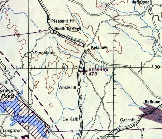
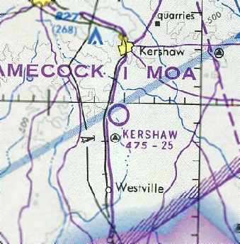
34.49, -80.6 (Northeast of Columbia, SC)
Kershaw Municipal Airport, as depicted in the 1945 AAF Airfield Directory (courtesy of Scott Murdock).
The Kershaw Airport was evidently established at some point between 1944-45,
(as were so many other new airports across the county, after the end of WW2),
as it was not depicted at all on the November 1944 Charlotte Sectional Chart (according to Chris Kennedy).
The earliest reference to the field which has been located
was in the 1945 AAF Airfield Directory (courtesy of Scott Murdock).
The directory described Kershaw Municipal Airport as a 63 acre irregularly-shaped field having 2 turf runways:
2,100' WNW/ESE & 1,800' ENE/WSW.
It not said to have any hangars, to be owned by the City of Kershaw, and to be operated by private interests.
The Haire Publishing Company's 1945 Airport Directory (courtesy of Chris Kennedy)
described "Kershaw Airport" as a "class 1" facility, owned by the City.
The operator & manager was listed as O. A. Williford.
It was said to have 2 sod runways: a 2,100' northwest/southeast strip, and an 1,800' northeast/southwest strip.
The field was said to offer a hangar, repairs, and fuel.
The earliest aeronautical chart depiction of the Kershaw Airport which has been located
was on the April 1945 Charlotte Sectional Chart.
It depicted Kershaw as an auxiliary airfield.
The October 1948 Charlotte Sectional Chart (courtesy of Chris Kennedy)
still depicted Kershaw as an auxiliary airfield.
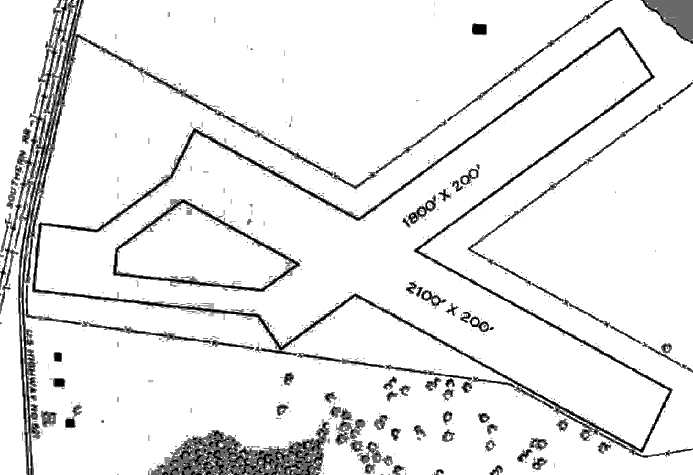
The earliest photo which has been located of Kershaw Airport was an undated aerial view looking north from a circa 1957 SC Airport Directory (courtesy of Don Fraser).
It depicted Kershaw as having 2 unpaved runways in an X-shape.
There were no buildings visible on the field.
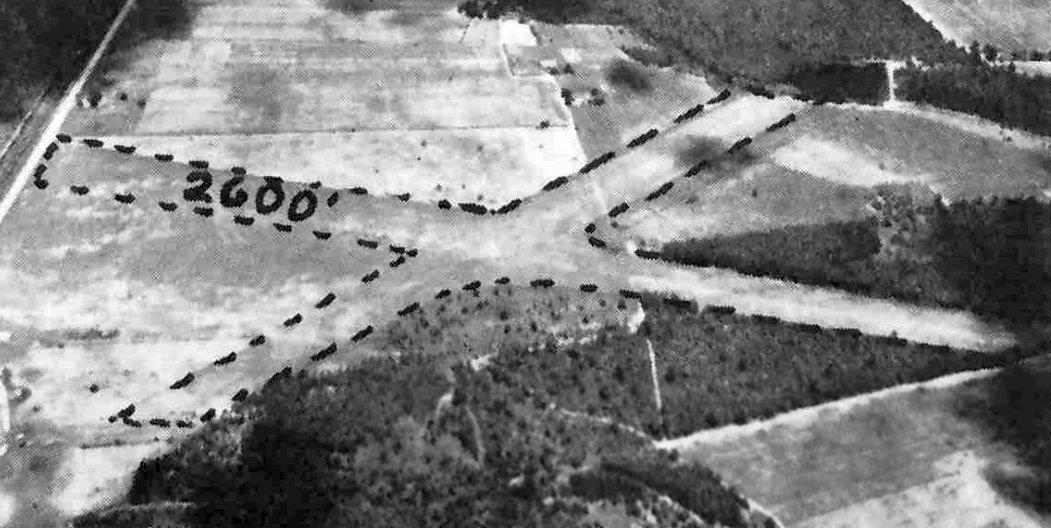
The last photo which has been located showing Kershaw Airport still operational was a 2/14/64 USGS aerial view.
It depicted Kershaw as having 2 unpaved runways in an X-shape.
The April 1966 Charlotte Sectional Chart (courtesy of Chris Kennedy)
depicted Kershaw Airport as having a 2,500' unpaved runway.
Kershaw Municipal Airport was still listed (although in the "Low-Use Airport" section)
of the 1987 Flight Guide (according to Chris Kennedy).
The last aeronautical chart depiction which has been located of the Kershaw Airport
was on the August 1988 Charlotte Sectional Chart (courtesy of Chris Kennedy)
It depicted Kershaw Airport as a public-use airport having a 2,500' unpaved runway.

Kershaw Airport was evidently abandoned in 1988, as it was labeled "Abandoned Landing Strip" on the 1988 USGS topo map.
The 2 runways were still depicted, though.
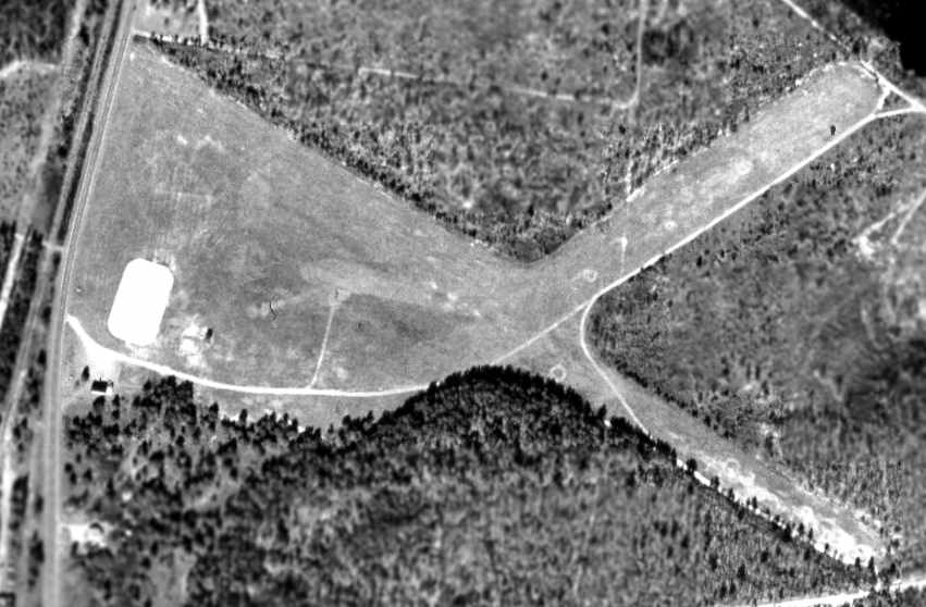
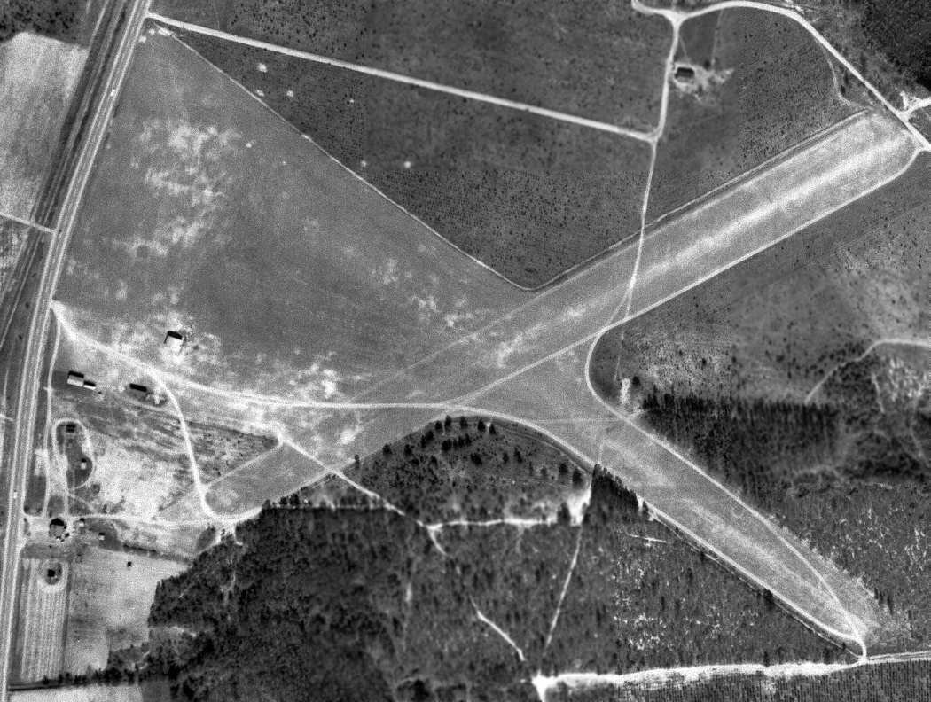
In the 1994 USGS aerial photo the 2 grass runways were still cleared & in quite good condition.
A few buildings were located on the west side of the airfield,
but it is not known if those dated to the site's days as an airfield.
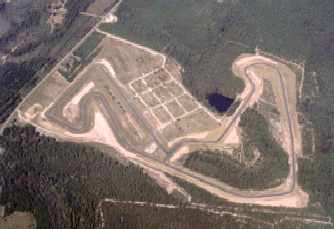
The property of the former Kershaw Airport was acquired in 1998 by a group led by Joe Hooker & Bob Humphreys,
and construction started soon thereafter on the Carolina Motorsports Park, a 2.3 mile club-level road racing course.
The track opened in July 1999.
As can be seen in the above recent aerial photo, it appears as if all remnants of the former airfield
have been erased by the development of the race track.
Note that the race track's web site claims that "The site is an old World War II fighter-training base",
but no evidence has been found to confirm the assertion that the airfield was in use earlier than 1945,
or that it was ever a military field.
The site of the Kershaw Airport is located southeast of the intersection of Route 521 & Old Georgetown Road.
Thanks to Chris Kennedy for pointing out this airfield.
____________________________________________________
Since this site was first put on the web in 1999, its popularity has grown tremendously.
That has caused it to often exceed bandwidth limitations
set by the company which I pay to host it on the web.
If the total quantity of material on this site is to continue to grow,
it will require ever-increasing funding to pay its expenses.
Therefore, I request financial contributions from site visitors,
to help defray the increasing costs of the site
and ensure that it continues to be available & to grow.
What would you pay for a good aviation magazine, or a good aviation book?
Please consider a donation of an equivalent amount, at the least.
This site is not supported by commercial advertising –
it is purely supported by donations.
If you enjoy the site, and would like to make a financial contribution,
you
may use a credit card via
![]() ,
using one of 2 methods:
,
using one of 2 methods:
To make a one-time donation of an amount of your choice:
Or you can sign up for a $10 monthly subscription to help support the site on an ongoing basis:
Or if you prefer to contact me directly concerning a contribution (for a mailing address to send a check),
please contact me at: paulandterryfreeman@gmail.com
If you enjoy this web site, please support it with a financial contribution.
please contact me at: paulandterryfreeman@gmail.com
If you enjoy this web site, please support it with a financial contribution.
____________________________________________________
This site covers airfields in all 50 states.