
Abandoned & Little-Known Airfields:
North Dakota
© 2003, © 2016 by Paul Freeman. Revised 6/6/16.
____________________________________________________
Please consider a financial contribution to support the continued growth & operation of this site.
Bowman Field (original location) / Bowman Municipal Airport (added 6/5/16) - Grand Forks Municipal Airport (original location) (revised 6/6/16)
Miller Airport (revised 7/9/15) - (Original) Minnkota Landing Strip (revised 4/25/16) - Wimbledon Airport (revised 7/9/15)
____________________________________________________
Grand Forks Municipal Airport (original location), Grand Forks, ND
47.929, -97.095 (Southwest of Bismarck, SD)
Scenes of the original Grand Forks Airport from a 1929 newspaper article.
The original airport for the town of Grand Forks was located adjacent to the west side of the town.
Mark Morgan reported, “In June 1928, a local club paid a landowner on Grand Forks’ west side $500 for 160 acres,
with a one-year option, for the purpose of building a permanent airport for the Grand Cities
(the earliest field serving Grand Forks was on the southwest side of town, consisting of a mowed alfalfa patch).
The proponents immediately had 2 runways graded & constructed support facilities.
The airport formally opened on 7/10/28; that date may have coincided with the field’s first BIG event,
the landing of an Army Air Service Fokker Trimotor hauling past national commander of the American Legion Hanford MacNider & Assistant Secretary of War Trubee Davison.
Interestingly enough, one Capt Ira Eaker piloted the aircraft, which delivered its passengers to the North Dakota Legion confab.
During the summer of 1929, Canadian-American Airlines added Grand Forks as a stop on its Twin Cities to Winnipeg route.
By the end of the year the company added Grand Forks to its Winnipeg to Omaha mail route.
Canadian-American, formed by investors in Minneapolis & Winnipeg with plans for major north-south operations, flew Travel Airs
and also made stops at St Cloud, Alexandria, Fergus Falls & Fargo. It went bankrupt in January 1930.
In October 1929, the city initiated efforts to purchase the field.
I have to assume the standards of the upper-midwest – Northwest & later North Central – regularly operated through the airport.”
The earliest depiction which has been located of Grand Forks Airport was a series of photographs from a 1929 newspaper article
showing aircraft, pilots, an a hangar (which appeared to still be under construction).
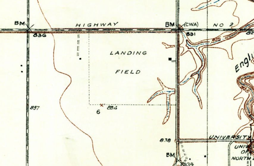
The earliest topo map depiction which has been located of the original Grand Forks Airport was on the 1934 USGS topo map.
It depicted as a square property outline, labeled simply as “Landing Field”, with a single building on the east side.

The earliest aeronautical chart depiction which has been located of the original Grand Forks Airport was on the 1935 Fargo Sectional Chart.
It depicted Grand Forks as a commercial/municipal airport.
Mark Morgan reported, “During World War II, Jolly Flying Services used the airport as a contract glider training facility for the Army.”
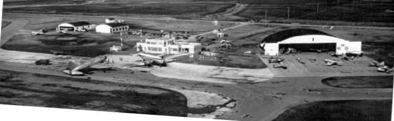
The earliest photo which has been located of the original Grand Forks Airport was a 1950 aerial view looking northeast.
It depicted 2 commercial airliners on the ramp in front of the terminal, and several smaller general aviation aircraft in front of 3 hangars.
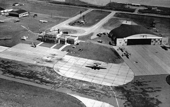
A circa 1950s aerial view looking northeast at the original Grand Forks Airport depicted several light aircraft on the ramp.

A circa 1950s aerial view looking southeast at the original Grand Forks Airport depicted several light aircraft on the ramp.

The last photo which has been located showing aircraft at the original Grand Forks Airport was a 9/10/52 USGS aerial view.
There were no more commercial aircraft visible on the field, just some light in front of the hangars to the north of the terminal building.
Mark Morgan reported, “In 1959, with Grand Forks growing west & south, the city started identifying locations for a new, larger airport.
They settled on the current location, west of town on US2 - KGFK opened on 8/18/64.”
Presumably the original Grand Forks Airport closed simultaneously.
The original Grand Forks Airport was no longer depicted on the August 1965 Fargo Sectional Chart (courtesy of Ron Kunse).

The last depiction which has been located of the original Grand Forks Airport was on the 1966 USGS topo map,
even though the original airport may have already been closed by that point.
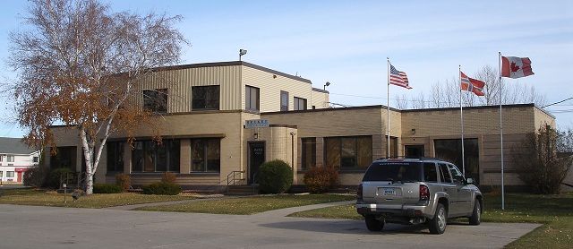
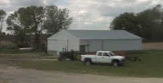
A 2011 photo of the last remnant of the original Grand Forks Airport – its terminal building which remains in good condition.
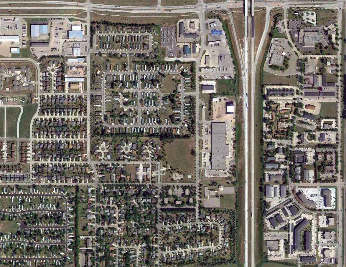
A 2015 aerial view of the site of the original Grand Forks Airport shows it to be heavily built-over,
but the terminal building remains standing on the east side of the property.
Mark Morgan reported in 2016, “The site’s now built over, with one exception: the city’s original passenger terminal, one story with a 2-story entry/atrium, in excellent condition.
Someone driving by would probably never figure out its original use.
Brekke Travel occupies the structure, complete complete with a sign out front styled to look like a B-52G/H tail”
The site of the original Grand Forks Airport is located south of the intersection of Route 2 & Interstate 29.
Thanks to Mark Morgan for pointing out this airfield.
____________________________________________________
Bowman Field (original location) / Bowman Municipal Airport (KBPP), Bowman, ND
46.185, -103.427 (Southwest of Bismarck, SD)
Bowman Field, as depicted on the 1948 Miles City Sectional Chart (courtesy of Chris Kennedy).
Photo of the airfield while open has not been located.
The original airport for the town of Bowman was located on the west side of the town.
According to its FAA Airport/Facility Directory data, Bowman Field was activated in September 1944.
The 1945 AAF Airfield Directory (courtesy of Scott Murdock) described Bowman Field
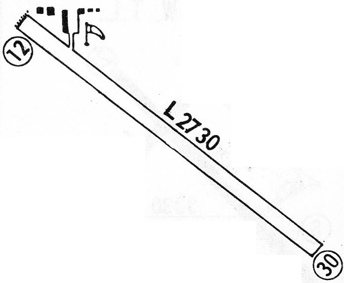
as a 160 acre square-shaped property having 2 turfed runways, measuring 2,400' northeast/southwest & 2,100' north/south.
The field was said to have a single 40' x 28' wooden hangar, and to be owned & operated by private interests.
The earliest depiction which has been located of Bowman Field was on the 1948 Miles City Sectional Chart (courtesy of Chris Kennedy).
It depicted Bowman as having a 2,700' unpaved runway.

The 1957 Miles City Sectional Chart (courtesy of Chris Kennedy)
depicted Bowman Field as having a 4,000' unpaved runway.

The 1968 USGS topo map depicted Bowman Municipal Airport as having a paved northwest/southeast runway, an unpaved crosswind runway,
and 4 small buildings on the west side.

The earliest photo which has been located of Bowman Field was a 1995 aerial view looking north Chart (courtesy of Chris Kennedy).
It depicted Bowman as having a 2,700' unpaved runway.
The last photo which has been located showing an aircraft at Bowman Field was a 2013 aerial view looking north, which showed 1 single-engine Cessna on the ramp.

Bowman Field was apparently closed at some point between 2013-2015,
as the runway was marked with yellow closed-runway “X” symbols on a 2015 aerial view.
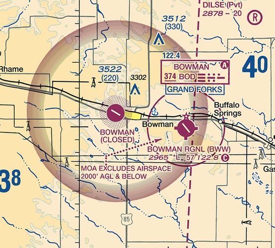
The original Bowman Airport was still depicted, but labeled as closed, on the 2016 Sectional Chart,
which also depicted the replacement Bowman Regional Airport several miles to the east.
The site of the original Bowman Field is located northwest of the intersection of Route 12 & Route 85.
Thanks to Jim Dalton for pointing out this airfield.
____________________________________________________
Wimbledon Airport, Wimbledon, ND
47.16, -98.47 (Northeast of Bismarck, SD)

Wimbledon Airport, as depicted on the April 1953 Fargo Sectional Chart (courtesy of Timothy Aanerud).
Photo of the airfield while open has not been located.
The date of construction of this small landing strip is unknown.
The earliest reference to this field which has been located
was on the April 1953 Fargo Sectional Chart (courtesy of Timothy Aanerud).
It depicted Wimbledon as a public-use airfield having a 2,600' unpaved runway.

The 1961 USGS topo map depicted Wimbledon Airport as having a single north/south unpaved runway,
with a few small buildings on the northwest side of the field.
The March 1965 Fargo Sectional Chart (courtesy of Timothy Aanerud)
depicted Wimbledon in the same fashion.

The 1968 Flight Guide (courtesy of Robert Levittan) depicted Wimbledon Airport as having a single 3,075' unpaved Runway 17/35,
with a few small buildings on the northwest side of the field.

The 1982 USGS topo map depicted Wimbledon Airport as having a single north/south unpaved runway,
with a few small buildings on the northwest side of the field.
At some point between 1965-86, the status of Wimbledon changed to a private airfield,
as that is how it was depicted on the July 1986 Twin Cities Sectional Chart (according to Timothy Aanerud).
In the 1997 USGS aerial photo,
there were no obvious signs of use of the Wimbledon Airport (no aircraft visible outside, etc.).
A single small hangar was located just west of the north end of the runway.

The last depiction which has been located of Wimbledon as an active airfield
was on the July 2001 Twin Cities Sectional Chart (courtesy of Timothy Aanerud).
The Wimbledon Airport was evidently closed (for reasons unknown) at some point between 2001-03,
as it was no longer depicted at all on the July 2003 Twin Cities Sectional Chart (according to Timothy Aanerud).
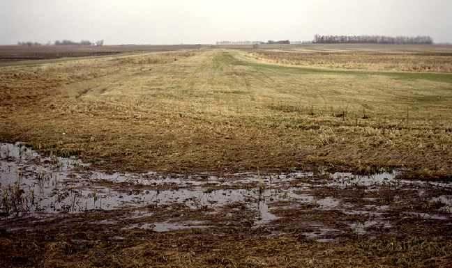
A 2006 photo by Jim Fenwick looking south down the former runway of Wimbledon Airport.
Jim reported also seeing a building being used for storage which looked “very much like a hangar.”
A circa 2007 photo looking southwest at what appears to be a former hangar at the site of Wimbledon Airport.
Wimbledon Airport is located southwest of the intersection of Route 9 & 96th Avenue Southeast.
Thanks to Timothy Aanerud for pointing out this airfield.
____________________________________________________
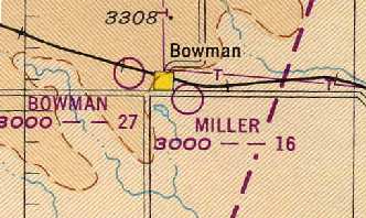
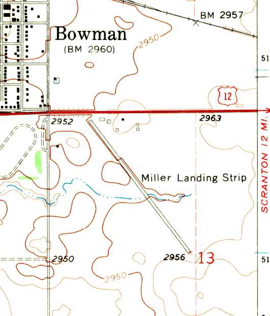
46.17, -103.38 (Southwest of Bismarck, SD)
Miller Airport, as depicted on the 1948 Miles City Sectional Chart (courtesy of Chris Kennedy).
Photo of the airfield while open has not been located.
The date of construction of this small airfield is unknown.
The earliest reference to the field which has been located
was on the 1948 Miles City Sectional Chart (courtesy of Chris Kennedy),
which depicted Miller as having a 1,600' unpaved runway.
The 1957 Miles City Sectional Chart (courtesy of Chris Kennedy)
described Miller Airport as having three runways, with the longest being a 3,000' turf strip.

The earliest photo which has been located of Miller Airport was a 6/11/59 USGS aerial view.
It depicted a northwest/southeast runway on the west side, perhaps still under construction,
along with 2 older unpaved runways to the east.
The 1962 AOPA Airport Directory described Miller Airport
as having a 3,100' gravel Runway 14/32 & two shorter turf strips,
and listed the operator as Al Miller.
The 1968 Flight Guide (courtesy of Robert Levittan) depicted Bowman Municipal Airport as having a single 2,735' unpaved Runway 12/30,
with a few small buildings on the northwest side of the field.
Miller had apparently gained a paved runway at some point between 1962-68,
as the 1968 USGS topo map depicted “Miller Landing Strip” as having a single paved northwest/southeast runway.
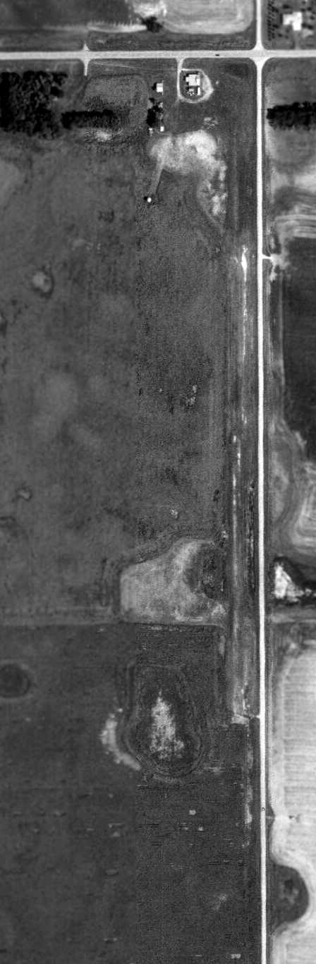
Miller Airport was apparently closed (for reasons unknown) at some point between 1968-82,
as it is no longer listed in the 1982 AOPA Airport Directory (courtesy of Ed Drury).
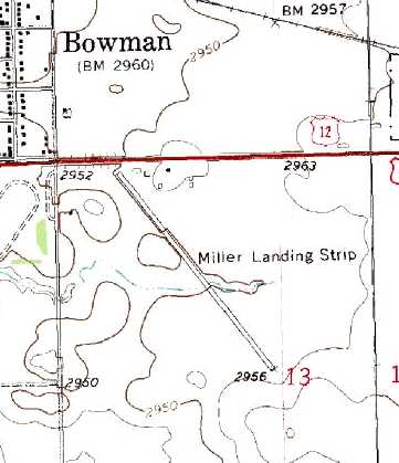
The 1991 USGS topo map still depicted “Miller Landing Strip” as having a single paved northwest/southeast runway.

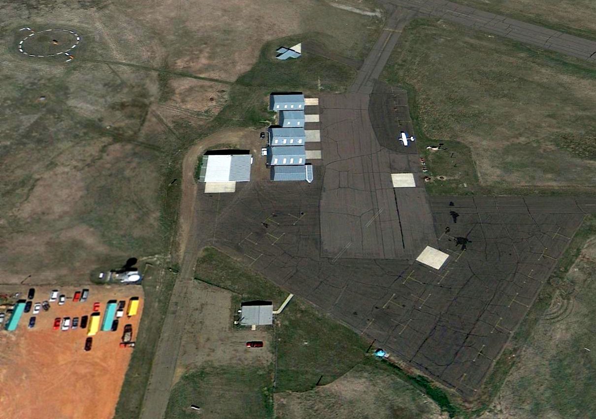
The 1997 USGS aerial photo depicted the paved runway at Miller as remaining in very good condition.
There was what appeared to be a single hangar at the northwest end of the runway.
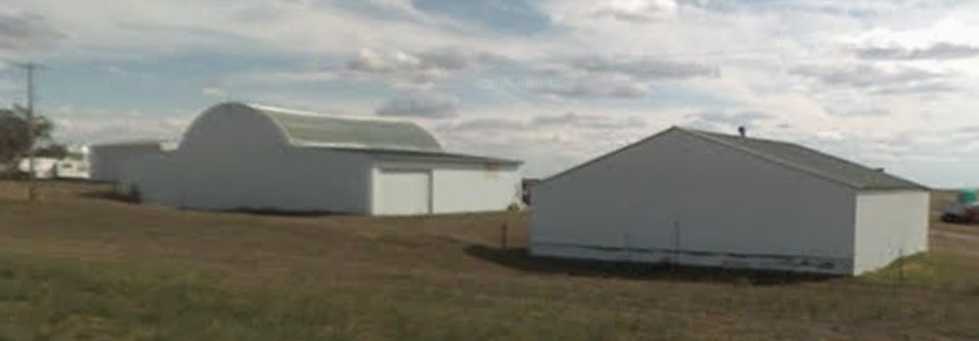
A circa 2007 photo looking southeast at what appears to be a former hangar at the northwest end of Miller Airport.
Miller Airport is located southeast of the intersection of Route 12 & 3rd Avenue Southeast.
Thanks to Chris Kennedy for pointing out this airfield.
____________________________________________________
(Original) Minnkota Landing Strip, Center, ND
47.08, -101.2 (Northwest of Bismarck, SD)
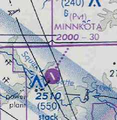
The original Minnkota Airfield, as depicted on the October 1977 Billings Sectional Chart (courtesy of Chris Kennedy).
This small private airfield was evidently constructed at some point between 1972-77,
as it was not yet depicted on a 4/25/72 USGS aerial photo.
The earliest depiction of the original Minnkota Airfield which has been located
was on the October 1977 Billings Sectional Chart (courtesy of Chris Kennedy).
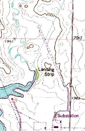
The 1977 USGS topo map depicted the field as having a single 3,000 northwest/southeast runway,
labeled simply as "Landing Strip".
The only photo which has been located of the original Minnkota Airfield was a 5/16/79 USGS aerial view.
It depicted Minnkota as having a single northwest/southeast runway.

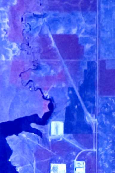
By 1993, the Billings Sectional Chart (courtesy of Timothy Aanerud)
showed that a replacement Minnkota Landing Strip had been built three miles to the west,
and the original airfield had been abandoned.

A 1997 USGS aerial view looking northeast showed that the site of the original Minnkota Airfield had been reused for farming,
with the land processed by a combine or a swather.
The alignment of the former runway was still barely evident if you know where to look.
The site of the original Minnkota Landing Strip is located
northwest of the intersection of 33rd Avenue SW & 24th Street SW.
Thanks to Chris Kennedy for pointing out this airfield.
____________________________________________________
Since this site was first put on the web in 1999, its popularity has grown tremendously.
That has caused it to often exceed bandwidth limitations
set by the company which I pay to host it on the web.
If the total quantity of material on this site is to continue to grow,
it will require ever-increasing funding to pay its expenses.
Therefore, I request financial contributions from site visitors,
to help defray the increasing costs of the site
and ensure that it continues to be available & to grow.
What would you pay for a good aviation magazine, or a good aviation book?
Please consider a donation of an equivalent amount, at the least.
This site is not supported by commercial advertising –
it is purely supported by donations.
If you enjoy the site, and would like to make a financial contribution,
you
may use a credit card via
![]() ,
using one of 2 methods:
,
using one of 2 methods:
To make a one-time donation of an amount of your choice:
Or you can sign up for a $10 monthly subscription to help support the site on an ongoing basis:
Or if you prefer to contact me directly concerning a contribution (for a mailing address to send a check),
please contact me at: paulandterryfreeman@gmail.com
If you enjoy this web site, please support it with a financial contribution.
please contact me at: paulandterryfreeman@gmail.com
If you enjoy this web site, please support it with a financial contribution.
____________________________________________________
This site covers airfields in all 50 states.