Abandoned & Little-Known Airfields:
Maryland, Southern Prince George's County area
© 2002, 2016 by Paul Freeman. Revised 6/20/16.
This site covers airfields in all 50 states: Click here for the site's main menu.
____________________________________________________
Please consider a financial contribution to support the continued growth & operation of this site.
For a suburban community, Prince George's County has a remarkable aviation heritage.
A total of 11 airfields are profiled on this website's Prince George's County pages.
Unfortunately, the county's proud aviation heritage is not very widely known.
Bower Field (revised 6/20/16) - Cheltenham Navy Airfield (revised 12/8/14)
Piscataway Airport (added 6/22/13) - Riverside Field / Columbia Air Center / Croom Field (revised 7/21/13)
____________________________________________________
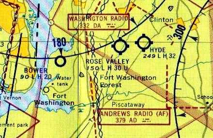
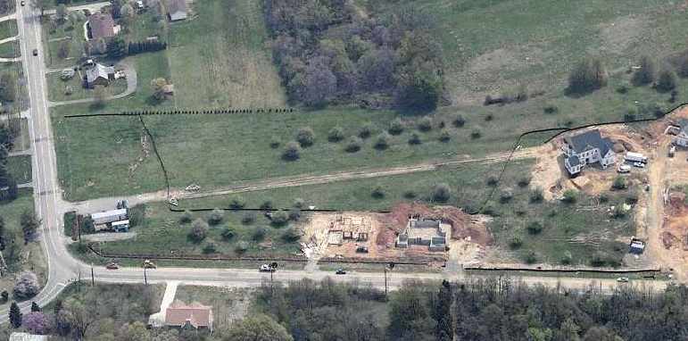
Piscataway Airport, Piscataway, MD
38.68, -76.98 (South of Washington, DC)
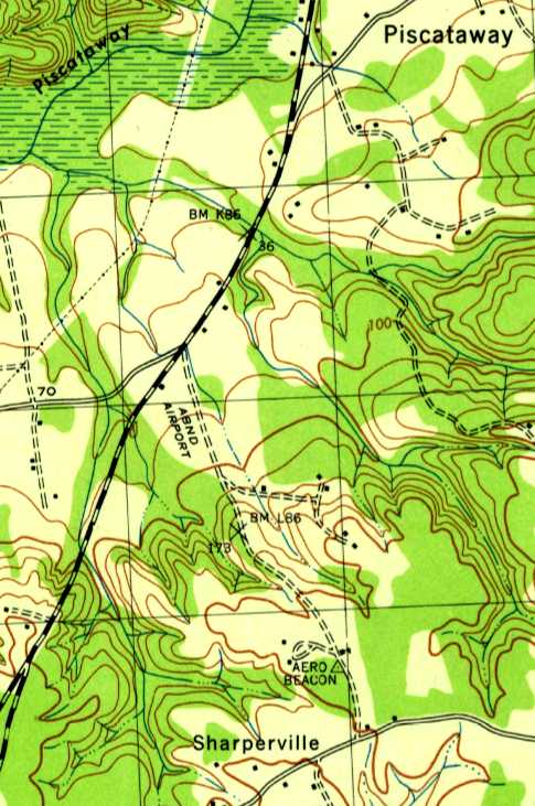
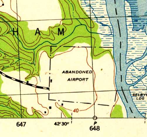
“Abandoned Airport”, as depicted on the 1944 USGS topo map.
Nothing was depicted at this location on the 1934 USGS topo map,
nor was any airport depicted at this location on the 1934 Washington Sectional Aeronautical Chart.
Dana Shifflett passed along the following, from Catherine Allen (Prince George's County Assistant Parks Division Chief,
who described a 1996 oral history recorded from Dotty Warren, “a local pilot who worked for ERCO for Henry Berliner.
She noted that another small airport in Prince George’s County was Piscataway Airport.
Doug Schall owned & operated the airport in the late 1930s.
The runways were all grass.”
According to Dana Shifflett, “I posted a request for information in my high school's alumni website & received replies from 3 folks.
The airport was located in a triangle formed on the south side of the junction of Berry, Livingston, and Farmington Roads.
The airport was owned by Doug Schall. He sold Luscombe aircraft.
It had one grass runway; I suspect it was oriented roughly northeast/southwest.”
No airport was depicted at this location on Washington Sectional Aeronautical Charts from 1935, 1940 or 1944.
The only depiction which has been located of this airport was on the 1944 USGS topo map.
It depicted a single building south of the intersection of Livingston Road & Berry Road,
with a northwest/southeast clearing labeled “Abandoned Airport”.
An “Aero Beacon” was also depicted about a half-mile further southeast.
Nothing was depicted at this location on the 1946 USGS topo map.
According to Dana Shifflett, “My best guess: When the post-war interest in private aviation didn't work out,
Schall took note of nearby residential developments & closed his field to follow that course in the early 1950s.
I say it was his own action because of the names given the streets: Schall & Airport. The bank didn't foreclose & he wasn't bought out.
Houses were already occupied on the site in the mid-1950s.”
A 1957 USGS aerial photo depicted houses & new streets covering the site,
but the single building depicted on the 1944 USGS topo map (a hangar?) was still depicted.
According to Dana Shifflett, “I think I recall a beacon tower in the area in 1960.”
A 1963 aerial photo still depicted the possible hangar.
A 1980 aerial photo showed the possible former hangar had been removed,
erasing the last possible remnant of this enigmatic small airport.
Nearby resident Patricia Keimig reported in 2008, “I asked a neighbor
who has lived in this self-contained neighborhood for upward of 50 years whether there had ever been an airport here.
He said that there had been, and that some of the homes near the intersection of Livingston & Berry were once the airport offices.”
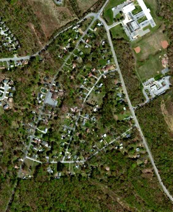
A circa 2012 aerial photo did not show any recognizable trace of the airport previously in Piscataway.
Dave Nordeloos reported in 2013, “I passed a road named Airport Lane in Accokeek.
No airport was visible on site.”
____________________________________________________
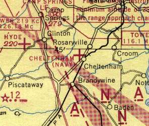
Cheltenham Navy Airfield, Cheltenham, MD
38.74 North / 76.83 West (Southeast of Washington, DC)
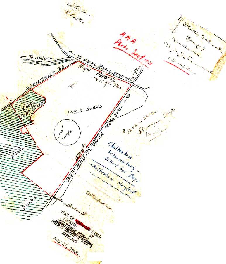
A 7/25/42 Navy “Plat of 108-acre field located at Cheltenham School” (courtesy of Brian Rehwinkel).
This is the unusual tale of a Washington area military airfield which was planned, and actually charted before it was ever constructed,
and eventually canceled before being built.
A 1938 aerial photo of the property did not yet show any recognizable trace of an airfield, just farmland,
and no airfield at Cheltenham was depicted on the 1942 Washington Sectional Chart (courtesy of Mike Keefe).
Brian Rehwinkel reported, “According to a May 1943 memo from the Commanding Officer of the US Naval Reserve Aviation Base Anacostia,
(informal) negotiations to use 'Practice Landing Field #13212 (Cheltenham Field)' as an outlying practice field for NRAB Anacostia were begun in May 1942.
The field was to be used by NE-1 aircraft [the Navy version of the ubiquitous Piper Cub] from the NRAB.
The small field (in the range of 120 acres) was suitable for the NE-1 aircraft because, according to the Navy document,
the aircraft had a 'very low landing speed & a rapid take-off.'”
The earliest depiction which has been located of the Cheltenham Airfield
was a 7/25/42 Navy “Plat of 108-acre field located at Cheltenham School” (courtesy of Brian Rehwinkel).
It showed the field to have an irregular outline, with the longest dimension being
Brian observed, “The plat says the field was 108 acres, however other documentation shows the size of the land for the field was eventually 120 acres.
The plat shows a 1,000' circle in the middle of the field.
This appears that the plans called for a sod landing mat similar to the mats originally placed (for primary training) at 2 other [Navy] fields:
OLF Switzerland & OLF Francis in the Jacksonville area.”
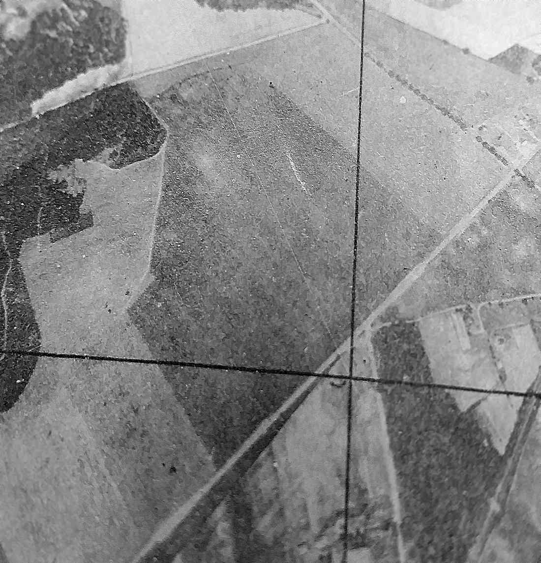
The earliest photo which has been located of the Cheltenham Airfield site was a 1943 Army Corps of Engineers aerial view looking north
(from the National Archives, courtesy of Oscar Gregory).
It depicted an irregularly-shaped grass field which matched the outline seen in the 1942 plat,
but with no specific sign of any aviation use.
Brian Rehwinkel continued, “Soon after the negotiations for the use of the field were initiated,
NRAB Anacostia replaced the NE-1 with N2S [Stearman] aircraft, which had a 'higher landing speed & a lower rate of climb', according the Navy memo.
The memo goes on to say that because of the small size of the field, additional costs would be required to make the field suitable for use by the N2S aircraft.
Although it is not clear if the field was ever used by the Navy as a landing field, it is clear the field was not in the plans for use by the base after May 1943.”
Brian continued, “A June 1943 Navy memo asked the Bureau of Yards & Docks (which handled the Navy’s real estate acquisition projects)
to terminate 'as soon as possible' the Navy’s condemnation proceedings to acquire the use of this field.
This land was condemned to acquire a leasehold interest (the owners would be compelled to lease the land to the Navy) for the land
(as opposed to the US Government attempting to acquire fee simple title for the land).
Interestingly enough, the land was apparently owned by the state of Maryland.”
Brian continued, “Of course, the primary training at Anacostia ,for which the field was originally needed, was discontinued in mid-1943
(Anacostia began disposing of all of the leased outlying fields when primary training ended at the base).
By January 1944, the US Government had officially dismissed the condemnation proceedings for use of the field –
with the state of Maryland agreeing not to seek any claim for compensation against the US for the Navy’s use of the field.”
Mike Doll reported, “I worked at the [Cheltenham] Naval Communications Unit in the mid-1980s.
While looking for history on the base I found some info that indicates
that the Navy considered moving air operations from the Anacostia NAS to Cheltenham in the 1940s
due to limited expansion room along the Anacostia River.
The Navy apparently owned additional land in Cheltenham that was to be used for this purpose.
Apparently this idea was scrapped for whatever reason.
I don't know if any type of strip was actually built” [at Cheltenham].
The only aeronautical chart depiction which has been located of the Cheltenham Airfield
was on the 1944 Washington Sectional Chart (courtesy of Mike Keefe),
which depicted "Cheltenham (Navy)" as an auxiliary airfield,
even though it was apparently never constructed, and never used as an airfield!
According to Brian Rehwinkel, “In the end, this field was a good example
of the challenges posed by the rapid expansion of the war effort in the early part of World War Two.
In this instance, the Navy needed to expand the pilot training program, and as such, acquired as many fields as possible for the training effort.
As the war progressed, and needs changed (and missions changed for Navy facilities), the Navy was left with property that was no longer suitable.
This was the case with land acquired for outlying fields acquired by the Navy, but never fully utilized.”
The 1944 & 1946 USGS topo maps labeled the Cheltenham property outline as “U.S. Naval Reservation”,
but did not show anything related to an airfield.
The Cheltenham Navy airfield was no longer depicted on the 1945 Washington Sectional Chart (courtesy of John Voss)
or later Sectional Charts.
A 1963 aerial photo of the site of the Cheltenham airfield showed the property to remain an open field.
A 1980 aerial photo showed that the Cheltenham Veterans' Cemetery had been built at some point between 1963-80 on the western portion of the airfield site.
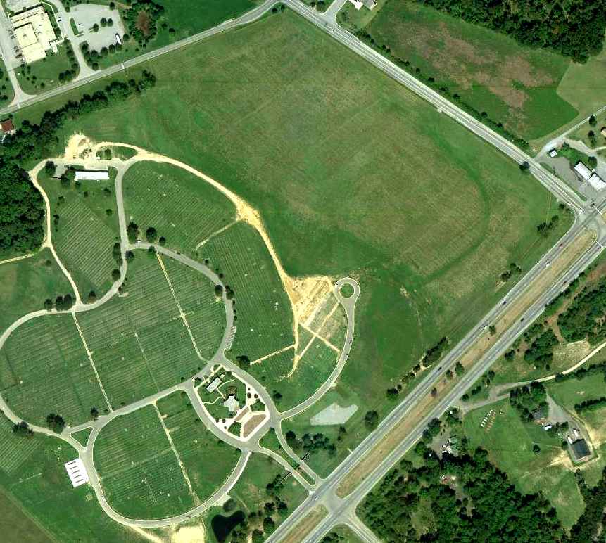
An 8/29/10 aerial photo shows the western portion of the site of Cheltenham airfield is occupied by the Cheltenham Veterans' Cemetery,
while the eastern portion remains an open field.
The site of the Cheltenham airfield is located west of the intersection of Crain Highway & Frank Tippett Road.
____________________________________________________
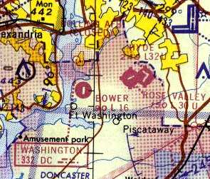
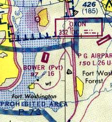
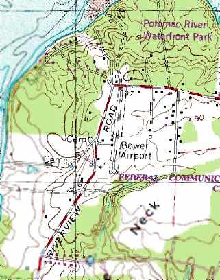
38.736, -77.022 (South of Washington, DC)
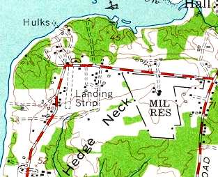
Bower Field (labeled simply "Landing Strip"), as depicted on the 1956 USGS topo map.
This very short little private paved strip was located along the east bank of the Potomac River,
seven miles south of Reagan National Airport.
The date of construction of Bower Field is unknown.
A 1938 aerial photo of the property did not yet show any recognizable trace of an airfield, just farmland.
It was apparently built at some point between 1955-56,
as it was not yet depicted on the 1955 Washington Local Aeronautical Chart (courtesy of Mike Keefe).
The earliest reference to Bower Airport which has been located is the 1956 USGS topo map,
which depicted the single north/south runway, labeled simply as "Landing Strip".
Merton Meade recalled, “I remember Don Bowers & his wee field.
Don used to keep his Cessna 310 there & also had a Cessna 180.”
The earliest photo which has been located of Bower Field was a 1957 aerial view.
It depicted the field as having a single grass runway.
The Aerodromes table on the 1957 Washington Sectional Chart
described Bower Field as having a single 2,000' turf runway.
The runway at Bower was apparently paved within the next 3 years,
as the Aerodromes table on the 1960 Washington Sectional Chart
described Bower Field as having a single 2,000' hard-surfaced runway.
Stan Fetter (of Hyde Field's Fetter Aviation) said that
"The guy that built it had a [Cessna] 310 in there, believe it or not.
He'd go out light & pick up fuel & passengers at Hyde."
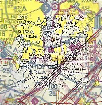
Bower Field was depicted on the February 1961 Washington Local Aeronautical Chart (courtesy of Scott Kimball) as having a 2,000' paved runway.
Also note the close proximity of Rose Valley Airport & Hyde Field.
The 1962 AOPA Airport Directory described Bower Field as a private field
consisting of a single 2,000' blacktop Runway 18/36.
Apparently, the runway length was shortened somewhat by 1964,
as the Aerodromes table on the 1964 Washington Sectional Chart (courtesy of John Voss)
described Bower Field as consisting of a single 1,660' asphalt runway.
A 1965 aerial photo of Bower Field showed the airport to have a single paved runway,
and what appeared to be 2 aircraft parked on the west side of the runway.
Also note the airport circle marking on the east side of the field.
Ben Selig recalled, "I grew up in Ft. Washington just down the street from the Bower airfield.
My first airplane ride was from there at the age of about 3 from the original owner Don Bowers about 32 years ago [circa 1970].
Don had a [Cessna] 210 and a yellow 172.
With my brother about 4 years & myself screaming at the offer for a ride from Don my mother couldn't say 'No.'
Off we went my brother & I standing in the back of the 172,
out over the roller coaster at Glenn Echo & around southern PG county."
Bower Field, as depicted on the 1975 Washington Terminal Area Chart (courtesy of Ed Drury).
The last photo which has been located showing aircraft still on Bower Field was a 1980 aerial view.
It showed 2 single-engine aircraft parked on the southwest side of the runway.
The airport circle marking previously seen on the east side of the field had evidently been removed at some point between 1965-80.
The 1982 AOPA Airport Directory (courtesy of Ed Drury)
described Bower Field as having a single 1,660' asphalt runway.
The 1983 USGS topo map depicted Bower as having a single paved runway with buildings along the west side.
The March 1993 Washington Sectional Chart (courtesy of Carl Taylor)
depicted Bower as having a single 1,600' paved runway.
Bower Field was still depicted as an active private airfield on 1998 aeronautical charts.
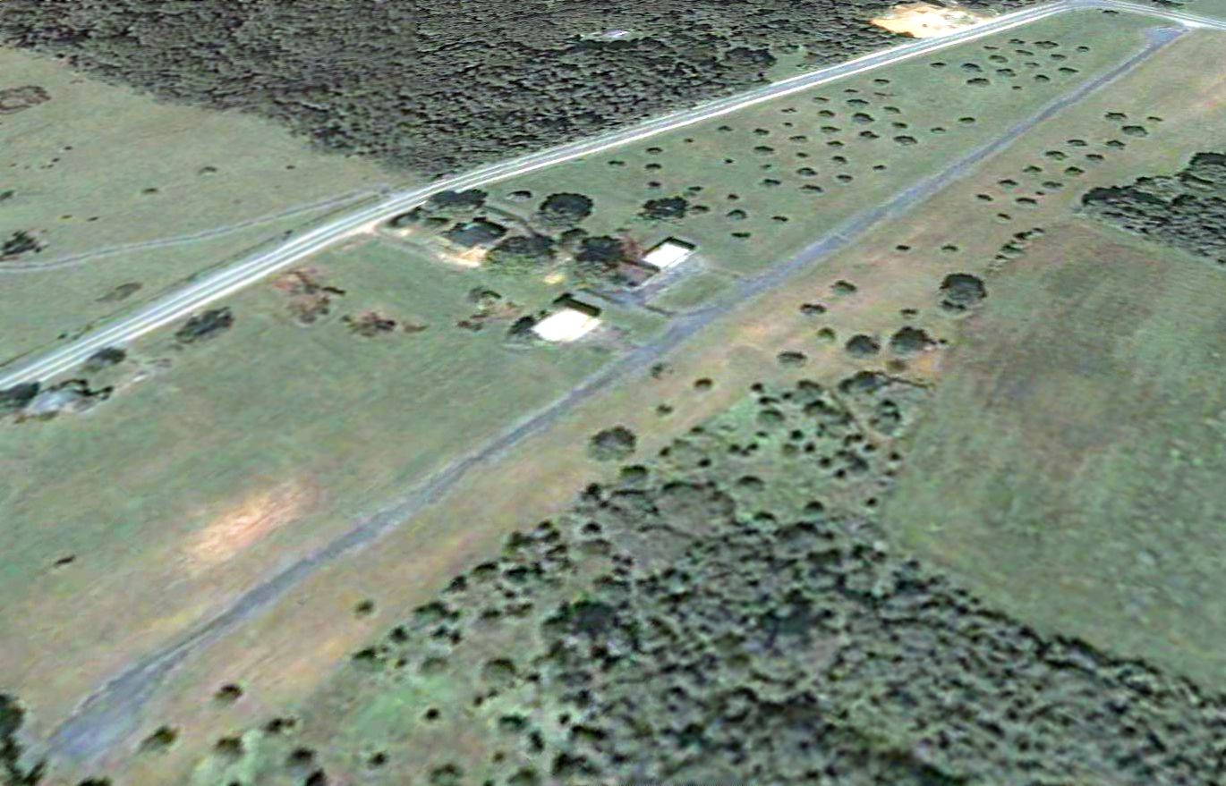
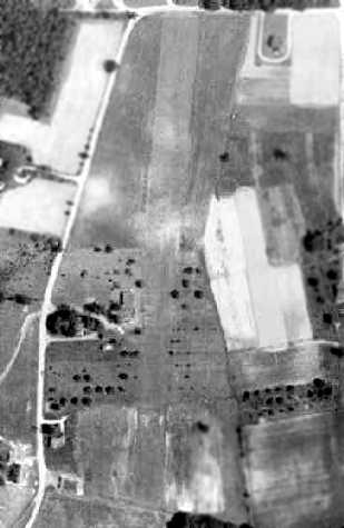
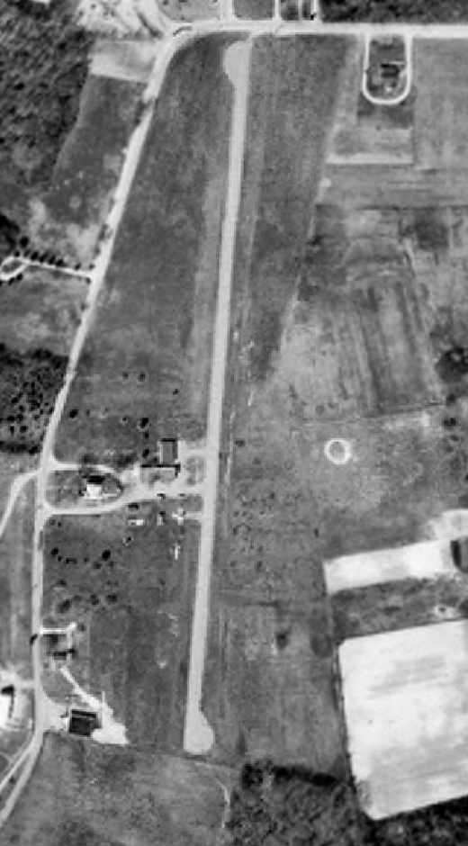
A 2001 aerial view looking north showed 2 small hangars were situated west of the single runway at Bower Field.
There did not appear to be any aircraft parked outside at the field.

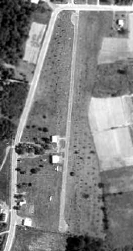
Unfortunately a 2002 aerial view looking northwest at Bower Field showed that the house & hangars on the west side of the runway had been removed between 2001-2002,
although the runway still remained intact.
A sad sight – a circa 2002-2004 aerial view looking east, showing the Bower Field runway in the process of being replaced by new houses.
Stan Fetter said in 2003 that the Bower Airport property
was sold a couple of years ago to a real estate developer
"and it's been dug up to become the backyards of some very expensive homes."
Ben Selig reported in 2004, "It's completely gone & 20 or so homes have been built there,
and a plan for another 30 or so to be built along the Potomac River waterfront area."
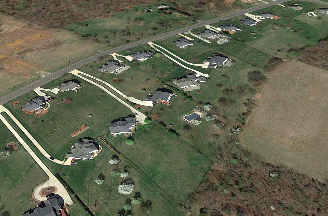
A 2015 aerial view looking northwest at showed no trace remaining of Bower Field, with houses covering the property.
____________________________________________________
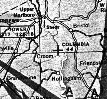
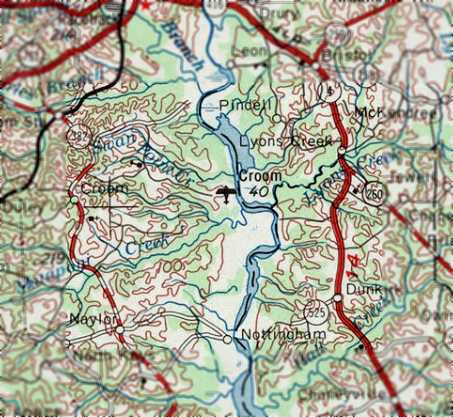
Riverside Field / Columbia Air Center / Croom Field, Croom, MD
38.75 North / 76.7 West (East of Andrews AFB, MD)
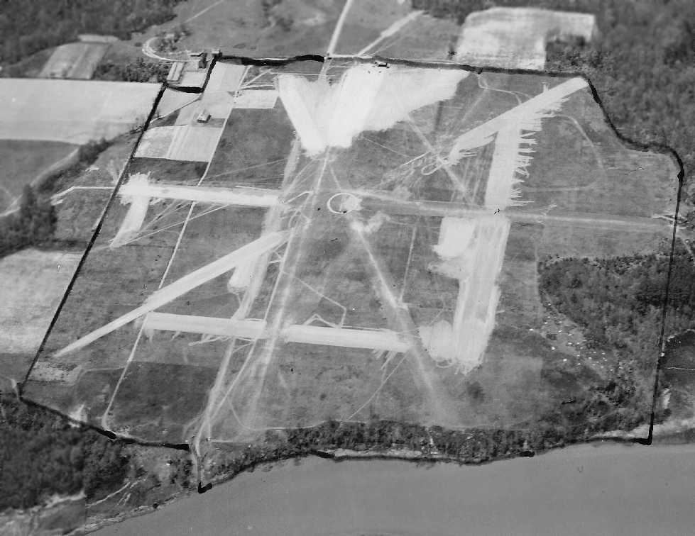
An undated (believed to be 1942) U.S. Navy aerial view looking southwest at Riverside Field (courtesy of Brian Rehwinkel), “annotated to show the airfield boundaries.”
A 1938 aerial photo of this property did not yet show any recognizable trace of an airfield, just farmland.
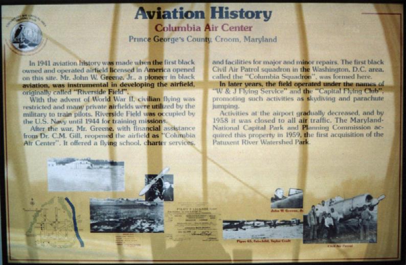
In 1941 aviation history was made when Riverside Field,
the first black owned & operated airfield licensed in America, opened on this site.
The property, a 450 acre potato field, was leased by The Cloud Club, a group of black pilots from Washington,
for $50 / month from Rebecca Fisher.
John Greene, a pioneer in black aviation, was instrumental in developing the airfield.
According to the book "Maryland Aloft" by Preston, Lanman, and Breilhan,
"Riverside Field opened in February 1941.”
The Washington Afro-American newspaper wrote August 16, 1941,
"...(Croom is) the only field solely operated by a colored staff."
According to the book "Maryland Aloft" by Preston, Lanman, and Breilhan,
"In August [1941], an air show there drew 800 spectactors, about 150 of whom went aloft for rides.
During this same general period,
students from the Civilian Pilot Training Program at Howard University did their flight training at the field."
With the advent of WW2, civilian flying was restricted & many private airfields
were utilized by the military to train pilots.
Wartime restrictions halted private flying at Riverside.
According to Brian Rehwinkel, “The Navy first attempted to lease the field in late 1941 or early 1942”,
to support flight training at nearby NAS Anacostia.
However, Brian Rehinkel reported, “The Navy’s use of the field was complicated because the owner of the field could not sell the property to the Navy.
According to Navy records, she held a 'life estate' for the property, and upon her death, the land would revert to her late husband’s heirs.
The airfield was situated on a 470 acre farm & the Navy wanted to lease the 120 acres for the existing airfield,
as well as an additional acres to expand the field for training.”
Brian continued, “Of course, the challenge was that the 120 acres for the airfield was already being leased by the Cloud Club, Inc.
The members of this club were leasing the field (according to Navy documents) for $50 / month.
The Navy did not want to pay much for the lease of this field & apparently was not willing to sub-lease from the Cloud Club
because they did not think the lease rate offered by the Club was reasonable.
However, the Cloud Club claimed they had invested, at least, $12,000 in improvements to the field.”
The Cloud Club's Secretary sent a 2/4/42 letter (courtesy of Brian Renhwinkel) to the Navy, which was marked “Defendant’s Exhibit #6”
evidently because the letter was an exhibit in the drawn-out legal proceedings for this field.
The earliest depiction which has been located of Riverside Field
was an undated (believed to be 1942) U.S. Navy aerial view looking southwest (courtesy of Brian Rehwinkel), “annotated to show the airfield boundaries.”
It depicted the field as having 6 unpaved runways,
with a few small buildings along the west side.
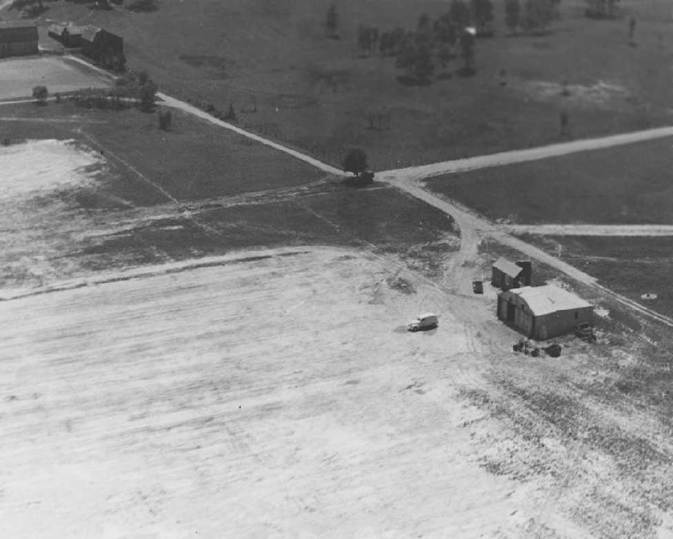
An undated (believed to be 1942) U.S. Navy aerial view looking southwest at Riverside Field (courtesy of Brian Rehwinkel),
showing a single hangar, a small office building, and a truck, but no aircraft.
Brian Rehwinkel observed, “At this time, according to Navy records, the buildings consisted of a 45’ x 40' wooden hangar
and a small building that was divided into 2 rooms – a locker room & a radio room.”
Strangely, no airfield at all was depicted at Croom
on the 1942 or 1944 Washington Sectional Charts (courtesy of Mike Keefe).
The Navy's usage of Riverside Field ended in 1944.
According to Brian Rehwinkel, “I don’t think the legal proceedings were completed until 1944.”
The earliest map depiction which has been located of Riverside Field was on the 1944 USGS topo map.
It depicted a rectangular property outline, with one small buildings on the west side.
Ironically, it was already labeled as “Abandoned Airport”.
After the war, John Greene reopened the airfield as "Columbia Air Center".
It was depicted as "Columbia" on the 1945 Washington Sectional Chart (courtesy of John Voss).
It continued to be depicted as "Columbia" on the and the 1946 Washington Sectional Chart (courtesy of Mike Keefe).
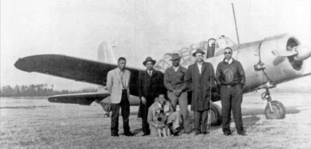
An undated (presumably post-WW2) photo of members of the Cloud Club at Columbia Air Center in front of a surplus Vultee BT-13.
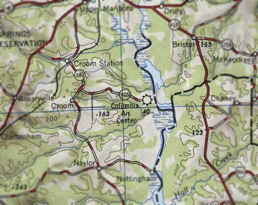
“Columbia Air Center”, as depicted on the 1946 USGS topo map.
According to the book "Maryland Aloft",
in 1946, the airfield consisted of 130 usable acres with 7 marked runways.
The airport had one 100' x 60' hangar, one 40' square hangar, and a 20' square office building.
The management's fleet included a Fairchild PT-19 trainer, Piper J3L, Aeronca Champion, and Aeronca L3.
Columbia Air Center offered a flying school, charter services, and facilities for major & minor repairs.
The first black Civil Air Patrol squadron in the Washington DC area,
called the Columbia Squadron, was formed here.
The "Columbia" airfield was described on the 1949 Washington Sectional Chart (courtesy of Mike Keefe)
as having a 3,300' unpaved runway.
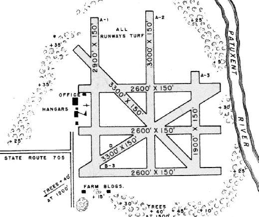
It was listed as "Columbia Air Center" in the 1950 MD Airport Directory (courtesy of Stephen Mahaley).
At the time, the field boasted a total of no less than 8 runways, all grass,
of which the longest was a 3,300' north/south strip.
The airport office building & 2 hangars were situated west of the runways.
Columbia Air Center was described on the 1951 Washington Sectional Chart (courtesy of Mike Keefe)
as having five runways, with the longest being a 2,600' unpaved strip.
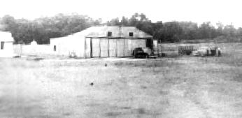
Undated photo of a hangar at Columbia Air Center.
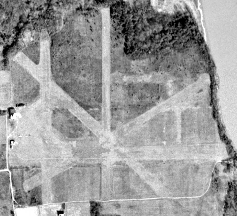
The only dated photo that has been located showing aircraft on the field at Columbia Air Center was a 12/17/53 USGS aerial view (courtesy of Brian Rehwinkel).
Brian observed, “This photo shows the original 2 structures (the small hangar & building) as well as what looks like the larger hangar.
You can also see what appears to be 3 aircraft on the field east of one of the hangars.”
After John Greene's retirement, the airport was managed by Charles Wren & Herbert Jones,
whose firm was named "W & J Flying Service".
The "Capital Flying Club" also was based here,
promoting such activities as skydiving & parachute jumping.
The flying service at the field operated until 1956, when the Fisher family refused to renew the lease.
However, Columbia Air Center was still depicted as an active airfield
on the 1957 Washington Sectional Chart (courtesy of Mike Keefe),
and described as having five runways, with the longest being a 2,600' turf strip.
Columbia Air Center was closed to all air traffic in 1958.
In 1959, the property became the first acquisition of the Patuxent River Watershed Park.
No airfield was depicted at the site on the 1961 Washington Local Aeronautical Chart (courtesy of Mike Keefe).
However, this airfield may have briefly reopened at some point between 1961-63,
as a "Croom" Field was depicted at the same location
on the 1963 Washington Local Aeronautical Chart (courtesy of Mike Keefe).
It was described as having 2 runways, with the longest being a 3,200' turf runway.
Croom Field evidently lasted only one year,
as nothing was depicted at the site on the 1964 Washington Local Aeronautical Chart (courtesy of Mike Keefe).
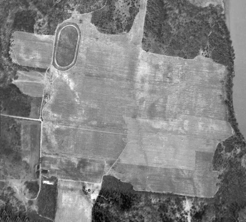
A 1965 aerial photo of Croom Field showed a large open grass area.
A horsetrack was situated on the northwest side of the property.
Traces of the former airport buildings on the west side of the field were evident, but it is not certain if they were still standing at that point.
There was no sign of any based aircraft.
Dana Shifflett observed, “runways... I see traces of something extending upper right to lower left, or at least to center.
I remember flying over that field with Dad in the mid-1960s & him pointing out traces of it in soil color & vegetation.”
The 1969 USGS topo map still depicted Croom Airport, even though it had evidently already been closed for several years.
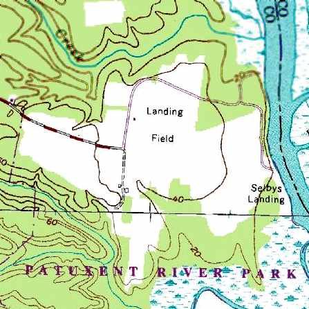
The 1979 USGS topo map still depicted the site as a “Landing Field”,
with 2 small buildings along the west side of the field.
The 1983 MD Aeronautical Chart no longer depicted the field at all (not even as an abandoned airfield).

A 1993 aerial photo of Croom Field showed a somewhat smaller cleared area compared to the 1965 photo.
However, an airport circle marking was visible in the center of the field, which was not visible on the 1965 photo.
A circa 2000 aerial view of Riverside Field showed that the cleared area was the only trace remaining of the airfield.
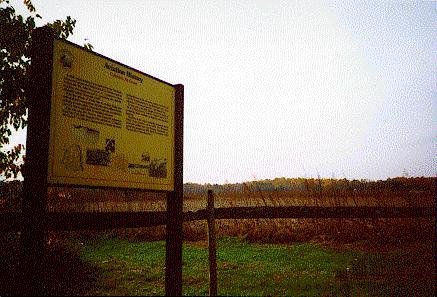
A recent photo of the historic marker at the open grass field.
The historic marker is also displayed at the College Park Aviation Museum.
Today, the only remaining trace of the airport is a historic marker on the side of an open grass field.
However, the 2002 book "Maryland Aloft" reported that a fuel pump remained at the field.
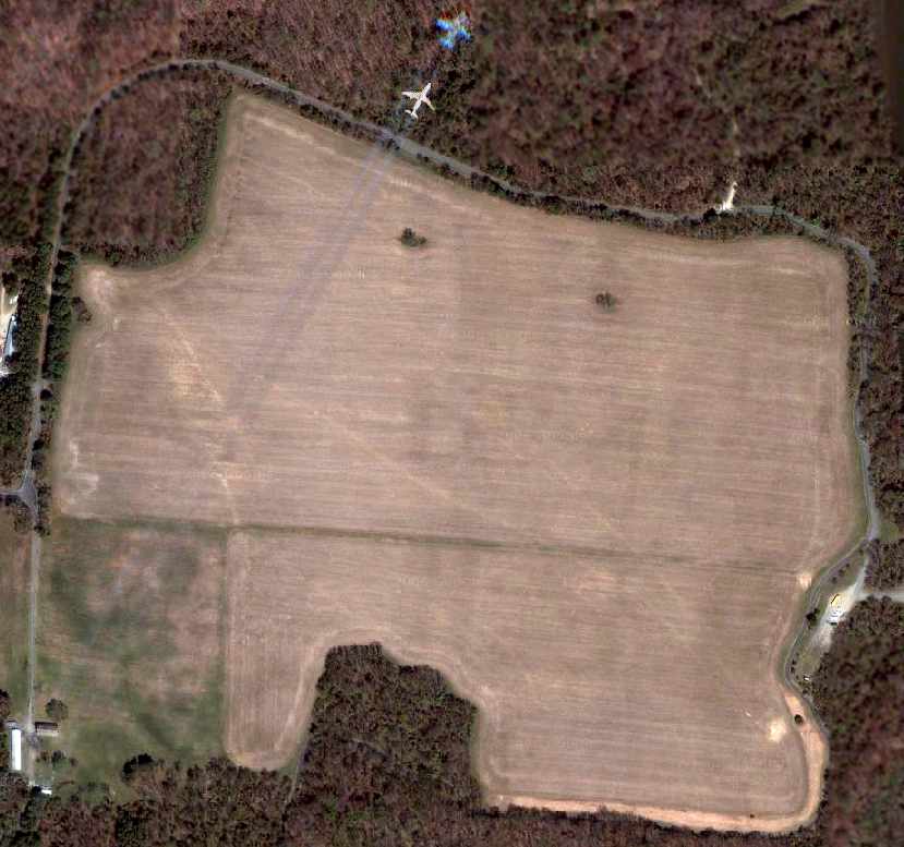
Although a 2006 aerial view of Riverside Field showed that the cleared area was the only trace remaining of the airfield,
an airliner was also captured overflying the field (along with a photo artifact of the same airliner).
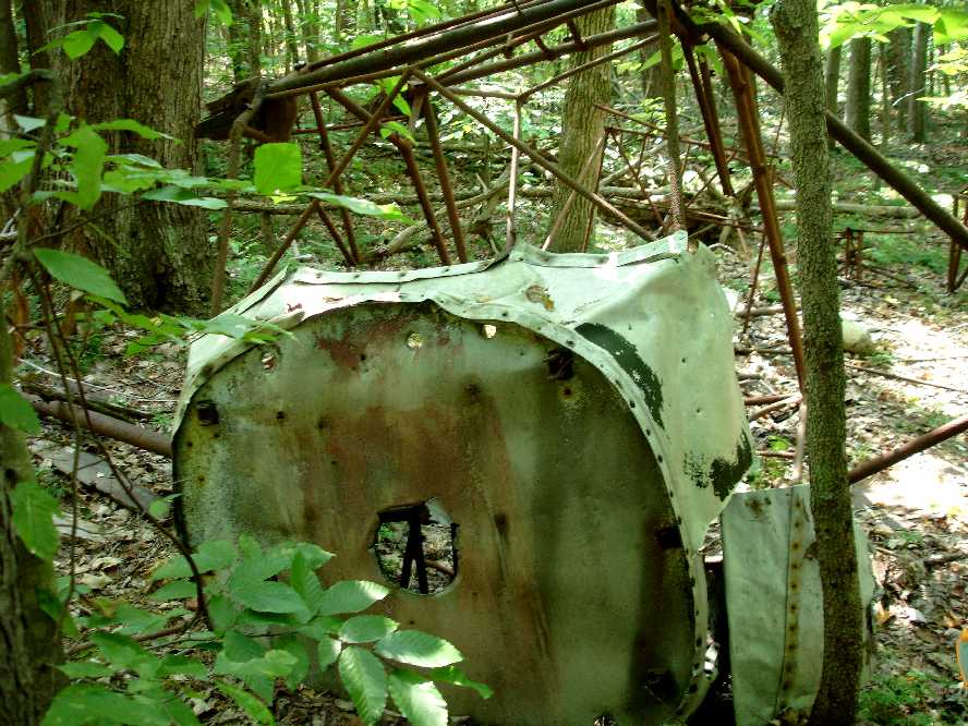
A 2007 photo by Michael Regen of the wreck of an unidentified light single-engine aircraft
found in the woods only a few hundred feet northwest of the northwest corner of Croom Field.
Micheal reported, “September 2007 the Civil Air Patrol Maryland Wing had a SAREX (Search & Rescue Exercise)
in the area that was Croom Airport & surrounding Jug Bay.
None of us at the time knew that this area had previously been an airport.
I was leading a ground team searching for a practice ELT
and ran across this aircraft frame in the woods at N 38.767 / W 76.71.
You can probably guess at the shock & surprise when I radioed back to mission base that we had found a wrecked aircraft
since no one knew of either this plane’s existence or the fact that it had once been an airport.
I could not identify the old aircraft tube frame. Pieces of it were scattered around the site.
It had wooden wing spars with the bolted ends still in the upper tube frame but badly deteriorated.
There was no trace of wings other than the spar ends and the tubular struts so the wing may have been all wood & long since deteriorated.
It was obviously a fabric-covered high wing aircraft.”
Stanley Braisted reported in 2009, “My son had also found the airframe [pictured above].
The throttle quadrant & frame positively identify it as a J-3 Cub.
Engine & wings & internals are missing, so we theorize that it landed short,
and they cannibalized & recovered everything useful, but left the airframe, which was pretty badly bent up & likely not worth the trouble.
Elsewhere in the woods is another large & heavy high-wing center section box similar to a DH Beaver,
but I have yet to find anything diagnostic to ID it.”
However, Harvey Cash reported, “A J-3 never had welded diagonal braces extending outward from the fuselage, and never had a 3-piece windscreen.
From the photo, the physical size of the frame seems too large to be a J-3 sized aircraft.
Most likely the aircraft is a Stinson Junior.
The photo clearly still shows the 3 segments of retaining trim still on the cowl of the wreckage.”
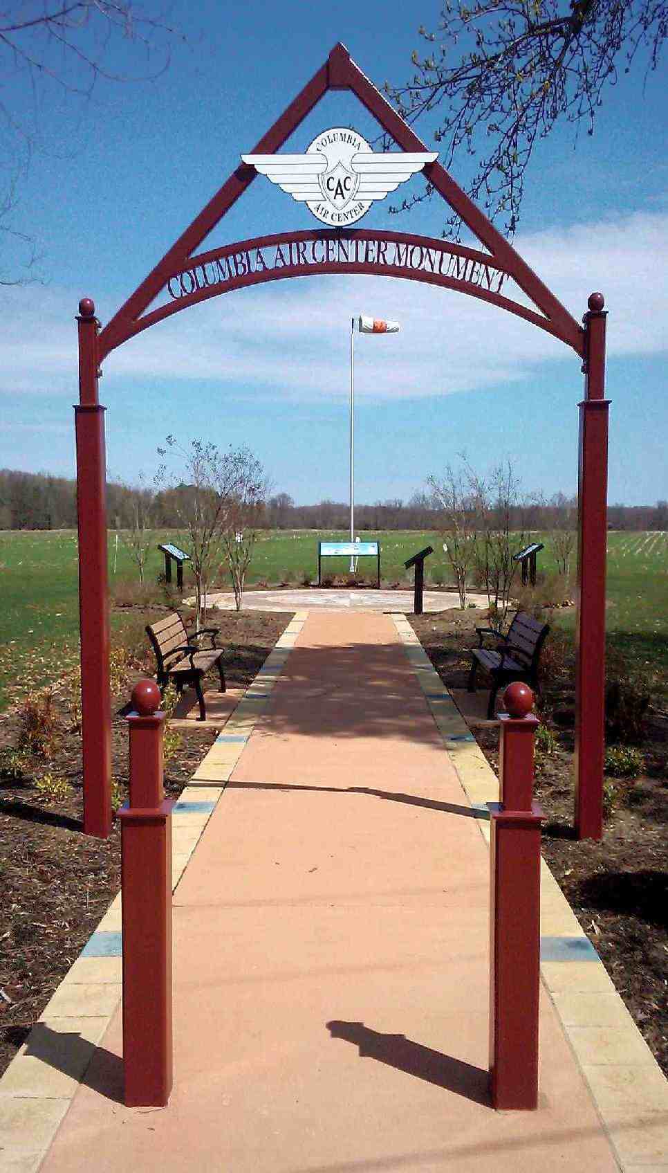
An April 2011 photo by Greg Wright of the “Columbia Air Center Monument”.
Greg reported, “The State Park that the former field is located on has put up a formal type of memorial for the field.”
Croom Field is located along "Croom Airport Road", on the western shore of the Patuxent River.
See also:
http://www.geocities.com/cd19/croom.html
http://www.tc-solutions.com/croom/airport/airport.htm
____________________________________________________
Since this site was first put on the web in 1999, its popularity has grown tremendously.
That has caused it to often exceed bandwidth limitations
set by the company which I pay to host it on the web.
If the total quantity of material on this site is to continue to grow,
it will require ever-increasing funding to pay its expenses.
Therefore, I request financial contributions from site visitors,
to help defray the increasing costs of the site
and ensure that it continues to be available & to grow.
What would you pay for a good aviation magazine, or a good aviation book?
Please consider a donation of an equivalent amount, at the least.
This site is not supported by commercial advertising –
it is purely supported by donations.
If you enjoy the site, and would like to make a financial contribution,
you
may use a credit card via
![]() ,
using one of 2 methods:
,
using one of 2 methods:
To make a one-time donation of an amount of your choice:
Or you can sign up for a $10 monthly subscription to help support the site on an ongoing basis:
Or if you prefer to contact me directly concerning a contribution (for a mailing address to send a check),
please contact me at: paulandterryfreeman@gmail.com
If you enjoy this web site, please support it with a financial contribution.
please contact me at: paulandterryfreeman@gmail.com
If you enjoy this web site, please support it with a financial contribution.
____________________________________________________
This site covers airfields in all 50 states.
For the site's main menu: Home