Abandoned & Little-Known Airfields:
Indiana: Eastern Indianapolis area
© 2002, © 2016 by Paul Freeman. Revised 2/15/16.
This site covers airfields in all 50 states: Click here for the site's main menu.
____________________________________________________
Please consider a financial contribution to support the continued growth & operation of this site.
Eastport Airport (revised 5/8/14) - McCordsville Airpark / Brookside Airpark (revised 9/28/15)
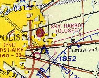
Schoen Field (revised 2/15/16) - Sky Harbor Airport (revised 12/31/15)
____________________________________________________
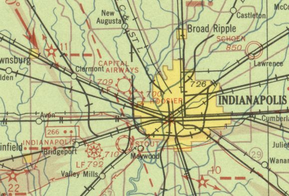
Eastport Airport, Indianapolis, IN
39.79, -86 (East of Downtown Indianapolis, IN)
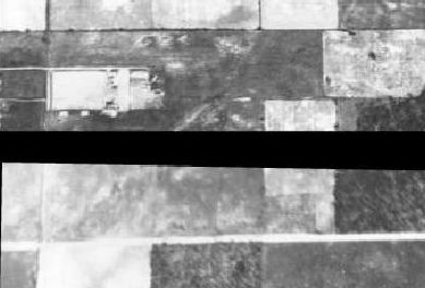
The very early stages of Eastport Airport as seen in a 1937 aerial view (from http://maps.indy.gov/MapIndy/).
This little general aviation airfield was apparently quite short-lived.
Eastport Airport was evidently established at some point between 1934-37,
as it was not yet depicted on the 1934 Cincinnati Sectional Chart.
The earliest depiction of Eastport Airport which has been located
was a 1937 aerial view (from http://maps.indy.gov/MapIndy/).
It depicted Eastport as having 2 grass runways, oriented east/west & northeast/southwest,
with several hangars in the middle.
Eastport was not yet depicted on the September 1941 9M Regional Aeronautical Chart (courtesy of Chris Kennedy),
nor listed among active airports in a 1941 airport directory (according to Chris Kennedy).
A 1941 aerial photo (from the IN Historical Aerial Archive, courtesy of Chris Kennedy)
depicted Eastport as having 2 grass runways, oriented east/west & northeast/southwest, with several hangars in the middle.
There did not appear to be any aircraft visible on the field.
The earliest chart depiction of Eastport which has been located
was on the April 1943 Cincinnati Sectional Chart (courtesy of Chris Kennedy).
It depicted Eastport as an auxiliary airfield.
The last photo which has been located of Eastport Airport was a 11/17/43 aerial view looking east
from the 1945 AAF Airfield Directory (courtesy of Scott Murdock).
It depicted Eastport as having 2 grass runways.
Eastport was still depicted as an auxiliary airfield on the May 1944 Cincinnati Sectional Chart (courtesy of Chris Kennedy).
Eastport Airport was evidently closed (for reasons unknown) at some point within the next year,
as the the 1945 AAF Airfield Directory (courtesy of Scott Murdock) described the field as “Not in operation.”
It described Eastport as a 60 acre square-shaped property having 2 sod runways, the longest being the 2,200' northeast/southwest strip.
The field was said to have 5 wooden hangars, the largest being a 45' x 30' structure.
Eastport was described as being owned by private interests.
Eastport Airport was no longer listed among active airports in the Haire Publishing Company's 1945 Airport Directory (according to Chris Kennedy),
nor depicted on the September 1948 Cincinnati Sectional Chart (courtesy of Chris Kennedy)
or the 1948 USGS topo map.
A 1956 aerial view (from http://maps.indy.gov/MapIndy/) showed that houses had been built over the former east/west runway,
but the cleared area of the northeast/southwest runway was still recognizable.
A 1971 aerial view showed that the Warren Central High School had been constructed at some point between 1956-71,
erasing the last traces of the Eastport Airport.
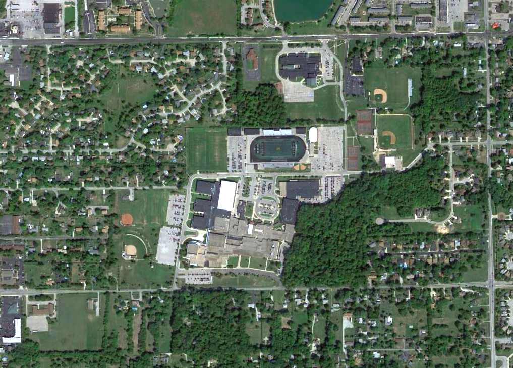
An 8/29/12 aerial photo showed the site of Eastport Airport is covered by the Warren Central High School,
and not a trace appears to remain of the former airport.
The site of Eastport Airport is located northeast of the intersection of North Post Road & East 15th Street.
____________________________________________________
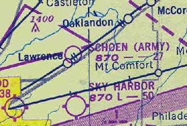
Schoen Field, Indianapolis, IN
39.852, -86.012 (Northeast of Downtown Indianapolis, IN)
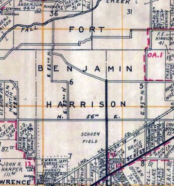
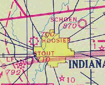
Schoen Field, as depicted on the 1931 Wagner's Map of Marion County (courtesy of Bruce Sutherlin).
This military airfield was established in 1922 on the grounds of the Army's Fort Benjamin Harrisson,
an infantry training base (according to the Fort Benjamin Harrison Historical Society).
The Indiana National Guard's 137th Observation Squadron (later redesignated the 113th Observation Squadron)
relocated from Kokomo to Schoen Field in 1926,
before moving again to Stout Field.
The earliest depiction which has been located of Schoen Field was on the 1931 Wagner's Map of Marion County (courtesy of Bruce Sutherlin).
The Airport Directory Company's 1933 Airports Directory (courtesy of Chris Kennedy)
described Schoen as an auxiliary airfield consisting of an irregularly shaped sod field,
measuring 2,800' across at its widest point.
The field was said to have hangars, one of which had "Schoen Field" painted on the roof.
The earliest aeronautical chart depiction which has been located of Schoen Field was on the November 1933 Cincinnati Sectional Chart,
which depicted Schoen as a military airfield.
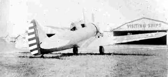
A undated (circa 1930s?) photo of an unidentified Army Air Corps plane at Schoen Field.
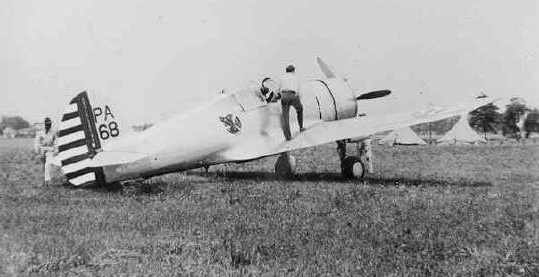
A undated (circa 1930s?) photo of an Army Air Corps fighter at Schoen Field.
Schoen Field, as depicted on the September 1941 9M Regional Aeronautical Chart (courtesy of Chris Kennedy).
A 1941 aerial view of Schoen Field, from the IN Historical Aerial Archive (courtesy of Chris Kennedy).
The field consisted of a pockmarked rectangular grass field,
with a cluster of hangars with checkerboard roof markings on the east side of the field.
It is not apparent if the field was still in use at this point, though,
as there did not appear to be any aircraft on the field.
Schoen Field was evidently closed for some reason during the WW2 years
(possibly due to the Fort having to use the land for other needs),
as it was not depicted at all on the April 1943 Cincinnati Sectional Chart (courtesy of Chris Kennedy)
or the May 1944 Cincinnati Sectional Chart (courtesy of Chris Kennedy),
nor listed among active airfields in the 1945 AAF Airfield Directory (courtesy of Scott Murdock).
Schoen Field was evidently reopened (for reasons unknown) at some point between 1945-48,
as "Schoen (Army)" was once again depicted on the September 1948 Cincinnati Sectional Chart (courtesy of Chris Kennedy).
It was depicted as having a 2,700' unpaved runway.
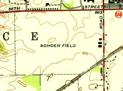
The 1948 USGS topo map depicted Schoen Field as an open area with 3 buildings along the east side.
Schoen Field was evidently closed again (for reasons unknown) at some point after 1948.
It may have been closed by 1951,
when ground was broken for a new Finance Center
(according to the web site of the Fort Benjamin Harrison Historical Society,
the Finance Center occupies the site of the former airfield).
The Finance Center & its parking lots covered the site of Schoen Field by the time of a 1956 aerial photo.
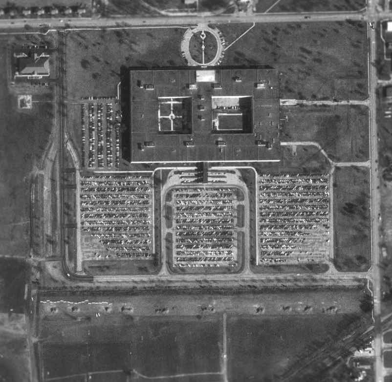
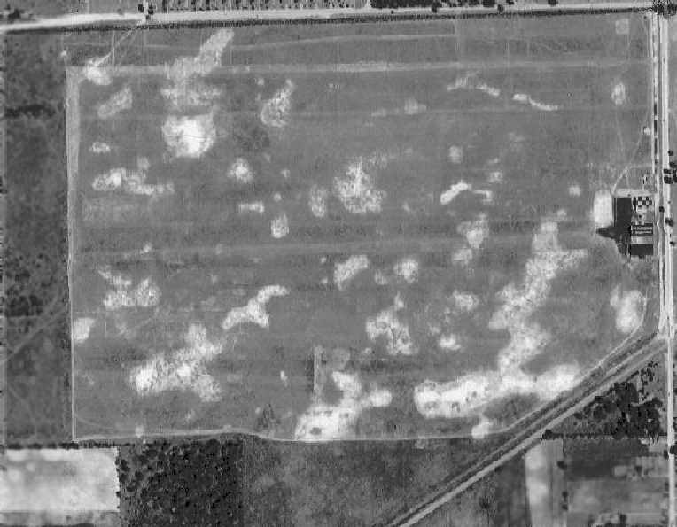
As seen in the 1998 USGS aerial photo,
the site of the former Schoen Field is occupied by the Fort's Finance Center,
and not a trace appears to remain of the former airport.
The site of Schoen Field is located southwest of the intersection of East 56th Street & North Post Road.
____________________________________________________
McCordsville Airpark / Brookside Airpark (I21), Indianapolis, IN
39.906, -85.923 (Northeast of Downtown Indianapolis, IN)
What was originally known as McCordsville Airpark,
as depicted on the 1968 Cincinnati Sectional Chart (courtesy of Chris Kennedy).
This is yet another suburban general aviation airport which has been lost to the pressures of development.
McCordsville Airpark was evidently established at some point between 1966-68,
as no airfield at this location was perceptible on a 1956 aerial photo of the property
(from the IN University Electronic Atlas of Central Indiana Historical Aerial Archive, courtesy of Chris Kennedy),
nor was any airfield at this location yet depicted on the 1963 USGS topo map nor the 1966 Cincinnati Sectional Chart (according to Chris Kennedy).
The earliest depiction of the field which has been located
was on the 1968 Cincinnati Sectional Chart (courtesy of Chris Kennedy),
which depicted it as McCordsville Airpark.
The Aerodromes table on the chart described McCordsville as having 2 runways,
with the longest being a 3,100' asphalt strip.
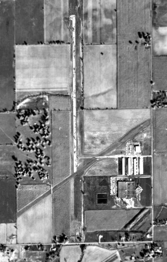
A 1969 aerial view of McCordsville Airpark,
from the IN University Electronic Atlas of Central Indiana Historical Aerial Archive (courtesy of Chris Kennedy).
The field was depicted to have a paved north/south runway & an unpaved northeast/southwest strip.
Several hangars were located to the east of the runway intersection.
The airport was evidently renamed “Brookside” at some point between 1968-71,
as that is how it was listed in the 1971 Flight Guide (courtesy of Chris Kennedy).
It depicted Brookside as having a 3,100' paved Runway 18/36 & a 3,150' unpaved runway 5/23,
and a ramp on the east side of the field with 2 hangars.
A 1971 aerial photo depicted Brookside Airpark with a total of 4 rows of T-hangars on the southeast side.
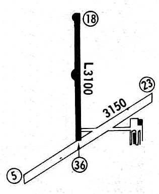
The 1982 AOPA Airport Directory (courtesy of Ed Drury)
described Brookside as having a 3,100' asphalt Runway 18/36 & a 3,200' turf Runway 6/24.
The operator was listed as All-American Air Service.
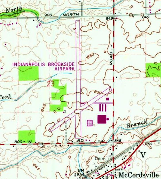
The 1981 USGS topo map depicted Indianapolis Brookside Airpark as having 2 paved runways
with several buildings on the southeast side.
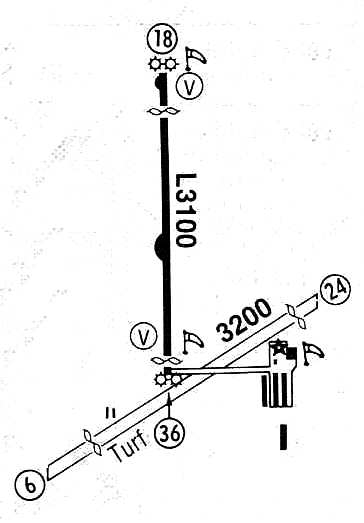
Brookside Airpark, as depicted in the 1987 Flight Guide (courtesy of Chris Kennedy).
The operator was listed as Foster Aviation.
In a 1998 USGS aerial view looking northwest, Brookside Airport still appeared relatively healthy, with a total of 7 light aircraft visible on the ramp.
A total of 4 hangars were also situated at the southwest side of the field.
Indianapolis Brookside Airpark was still listed as an active airfield in the 2003 AOPA Airport Directory
with a 3,072' asphalt Runway 18/36 & a 3,152' turf Runway 6/24.
In 2003, the last published Airport/Facility Directory data for Brookside Airpark
listed the owner as the Forth Corporation.
A total of 37 aircraft were listed as being based at Brookside, including 3 helicopters.
The field was listed as conducting an average of 33 aircraft operations per day.
The operator was listed as Giest Air Services,
and the airport manager was listed as Karen Farson.
Brookside Airpark was closed at some point during 2003.
Russ Ryle reported in 2003, “The owner died earlier this year & his kids did not want anything but the money it was worth dead.
So, they sold the FBO / flight service / training facility for $$$ & have a nice big chunk of land on the market for development.
Sad, but not uncommon.”
A 2003 aerial view showed Brookside Airport remaining intact, but sadly devoid of aircraft.
A 2004 aerial view showed Brookside Airport's runway painted with closed-runway yellow “X” symbols.
A 2006 photo by Zack Tucker, looking west at the remains of Brookside Airpark.
Zack reported, “The airport has been sold off & is now going to be developed for new high-end housing.
I passed by the airport a month ago & there is a large sign by the road with a layout of the housing development;
nothing of the airport will be left when the new houses are built.
The grass runway & cement runways are both still there, but are in terrible shape.
The FBO building is still there, but all of the hangars have been destroyed.
I think they are getting ready to tear down the FBO because there used to be a large truck parked inside,
and there used to be bails of hay piled in the hangar.”
A circa 2007 aerial view looking north at the former hangar which remains standing at the site of Brookside Airpark.
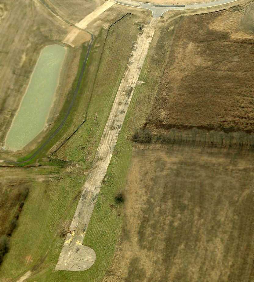
A circa 2007 aerial view looking south at the remains of the north end of the Brookside Airpark runway.
At the top of the photo is visible the housing development streets which had covered the middle portion of the former airfield.
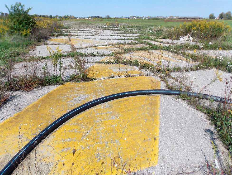
A 9/29/12 photo by Nick Newcomb looking at the remains of Brookside's “infamous X on Runway 26.”
Nick Newcomb reported on 9/29/12: “Surprisingly, a lot of the airfield still remains.
I went inside the hangar & the concrete is in pretty good condition, but it is full of debris & trash, there is alsograffiti all over the inside.
I went inside the office building, and there are pieces of ceiling, wall paper, flooring etc scattered around.
Out on the ramp, I found 2 different tires, I assume they were the tires of a single-engine aircraft because of their size.
I walked down the taxiway, which, in some places, is in pretty good condition. But in other areas, it is in terrible condition.
Along the taxiway, you can occasionally see the yellow taxi line, and you can also see the yellow lines that marked the location of Runway 6/24, the grass runway.
Once you get to the runway, you're looking at the same kind of conditions that you will see on the taxiway.
I walked down to the end, and saw the runway numbering, the X, etc.
Most of the runway is in very poor condition, yet you will still find some areas that are good, considering it has not been used for more than 10 years.
The runways & taxiways are buckled in some places, cracked very badly in others, sunk-in in some spots, and completely grown over in others.”
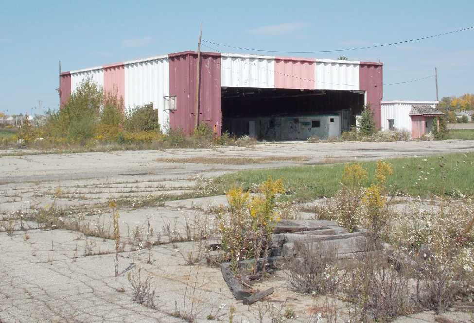
A 9/29/12 photo by Nick Newcomb looking at Brookside's “last remaining hangar & office building.”
A 2014 aerial view looking northwest show that Brookside Airpark's main hangar remains standing,
and portions remain of the paved north/south runway & unpaved northeast/southwest runway,
although construction has covered portions of the airport.
The site of Brookside Airpark is located northwest of the intersection of Route 36 & Mount Comfort Road.
Thanks to Bill Griffith for pointing out this airfield.
____________________________________________________
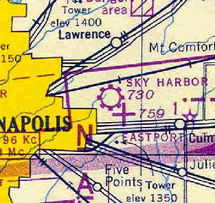
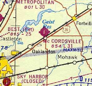
Sky Harbor Airport, Indianapolis, IN
39.805, -86.02 (East of downtown Indianapolis, IN)
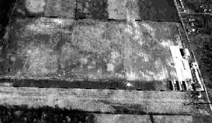
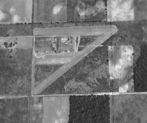
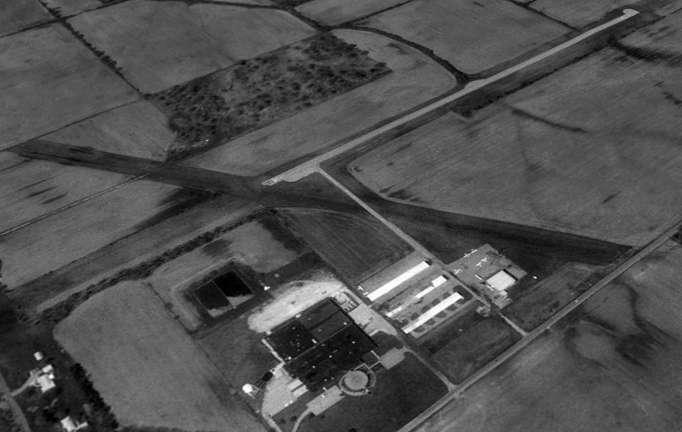
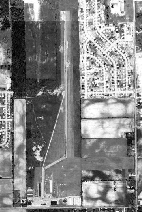
A 11/17/43 aerial view looking east at Sky Harbor Airport from the 1945 AAF Airfield Directory (courtesy of Scott Murdock).
The date of construction of this former general aviation airport is unknown.
It was apparently built at some point between 1941-43,
as a 1941 aerial photo of the location showed that it was still undeveloped farmland.
The earliest depiction of Sky Harbor Airport which has been located
was a 11/17/43 aerial view looking east from the 1945 AAF Airfield Directory (courtesy of Scott Murdock).
It depicted Sky Harbor as having a rectangular grass airfield with several hangars & a number of light planes along the south side.
The earliest aeronautical chart depiction of Sky Harbor Airport which has been located
was on the 1943 Cincinnati Sectional Chart (according to Chris Kennedy).
The 1945 AAF Airfield Directory (courtesy of Scott Murdock) described Sky Harbor Airport
as a 90 acre irregularly-shaped property having 2 sod 2,640' runways, oriented east/west & north/south.
The field was said to have 2 hangars & 18 T-hangars, and to be owned & operated by private interests.
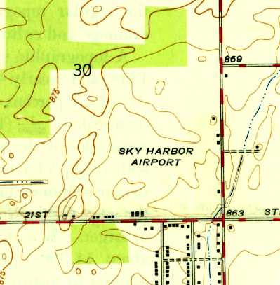
The 1948 USGS topo map depicted Sky Harbor Airport as an open area with several small buildings along the south & east sides.
The 1953 Flight Chart (courtesy of Scott O'Donnell) described Sky Harbor as having a 3,500' paved runway.
In the 1956 aerial photo of Sky Harbor
from the Electronic Atlas of Central Indiana (courtesy of Chris Kennedy),
it appeared to have at least 6 hangars, and at least 10 aircraft were visible parked outside.
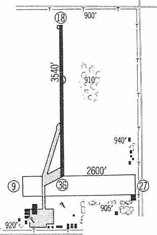
The 1960 Jeppesen Airway Manual (courtesy of Chris Kennedy)
depicted Sky Harbor as having a 3,540' paved Runway 18/36 as well as a 2,600' unpaved Runway 9/27.
Taxiways led to a ramp on the southwest side of the field with a cluster of hangars.
The 1961 USGS topo map depicted Sky Harbor Airport as having a paved north/south runway
with taxiways leading to a ramp on the southwest side of the field with a cluster of hangars.
The 1962 AOPA Airport Directory described Sky Harbor
as having a 3,540' bituminous Runway 18/36 & a 2,600' sod Runway 9/27.
The operator was listed as Sky Harbor Airport, Inc.
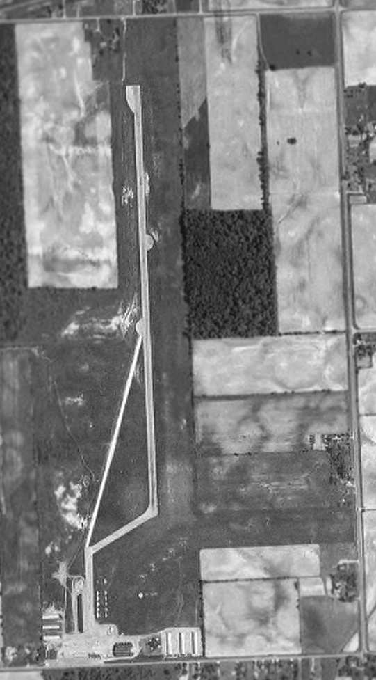
The last photo which has been located of Sky Harbor was a 1962 aerial view (from http://maps.indy.gov/MapIndy/).
It depicted the field at perhaps its zenith of popularity, with 26 aircraft visible parked outside.
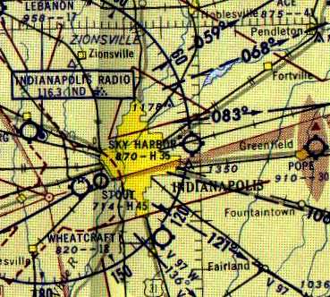
Sky Harbor was still depicted as an active airport on the 1964 Cincinnati Sectional Chart (according to Chris Kennedy).
Sky Harbor was apparently closed at some point between 1964-67,
as the Aerodromes table on the 1967 Cincinnati Sectional Chart (according to Chris Kennedy)
described the field as "Permanently closed".
However the airport evidently remained at least in unofficial operation even after it was depicted as closed on the aeronautical charts.
Harold Webb recalled, “On two occasions in the spring of 1968 I chartered aircraft for flights to Detroit... out of Sky Harbor.
On the second flight we had to return because of hydraulic problems with the gear.
I don't know when it was officially closed but I did fly out of there in 1968.”
The 1970 USGS topo map no longer depicted the runway, but instead depicted Interstate 70 “under construction” bisecting the airport from east to west.
Several hangars on the south side remained depicted.
Sky Harbor was depicted as an abandoned airfield
on the May 1971 St. Louis Sectional Chart (courtesy of Robert Brown).
Unfortunately, this airport had the misfortune to be located in the path of Interstate 70,
which was built at some point between 1968-71.
A 1971 aerial photo showed the new Interstate cutting through the south portion of the airfield,
with the majority of the runway pavement north of the Interstate remaining intact.
Brian Fields recalled, “Sky Harbor Airport... during 1972 & 1973, there was still some of the runway existing...
enough for some late night drag racing of which we did regularly! Never did get caught!”
In the 1998 USGS aerial photo,
the area of the former Runway 18/36 was still recognizable as a clear area running north/south in the center of the photo.
However, the interstate bisected the lower end of the former runway.
Harold Webb reported in 2005, “The old airport area just south of Interstate 70 is now home to the Indiana State Police.
North of the Interstate and east of the old runway is a Lowes store.
To the west is a Nike distributor.”
Rob Valdez added, “The road heading North & South to the West of where the runway was is named Planes Drive.”
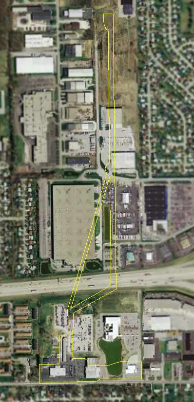
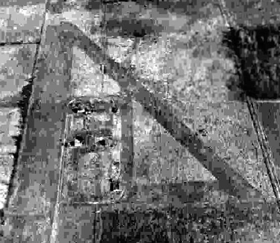
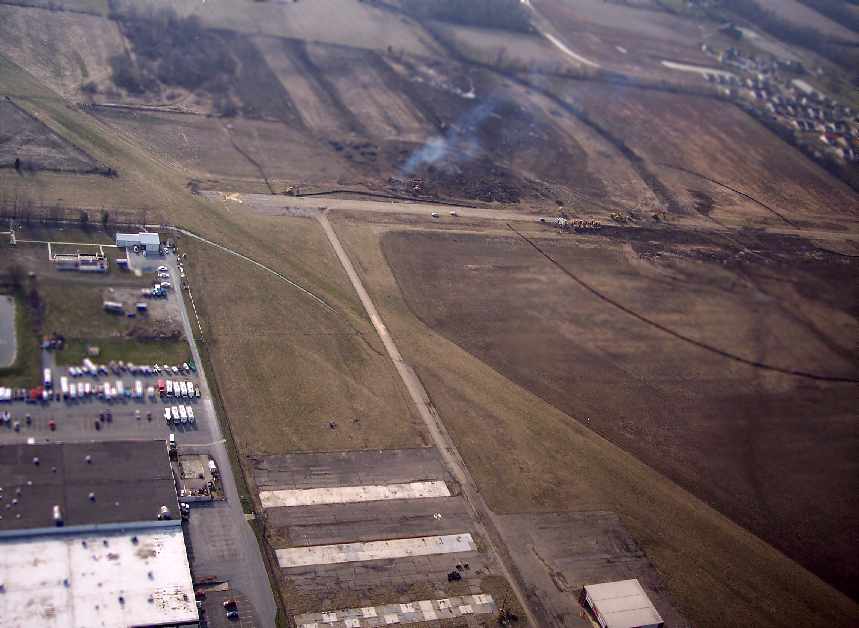
A 2006 aerial photo of the site of Sky Harbor Airport,
annotated by Chris Kennedy to show the outline of the former runway, taxiway, and ramp areas.
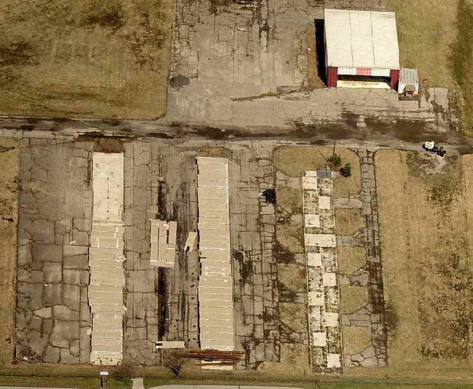
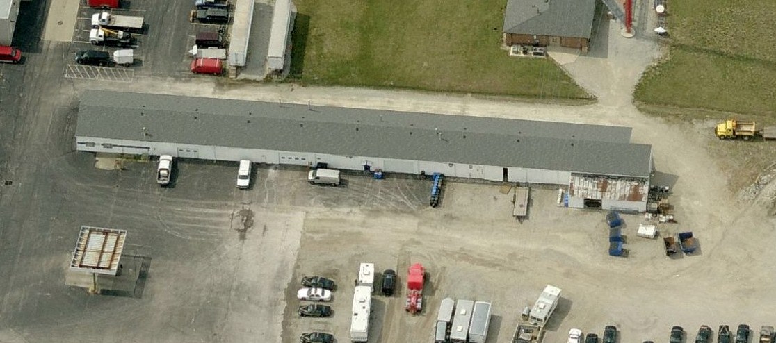
A close-up of the 2006 aerial photo,
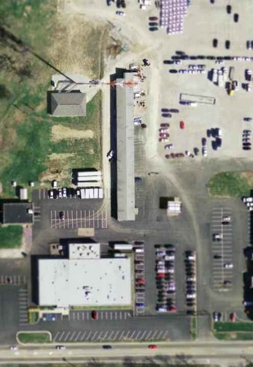
showing the former Sky Harbor Airport building which remains standing at the southwest corner of the former airport property.
Leroy Wheeler reported in 2006, “The site is now Post 53 of the Indiana State Police
which also houses the Museum of the Indiana State Police.
There are actually 2 buildings that remain from the old airport.
The 1st one is the one depicted [in the photo above] at the west end,
the 2nd is located about 400' east & is still on the grounds.
The western building was used mainly for maintenance & the middle building was used for hangar space.”
A circa 2012 aerial view looking west at the former Sky Harbor Airport building which remains standing at the southwest corner of the former airport property.
The site of Sky Harbor Airport is located east of the intersection of Interstate 70 & Interstate 465.
Thanks to Jorge Rodriguez for pointing out this field.
____________________________________________________
Since this site was first put on the web in 1999, its popularity has grown tremendously.
That has caused it to often exceed bandwidth limitations
set by the company which I pay to host it on the web.
If the total quantity of material on this site is to continue to grow,
it will require ever-increasing funding to pay its expenses.
Therefore, I request financial contributions from site visitors,
to help defray the increasing costs of the site
and ensure that it continues to be available & to grow.
What would you pay for a good aviation magazine, or a good aviation book?
Please consider a donation of an equivalent amount, at the least.
This site is not supported by commercial advertising –
it is purely supported by donations.
If you enjoy the site, and would like to make a financial contribution,
you
may use a credit card via
![]() ,
using one of 2 methods:
,
using one of 2 methods:
To make a one-time donation of an amount of your choice:
Or you can sign up for a $10 monthly subscription to help support the site on an ongoing basis:
Or if you prefer to contact me directly concerning a contribution (for a mailing address to send a check),
please contact me at: paulandterryfreeman@gmail.com
If you enjoy this web site, please support it with a financial contribution.
please contact me at: paulandterryfreeman@gmail.com
If you enjoy this web site, please support it with a financial contribution.
____________________________________________________
This site covers airfields in all 50 states.