Abandoned & Little-Known Airfields:
Florida, Daytona Beach area
© 2002, © 2016 by Paul Freeman. Revised 11/19/16.
This site covers airfields in all 50 states: Click here for the site's main menu.
____________________________________________________
Please consider a financial contribution to support the continued growth & operation of this site.
Bear Island Airfield (revised 8/8/13) - (Original) Flagler Beach Airport (revised 8/22/14) - Osceola NOLF (revised 11/19/16)
____________________________________________________
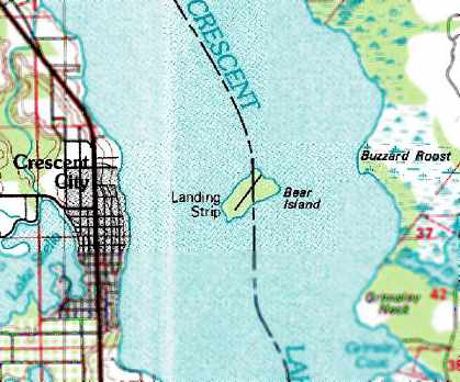
Bear Island Airfield, Crescent City, FL
29.44, -81.49 (West of Daytona Beach, FL)
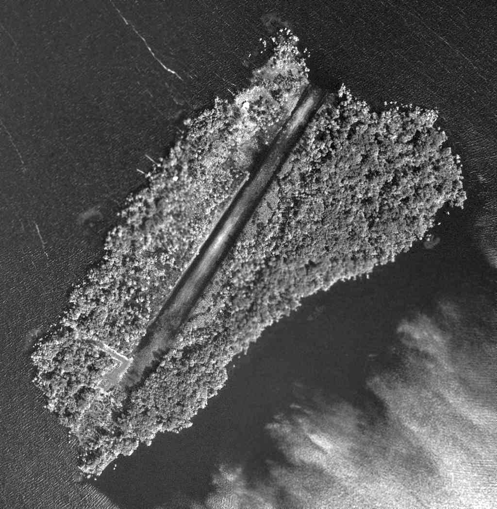
The Bear Island Airfield, as depicted on a 10/13/69 USGS aerial photo (courtesy of Dallam Oliver-Lee).
This unusual little airfield takes up almost the entire length of Bear Island, in the middle of Crescent Lake.
Bear Island Airfield was evidently constructed at some point between 1964-69,
as it was not yet depicted on a 1/29/64 USDA aerial photo (courtesy of Dallam Oliver-Lee).
The earliest depiction which has been located of the field was on a 10/13/69 USGS aerial photo (courtesy of Dallam Oliver-Lee).
It depicted Bear Island as having a single paved northeast/southwest runway,
running almost the whole length of the island.
The runway may still have been under construction at the time of the photo.
A 1970 aerial photo (from the U of FL Libraries) depicted the Bear Island runway somewhat more distinct, possibly after construction was completed.
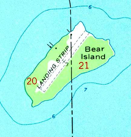
The 1972 USGS topo map depicted a single northeast/southwest runway, labeled simply as “Landing Strip”.
The 1978 USGS topo map depicted a single northeast/southwest runway, labeled simply as “Landing Strip”.
The 1999 USGS aerial photo depicted Bear Island as having a single unpaved runway,
along with what may have been a residence on the north side of the island.
The airfield was presumably a private field for the residence.
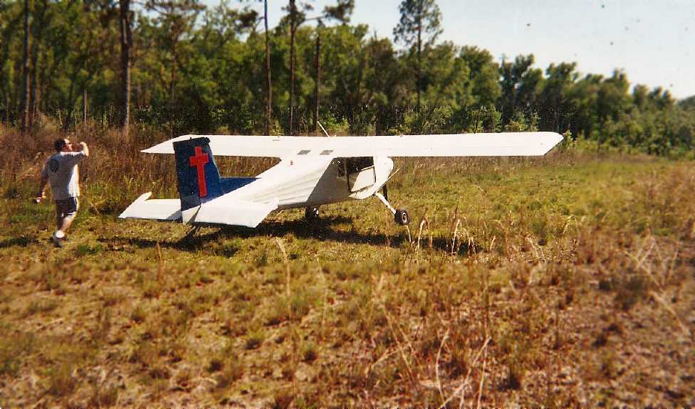
The only photo which has been located of an aircraft on Bear Island was a spring 2004 photo by Jeff Ellsworth of his friend & his Murphy Rebel.
Jeff recalled, “After landing, we walked off the length of the runway & estimated it to be 900'.
My Murphy Rebel... only used about 300' of the 900'.
We went in there on 2 different occasions in 2004, but in August/September of that same year 3 hurricanes struck Central Florida,
and I remember my buddy who flew over it some time later telling me that he saw pine trees down on the runway.”
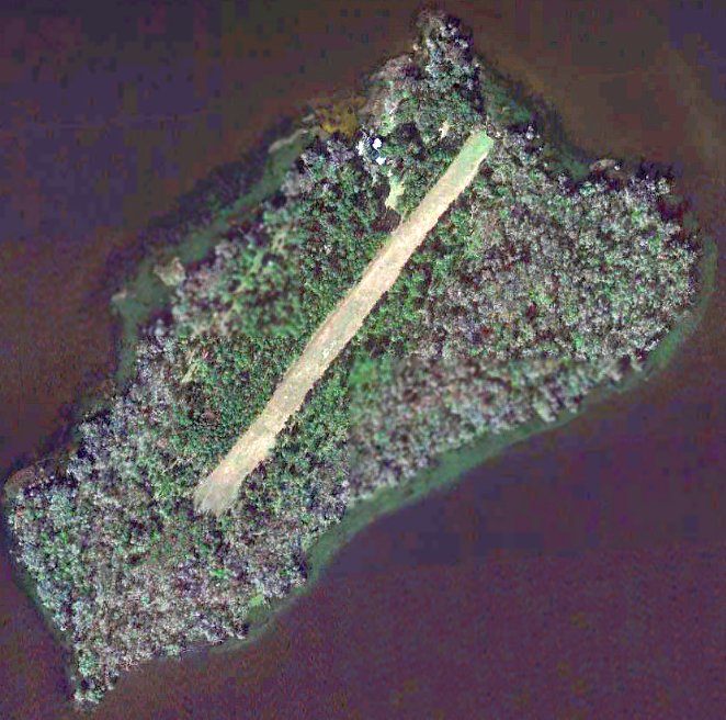
A 2004 aerial view (courtesy of Dan Guerra) looking northeast at the Bear Island Airfield.
According to Dan, “The guy who took these pics actually landed a Cessna 185 there.”
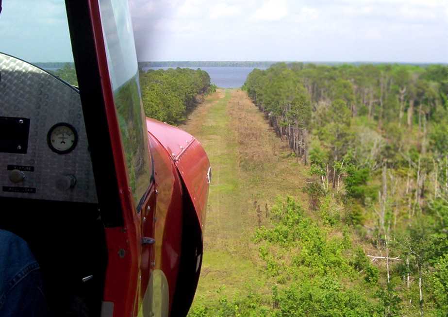
A 3/20/04 aerial view by Philip Pecoulas looking northeast at the Bear Island runway from a Piper PA-12 Super Cruiser.
William Chambers reported in 2006, “The last time I flew over here it looked overgrown.”
As of 2006, there was no airfield depicted on aeronautical charts on Bear Island,
nor any listed among the FAA Airport/Facility Directory data.
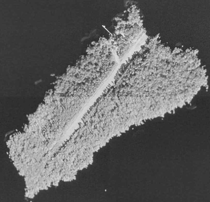
In contrast to the earlier reports of the runway being overgrown,
a 1/19/12 aerial photo (courtesy of Dallam Oliver-Lee) showed the runway to be very distinct & well cleared.
____________________________________________________
(Original) Flagler Beach Airport, Flagler Beach, FL
29.47, -81.13 (North of Daytona Beach, FL)
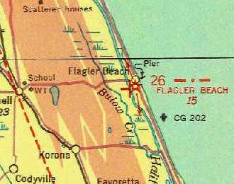
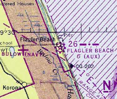
Flagler Beach Airport, as depicted on the 1935 Orlando Sectional Chart (courtesy of Chris Kennedy).
According to an article by Rob Creal (courtesy of Matthew Reynolds) in the Winter 2007 Flagler Beach Historical Society newsletter,
“In May of 1929 the Flagler Beach Town Commissioners began exploring the establishment of an emergency aviation landing field.
By August the town had agreed to lease land from George Moody, D.F. Fuquay, and L.O. Upson for an airfield
and by the end of the year it was nearly complete.
The airfield was located on what is now South Flagler Avenue.”
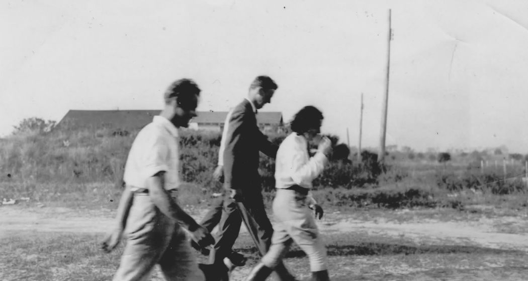
A November 1931 photo (courtesy of Matthew Reynolds), of “my Grandfather, John Upson, walking with Lindy & I think the woman flight instructor at Flagler
after Lindy emergency landed after he had engine problems.”
The article continued, “Two years later, one of the most famous aviators of all time would make an unexpected landing there.
On Saturday, 11/28/31 Colonel Charles Lindbergh left Miami before daylight in a borrowed U.S. Army airplane on a flight to New York.
While flying over Flagler Beach Lindbergh noticed the airfield & about 15 miles north of town he encountered dense fog.
Colonel Lindbergh turned around & landed on the grass runway at the Flagler Beach Municipal Airport at 9:15 am.
The Army airplane was larger than the aircraft that normally used the airfield & immediately attracted the attention of local residents.
When asked by Dewey Moody, Lindbergh admitted his identity & told residents that he expected to leave by 10:30 am.
The news spread quickly that he was at the airport & other local residents went there to greet him.
After receiving weather updates, he decided to stay in Flagler Beach until the flying conditions improved.”
The article continued, “Mr. & Mrs. J.L. Bivens were establishing a flying school at the airport
and Colonel Lindbergh took up one of their 2-cylinder Aeronoca airplanes for 2 short flights.
Afterward he posed for pictures with local residents & then the Bivens took him to the Flagler Beach Hotel for his second breakfast of the day.
Lindbergh decided to get a room at the hotel & as the news spread that he was in Flagler Beach,
visitors began to arrive from Daytona Beach, St. Augustine, and Jacksonville.
He became more reticent when confronted by the crowds of people trying to get a glimpse of him.
Lindbergh spent most of Sunday in his motel room studying charts & receiving weather reports.”
The article continued, “By Monday morning the weather had cleared & Colonel Lindbergh began preparing his aircraft to resume the flight to New York.
Several groups of people flew in from Daytona Beach to see him off.
It was noted that Mr. Bivens assisted him with the safety checks on the aircraft.
Colonel Lindbergh said that he enjoyed Flagler Beach & would like to return for a longer stay.
After shaking hands with those present at the airport, he climbed into the airplane & took off flying south for a short distance.
He then turned north & flew back. When he was over the center of town, Lindbergh dipped the wing of his airplane half a dozen times.”
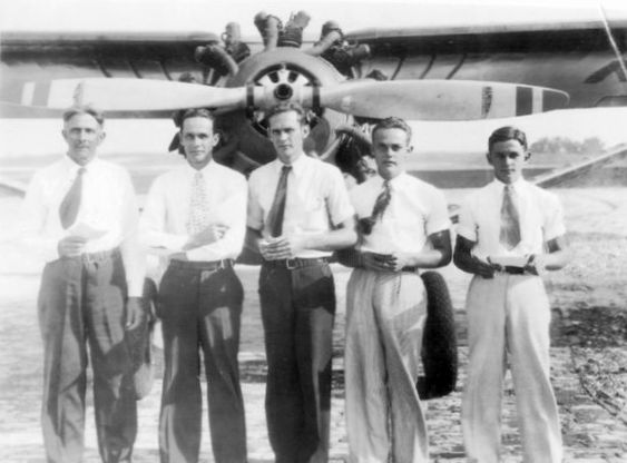
A 1930s photo (courtesy of Matthey Reynolds) of “my great grandfather & his 4 sons (including my granddad), the Upsons,
after they all received their pilot’s licenses at Flagler.
I remember that a newspaper article at the time called them the 'Flying Family of Flagler (or Florida)'.”
Pictured are: Luther Upson, Lawrence Upson, Louis Upson, John Upson, and Reginald Upson,
in front of an unidentified high-wing monoplane.
The 1934 Department of Commerce Airfield Directory (courtesy of Chris Kennedy)
described Flagler Beach as a municipal field having 2 sod runways under construction:
3,200' northwest/southeast & 3,000' north/south.
According to the Flagler Beach Historical Museum,
Amelia Earhart landed at the Flagler Beach Airport in the early 1930s.
The earliest depiction of the field which has been located
on the 1935 Orlando Sectional Chart (courtesy of Chris Kennedy),
which depicted Flagler Beach as an auxiliary airfield.
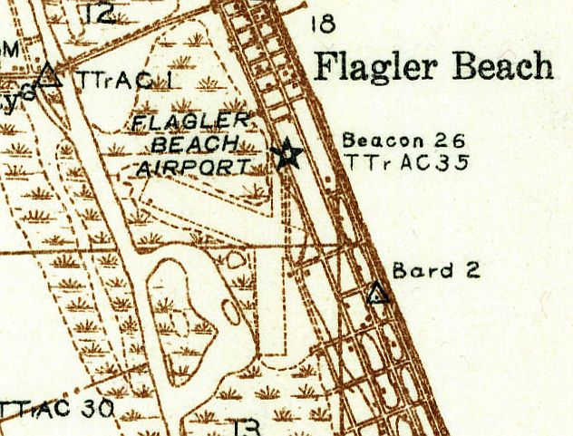
The 1937 USGS topo map depicted Flagler Beach Airport as having 2 unpaved runways,
with a beacon on the northeast corner.
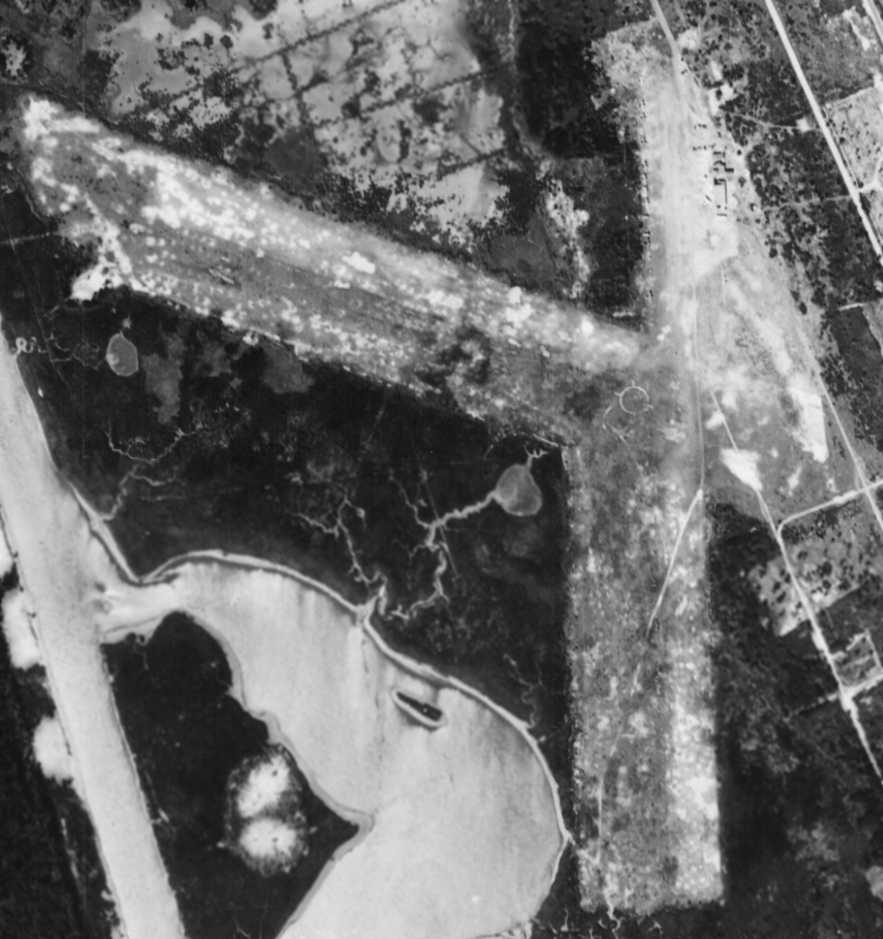
The only photo which has been located showing Flagler Beach Airport in operation was a 2/12/43 USDA aerial view (courtesy of Dallam Oliver-Lee).
The airfield consisted of 2 grass runways, with an airport circle marking at the intersection.
A dozen light aircraft were parked along the northeast side of the field, near some small buildings.
"Flagler Beach (Aux)" was depicted as a municipal airport on the July 1943 Orlando Sectional Chart (courtesy of Chris Kennedy).
The 4/1/44 US Army/Navy Directory of Airfields (courtesy of Ken Mercer)
described Flagler Beach Airport as having a 3,000' unpaved runway,
and indicated that the field conducted Civil Air Patrol Operations.
Flagler Beach Airport was still depicted on the 1944 USGS topo map.
The Flagler Beach Airport was evidently closed (for reasons unknown) at some point within the next year,
as the February 1945 Orlando Sectional Chart (according to Chris Kennedy)
no longer depicted an airfield at the location, although its beacon was still depicted.
A 12/19/50 USGS aerial photo (courtesy of Dallam Oliver-Lee) still showed Flagler Beach Airport as remaining intact,
but there did not appear to be any aircraft on the field.
A 1/17/52 USDA aerial photo (courtesy of Dallam Oliver-Lee) showed several streets
as having been built over the eastern edge of the site of Flagler Beach Airport.
Nothing was depicted at the site of the airport on the 1960 USGS topo map.
Chris Kennedy pointed out in 2004 that the reason the airfield property has remained intact & not redeveloped is that it is a preserve -
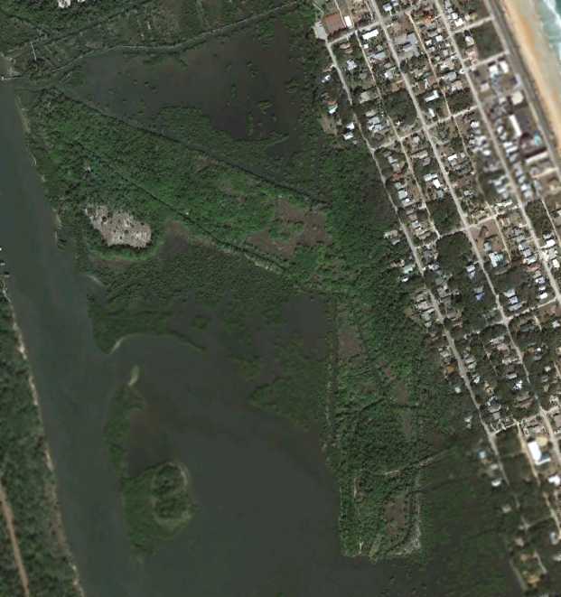
Incredibly, a 1/19/12 aerial photo showed that the outline of the 2 runways
of the former Flagler Beach Airport remained almost completely intact.
When this picture is compared with the 1943 aerial photo, it is amazing that the site has remained largely intact after 69 years.
The site of the Flagler Beach Airport is located west of the intersection of Flagler Avenue & South 12th Street.
____________________________________________________
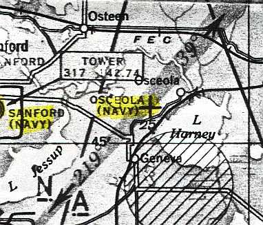
Osceola Naval Outer Landing Field, Osceola, FL
28.79, -81.08 (Northeast of Orlando, FL)
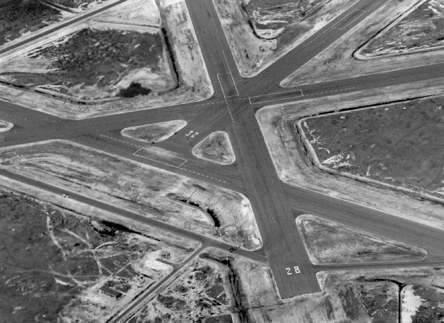
A March 15, 1944 U.S. Navy aerial view looking west at NOLF Osceola (courtesy of Brian Rehwinkel).
This airfield was built in 1943 as an auxiliary gunnery field for Sanford NAS,
which initially trained bomber crews, and later switched to training fighter crews.
The earliest depiction which has been located of NOLF Osceola was on the 1943 Orlando Sectional Chart (according to Chris Kennedy).
It depicted "Osceola (Navy)" as having a 4,000' hard-surface runway.
The earliest photo which has been located of the Osceola airfield
was a March 15, 1944 U.S. Navy aerial view looking west at NOLF Osceola (courtesy of Brian Rehwinkel).
It depicted the field as having 4 paved runways, paved taxiways,
and a few small buildings alongside the access road.
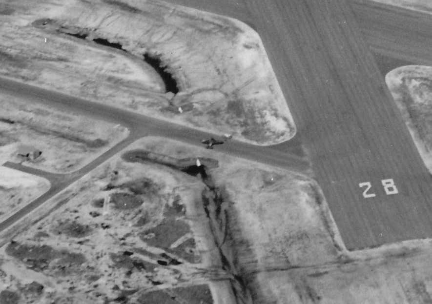
A closeup from the March 15, 1944 U.S. Navy aerial view of NOLF Osceola (courtesy of Brian Rehwinkel),
showing a single low-wing single-engine aircraft on a taxiway on the north side of the field.
"Osceola (Navy)" was still depicted as an active airfield on the 1945 Jacksonville Sectional Chart (courtesy of John Voss).
Osceola NOLF was declared surplus in 1946.
It is not known if the field was ever reused for civilian aviation.
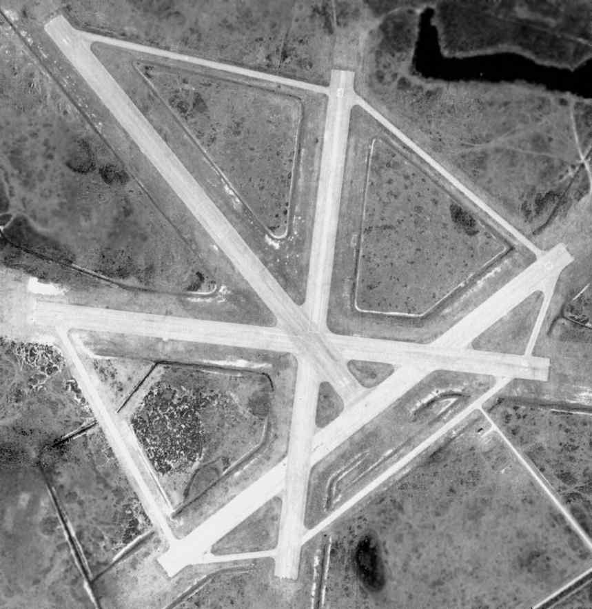
An 11/25/48 USDA aerial photo of Osceola NOLF, from the FL DOT (courtesy of Brian Rehwinkel).
The airfield consisted of 4 paved 4,100' runways & taxiways.
In this photo, the airfield was still completely intact,
but it appeared abandoned - there was no indication of any current use of the airfield.
There also did not appear to be any traces of any buildings at the site.
"Osceola OLF (Navy)" was still depicted as an active airfield on the August 1954 Orlando Sectional Chart (courtesy of Chris Kennedy),
but the Aerodromes table on the chart listed its status as "Closed, leased for grazing."
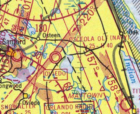
The last aeronautical chart depiction which has been located of "Osceola OLF (Navy)" was on the 1956 FL Aeronautical Chart (courtesy of Roger Connor).
The last photo which has been located showing the Osceola airfield remaining intact was a 1958 aerial photo (from the U of FL Libraries).
It would've made a nice municipal airport, if it had been located elsewhere.
Al Fitzgerald recalled, “Osceola NOLF was used mostly as a drag strip & model airplane flying field when I knew of it in the early 1960s.
I can remember landing there a couple times for the fun of it in a Mooney M21 around 1964-65.
The runways were in good shape, but had a lot of trash on them.”
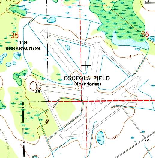
The 1966 USGS topo map still depicted the 4 intact runways & taxiways of “Osceola Field (Abandoned)”.
Sonny Hartley recalled of Osceola, “When I was in high school in the early 1960s,
drag races were held on the old airstrip every other Saturday night.
That was from about 1961-67.
In 1968 the SCCA held regional sports car races on the airfield.
I was a volunteer flagman at many of those events until 1973.”
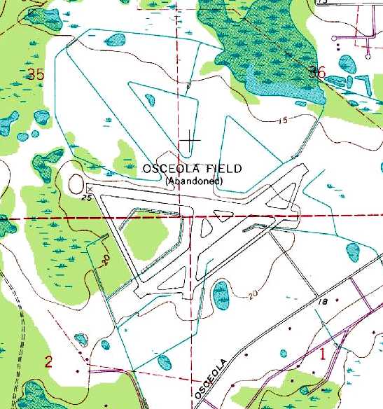
The 1988 USGS topo map showed that the southern half of the runways & taxiways of “Osceola Field (Abandoned)” remained,
but the northern half had been removed at some point between 1966-88.
Ross Burton recalled, “I did a lot of flight training down in the Orlando area.
I had always wanted to know the origin of the abandoned airfield in Osceola.
One day in 1991 we had a massive wind storm.
The next day I flew over the site & the runways were far more visible (largely intact)
as the sand/dirt had blown off the runways.”
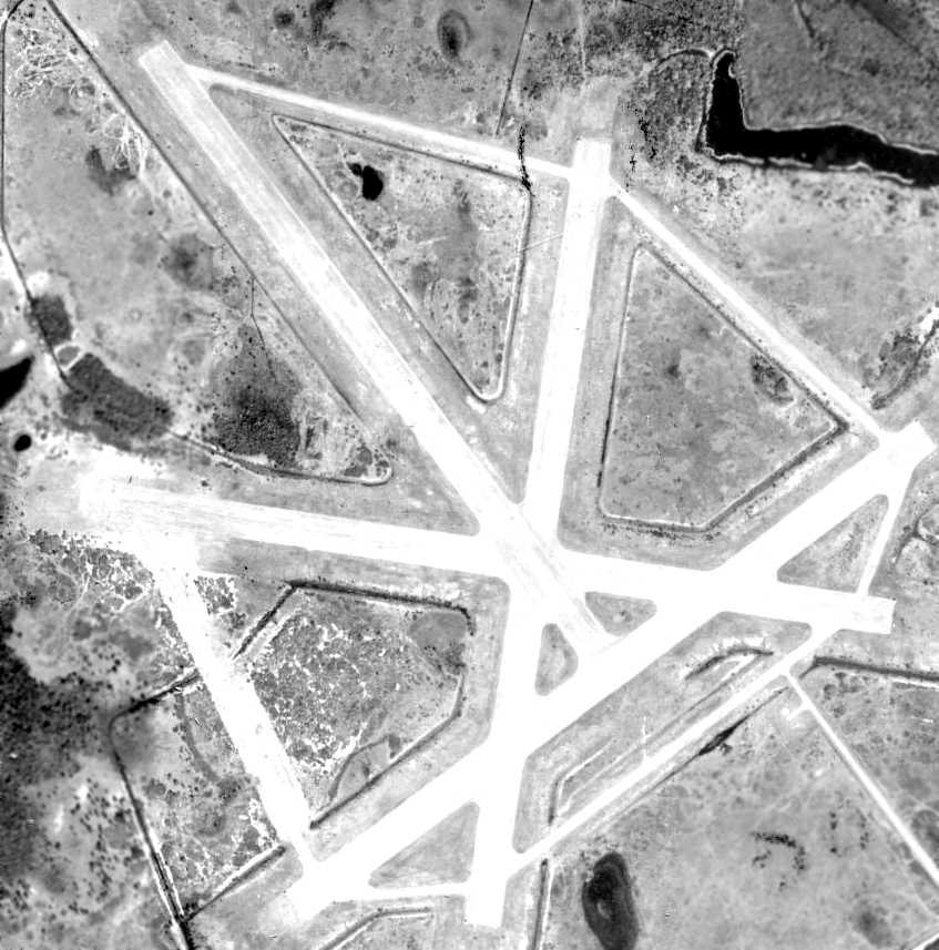
A 1995 USGS aerial view looking north at the site of Osceola Field showed that a significant proportion of the runways had been removed.
Gary Klingebiel reported in 2002 that the property is currently being used as the county landfill,
with almost nothing left of the runways.
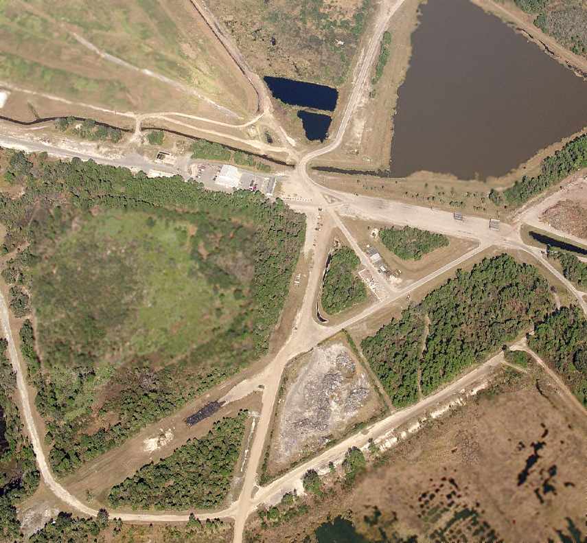
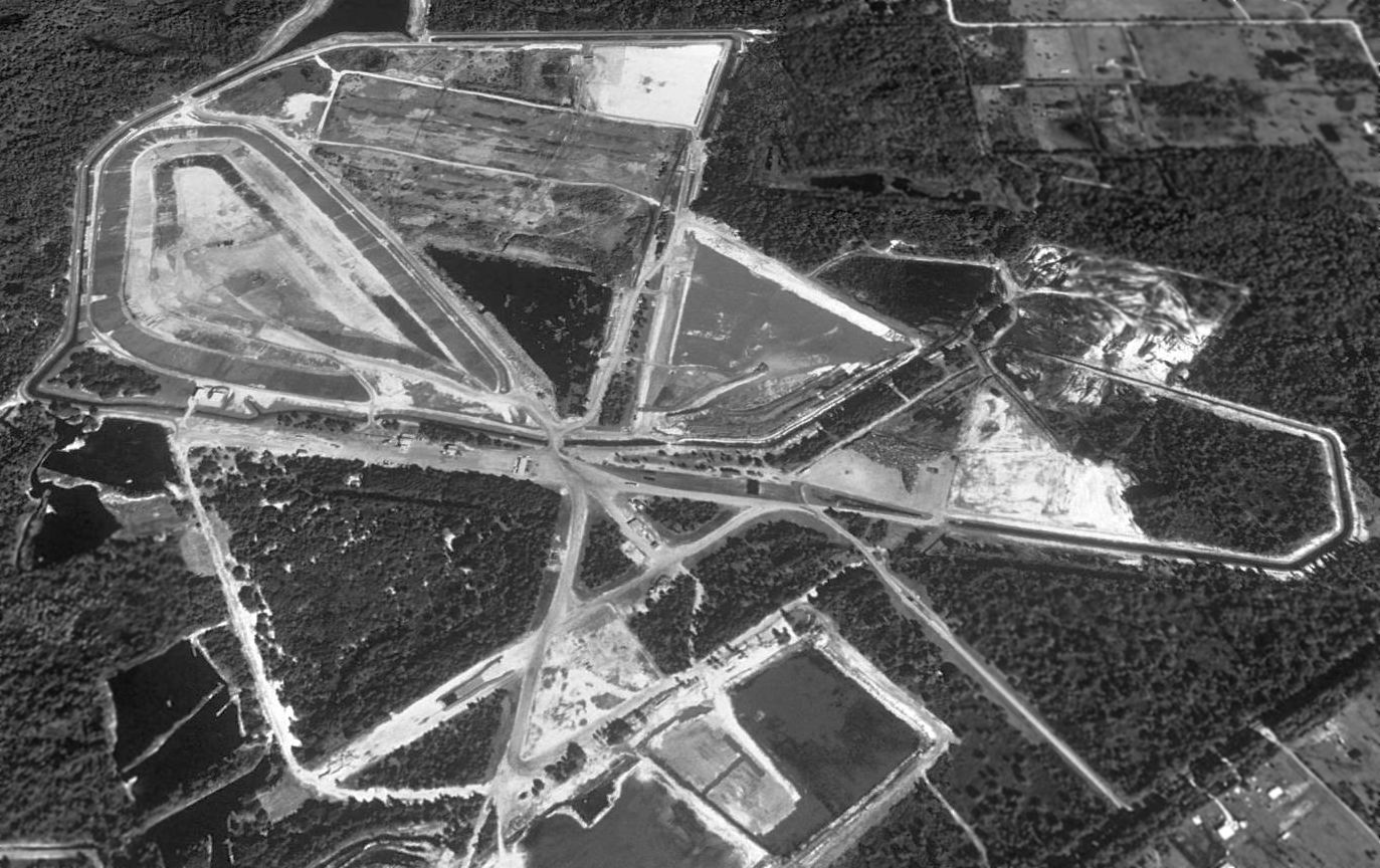
A circa 2006-2007 aerial view looking north at the remains of the Osceola runways,
showing that a shed had been built over the former east/west runway.
Sonny Hartley reported in 2007, “I had occasion to visit Osceola Airfield. Yes, it is a [landfill].
Most of the landing strips are gone but a lot of the access roads are still there.”
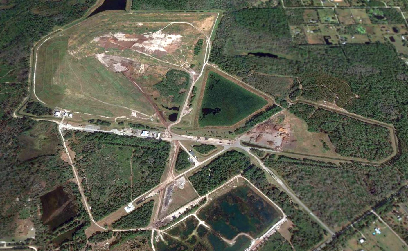
A 2016 aerial view looking north shows the Osceola Field site remains recognizable as a former airfield.
____________________________________________________
Since this site was first put on the web in 1999, its popularity has grown tremendously.
That has caused it to often exceed bandwidth limitations
set by the company which I pay to host it on the web.
If the total quantity of material on this site is to continue to grow,
it will require ever-increasing funding to pay its expenses.
Therefore, I request financial contributions from site visitors,
to help defray the increasing costs of the site
and ensure that it continues to be available & to grow.
What would you pay for a good aviation magazine, or a good aviation book?
Please consider a donation of an equivalent amount, at the least.
This site is not supported by commercial advertising –
it is purely supported by donations.
If you enjoy the site, and would like to make a financial contribution,
you
may use a credit card via
![]() ,
using one of 2 methods:
,
using one of 2 methods:
To make a one-time donation of an amount of your choice:
Or you can sign up for a $10 monthly subscription to help support the site on an ongoing basis:
Or if you prefer to contact me directly concerning a contribution (for a mailing address to send a check),
please contact me at: paulandterryfreeman@gmail.com
If you enjoy this web site, please support it with a financial contribution.
please contact me at: paulandterryfreeman@gmail.com
If you enjoy this web site, please support it with a financial contribution.
____________________________________________________
This site covers airfields in all 50 states.