THE PHILIPPINE ISLANDS
And its Butterfly Fauna
![]() ©
©
See also: Moths of the Philippine Islands
|
CESA Home Page | Researchers | Research Activities | International Expeditions | Services | Special Sources | Collections | Library | Databank | Scientific Publications | Priamus | Miscellaneous Papers | Memoirs | Electronical Version of the Publication | SLOW PROGRAM and CD-ROMs | BWNE | CESA Ó |
INTRODUCTION
REPUBLIC OF THE PHILIPPINES
Pilipino REPUBLIKA NG, PILIPINAS
covering a land area of about 300,000 square km on the archipelago of about 7,100 islands and islets lying about 800 km off the southeastern coast of Asia.The country spans about 1,850 km from south to north at its longest extent and about 1,125 km from west to east at its widest extent; surrounded by the Pacific Ocean, it is bounded by the Philippine Sea to the east, the Celebes Sea to the south, the Sulu Sea to the southwest, and the South China Sea to the west. The two principal islands of the Philippines are Luzon in the north, occupying 104,688 square km, and Mindanao in the south, occupying 94,630 square km. The Visayan group of islands in the central Philippines include Panay, Negros, Cebu, Leyte, and Samar; Mindoro is situated directly south of Luzon, and Palawan is isolated in the west. The population in 1990 was estimated at 61,483,000.
THE LAND

The Philippine topography is varied, with inactive volcanoes and mountain ranges being the conspicuous features of most of the larger islands. Many islands have narrow and often-interrupted coastal plains and river systems that generally trend northward. Large lakes on Luzon and Mindanao are of volcanic origin except Laguna de Bay, the country's largest lake (922 square km), southeast of Manila; it was probably once an arm of Manila Bay.
Northern Luzon has rugged mountain ranges trending north-south (including the Sierra Madre in the east and the Cordillera Central in the west) separated by the fertile Cagayan River valley. A merger of these mountain systems in central Luzon separates the Cagayan valley from the 240-by-80-kilometre densely populated, agriculturally productive central plain of Luzon to the south.
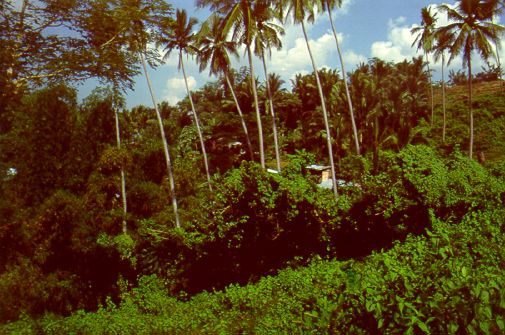

Manila, capital and chief city of the Philippines, located at the southern end of this plain on the natural harbour provided by Manila Bay. The convoluted peninsular arm of southeastern Luzon is occupied by isolated volcanoes and irregular masses of mountains and hills. The city has for four centuries been the economic, political, social, and cultural centre of the Philippines.
Manila and its contiguous cities and municipalities form a single unit known as Metropolitan Manila (National Capital Region). The city spreads along the eastern shore of Manila Bay, a large inlet with access to the sea, to the southwest, through a channel 12 miles wide. It occupies the low, narrow deltaic plain of the Pasig River, which flows northwestward to Manila Bay out of a large lake, Laguna de Bay, southeast of the city.

The city is an excellent port site because of its sheltered harbour, its access to inland agricultural areas by way of the river, and its relative proximity to the Asian mainland.
Manila's tropical climate is characterized by a wet season (June to November), a dry season (December to May), and a year-round temperature of about 27 C.
The heavily populated Tondo district on the northern shore of the Pasig River is the site of Manila North Harbor, the local port, while the international port, Manila South Harbor, is on the southern shore. The district of San Miguel is the site of Malacañang Palace, the presidential residence; Intramuros is renowned for its 16th-century San Agustin Church and other historical sites. Architectural styles reflect American, Spanish, Chinese, and Malayan influences.

As the education centre of the country, Greater Manila houses many of the major institutions of higher learning, including the University of the Philippines (with its main campus in Quezon City), the University of the City of Manila, and the Technological University of the Philippines. The heart of the country's performing arts activities is the Philippine Cultural Center. Other theatres include the Folk Arts, the historic Metropolitan, and an open-air theatre in Rizal Park. The many libraries and museums include the National Library, the National Museum, the National Institute of Science and Technology, the geological museum of the Bureau of Mines, and the archival Kamaynilaan (Manila City) Library and Museum.

Within Metropolitan Manila public transportation is provided by buses, jeepneys (small buses built on the chassis of jeeps), and taxis. Railways connect the city with northern and southeastern Luzon, but do not serve the port area. Interisland and international transportation is provided by shipping and by air services; Manila International Airport is located about 5 miles south of the city. Area city is 38 sq km; metropolitan area, 636 sq km. Pop. (1980) city, 1,630,485; metropolitan area, 5,925,900.

Bohol island, Visayan group, south-central Philippines. Roughly oval in shape, the island has an area of 3,865 square km and lies between the Camotes Sea (north) and the Bohol Sea (south). Its volcanic core is mostly covered with coralline limestone. The rivers are short, and there are few good anchorages. Settlement is mainly coastal, except for a low central plateau that encircles the town of Carmen. The spectacular chocolate hills," or "haycock hills," in west-central Bohol are named for their brown appearance in the dry season and their symmetrical, conical shapes. They are limestone remnants of an earlier erosion cycle, a phenomenon known to be present in only two or three other places in the world. The area has been developed for tourists.
Bohol's character is essentially rural. Rice, corn (maize), and coconuts are the principal crops. A secondary livestock industry is centred at Ubay, on rougher terrain near the east coast. Extensive, low-grade deposits of manganese are mined in the southeast. Loon and Talibon are important towns. Pop. (1990 est.) 881,051.

Negros island, one of the Visayan group, central Philippines. It is separated from the island of Panay to the northwest by the Guimaras Strait and from Cebu island to the east by the Tañon Straits. The island is bordered on the north and south by the Visayan and Sulu seas, respectively.
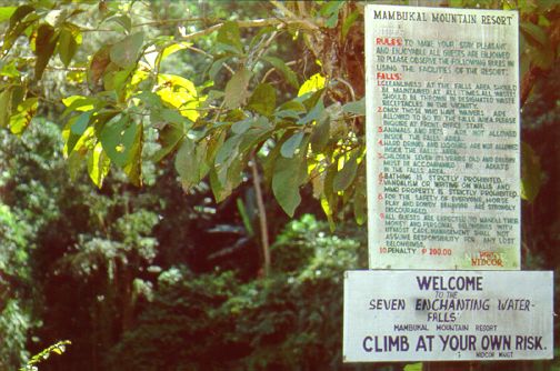
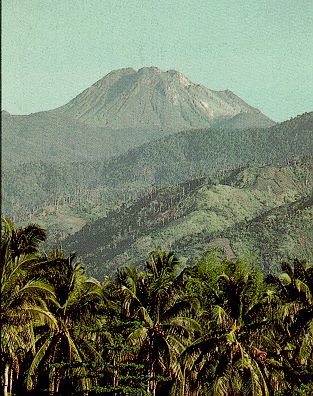
Negros is shaped like a boot and is about 217 km long and 35 to 79 km wide. It has an area of 12,710 square km. A lofty central mountain range runs nearly the island's entire length and is deeply dissected by erosion. The range contains Mount Canlaon, an active volcano that at 2,460 m is the highest point in Negros. The island's major rivers are the Binalbagan, Ilog, Tolong, and Tanjay. The southeastern peninsula (the toe of the boot) contains the crater lakes of Danao and Balinsasayan. Most of southwestern Negros comprises the Tablas, an undeveloped plateau with a varied landscape.
The island's coastal areas are densely populated. The eastern coast has only discontinuous piedmont plains, but the western coast's plains are among the broader Philippine lowlands, being from 8 to 48 km wide and extending for nearly 160 km along the shoreline. Visayans live in the coastal areas, while Negritos inhabit the forested upland interior. The island's main linguistic division reflects the separation of the eastern and western coastal areas from each other by the central mountain range: Hiligaynon, from Panay, is widely spoken in western Negros, whereas Cebuano, from Cebu, is dominant on the eastern coast.
Bacolod on the northwestern coast is the largest city on the island and is an important sugar exporter. Bais has a large paper mill, and Cadiz is an important fishing port. Other cities include Escalante, La Carlota, Dumaguete, and Bago. A highway links Canlaon, a city in the north-central part of Negros, with other cities and towns all along the coast of the island. Pop. (1990 est.) 3,168,000.

Mindoro lies across the Verde Island Passage from Luzon (northeast) and between the Mindoro (southwest) and Tablas (southeast) straits. Unlike the majority of its sister islands, Mindoro has no deep coastal embayments or fringing islets. Oval-shaped, it has an area of 9,735 square km.
A mountainous core extending for 100 miles (160 km) along the island's entire length is surrounded by a broken coastal plain, widest along the eastern shore. Lake Naujan and Mount Halcon (2,585 m), the island's highest point, are in the northeast. Steep-sided valleys are formed by rivers, including the Pandan, Ibod, and Bongabong. The tamaraw (tamarau), a small water buffalo, is unique to Mindoro.
Historically, Mindoro's population growth was kept in check through raids by Muslim (Moro) seafarers from the southern islands and by the prevalence of malaria. Since 1948 the island has been one of the nation's resettlement areas, which has lent a frontier aspect to its life. The inhabitants of the rugged interior are non-Christian, seminomadic peoples who practice slash-and-burn (kaingin) farming; they include Negritos and Hanunóo. Coastal areas, especially in the west, are more densely populated and commercialized and are settled primarily by Christian Tagalogs, particularly from the Batangas Peninsula of Luzon. Hiligaynon peoples have migrated to the southern areas.
The University of the Philippines maintains a marine biological station at Puerto Galera on the northern coast. There are substantial deposits of coal in the south. The island's main population centres are Calapan and Mamburao. Population (1990 est.) including adjacent islands, 833,000.

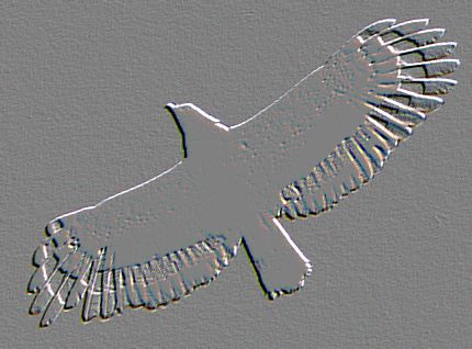
Mindanao island, the second largest (after Luzon) in the Philippines, in the southern part of the archipelago, surrounded by the Bohol, Philippine, Celebes, and Sulu seas. Irregularly shaped, it has an area of 94,630 square km and measures 471 km north to south and 324 miles (521 km) east to west. The island is marked by peninsulas and is heavily indented by the Davao and Moro gulfs in the south and by Iligan Bay in the north. The long, semicircular Zamboanga Peninsula (west) extends southwesterly toward the Sulu Archipelago and Borneo, and the Cotabato and Surigao peninsulas extend south and north, respectively. Rugged, faulted mountains and volcanoes occur in many areas. Mount Apo, at 2,954 m, is an active volcano in the southern part of the central highlands; it is the highest peak in the Philippines. The island has narrow coastal plains, and broad, fertile basins and extensive swamps are formed by the Mindanao and Agusan river systems. Lake Sultan Alonto (formerly called Lake Lanao), created by a lava dam, has an area of 347 square km. The island has a marsh-game refuge and bird sanctuary. The rare monkey-eating eagle is unique to Mindanao.
Mindanao is a Muslim outpost in the predominantly Roman Catholic Philippines. Although Muslims are no longer a majority, Islamic culture is evident; there are many mosques, and distinctive brassware, including the kris, or dagger, is manufactured. The autonomous region of Muslim Mindanao--consisting of territory in western and southwestern Mindanao along with a number of nearby islands, including Tawitawi and Jolo--was established in 1990.
Mindanao also has the largest concentration of ethnic minorities in the Philippines. They include the Magindanaw, Maranaw, Ilanum, and Sangil; all are Muslim groups known collectively as the Moro. Groups usually found in the uplands include the Tagabili, Subanon, Bukidnon, Bagobo, Mandaya, and Manobo. Another important group is the Tiruay, whose religion is a mixture of Christian, Muslim, and animist beliefs. The timber industry is important, and there are gold, nickel, iron, and coal deposits. Chartered cities include Zamboanga City, Cotabato City, Davao City, Cagayan de Oro, and Butuan. Population (1990) 13,232,000.
The Philippines have a maritime tropical climate with temperature variations being almost entirely a result of elevation. Manila has an average annual temperature of 27 C. The archipelago is well watered, with the western Philippines having a distinct dry season. Typhoons frequently strike the more northerly eastern coast. More than one-third of the country is forested. There are many valuable hardwoods, such as lauan (Philippine mahogany), as well as many softwoods, including pine. Native plants and animals include some 800 species of orchid and at least 56 species of bat.
The Philippines is rich in mineral resources. Deposits of gold, silver, iron ore, copper, lead, chromite, nickel, manganese, and limestone occur in commercial quantities. Limited petroleum reserves are located off the island of Palawan.
THE PEOPLE
The people of the Philippines (who are called Filipinos) are predominantly of a Malay stock frequently admixed with Chinese and sometimes with American or Spanish ethnic groups. Pilipino, a language based on Tagalog (the language spoken around Manila by almost one-third of the country's total population), and English are both official languages. There are scores of other languages, the main groups of which are the Cebuano (spoken by approximately one-fourth of the total population), Ilocano, Hiligaynon, and Bicol.
More than four-fifths of the population is Roman Catholic, and a sizable minority is Muslim. Some of the population belongs to the Philippine Independent Church (Aglipayan) and others are mainline Protestant.
Population density in the Philippines is relatively high. Nearly two-fifths are younger than 15 years of age. Family-planning programs have been concentrated especially in rural areas. Overall life expectancy has increased to 65 years. Heavy migration from rural to urban areas has caused overcrowding, particularly in metropolitan Manila; about two-fifths of the country's population is urban. Emigration and immigration generally balance each other, although many of the emigrants include highly skilled workers.
![]()
HISTORY
Chinese traders are known to have visited and resided on the islands from about AD 1000, but the influence of both China and India on the Philippines was of little importance. At the beginning of the 15th century Filipinos were primarily shifting cultivators, hunters, and fishermen having animistic beliefs. Islam was introduced later in the same century (particularly in the area of Mindanao) followed by Ferdinand Magellan's European discovery of the Philippines in 1521. The late 16th-century, militarily enforced Spanish colonization of much of the northern and central Philippines led to the nominal conversion of all the inhabitants to Roman Catholicism. The Moros, as the Spanish called the Muslims of Mindanao and the Sulu Archipelago farther southwest, were never completely subdued by the Spanish.
Central government in Manila retained a medieval, autocratic cast into the 19th century; the city also dominated the islands as an oppressive ecclesiastical centre and as a commercial centre serving as an entrepôt for Chinese silks and Mexican silver.
By the 1830s Manila was open to foreign markets. The European demand for sugar and abaca led to the intensive growth of commercial agriculture, with most of the economic benefits going to a wealthy elite of Spanish-descended large landowners.
In the late 19th-century, sons of wealthy landholders returned from European schools to the Philippines imbued with nationalistic ideals that led to an 1896 insurrection that was put down by Spanish troops.
The islands were ceded to the United States after the latter's victory in the Spanish-American War of 1898, but an independence movement within the Philippines was not subdued until 1906. The juxtaposition of U.S. democracy and imperialistic rule over the Filipinos was sufficiently jarring to most Americans that, from the beginning, the training of Filipinos for self-government and ultimate independence was an essential rationalization for U.S. hegemony.
The Commonwealth of the Philippines was established in 1935 in an attempt to prepare the country for political and economic independence, but this effort was delayed by World War II and the subsequent Japanese invasion and occupation.
After the Philippines' liberation by U.S. forces in 1944-45, the independent Republic of the Philippines was proclaimed on July 4, 1946, with a government patterned on that of the United States and with Manuel Roxas as the first president.
In 1965 Ferdinand E. Marcos was first elected president, and in 1972 he declared martial law, a state of affairs that was formally ended in 1981, although Marcos continued dictatorial rule. The assassination of opposition leader Benigno S. Aquino, Jr., in 1983 became the focal point of mounting opposition to Marcos' increasingly corrupt rule, and a revolt drove him from power in 1986. Corazon Aquino, Benigno's widow, took over as president, instituting a period of democracy that led in 1992 to the free election of her successor, Fidel V. Ramos.
THE LEPIDOPTERA FAUNA
OF THE PHILIPPINE ISLANDS
PAPILIONOIDEA -
HESPERIOIDEA
The Tentative Checklist
|
CESA Home Page | Researchers | Research Activities | International Expeditions | Services | Special Sources | Collections | Library | Databank | Scientific Publications | Priamus | Miscellaneous Papers | Memoirs | Electronical Version of the Publication | SLOW PROGRAM and CD-ROMs | BWNE | CESA Ó |
Updated November 12nd, 1999
Ó